CRCR27 Nordegg - Canadian Rockies Topo
Backroad Mapbooks
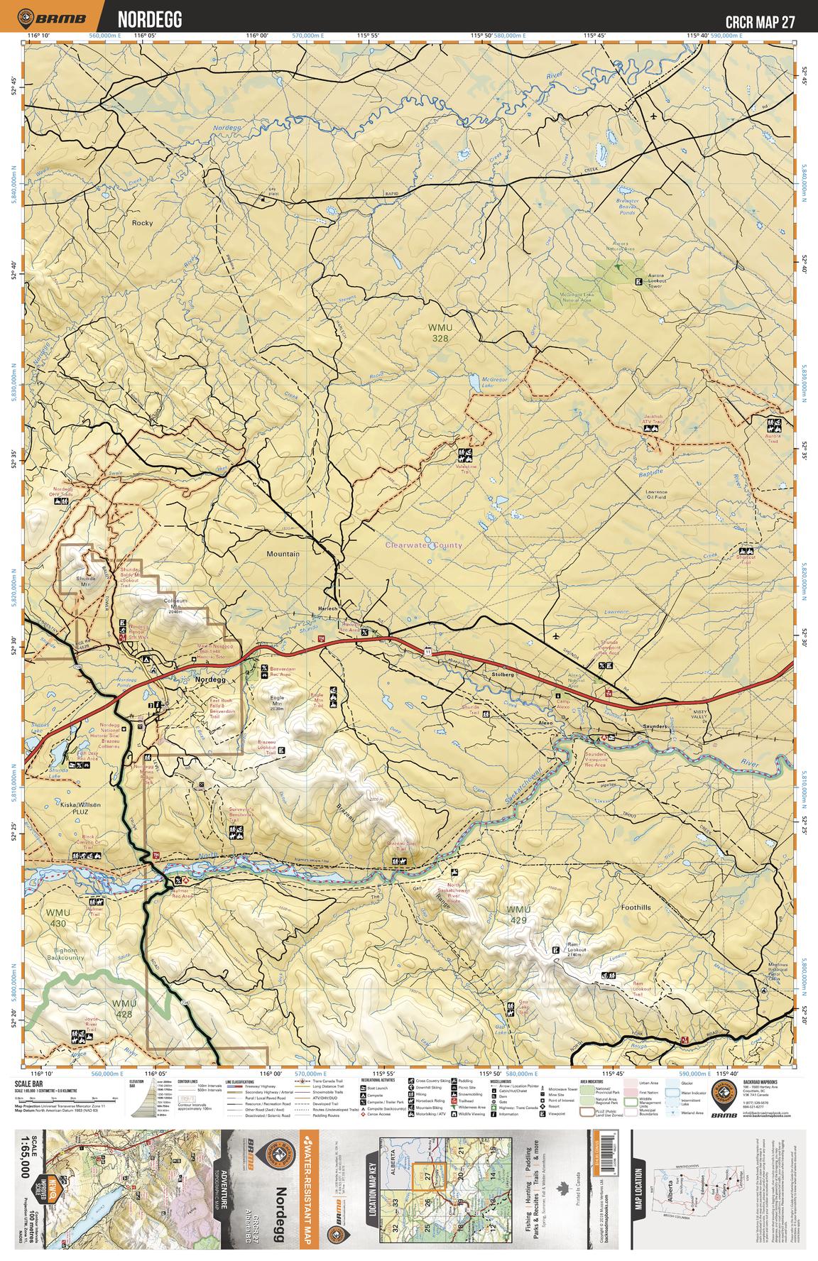
This recreation topographic map for Nordegg highlights all the roads, fishing lakes & streams, front and backcountry campsites, paddling routes for canoeing and kayaking, wildlife viewing areas, multi-use trails for hiking, backcountry skiing, snowshoeing, mountain biking, horseback riding & more. Covering 1,950 km2 (753 mi2), this map measures 38 x 51 km (24 x 32 mi), providing you with more topographic and recreational detail for the Whiteswan Lake area than any other map on the market. Special features include private land and countless roads, trails and recreational Points of Interest. Included on this map are Nordegg, McGregor Lake Natural Area, Aurora Natural Area, Nordegg River, Baptiste River, North Saskatchewan River and more!
Page Size: 24 x 37 in (610 x 940 mm)
Buy this map on MapTrove.ca