


MapSherpa Catalog
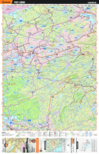
CCON86 Port Loring - Cottage Country Ontario Topo
Backroad Mapbooks
This recreation topographic map for Port Loring highlights all the logging/resource roads, hunting areas, fishing lakes & streams, campsites, paddling routes for canoeing and kayaking, wildlife viewing areas, multi-use trails for hiking, biking, horseback riding, cross-country skiing and snowshoeing, motorized trails for ATVing and snowmobiling & more. Covering 1,090 km2 (420 mi2), this 1:50,000 scale map measures 29 x 38 km (18 x 24 mi), providing you with more topographic and recreational detail for the Richmond Hill area than any other map on the market. New features include enhanced Crown land, countless new roads and trails and a wealth of recreational Points of Interest. Included on this map are Port Loring, Golden Valley, Bear Valley, Spring Creek, Arnstein, Restoule and more!
Page Size: 24 x 37 in (610 x 940 mm)
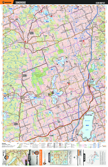
CCON87 Sundridge - Cottage Country Ontario Topo
Backroad Mapbooks
This recreation topographic map for Sundridge highlights all the logging/resource roads, hunting areas, fishing lakes & streams, campsites, paddling routes for canoeing and kayaking, wildlife viewing areas, multi-use trails for hiking, biking, horseback riding, cross-country skiing and snowshoeing, motorized trails for ATVing and snowmobiling & more. Covering 1,090 km2 (420 mi2), this 1:50,000 scale map measures 29 x 38 km (18 x 24 mi), providing you with more topographic and recreational detail for the Richmond Hill area than any other map on the market. New features include enhanced Crown land, countless new roads and trails and a wealth of recreational Points of Interest. Included on this map are Sundridge, Stewart Bay, Deans, Farleys Corners, Lake Bernard, Trout Creek, Trans Canada Trail and more!
Page Size: 24 x 37 in (610 x 940 mm)
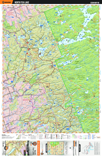
CCON88 North Tea Lake - Cottage Country Ontario Topo
Backroad Mapbooks
This recreation topographic map for North Tea Lake highlights all the logging/resource roads, hunting areas, fishing lakes & streams, campsites, paddling routes for canoeing and kayaking, wildlife viewing areas, multi-use trails for hiking, biking, horseback riding, cross-country skiing and snowshoeing, motorized trails for ATVing and snowmobiling & more. Covering 1,090 km2 (420 mi2), this 1:50,000 scale map measures 29 x 38 km (18 x 24 mi), providing you with more topographic and recreational detail for the Richmond Hill area than any other map on the market. New features include enhanced Crown land, countless new roads and trails and a wealth of recreational Points of Interest. Included on this map are North Tea Lake, Algonquin Provincial Park, Trail, Sausage Lake Forest, Magnetawan River, Manitou Lake and more!
Page Size: 24 x 37 in (610 x 940 mm)
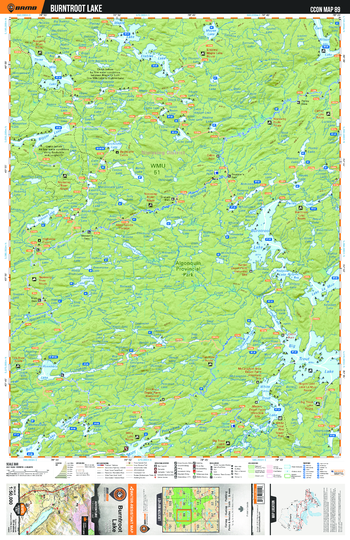
CCON89 Burntroot Lake - Cottage Country Ontario Topo
Backroad Mapbooks
This recreation topographic map for Burntoot Lake highlights all the logging/resource roads, hunting areas, fishing lakes & streams, campsites, paddling routes for canoeing and kayaking, wildlife viewing areas, multi-use trails for hiking, biking, horseback riding, cross-country skiing and snowshoeing, motorized trails for ATVing and snowmobiling & more. Covering 1,090 km2 (420 mi2), this 1:50,000 scale map measures 29 x 38 km (18 x 24 mi), providing you with more topographic and recreational detail for the Richmond Hill area than any other map on the market. New features include enhanced Crown land, countless new roads and trails and a wealth of recreational Points of Interest. Included on this map are Burntroot Lake, Algonquin Provincial Park, Big Trout Lake, Biggar Lake, Carl Wilson Lake, Gibson Lake and more!
Page Size: 24 x 37 in (610 x 940 mm)
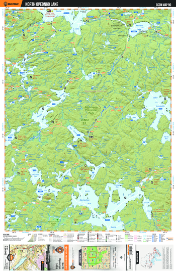
CCON90 North Opeongo Lake - Cottage Country Ontario Topo
Backroad Mapbooks
This recreation topographic map for North Opeongo Lake highlights all the logging/resource roads, hunting areas, fishing lakes & streams, campsites, paddling routes for canoeing and kayaking, wildlife viewing areas, multi-use trails for hiking, biking, horseback riding, cross-country skiing and snowshoeing, motorized trails for ATVing and snowmobiling & more. Covering 1,090 km2 (420 mi2), this 1:50,000 scale map measures 29 x 38 km (18 x 24 mi), providing you with more topographic and recreational detail for the Richmond Hill area than any other map on the market. New features include enhanced Crown land, countless new roads and trails and a wealth of recreational Points of Interest. Included on this map are North Opeongo Lake, Algonquin Provincial Park, Radiant Lake, Merchant Lake, Happy Isle Lake, Hogan Lake and more!
Page Size: 24 x 37 in (610 x 940 mm)
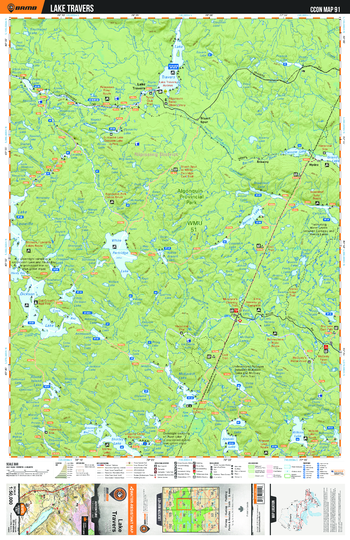
CCON91 Lake Travers - Cottage Country Ontario Topo
Backroad Mapbooks
This recreation topographic map for Lake Travers highlights all the logging/resource roads, hunting areas, fishing lakes & streams, campsites, paddling routes for canoeing and kayaking, wildlife viewing areas, multi-use trails for hiking, biking, horseback riding, cross-country skiing and snowshoeing, motorized trails for ATVing and snowmobiling & more. Covering 1,090 km2 (420 mi2), this 1:50,000 scale map measures 29 x 38 km (18 x 24 mi), providing you with more topographic and recreational detail for the Richmond Hill area than any other map on the market. New features include enhanced Crown land, countless new roads and trails and a wealth of recreational Points of Interest. Included on this map are Lake Travers, Algonquin Provincial Park, Brawny, Stuart Spur, Hydro, White Partridge Lake and more!
Page Size: 24 x 37 in (610 x 940 mm)
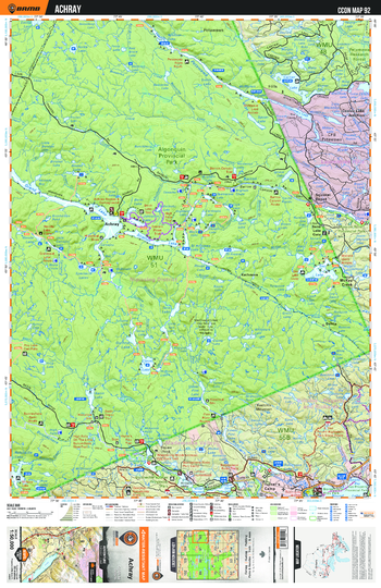
CCON92 Achray - Cottage Country Ontario Topo
Backroad Mapbooks
This recreation topographic map for Achray highlights all the logging/resource roads, hunting areas, fishing lakes & streams, campsites, paddling routes for canoeing and kayaking, wildlife viewing areas, multi-use trails for hiking, biking, horseback riding, cross-country skiing and snowshoeing, motorized trails for ATVing and snowmobiling & more. Covering 1,090 km2 (420 mi2), this 1:50,000 scale map measures 29 x 38 km (18 x 24 mi), providing you with more topographic and recreational detail for the Richmond Hill area than any other map on the market. New features include enhanced Crown land, countless new roads and trails and a wealth of recreational Points of Interest. Included on this map are Achray, Algonquin Provincial Park, Dahlia, Basin Depot, Trail, Turner's Camp and more!
Page Size: 24 x 37 in (610 x 940 mm)
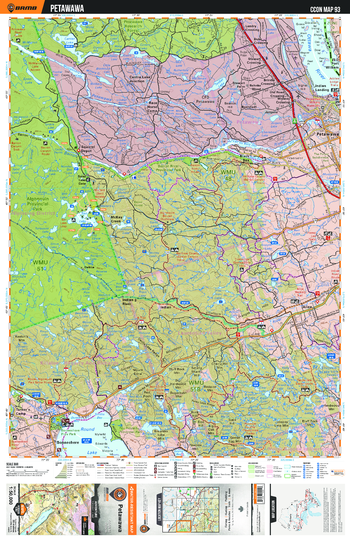
CCON93 Petawawa - Cottage Country Ontario Topo
Backroad Mapbooks
This recreation topographic map for Petawawa highlights all the logging/resource roads, hunting areas, fishing lakes & streams, campsites, paddling routes for canoeing and kayaking, wildlife viewing areas, multi-use trails for hiking, biking, horseback riding, cross-country skiing and snowshoeing, motorized trails for ATVing and snowmobiling & more. Covering 1,090 km2 (420 mi2), this 1:50,000 scale map measures 29 x 38 km (18 x 24 mi), providing you with more topographic and recreational detail for the Richmond Hill area than any other map on the market. New features include enhanced Crown land, countless new roads and trails and a wealth of recreational Points of Interest. Included on this map are Petawawa, Indian River, Algonquin Provincial Park, McKay Creek, Bonnechere, Black Bay and more!
Page Size: 24 x 37 in (610 x 940 mm)
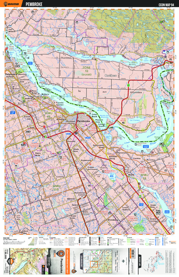
CCON94 Pembroke - Cottage Country Ontario Topo
Backroad Mapbooks
This recreation topographic map for Pembroke highlights all the logging/resource roads, hunting areas, fishing lakes & streams, campsites, paddling routes for canoeing and kayaking, wildlife viewing areas, multi-use trails for hiking, biking, horseback riding, cross-country skiing and snowshoeing, motorized trails for ATVing and snowmobiling & more. Covering 1,090 km2 (420 mi2), this 1:50,000 scale map measures 29 x 38 km (18 x 24 mi), providing you with more topographic and recreational detail for the Richmond Hill area than any other map on the market. New features include enhanced Crown land, countless new roads and trails and a wealth of recreational Points of Interest. Included on this map are Pembroke, Petawawa, Locksley, Slabtown, Rankin, Lower Strafford, Snake River and more!
Page Size: 24 x 37 in (610 x 940 mm)
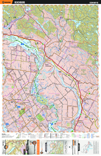
CCON95 Beachburg - Cottage Country Ontario Topo
Backroad Mapbooks
This recreation topographic map for Beachburg highlights all the logging/resource roads, hunting areas, fishing lakes & streams, campsites, paddling routes for canoeing and kayaking, wildlife viewing areas, multi-use trails for hiking, biking, horseback riding, cross-country skiing and snowshoeing, motorized trails for ATVing and snowmobiling & more. Covering 1,090 km2 (420 mi2), this 1:50,000 scale map measures 29 x 38 km (18 x 24 mi), providing you with more topographic and recreational detail for the Richmond Hill area than any other map on the market. New features include enhanced Crown land, countless new roads and trails and a wealth of recreational Points of Interest. Included on this map are Beachburg, Rocher Fendu, Westmeath, Pleasant Valley, La Passe, Millars Corner and more!
Page Size: 24 x 37 in (610 x 940 mm)
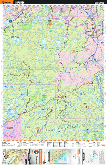
CCON96 Burwash - Cottage Country Ontario Topo
Backroad Mapbooks
This recreation topographic map for Burwash highlights all the logging/resource roads, hunting areas, fishing lakes & streams, campsites, paddling routes for canoeing and kayaking, wildlife viewing areas, multi-use trails for hiking, biking, horseback riding, cross-country skiing and snowshoeing, motorized trails for ATVing and snowmobiling & more. Covering 1,090 km2 (420 mi2), this 1:50,000 scale map measures 29 x 38 km (18 x 24 mi), providing you with more topographic and recreational detail for the Richmond Hill area than any other map on the market. New features include enhanced Crown land, countless new roads and trails and a wealth of recreational Points of Interest. Included on this map are Burwash, Moxam's Landing, McVitties, Secord, Waterfall, French River Provincial Park and more!
Page Size: 24 x 37 in (610 x 940 mm)
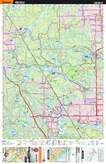
CCON97 Noëlville - Cottage Country Ontario Topo
Backroad Mapbooks
This recreation topographic map for Noëlville highlights all the logging/resource roads, hunting areas, fishing lakes & streams, campsites, paddling routes for canoeing and kayaking, wildlife viewing areas, multi-use trails for hiking, biking, horseback riding, cross-country skiing and snowshoeing, motorized trails for ATVing and snowmobiling & more. Covering 1,090 km2 (420 mi2), this 1:50,000 scale map measures 29 x 38 km (18 x 24 mi), providing you with more topographic and recreational detail for the Richmond Hill area than any other map on the market. New features include enhanced Crown land, countless new roads and trails and a wealth of recreational Points of Interest. Included on this map are Trout Lake, Quelette, St Charles, Happy Landing, Delamere, French River Provincial Park and more!
Page Size: 24 x 37 in (610 x 940 mm)
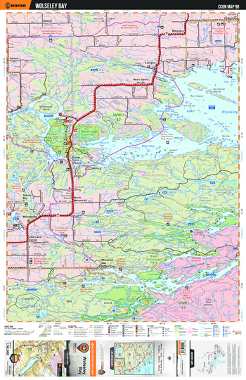
CCON98 Wolseley Bay - Cottage Country Ontario Topo
Backroad Mapbooks
This recreation topographic map for Wolseley Bay highlights all the logging/resource roads, hunting areas, fishing lakes & streams, campsites, paddling routes for canoeing and kayaking, wildlife viewing areas, multi-use trails for hiking, biking, horseback riding, cross-country skiing and snowshoeing, motorized trails for ATVing and snowmobiling & more. Covering 1,090 km2 (420 mi2), this 1:50,000 scale map measures 29 x 38 km (18 x 24 mi), providing you with more topographic and recreational detail for the Richmond Hill area than any other map on the market. New features include enhanced Crown land, countless new roads and trails and a wealth of recreational Points of Interest. Included on this map are Wolseley Bay, French River Provincial Park, Sucker Creek Landing, Monetville, Chartrand Corner, Trans Canada Trail and more!
Page Size: 24 x 37 in (610 x 940 mm)
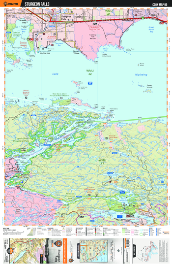
CCON99 Sturgeon Falls - Cottage Country Ontario Topo
Backroad Mapbooks
This recreation topographic map for Sturgeon Falls highlights all the logging/resource roads, hunting areas, fishing lakes & streams, campsites, paddling routes for canoeing and kayaking, wildlife viewing areas, multi-use trails for hiking, biking, horseback riding, cross-country skiing and snowshoeing, motorized trails for ATVing and snowmobiling & more. Covering 1,090 km2 (420 mi2), this 1:50,000 scale map measures 29 x 38 km (18 x 24 mi), providing you with more topographic and recreational detail for the Richmond Hill area than any other map on the market. New features include enhanced Crown land, countless new roads and trails and a wealth of recreational Points of Interest. Included on this map are Sturgeon Falls, Lake Nipissing, Trans Canada Trail, French River Provincial Park, Dokis, Meadowside and more!
Page Size: 24 x 37 in (610 x 940 mm)
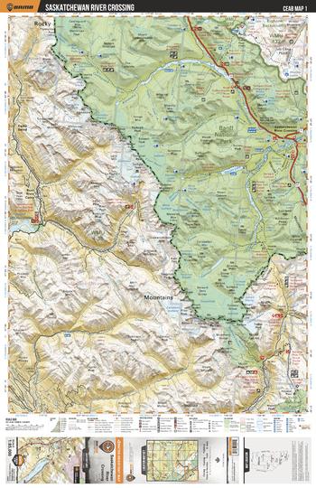
CEAB01 Saskatchewan River Crossing - Central Alberta Topo
Backroad Mapbooks
This recreation topographic map for Saskatchewan River Crossing highlights all the logging and resource roads, multi-use trails for hikers, mountain bikers, horseback riders, cross-country skiers and snowshoers, motorized trails for ATVers and snowmobiles, fishing lakes and rivers, recreation areas, campgrounds, day-use areas, viewpoints, backcountry campsites, work camps, oil & gas sites, backcountry huts and cabins and more. No other map for the area provides you with this level of recreational or topographic detail. Covering 3,040 km2 (1,175 mi2) in total, this 1:85,000 scale map measures 48 x 63.5 km (30 x 39.5 mi). Special features include enhanced oil & gas data plus countless roads, trails and recreational Points of Interest. This map includes Alexandra River, Banff National Park, Blaeberry River, Castleguard Mountain, David Thompson Trail, Glacier Lake, Great Divide Trail, Howse River, Michele Falls, Mount Outram, Pinto Lake and more!
Page Size: 24 x 37 in (610 x 940 mm)
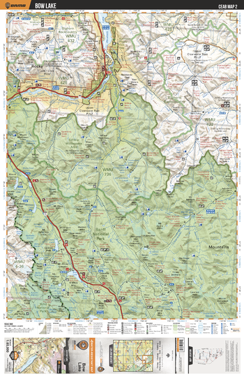
CEAB02 Bow Lake - Central Alberta Topo
Backroad Mapbooks
This recreation topographic map for Bow Lake highlights all the logging and resource roads, multi-use trails for hikers, mountain bikers, horseback riders, cross-country skiers and snowshoers, motorized trails for ATVers and snowmobiles, fishing lakes and rivers, recreation areas, campgrounds, day-use areas, viewpoints, backcountry campsites, work camps, oil & gas sites, backcountry huts and cabins and more. No other map for the area provides you with this level of recreational or topographic detail. Covering 3,040 km2 (1,175 mi2) in total, this 1:85,000 scale map measures 48 x 63.5 km (30 x 39.5 mi). Special features include enhanced oil & gas data plus countless roads, trails and recreational Points of Interest. This map includes Abraham Lake, North Saskatchewan River, Banff National Park, Yoho National Park, Clearwater River, Siffleur River and more!
Page Size: 24 x 37 in (610 x 940 mm)
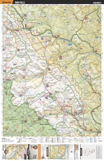
CEAB03 Ram Falls - Central Alberta Topo
Backroad Mapbooks
This recreation topographic map for Ram Falls highlights all the logging and resource roads, multi-use trails for hikers, mountain bikers, horseback riders, cross-country skiers and snowshoers, motorized trails for ATVers and snowmobiles, fishing lakes and rivers, recreation areas, campgrounds, day-use areas, viewpoints, backcountry campsites, work camps, oil & gas sites, backcountry huts and cabins and more. No other map for the area provides you with this level of recreational or topographic detail. Covering 3,040 km2 (1,175 mi2) in total, this 1:85,000 scale map measures 48 x 63.5 km (30 x 39.5 mi). Special features include enhanced oil & gas data plus countless roads, trails and recreational Points of Interest. This map includes Ram Falls, Ram Falls Provincial Park, Banff Nationa Park, Red Deer River, Clearwater River, Limestone Mountain and more!
Page Size: 24 x 37 in (610 x 940 mm)
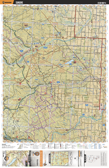
CEAB04 Sundre - Central Alberta Topo
Backroad Mapbooks
This recreation topographic map for Sundre highlights all the logging and resource roads, multi-use trails for hikers, mountain bikers, horseback riders, cross-country skiers and snowshoers, motorized trails for ATVers and snowmobiles, fishing lakes and rivers, recreation areas, campgrounds, day-use areas, viewpoints, backcountry campsites, work camps, oil & gas sites, backcountry huts and cabins and more. No other map for the area provides you with this level of recreational or topographic detail. Covering 3,040 km2 (1,175 mi2) in total, this 1:85,000 scale map measures 48 x 63.5 km (30 x 39.5 mi). Special features include enhanced oil & gas data plus countless roads, trails and recreational Points of Interest. This map includes Sundre, Burnstick Lake, Red Deer River, Caroline, Clearwater River, Swan Lake, Ram River, James River, Whiskey Jack Crossing, Tay River and more!
Page Size: 24 x 37 in (610 x 940 mm)
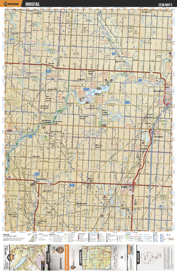
CEAB05 Innisfail - Central Alberta Topo
Backroad Mapbooks
This recreation topographic map for Innisfail highlights all the logging and resource roads, multi-use trails for hikers, mountain bikers, horseback riders, cross-country skiers and snowshoers, motorized trails for ATVers and snowmobiles, fishing lakes and rivers, recreation areas, campgrounds, day-use areas, viewpoints, backcountry campsites, work camps, oil & gas sites, backcountry huts and cabins and more. No other map for the area provides you with this level of recreational or topographic detail. Covering 3,040 km2 (1,175 mi2) in total, this 1:85,000 scale map measures 48 x 63.5 km (30 x 39.5 mi). Special features include enhanced oil & gas data plus countless roads, trails and recreational Points of Interest. This map includes Gleniffer Lake, Bowden, Olds, Innisfail, Westward Ho, Red Deer River, Medicine River, Raven, Little Red Deer River, Markerville and more!
Page Size: 24 x 37 in (610 x 940 mm)
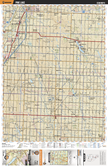
CEAB06 Pine Lake - Central Alberta Topo
Backroad Mapbooks
This recreation topographic map for Pine Lake highlights all the logging and resource roads, multi-use trails for hikers, mountain bikers, horseback riders, cross-country skiers and snowshoers, motorized trails for ATVers and snowmobiles, fishing lakes and rivers, recreation areas, campgrounds, day-use areas, viewpoints, backcountry campsites, work camps, oil & gas sites, backcountry huts and cabins and more. No other map for the area provides you with this level of recreational or topographic detail. Covering 3,040 km2 (1,175 mi2) in total, this 1:85,000 scale map measures 48 x 63.5 km (30 x 39.5 mi). Special features include enhanced oil & gas data plus countless roads, trails and recreational Points of Interest. This map includes Pine Lake, Torrington, Three Hills, Burns Lake, Knee Hill Valley, Penhold, Red Deer, Spyker Little, Red Deer River, Pakkwaw Lake and more!
Page Size: 24 x 37 in (610 x 940 mm)
No search results