


MapSherpa Catalog
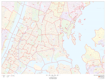
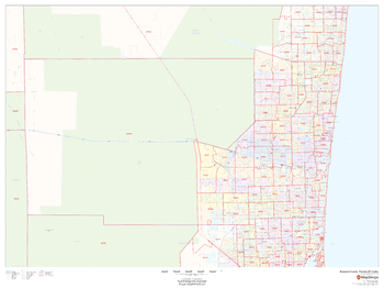
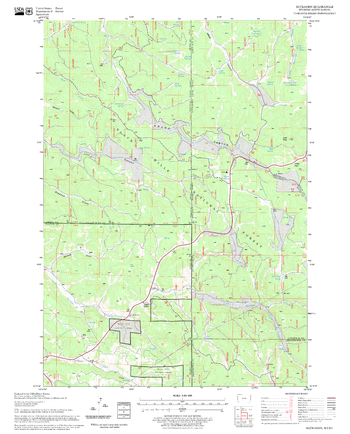
Bronx County, New York ZIP Codes
MapSherpa
This map of Bronx County, New York shows ZIP code areas overlaid on a road map. Ideal for planning of deliveries, home services, sales territories, real estate and much more. Base map features include all roads with major roads and highways labelled; neighborhood names; railways; and high level land use such as parks and recreation areas, industrial areas and hospital campuses.
Page Size: 48 x 36 in (1219 x 914 mm)
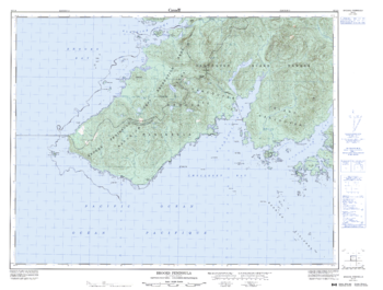
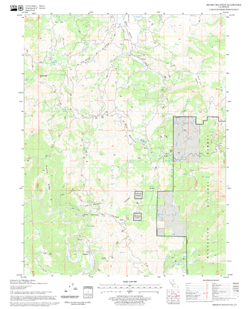
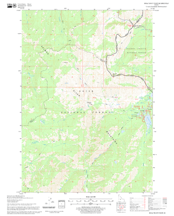
Brooks Peninsula - 92 L/4 - British Columbia
Natural Resources Canada
Canadian topographic map of Brooks Peninsula, British Columbia. NTS sheet 092L04 Edition 3.
Page Size: 34.25 x 26 in (865 x 655 mm)
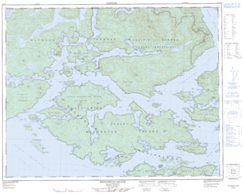
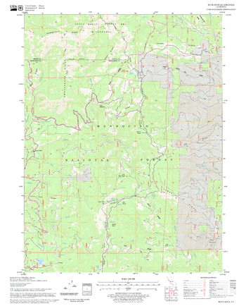
Broughton Island - 92 L/15 - British Columbia
Natural Resources Canada
Canadian topographic map of Broughton Island, British Columbia. NTS sheet 092L15 Edition 3.
Page Size: 32 x 25.5 in (809 x 642 mm)
Broward County, Florida
MapSherpa
This map of Broward County, Florida shows regional level information. Base map features include highways and major roads with labelling; neighborhood names; railways; high level land use such as parks and recreation areas, industrial areas and hospital campuses; and a selection of points of interest including transportation hubs like airports and train stations, tourist information, police stations and shopping centres. ZIP code boundaries are shown as a secondary map feature.
Page Size: 48 x 36 in (1219 x 914 mm)
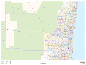
Broward County, Florida ZIP Codes
MapSherpa
This map of Broward County, Florida shows ZIP code areas overlaid on a road map. Ideal for planning of deliveries, home services, sales territories, real estate and much more. Base map features include all roads with major roads and highways labelled; neighborhood names; railways; and high level land use such as parks and recreation areas, industrial areas and hospital campuses.
Page Size: 48 x 36 in (1219 x 914 mm)
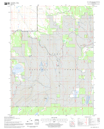
Brushy Mountain Quadrangle, California
United States Department of Agriculture Forest Service
United States Department of Agriculture Forestry Service topographical map of Brushy Mountain, Mendocino National Forest, California.
Page Size: 21.75 x 27 in (552 x 686 mm)
Buck Rock Quadrangle, California
United States Department of Agriculture Forest Service
United States Department of Agriculture Forestry Service topographical map of Buck Rock, Mendocino National Forest, California.
Page Size: 21.75 x 27 in (552 x 686 mm)
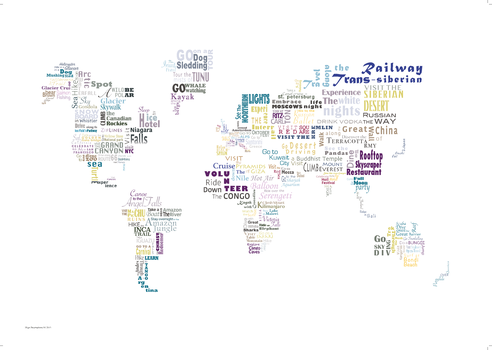
Bucket List Map
Maps International
This Bucket List is a typographic print of over 100 things you can do around the world, a great gift for an enthusiastic traveller or couple who dream sharing of adventures around the world. This print will look great in your home, inspiring your wanderlust when planning your next big adventure.
ISBN 9781910378267
Page Size: 33.25 x 23.5 in (841 x 594 mm)

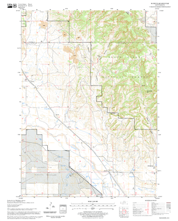
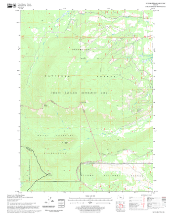
Buckhorn Mountain Quadrangle, Arizona
United States Department of Agriculture Forest Service
United States Department of Agriculture Forestry Service topographical map of Buckhorn Mountain, Coconino National Forest, Arizona.
Page Size: 21.75 x 27 in (552 x 686 mm)
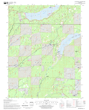
Buckhorn Quadrangle, South Dakota
United States Department of Agriculture Forest Service
United States Department of Agriculture Forestry Service topographical map of Buckhorn, Black Hills National Forest, South Dakota.
Page Size: 21.75 x 27 in (552 x 686 mm)

Buckinghamshire County Map
XYZ Maps
This is a large ceremonial county map of Buckinghamshire highlighting the county border, with the surrounding area faded out for excellent contrast. The map covers Aylesbury, Beaconsfiled, Buckingham, Chalfont St Giles, Eton, High Wycombe, Linslade, Marlow, Milton Keynes, Princes Risborough and Slough. The county map shows the latest County and Unitary Authority Boundaries, Overlaid on a Clear and Easy to Read Ordnance Survey map.
Page Size: 33.25 x 47 in (841 x 1189 mm)
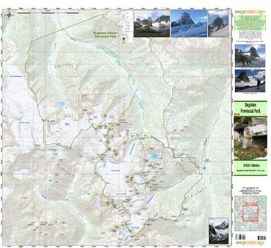
Bugaboo Provincial Park
GoTrekkers
Bugaboo Provincial Park
Page Size: 35 x 32 in (889 x 813 mm)
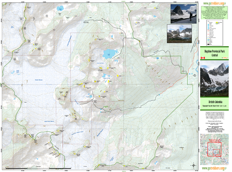
Bugaboo Provincial Park Central
GoTrekkers
Bugaboo Provincial Park Central
Page Size: 35 x 26 in (889 x 660 mm)
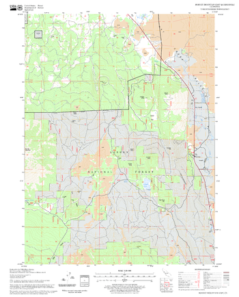
Bull Trout Point Quadrangle, Idaho
United States Department of Agriculture Forest Service
United States Department of Agriculture Forestry Service topographical map of Bull Trout Point, Salmon-Chalis National Forest, Idaho.
Page Size: 21.75 x 27 in (552 x 686 mm)
Bullard Lake Quadrangle, California
United States Department of Agriculture Forest Service
United States Department of Agriculture Forestry Service topographical map of Bullard Lake, Lassen National Forest, California.
Page Size: 21.75 x 27 in (552 x 686 mm)
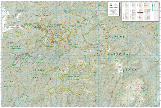
Buller-Howitt Alpine Area, Victoria Topographic Map
Spatial Vision
Outdoor Recreation Guide of Buller-Howitt Alpine area in Victoria for Bushwalking, skiing, mountain biking and car touring
Page Size: 39.5 x 26.75 in (1000 x 675 mm)
Bunker Hill Quadrangle, California
United States Department of Agriculture Forest Service
United States Department of Agriculture Forestry Service topographical map of Bunker Hill, Tahoe National Forest, California.
Page Size: 21.75 x 27 in (552 x 686 mm)
Burdock Quadrangle, South Dakota
United States Department of Agriculture Forest Service
United States Department of Agriculture Forestry Service topographical map of Burdock, Black Hills National Forest, South Dakota.
Page Size: 21.75 x 27 in (552 x 686 mm)
Burn Butte Quadrangle, Oregon
United States Department of Agriculture Forest Service
United States Department of Agriculture Forestry Service topographical map of Burn Butte, Deschutes National Forest, Oregon.
Page Size: 21.75 x 27 in (552 x 686 mm)
Burney Mountain East Quadrangle, California
United States Department of Agriculture Forest Service
United States Department of Agriculture Forestry Service topographical map of Burney Mountain East, Lassen National Forest, California.
Page Size: 21.75 x 27 in (552 x 686 mm)
No search results