


MapSherpa Catalog
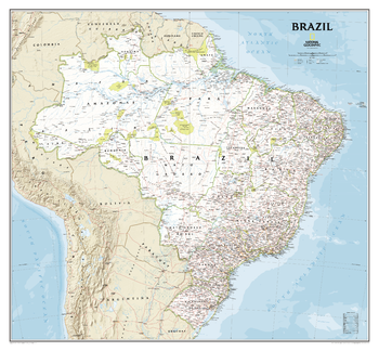
Brazil Classic
National Geographic
National Geographic's Brazil Classic wall map is fittingly one of the largest maps available of the largest country by area in South America, and the fifth largest in the World.<br><br>It shows the entire country in exceptional detail, including Brazil's 26 states and 1 federal district, plus the coastal islands that make up Fernando de Noronha National Marine Park, Abrolhos National Park, and Arquipelago dos Abrolhos.<br><br>The map shows over 1,000 named places including state capitals, primary and secondary towns, political boundaries, important infrastructure, and all key landforms. Brazil's national parks are clearly highlighted and labeled, as is the country's rich network of rivers that feed the Amazon–the world's second longest river.
Page Size: 41 x 38 in (1041 x 965 mm)
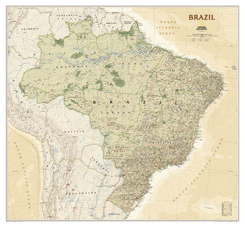
Brazil Executive
National Geographic
National Geographic's Brazil Executive wall map is fittingly one of the largest maps available of the largest country by area in South America, and the fifth largest in the World.<br><br>It shows the entire country in exceptional detail, including Brazil's 26 states and 1 federal district, plus the coastal islands that make up Fernando de Noronha National Marine Park, Abrolhos National Park, and Arquipelago dos Abrolhos.<br><br>The map shows over 1,000 named places including state capitals, primary and secondary towns, political boundaries, important infrastructure, and all key landforms. Brazil's national parks are clearly highlighted and labeled, as is the country's rich network of rivers that feed the Amazon–the world's second longest river.
Page Size: 41 x 38 in (1041 x 965 mm)
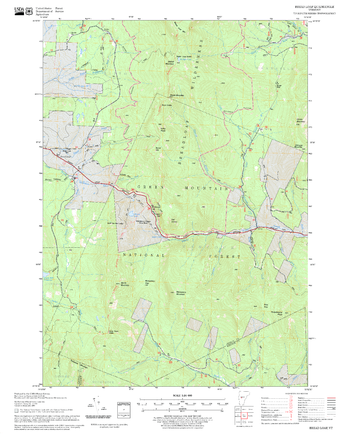
Bread Loaf Quadrangle, New Hampshire-Vermont
United States Department of Agriculture Forest Service
United States Forestry Service topographical map of Bread Loaf, New Hampshire-Vermont
Page Size: 21.75 x 27 in (552 x 686 mm)
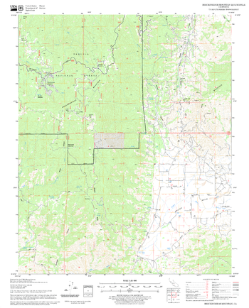
Breckenridge Mountain Quadrangle, California
United States Department of Agriculture Forest Service
United States Department of Agriculture Forestry Service topographical map of Breckenridge Mountain, Sequoia National Forest, California.
Page Size: 21.75 x 27 in (552 x 686 mm)
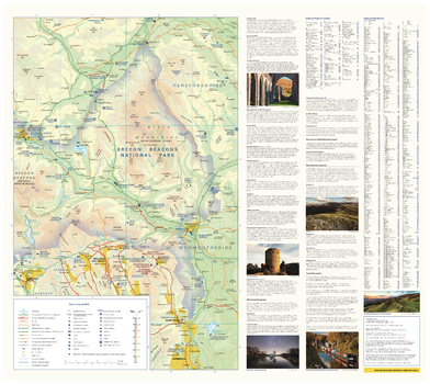
Brecon Beacons National Park Map - East
Collins
With clear mapping and a high level of detail, explore Brecon Beacons National Park easily with maps from Collins. This map identifies key park, tourist, and travel information, presented alongside a selection of photographs, making it an ideal companion for those exploring this beautiful area of Wales.
Page Size: 25 x 22.25 in (630 x 560 mm)
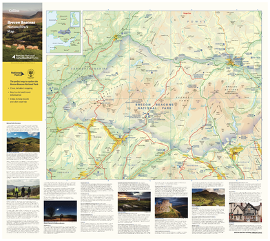
Brecon Beacons National Park Map - West
Collins
With clear mapping and a high level of detail, explore Brecon Beacons National Park easily with maps from Collins. This map identifies key park, tourist, and travel information, presented alongside a selection of photographs, making it an ideal companion for those exploring this beautiful area of Wales.
Page Size: 25 x 22.25 in (630 x 560 mm)
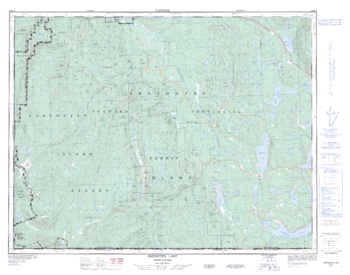
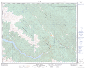
Brewster Lake - 92 K/4 - British Columbia
Natural Resources Canada
Canadian topographic map of Brewster Lake, British Columbia. NTS sheet 092K04 Edition 2.
Page Size: 33.25 x 26.25 in (841 x 662 mm)
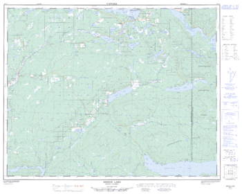
Bridge Lake - 92 P/7 - British Columbia
Natural Resources Canada
Canadian topographic map of Bridge Lake, British Columbia. NTS sheet 092P07 Edition 2.
Page Size: 32 x 25.5 in (808 x 645 mm)
Bridge River - 92 J/16 - British Columbia
Natural Resources Canada
Canadian topographic map of Bridge River, British Columbia. NTS sheet 092J16 Edition 2.
Page Size: 32.5 x 25.5 in (821 x 646 mm)

Brighton - BN - Postcode Wall Map
XYZ Maps
The Brighton Postcode Sector Wall Map shows detailed postcode sector boundaries (BN1 1, BN1 2) on a comprehensive background and is perfect for determining postcode boundaries for sales areas, planning mailshots and also an excellent reference for logistics. This wall map covers the whole of the BN Postcode Area.
Page Size: 47 x 33.25 in (1189 x 841 mm)
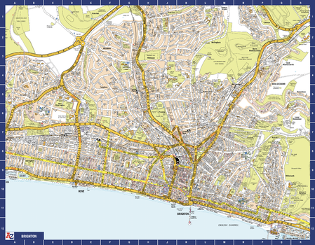
Brighton A-Z Street Map
A-Z Maps
The perfect reference map for finding your way around Brighton. This up-to-date detailed A-Z town plan includes 2,600 streets in and around Brighton. As well as the sea front and Brighton Palace Pier, the other areas covered are The Lanes, Preston Park, the Artists’ Quarter, Hanover and Seven Dials. The large scale 1 mile to 5.5 inch street map includes places of interest, among other features.
Page Size: 28.5 x 22.25 in (718 x 560 mm)
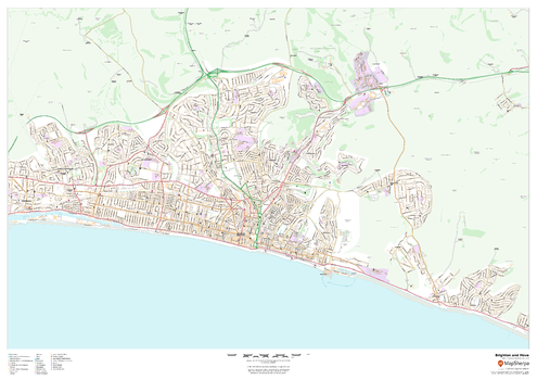
Brighton and Hove
MapSherpa
This map of Brighton and Hove shows detailed street level information including extensive street labelling. Ideal for planning of deliveries, home services, sales territories, real estate and much more.
Page Size: 47 x 33.25 in (1189 x 841 mm)
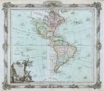
Brion de la Tour Map of North America and South America (1764)
Artokoloro
1764 map of North and South America by French geographer Louis Brion de la Tour. Full title: L'Amérique Dressée for l'étude de la Géographie.
Page Size: 17.25 x 15.25 in (436 x 383 mm)
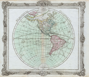
Brion de la Tour Map of the Western Hemisphere (1764)
Artokoloro
1764 map of the Western Hemisphere by French geographer Louis Brion de la Tour. Full Title: Hémisphere Occidental.
Page Size: 17.5 x 15.25 in (442 x 384 mm)
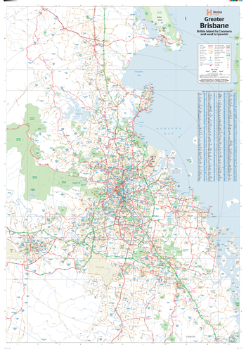
Brisbane & Region Supermap
Hema Maps
A large map of Brisbane and its surrounding regions that features suburbs and postcodes, marked camping areas, caravan parks, fuel supplies, major national parks and an index.
ISBN 9781925195576
Page Size: 39.5 x 56.25 in (1000 x 1428 mm)
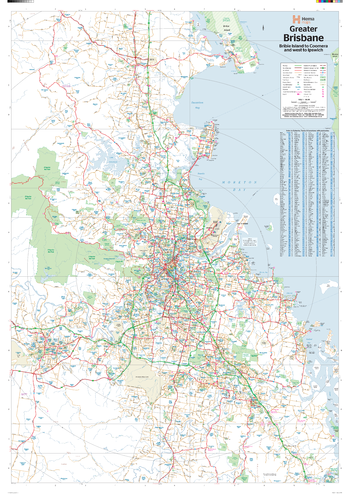
Brisbane & Region Wall Map
Hema Maps
A map of Brisbane and its surrounding regions that features suburbs and postcodes, marked camping areas, caravan parks, fuel supplies, major national parks and an index.
Page Size: 27.75 x 39.5 in (700 x 1000 mm)

Bristol & South Gloucestershire County Map
XYZ Maps
This is a large ceremonial county map of Bristol & South Gloucestershire. highlighting the county border, with the surrounding area faded out for excellent contrast. The map covers Thornbury, Yate, Acton Turville, Kingswood Bristol, Shirehampton and Avonmouth. The county map shows the latest County and Unitary Authority Boundaries, overlaid on a clear and easy to read Ordnance Survey map.
Page Size: 33.25 x 47 in (841 x 1189 mm)

Bristol - BS - Postcode Wall Map
XYZ Maps
The Bristol Postcode Sector Wall Map shows detailed postcode sector boundaries (BS1 1, BS1 2) on a comprehensive background and is perfect for determining postcode boundaries for sales areas, planning mailshots and also an excellent reference for logistics. This wall map covers the whole of the BS Postcode Area.
Page Size: 33.25 x 47 in (841 x 1189 mm)
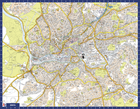
Bristol A-Z Street Map
A-Z Maps
The perfect reference map for finding your way around Bristol. This up-to-date detailed A-Z town plan includes more than 3,700 streets in and around Bristol. Detailed coverage of an area extending from Bishopston in the north to Knowle Golf Course in the south, and from Crew’s Hole in the east to Leigh Woods in the west. The highly detailed 1 mile to 4.5 inch street map includes places of interest, among other features.
Page Size: 28.5 x 22.25 in (718 x 560 mm)
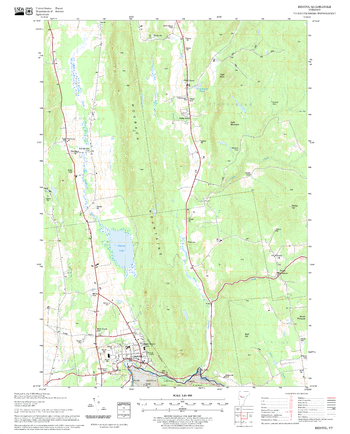
Bristol Quadrangle, New Hampshire-Vermont
United States Department of Agriculture Forest Service
United States Forestry Service topographical map of Bristol, New Hampshire-Vermont
Page Size: 21.75 x 27 in (552 x 686 mm)
No search results