


MapSherpa Catalog
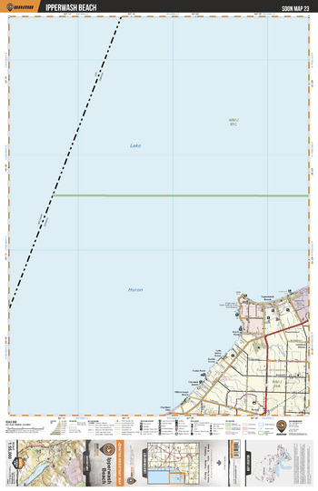
SOON23 Ipperwash Beach - Southern Ontario Topo
Backroad Mapbooks
This recreation topographic map for Ipperwash Beach highlights all the logging/resource roads, hunting areas, fishing lakes & streams, campsites, paddling routes for canoeing and kayaking, wildlife viewing areas, multi-use trails for hiking, biking, horseback riding, cross-country skiing and snowshoeing, motorized trails for ATVing and snowmobiling & more. Covering 1,325 km2 (510 mi2), this 1:55,000 scale map measures 31.5 x 42 km (19.5 x 26 mi), providing you with more topographic and recreational detail for the Detroit River area than any other map on the market. New features include expanded road and trail data and countless recreational Points of Interest. Included on this map are Lake Huron, Ipperwash Beach, Cedar Point, Glendale Beach, Highland Glen, Forest, Ipperwash Provincial Park, Ravenswood, Kinnaird, Kettle Point and more!
Page Size: 24 x 37 in (610 x 940 mm)
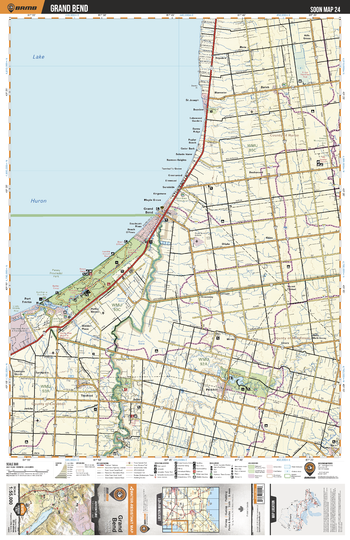
SOON24 Grand Bend - Southern Ontario Topo
Backroad Mapbooks
This recreation topographic map for Grand Bend highlights all the logging/resource roads, hunting areas, fishing lakes & streams, campsites, paddling routes for canoeing and kayaking, wildlife viewing areas, multi-use trails for hiking, biking, horseback riding, cross-country skiing and snowshoeing, motorized trails for ATVing and snowmobiling & more. Covering 1,325 km2 (510 mi2), this 1:55,000 scale map measures 31.5 x 42 km (19.5 x 26 mi), providing you with more topographic and recreational detail for the Detroit River area than any other map on the market. New features include expanded road and trail data and countless recreational Points of Interest. Included on this map are Lake Huron, The Pinery Provincial Park, Grand Bend, St Joseph, Parkhill, Ausable River, Thedford, Port Franks, Sylvan, Nairn and more!
Page Size: 24 x 37 in (610 x 940 mm)
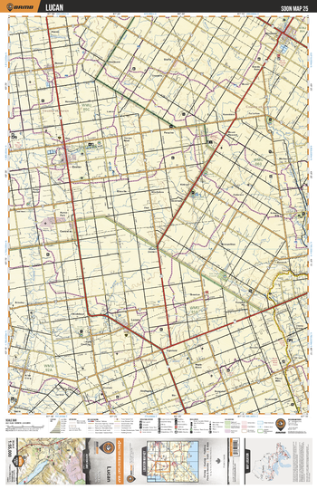
SOON25 Lucan - Southern Ontario Topo
Backroad Mapbooks
This recreation topographic map for Lucan highlights all the logging/resource roads, hunting areas, fishing lakes & streams, campsites, paddling routes for canoeing and kayaking, wildlife viewing areas, multi-use trails for hiking, biking, horseback riding, cross-country skiing and snowshoeing, motorized trails for ATVing and snowmobiling & more. Covering 1,325 km2 (510 mi2), this 1:55,000 scale map measures 31.5 x 42 km (19.5 x 26 mi), providing you with more topographic and recreational detail for the Detroit River area than any other map on the market. New features include expanded road and trail data and countless recreational Points of Interest. Included on this map are Mitchell, Lucan, Exeter, Hay, Huron Park, Hensall, Ailsa Craig, Thames River, Centralia, Motherwell and more!
Page Size: 24 x 37 in (610 x 940 mm)
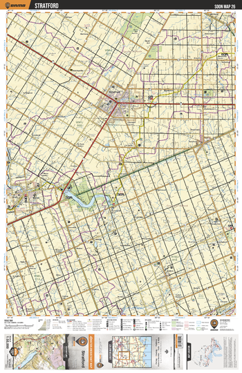
SOON26 Stratford - Southern Ontario Topo
Backroad Mapbooks
This recreation topographic map for Stratford highlights all the logging/resource roads, hunting areas, fishing lakes & streams, campsites, paddling routes for canoeing and kayaking, wildlife viewing areas, multi-use trails for hiking, biking, horseback riding, cross-country skiing and snowshoeing, motorized trails for ATVing and snowmobiling & more. Covering 1,325 km2 (510 mi2), this 1:55,000 scale map measures 31.5 x 42 km (19.5 x 26 mi), providing you with more topographic and recreational detail for the Detroit River area than any other map on the market. New features include expanded road and trail data and countless recreational Points of Interest. Included on this map are Stratford, St Marys, Lind, Tavistock, Embro, Wildwood Lake, Shakespear, Sebringville and more!
Page Size: 24 x 37 in (610 x 940 mm)
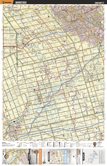
SOON27 Woodstock - Southern Ontario Topo
Backroad Mapbooks
This recreation topographic map for Woodstock highlights all the logging/resource roads, hunting areas, fishing lakes & streams, campsites, paddling routes for canoeing and kayaking, wildlife viewing areas, multi-use trails for hiking, biking, horseback riding, cross-country skiing and snowshoeing, motorized trails for ATVing and snowmobiling & more. Covering 1,325 km2 (510 mi2), this 1:55,000 scale map measures 31.5 x 42 km (19.5 x 26 mi), providing you with more topographic and recreational detail for the Detroit River area than any other map on the market. New features include expanded road and trail data and countless recreational Points of Interest. Included on this map are Kitchener, Waterloo, Baden, New Hamburg, Wellesley, Plattsville, Ayr, Paris, Innerkip, Woodstock and more!
Page Size: 24 x 37 in (610 x 940 mm)
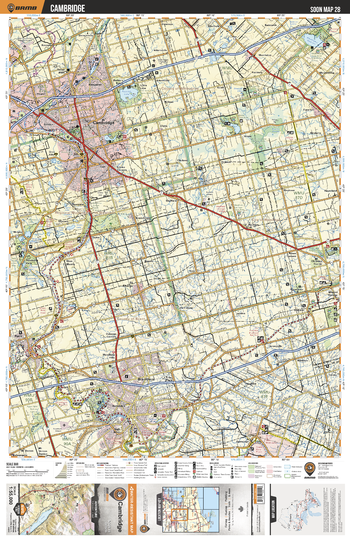
SOON28 Cambridge - Southern Ontario Topo
Backroad Mapbooks
This recreation topographic map for Cambridge highlights all the logging/resource roads, hunting areas, fishing lakes & streams, campsites, paddling routes for canoeing and kayaking, wildlife viewing areas, multi-use trails for hiking, biking, horseback riding, cross-country skiing and snowshoeing, motorized trails for ATVing and snowmobiling & more. Covering 1,325 km2 (510 mi2), this 1:55,000 scale map measures 31.5 x 42 km (19.5 x 26 mi), providing you with more topographic and recreational detail for the Detroit River area than any other map on the market. New features include expanded road and trail data and countless recreational Points of Interest. Included on this map are Cambridge, Brantford, Paris, Freelton, Mineral Springs, Onondaga, Grand River, Harrisburg, St George, Mountsberg Reservoir and more!
Page Size: 24 x 37 in (610 x 940 mm)
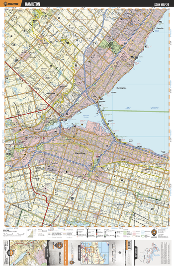
SOON29 Hamilton - Southern Ontario Topo
Backroad Mapbooks
This recreation topographic map for Hamilton highlights all the logging/resource roads, hunting areas, fishing lakes & streams, campsites, paddling routes for canoeing and kayaking, wildlife viewing areas, multi-use trails for hiking, biking, horseback riding, cross-country skiing and snowshoeing, motorized trails for ATVing and snowmobiling & more. Covering 1,325 km2 (510 mi2), this 1:55,000 scale map measures 31.5 x 42 km (19.5 x 26 mi), providing you with more topographic and recreational detail for the Detroit River area than any other map on the market. New features include expanded road and trail data and countless recreational Points of Interest. Included on this map are Lake Ontario, Hamilton, Burlington, Oakville, Dundas, Hamilton Harbour, Stoney Creek, Ancaster, Carlisle, Waterdown and more!
Page Size: 24 x 37 in (610 x 940 mm)
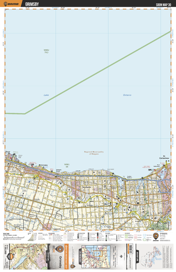
SOON30 Grimsby - Southern Ontario Topo
Backroad Mapbooks
This recreation topographic map for Grimsby highlights all the logging/resource roads, hunting areas, fishing lakes & streams, campsites, paddling routes for canoeing and kayaking, wildlife viewing areas, multi-use trails for hiking, biking, horseback riding, cross-country skiing and snowshoeing, motorized trails for ATVing and snowmobiling & more. Covering 1,325 km2 (510 mi2), this 1:55,000 scale map measures 31.5 x 42 km (19.5 x 26 mi), providing you with more topographic and recreational detail for the Detroit River area than any other map on the market. New features include expanded road and trail data and countless recreational Points of Interest. Included on this map are Lake Ontario, Grimsby, St Catharines, DeCew Falls, Beamsville, Smithville, Jordan Harbour and more!
Page Size: 24 x 37 in (610 x 940 mm)
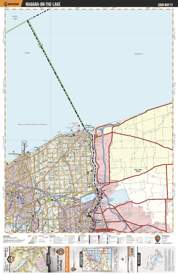
SOON31 Niagara-on-the-Lake – Southern Ontario Topo
Backroad Mapbooks
This recreation topographic map for Niagara-on-the-Lake highlights all the logging/resource roads, hunting areas, fishing lakes & streams, campsites, paddling routes for canoeing and kayaking, wildlife viewing areas, multi-use trails for hiking, biking, horseback riding, cross-country skiing and snowshoeing, motorized trails for ATVing and snowmobiling & more. Covering 1,090 km2 (420 mi2), this 1:55,000 scale map measures 29 x 38 km (18 x 24 mi), providing you with more topographic and recreational detail for the Niagara-on-the-Lake area than any other map on the market. New features include expanded road and trail data and countless recreational Points of Interest. Included on this map are Lake Ontario, McNab, Niagara-on-the-Lake, Niagara Falls, St Catharines, Thorold, Virgil and parts of New York state.
Page Size: 24 x 37 in (610 x 940 mm)
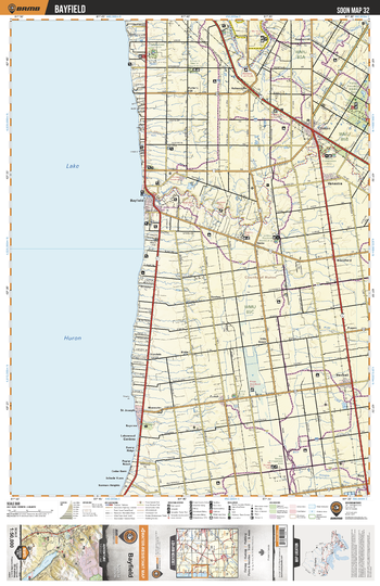
SOON32 Bayfeild - Southern Ontario Topo
Backroad Mapbooks
This recreation topographic map for Bayfeild highlights all the logging/resource roads, hunting areas, fishing lakes & streams, campsites, paddling routes for canoeing and kayaking, wildlife viewing areas, multi-use trails for hiking, biking, horseback riding, cross-country skiing and snowshoeing, motorized trails for ATVing and snowmobiling & more. Covering 1,090 km2 (420 mi2), this 1:50,000 scale map measures 29 x 38 km (18 x 24 mi), providing you with more topographic and recreational detail for the Niagara-on-the-Lake area than any other map on the market. New features include expanded road and trail data and countless recreational Points of Interest. Included on this map are Lake Huron, Bayfield, Clinton, Vanastra, Hensall, Zurich, St Joseph, Bayfield River, Maitland River, Hay and more.
Page Size: 24 x 37 in (610 x 940 mm)
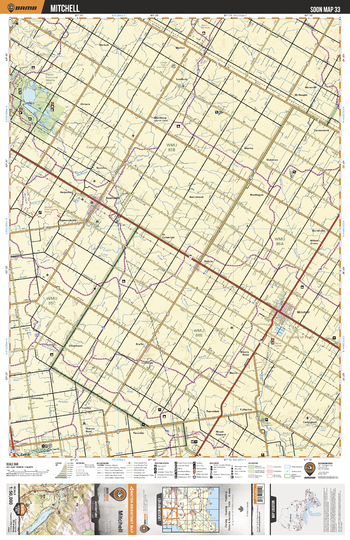
SOON33 Mitchell - Southern Ontario Topo
Backroad Mapbooks
This recreation topographic map for Mitchell highlights all the logging/resource roads, hunting areas, fishing lakes & streams, campsites, paddling routes for canoeing and kayaking, wildlife viewing areas, multi-use trails for hiking, biking, horseback riding, cross-country skiing and snowshoeing, motorized trails for ATVing and snowmobiling & more. Covering 1,090 km2 (420 mi2), this 1:50,000 scale map measures 29 x 38 km (18 x 24 mi), providing you with more topographic and recreational detail for the Niagara-on-the-Lake area than any other map on the market. New features include expanded road and trail data and countless recreational Points of Interest. Included on this map are Huilette Provincial Wildlife Management Area, Mitchell, Seaforth, Walton, Hay,Winthrop, Dublin and more.
Page Size: 24 x 37 in (610 x 940 mm)
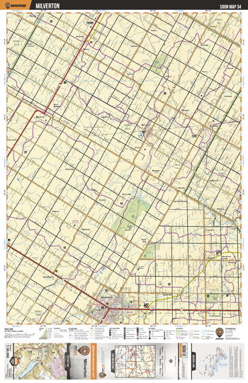
SOON34 Milverton - Southern Ontario Topo
Backroad Mapbooks
This recreation topographic map for Milverton highlights all the logging/resource roads, hunting areas, fishing lakes & streams, campsites, paddling routes for canoeing and kayaking, wildlife viewing areas, multi-use trails for hiking, biking, horseback riding, cross-country skiing and snowshoeing, motorized trails for ATVing and snowmobiling & more. Covering 1,090 km2 (420 mi2), this 1:50,000 scale map measures 29 x 38 km (18 x 24 mi), providing you with more topographic and recreational detail for the Niagara-on-the-Lake area than any other map on the market. New features include expanded road and trail data and countless recreational Points of Interest. Included on this map are Stratford, Shakespear, Milverton, Millbank, Newton, Atwood, Monkton, Sebringville, Mennonite Corner, Ellice Swamp Conservation Area and more.
Page Size: 24 x 37 in (610 x 940 mm)
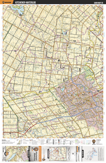
SOON35 Kitchener Waterloo - Southern Ontario Topo
Backroad Mapbooks
This recreation topographic map for Kitchener Waterloo highlights all the logging/resource roads, hunting areas, fishing lakes & streams, campsites, paddling routes for canoeing and kayaking, wildlife viewing areas, multi-use trails for hiking, biking, horseback riding, cross-country skiing and snowshoeing, motorized trails for ATVing and snowmobiling & more. Covering 1,090 km2 (420 mi2), this 1:50,000 scale map measures 29 x 38 km (18 x 24 mi), providing you with more topographic and recreational detail for the Niagara-on-the-Lake area than any other map on the market. New features include expanded road and trail data and countless recreational Points of Interest. Included on this map are Kitchener, Waterloo, New Hamburg, Wellesley, Elmira, Conestogo Lake, St Jacobs, Hawkesville, Baden, Woolwich Reservoir and more.
Page Size: 24 x 37 in (610 x 940 mm)
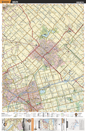
SOON36 Guelph - Southern Ontario Topo
Backroad Mapbooks
This recreation topographic map for Guelph highlights all the logging/resource roads, hunting areas, fishing lakes & streams, campsites, paddling routes for canoeing and kayaking, wildlife viewing areas, multi-use trails for hiking, biking, horseback riding, cross-country skiing and snowshoeing, motorized trails for ATVing and snowmobiling & more. Covering 1,090 km2 (420 mi2), this 1:50,000 scale map measures 29 x 38 km (18 x 24 mi), providing you with more topographic and recreational detail for the Niagara-on-the-Lake area than any other map on the market. New features include expanded road and trail data and countless recreational Points of Interest. Included on this map are Guelph, Cambridge, Kitchener, Blair, Valens, Rockwood, Elora, Morriston, Speed River, Guelph Lake and more.
Page Size: 24 x 37 in (610 x 940 mm)
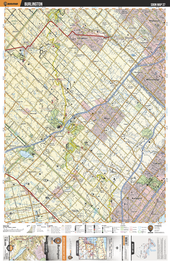
SOON37 Burlington - Southern Ontario Topo
Backroad Mapbooks
This recreation topographic map for Burlington highlights all the logging/resource roads, hunting areas, fishing lakes & streams, campsites, paddling routes for canoeing and kayaking, wildlife viewing areas, multi-use trails for hiking, biking, horseback riding, cross-country skiing and snowshoeing, motorized trails for ATVing and snowmobiling & more. Covering 1,090 km2 (420 mi2), this 1:50,000 scale map measures 29 x 38 km (18 x 24 mi), providing you with more topographic and recreational detail for the Niagara-on-the-Lake area than any other map on the market. New features include expanded road and trail data and countless recreational Points of Interest. Included on this map are Mississauga, Georgetown, Brampton, Acton, Milton, Burlington, Oakville, Bronte Creek Provincial Park, Mountsberg Reservoir, Crawford Lake and more.
Page Size: 24 x 37 in (610 x 940 mm)
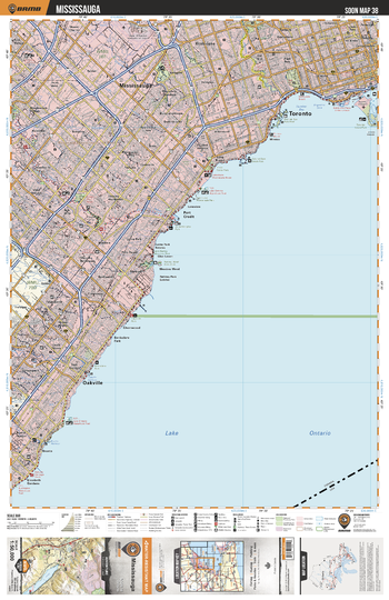
SOON38 Mississauga - Southern Ontario Topo
Backroad Mapbooks
This recreation topographic map for Mississauga highlights all the logging/resource roads, hunting areas, fishing lakes & streams, campsites, paddling routes for canoeing and kayaking, wildlife viewing areas, multi-use trails for hiking, biking, horseback riding, cross-country skiing and snowshoeing, motorized trails for ATVing and snowmobiling & more. Covering 1,090 km2 (420 mi2), this 1:50,000 scale map measures 29 x 38 km (18 x 24 mi), providing you with more topographic and recreational detail for the Niagara-on-the-Lake area than any other map on the market. New features include expanded road and trail data and countless recreational Points of Interest. Included on this map are Lake Ontario, Toronto, Oakville, Mississauga, Port Credit, Etobicoke and more.
Page Size: 24 x 37 in (610 x 940 mm)
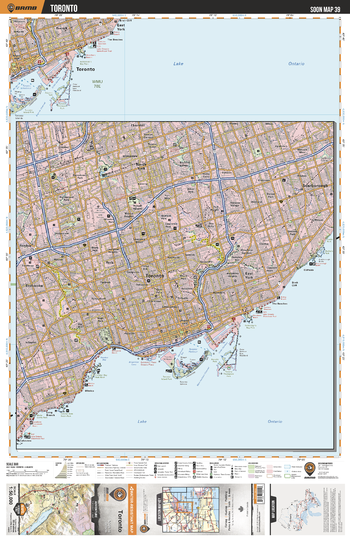
SOON39 Toronto - Southern Ontario Topo
Backroad Mapbooks
This recreation topographic map for Toronto highlights all the logging/resource roads, hunting areas, fishing lakes & streams, campsites, paddling routes for canoeing and kayaking, wildlife viewing areas, multi-use trails for hiking, biking, horseback riding, cross-country skiing and snowshoeing, motorized trails for ATVing and snowmobiling & more. Covering 1,090 km2 (420 mi2), this 1:50,000 scale map measures 29 x 38 km (18 x 24 mi), providing you with more topographic and recreational detail for the Niagara-on-the-Lake area than any other map on the market. New features include expanded road and trail data and countless recreational Points of Interest. Included on this map are Lake Ontario, Toronto, East York, Scarborough, North York, Etobicoke, Rexdale, Thornhill and more.
Page Size: 24 x 37 in (610 x 940 mm)
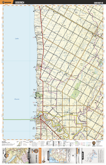
SOON40 Goderich - Southern Ontario Topo
Backroad Mapbooks
This recreation topographic map for Goderich highlights all the logging/resource roads, hunting areas, fishing lakes & streams, campsites, paddling routes for canoeing and kayaking, wildlife viewing areas, multi-use trails for hiking, biking, horseback riding, cross-country skiing and snowshoeing, motorized trails for ATVing and snowmobiling & more. Covering 1,090 km2 (420 mi2), this 1:50,000 scale map measures 29 x 38 km (18 x 24 mi), providing you with more topographic and recreational detail for the Niagara-on-the-Lake area than any other map on the market. New features include expanded road and trail data and countless recreational Points of Interest. Included on this map are Lake Huron, Goderich, Port Albert, Auburn, Maitland River, Benmiller, Point Farms Provincial Park, Lucknow, Saratoga, Dungannon and more.
Page Size: 24 x 37 in (610 x 940 mm)
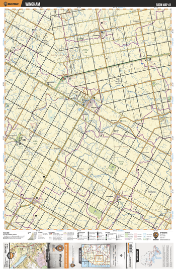
SOON41 Wingham - Southern Ontario Topo
Backroad Mapbooks
This recreation topographic map for Wingham highlights all the logging/resource roads, hunting areas, fishing lakes & streams, campsites, paddling routes for canoeing and kayaking, wildlife viewing areas, multi-use trails for hiking, biking, horseback riding, cross-country skiing and snowshoeing, motorized trails for ATVing and snowmobiling & more. Covering 1,090 km2 (420 mi2), this 1:50,000 scale map measures 29 x 38 km (18 x 24 mi), providing you with more topographic and recreational detail for the Niagara-on-the-Lake area than any other map on the market. New features include expanded road and trail data and countless recreational Points of Interest. Included on this map are Wingham, Brussels, Wroxeter, Teeswater, Donnybrook, Blyth, Londesborough, Langside, Belmore, Maitland River and more.
Page Size: 24 x 37 in (610 x 940 mm)
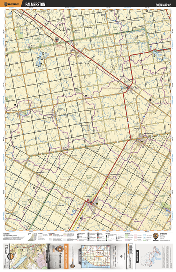
SOON42 Palmerston - Southern Ontario Topo
Backroad Mapbooks
This recreation topographic map for Palmerston highlights all the logging/resource roads, hunting areas, fishing lakes & streams, campsites, paddling routes for canoeing and kayaking, wildlife viewing areas, multi-use trails for hiking, biking, horseback riding, cross-country skiing and snowshoeing, motorized trails for ATVing and snowmobiling & more. Covering 1,090 km2 (420 mi2), this 1:50,000 scale map measures 29 x 38 km (18 x 24 mi), providing you with more topographic and recreational detail for the Niagara-on-the-Lake area than any other map on the market. New features include expanded road and trail data and countless recreational Points of Interest. Included on this map are Listowel, Palmerston, Harriston, Fordwich, Gorrie, Clifford, Pike Lake, Saugeen River, Lakelet Lake, Maitland River and more.
Page Size: 24 x 37 in (610 x 940 mm)
No search results