


MapSherpa Catalog
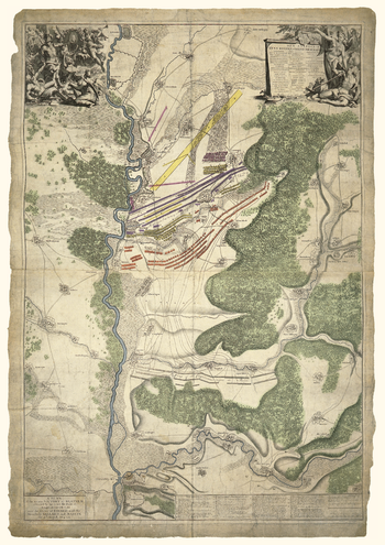
Blenheim Battle map 1704
Oxford Cartographers
Map of the Battle of Blenheim, 13 August 1704
Page Size: 16.75 x 23.5 in (420 x 594 mm)
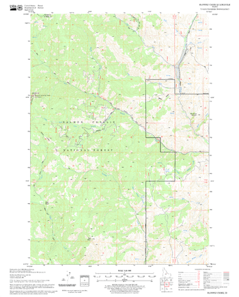
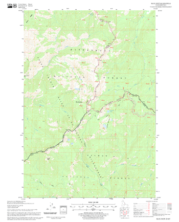
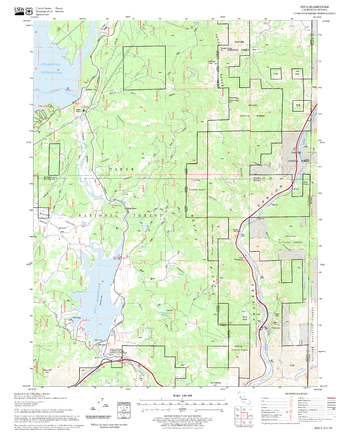
Blowfly Creek Quadrangle, Idaho
United States Department of Agriculture Forest Service
United States Department of Agriculture Forestry Service topographical map of Blowfly Creek, Salmon-Chalis National Forest, Idaho.
Page Size: 21.75 x 27 in (552 x 686 mm)
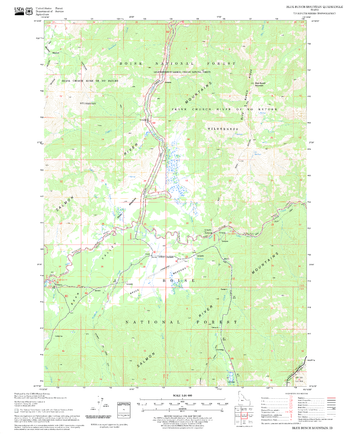
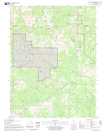
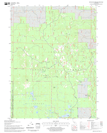
Blue Bunch Mountain Quadrangle, Idaho
United States Department of Agriculture Forest Service
United States Department of Agriculture Forestry Service topographical map of Blue Bunch Mountain, Salmon-Chalis National Forest, Idaho.
Page Size: 21.75 x 27 in (552 x 686 mm)
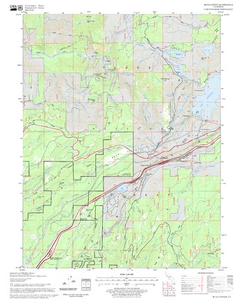
Blue Canyon Quadrangle, California
United States Department of Agriculture Forest Service
United States Department of Agriculture Forestry Service topographical map of Blue Canyon, Tahoe National Forest, California.
Page Size: 21.75 x 27 in (552 x 686 mm)
Blue Joint Quadrangle, Idaho
United States Department of Agriculture Forest Service
United States Department of Agriculture Forestry Service topographical map of Blue Joint, Salmon-Chalis National Forest, Idaho.
Page Size: 21.75 x 27 in (552 x 686 mm)
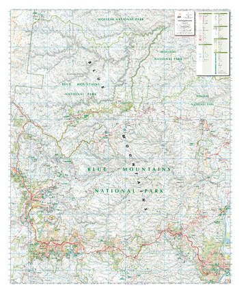
Blue Mountains North , New South Wales Topographic Map
Spatial Vision
Outdoor Recreation Guide of The Northern Blue Mountains in New South Wales for Bushwalking, mountain biking, car touring, rock climbing, water sports
Page Size: 34 x 41.5 in (860 x 1054 mm)
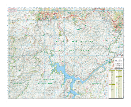
Blue Mountains South , New South Wales Topographic Map
Spatial Vision
Outdoor Recreation Guide of The Southern Blue Mountains in New South Wales for Bushwalking, mountain biking, car touring, rock climbing, water sports
Page Size: 41.5 x 34 in (1050 x 859 mm)
Bluenose Ridge Quadrangle, California
United States Department of Agriculture Forest Service
United States Department of Agriculture Forestry Service topographical map of Bluenose Ridge, Mendocino National Forest, California.
Page Size: 21.75 x 27 in (552 x 686 mm)
Boca Quadrangle, California
United States Department of Agriculture Forest Service
United States Department of Agriculture Forestry Service topographical map of Boca, Tahoe National Forest, California.
Page Size: 21.75 x 27 in (552 x 686 mm)
Bogard Buttes Quadrangle, California
United States Department of Agriculture Forest Service
United States Department of Agriculture Forestry Service topographical map of Bogard Buttes, Lassen National Forest, California.
Page Size: 21.75 x 27 in (552 x 686 mm)
Bogong Alpine Area, Victoria Topographic Map
Spatial Vision
Outdoor Recreation Guide of Bogong Alpine area in Victoria for Bushwalking, skiing, mountain biking and car touring
Page Size: 39.5 x 32 in (1000 x 810 mm)
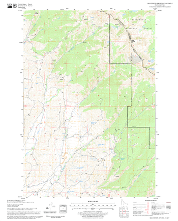
Bohannon Spring Quadrangle, Idaho
United States Department of Agriculture Forest Service
United States Department of Agriculture Forestry Service topographical map of Bohannon Spring, Salmon-Chalis National Forest, Idaho.
Page Size: 21.75 x 27 in (552 x 686 mm)
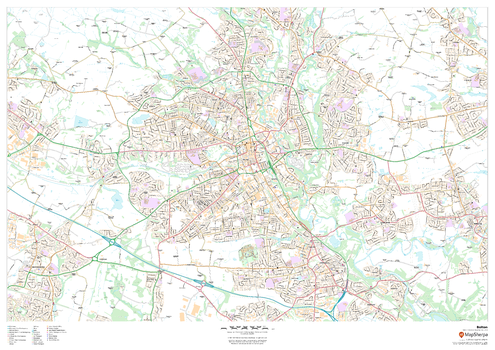
Bolton
MapSherpa
This map of Bolton shows detailed street level information including extensive street labelling. Ideal for planning of deliveries, home services, sales territories, real estate and much more.
Page Size: 47 x 33.25 in (1189 x 841 mm)

Bolton - BL - Postcode Wall Map
XYZ Maps
The Bolton Postcode Sector Wall Map shows detailed postcode sector boundaries (BL1 1, BL1 2) on a comprehensive background and is perfect for determining postcode boundaries for sales areas, planning mailshots and also an excellent reference for logistics. This wall map covers the whole of the BL Postcode Area.
Page Size: 47 x 33.25 in (1189 x 841 mm)
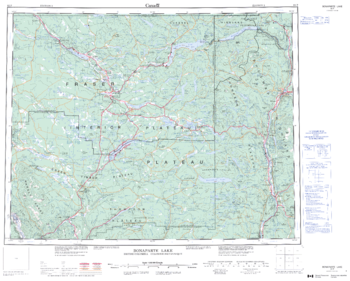
Bonaparte Lake - 92 P - British Columbia
Natural Resources Canada
Canadian topographic map of Bonaparte Lake, British Columbia. NTS sheet 092P Edition 3.
Page Size: 27.5 x 22 in (692 x 556 mm)
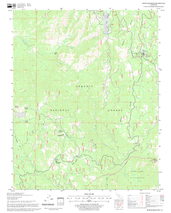
Bonita Meadows Quadrangle, California
United States Department of Agriculture Forest Service
United States Department of Agriculture Forestry Service topographical map of Bonita Meadows, Sequoia National Forest, California.
Page Size: 21.75 x 27 in (552 x 686 mm)
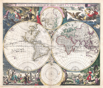
Bormeester Map of the World (1685)
Artokoloro
1685 hemisphere map of the World by Dutch publisher Joachim Bormeester. The East and West hemispheres are depicted, with the North and South Poles shown above and below the main map. Full title: Nova Totius Terrarum Orbis Tabula. A. J. Bormeester.
Page Size: 19 x 16.25 in (483 x 410 mm)
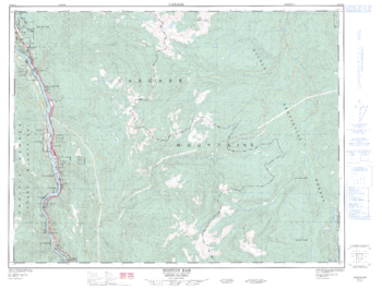
Boston Bar - 92 H/14 - British Columbia
Natural Resources Canada
Canadian topographic map of Boston Bar, British Columbia. NTS sheet 092H14 Edition 2.
Page Size: 33.5 x 25.5 in (848 x 641 mm)
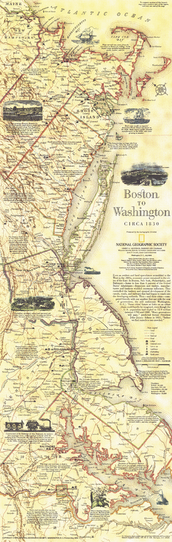
Boston To Washington Circa 1830 - Published 1830
National Geographic
This historical map is based on plates drafted by Henry Schenk Tanner which cover the Atlantic Coast from Boston to Washington, D.C. Features a variety of historical notes and illustrations. Published in July 1994 as half of a two–map set with "Boston to Washington, Megalopolis."
Page Size: 10 x 31.25 in (252 x 792 mm)
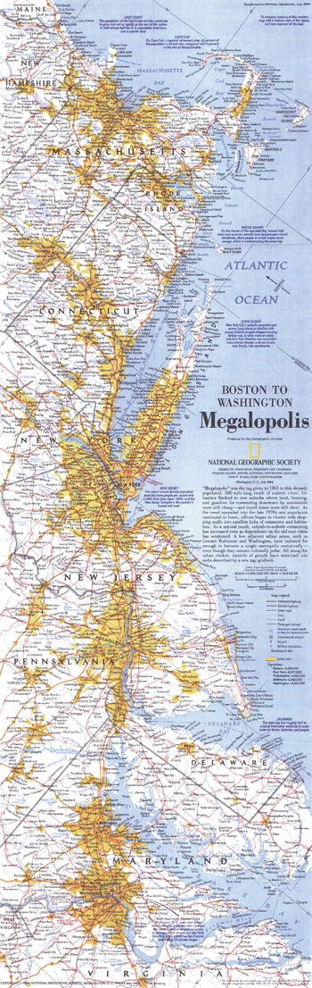
Boston To Washington Megalopolis - Published 1994
National Geographic
This map highlights the region dubbed "Megalopolis" in 1961, comprised of the densely populated 500-mile swath of eastern cities from Boston to Washington, D.C. Published in July 1994 as half of a two–map set with "Boston to Washington, Circa 1830."
Page Size: 10 x 31.25 in (250 x 791 mm)
No search results