


MapSherpa Catalog
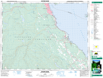
Oyster River - 92 F/14 - British Columbia
Natural Resources Canada
Canadian topographic map of Oyster River, British Columbia. NTS sheet 092F14 Edition 4.
Page Size: 34.25 x 26 in (869 x 659 mm)
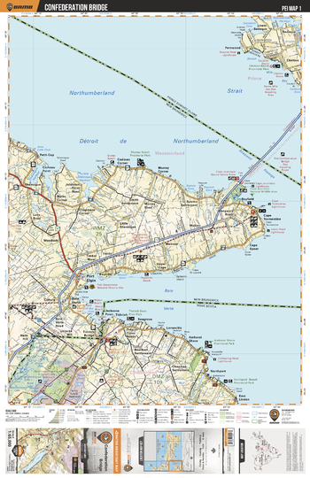
PEI01 Confederation Bridge - Prince Edward Island Topo
Backroad Mapbooks
This recreation topographic map for Confederation Bridge highlights all the logging/resource roads, hunting areas, fishing lakes & streams, campsites, paddling routes for canoeing and kayaking, wildlife viewing areas, multi-use trails for hiking, biking, horseback riding, cross-country skiing and snowshoeing, motorized trails for ATVing and snowmobiling & more. Covering 1,950 km2 (750 mi2), this 1:65,000 scale map measures 38 x 51 km (23.5 x 32 mi), providing you with more topographic and recreational detail for the Grand Manan Island area than any other map on the market. New features include enhanced Crown land data and countless updates to roads, trails and recreational Points of Interest. This map includes Cape Tormentine, Baie Verte, Port Elgin, Niles Lake, Collins Lake, Shemogue, Cape Spear, Gaspereau River, Halls Hill, Cape Jourimain Nat Wildlife Area and more!
Page Size: 24 x 37 in (610 x 940 mm)
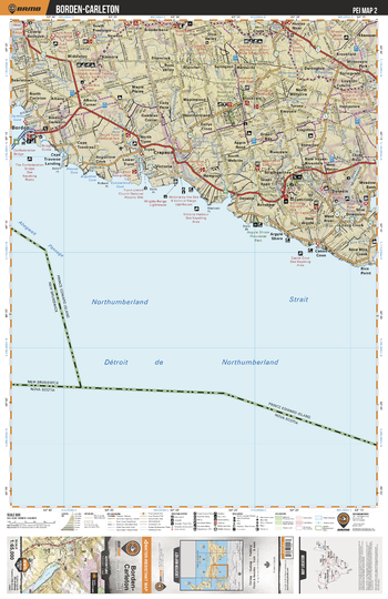
PEI02 Borden-Carleton - Prince Edward Island Topo
Backroad Mapbooks
This recreation topographic map for Borden-Carleton highlights all the logging/resource roads, hunting areas, fishing lakes & streams, campsites, paddling routes for canoeing and kayaking, wildlife viewing areas, multi-use trails for hiking, biking, horseback riding, cross-country skiing and snowshoeing, motorized trails for ATVing and snowmobiling & more. Covering 1,950 km2 (750 mi2), this 1:65,000 scale map measures 38 x 51 km (23.5 x 32 mi), providing you with more topographic and recreational detail for the Grand Manan Island area than any other map on the market. New features include enhanced Crown land data and countless updates to roads, trails and recreational Points of Interest. This map includes Borden Carleton, Argyle Shore Provincial Park, Strathgartney Provincial Park, Bonshaw Provicial Park, Westmoreland River and more!
Page Size: 24 x 37 in (610 x 940 mm)
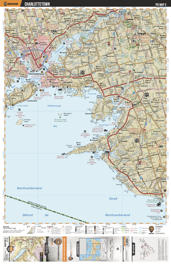
PEI03 Charlottetown - Prince Edward Island Topo
Backroad Mapbooks
This recreation topographic map for Charlottetown highlights all the logging/resource roads, hunting areas, fishing lakes & streams, campsites, paddling routes for canoeing and kayaking, wildlife viewing areas, multi-use trails for hiking, biking, horseback riding, cross-country skiing and snowshoeing, motorized trails for ATVing and snowmobiling & more. Covering 1,950 km2 (750 mi2), this 1:65,000 scale map measures 38 x 51 km (23.5 x 32 mi), providing you with more topographic and recreational detail for the Grand Manan Island area than any other map on the market. New features include enhanced Crown land data and countless updates to roads, trails and recreational Points of Interest. This map includes Charlottetown, Hillsborough River, Hillsborough Bay, Orwell Bay, Point Prim, Wood Islands Provincial Park, Pownal Bay and more!
Page Size: 24 x 37 in (610 x 940 mm)
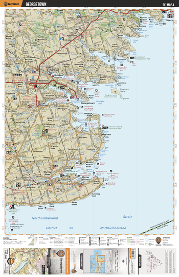
PEI04 Georgetown - Prince Edward Island Topo
Backroad Mapbooks
This recreation topographic map for Georgetown highlights all the logging/resource roads, hunting areas, fishing lakes & streams, campsites, paddling routes for canoeing and kayaking, wildlife viewing areas, multi-use trails for hiking, biking, horseback riding, cross-country skiing and snowshoeing, motorized trails for ATVing and snowmobiling & more. Covering 1,950 km2 (750 mi2), this 1:65,000 scale map measures 38 x 51 km (23.5 x 32 mi), providing you with more topographic and recreational detail for the Grand Manan Island area than any other map on the market. New features include enhanced Crown land data and countless updates to roads, trails and recreational Points of Interest. This map includes Georgetown, Cardigan Bay, Souris Beach Provincial Park, Sallys Beach Provincial Day Park, Brundell River Provincial Park, Panmure Island Provincial Park and more!
Page Size: 24 x 37 in (610 x 940 mm)
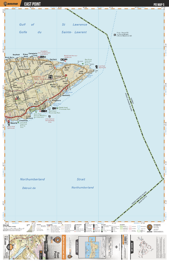
PEI05 East Point - Prince Edward Island Topo
Backroad Mapbooks
This recreation topographic map for East Point highlights all the logging/resource roads, hunting areas, fishing lakes & streams, campsites, paddling routes for canoeing and kayaking, wildlife viewing areas, multi-use trails for hiking, biking, horseback riding, cross-country skiing and snowshoeing, motorized trails for ATVing and snowmobiling & more. Covering 1,950 km2 (750 mi2), this 1:65,000 scale map measures 38 x 51 km (23.5 x 32 mi), providing you with more topographic and recreational detail for the Grand Manan Island area than any other map on the market. New features include enhanced Crown land data and countless updates to roads, trails and recreational Points of Interest. This map includes East Point, Basin Head Provincial Park, Red Point Provincial Park, North Lake, South Lake, Black Pond, Cross River and more!
Page Size: 24 x 37 in (610 x 940 mm)
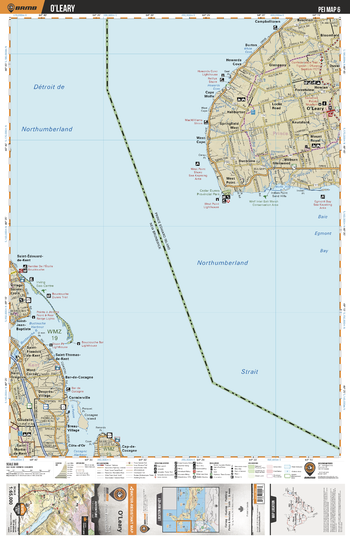
PEI06 O'Leary - Prince Edward Island Topo
Backroad Mapbooks
This recreation topographic map for O'Leary highlights all the logging/resource roads, hunting areas, fishing lakes & streams, campsites, paddling routes for canoeing and kayaking, wildlife viewing areas, multi-use trails for hiking, biking, horseback riding, cross-country skiing and snowshoeing, motorized trails for ATVing and snowmobiling & more. Covering 1,950 km2 (750 mi2), this 1:65,000 scale map measures 38 x 51 km (23.5 x 32 mi), providing you with more topographic and recreational detail for the Grand Manan Island area than any other map on the market. New features include enhanced Crown land data and countless updates to roads, trails and recreational Points of Interest. This map includes O'Leary, Cedar Dunes Provincial Park, Wolf Salt Marsh Conservation Area, Buctouche Harbour, Little Buctouche River, Egmont Bay and more!
Page Size: 24 x 37 in (610 x 940 mm)
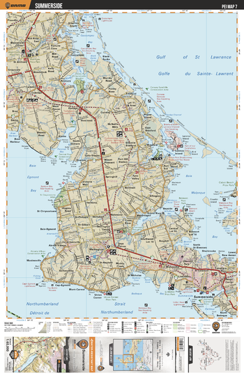
PEI07 Summerside - Prince Edward Island Topo
Backroad Mapbooks
This recreation topographic map for Summerside highlights all the logging/resource roads, hunting areas, fishing lakes & streams, campsites, paddling routes for canoeing and kayaking, wildlife viewing areas, multi-use trails for hiking, biking, horseback riding, cross-country skiing and snowshoeing, motorized trails for ATVing and snowmobiling & more. Covering 1,950 km2 (750 mi2), this 1:65,000 scale map measures 38 x 51 km (23.5 x 32 mi), providing you with more topographic and recreational detail for the Grand Manan Island area than any other map on the market. New features include enhanced Crown land data and countless updates to roads, trails and recreational Points of Interest. This map includes Summerside, Northumberland Strait, Linkletter Provincial Park, Belmont Provincial Park, Cabot Beach Provincial Park, Malpeque Bay and more!
Page Size: 24 x 37 in (610 x 940 mm)
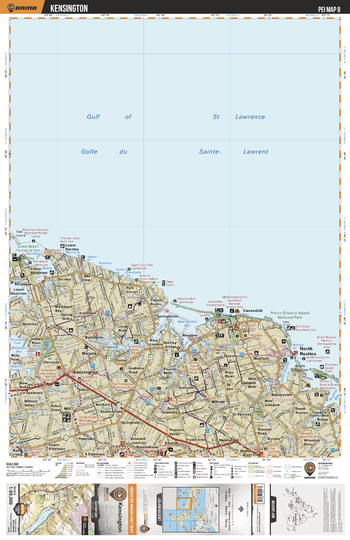
PEI08 Kensington - Prince Edward Island Topo
Backroad Mapbooks
This recreation topographic map for Kensington highlights all the logging/resource roads, hunting areas, fishing lakes & streams, campsites, paddling routes for canoeing and kayaking, wildlife viewing areas, multi-use trails for hiking, biking, horseback riding, cross-country skiing and snowshoeing, motorized trails for ATVing and snowmobiling & more. Covering 1,950 km2 (750 mi2), this 1:65,000 scale map measures 38 x 51 km (23.5 x 32 mi), providing you with more topographic and recreational detail for the Grand Manan Island area than any other map on the market. New features include enhanced Crown land data and countless updates to roads, trails and recreational Points of Interest. This map includes Kensington, Prince Edward Island National Park, New London Bay, Stanley River, Malpeque Bay, Cabot Beach Provincial Park and more!
Page Size: 24 x 37 in (610 x 940 mm)
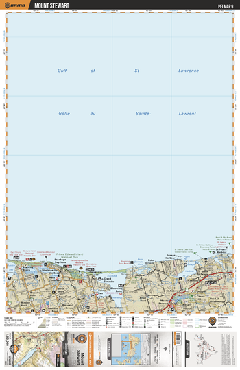
PEI09 Mount Stewart - Prince Edward Island Topo
Backroad Mapbooks
This recreation topographic map for Mount Stewart highlights all the logging/resource roads, hunting areas, fishing lakes & streams, campsites, paddling routes for canoeing and kayaking, wildlife viewing areas, multi-use trails for hiking, biking, horseback riding, cross-country skiing and snowshoeing, motorized trails for ATVing and snowmobiling & more. Covering 1,950 km2 (750 mi2), this 1:65,000 scale map measures 38 x 51 km (23.5 x 32 mi), providing you with more topographic and recreational detail for the Grand Manan Island area than any other map on the market. New features include enhanced Crown land data and countless updates to roads, trails and recreational Points of Interest. This map includes Mount Stewart, Prince Edward Island National Park, Tracadie Harbour, Savage Harbour, Covehead Bay, Brackley Bay and more!
Page Size: 24 x 37 in (610 x 940 mm)
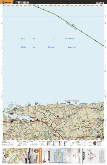
PEI10 St Peters Bay - Prince Edward Island Topo
Backroad Mapbooks
This recreation topographic map for St Peters Bay highlights all the logging/resource roads, hunting areas, fishing lakes & streams, campsites, paddling routes for canoeing and kayaking, wildlife viewing areas, multi-use trails for hiking, biking, horseback riding, cross-country skiing and snowshoeing, motorized trails for ATVing and snowmobiling & more. Covering 1,950 km2 (750 mi2), this 1:65,000 scale map measures 38 x 51 km (23.5 x 32 mi), providing you with more topographic and recreational detail for the Grand Manan Island area than any other map on the market. New features include enhanced Crown land data and countless updates to roads, trails and recreational Points of Interest. This map includes St Peters Bay, Prince Edward Island National Park, Souris Beach Provincial Park, Souris River, Naufrage River and more!
Page Size: 24 x 37 in (610 x 940 mm)
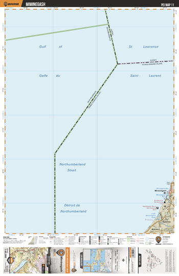
PEI11 Miminegash - Prince Edward Island Topo
Backroad Mapbooks
This recreation topographic map for Miminegash highlights all the logging/resource roads, hunting areas, fishing lakes & streams, campsites, paddling routes for canoeing and kayaking, wildlife viewing areas, multi-use trails for hiking, biking, horseback riding, cross-country skiing and snowshoeing, motorized trails for ATVing and snowmobiling & more. Covering 1,950 km2 (750 mi2), this 1:65,000 scale map measures 38 x 51 km (23.5 x 32 mi), providing you with more topographic and recreational detail for the Grand Manan Island area than any other map on the market. New features include enhanced Crown land data and countless updates to roads, trails and recreational Points of Interest. This map includes Miminegash, Miminegash Pond, Little Miminegash River, Roseville and more!
Page Size: 24 x 37 in (610 x 940 mm)
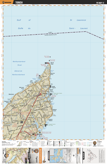
PEI12 Tignish - Prince Edward Island Topo
Backroad Mapbooks
This recreation topographic map for Tignish highlights all the logging/resource roads, hunting areas, fishing lakes & streams, campsites, paddling routes for canoeing and kayaking, wildlife viewing areas, multi-use trails for hiking, biking, horseback riding, cross-country skiing and snowshoeing, motorized trails for ATVing and snowmobiling & more. Covering 1,950 km2 (750 mi2), this 1:65,000 scale map measures 38 x 51 km (23.5 x 32 mi), providing you with more topographic and recreational detail for the Grand Manan Island area than any other map on the market. New features include enhanced Crown land data and countless updates to roads, trails and recreational Points of Interest. This map includes Tignish, Fishermans Haven Provincial Park, Gallant Pond, Jaques Cartier Provincial Park, Tignish River and more!
Page Size: 24 x 37 in (610 x 940 mm)
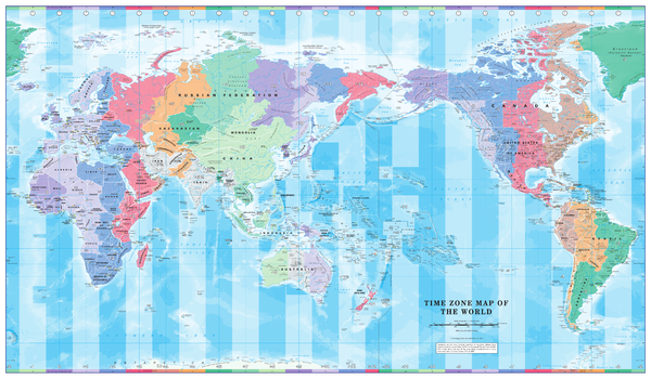
Pacific Centred Time Zone Wall Map of the World
Cosmographics
Centered on the Pacific Ocean a colourful yet informative map. Combined with a detailed political map of the world, contrasting colours are used to accurately depict the different time zones, both on land and in the oceans.
Page Size: 40.25 x 23.5 in (1020 x 595 mm)
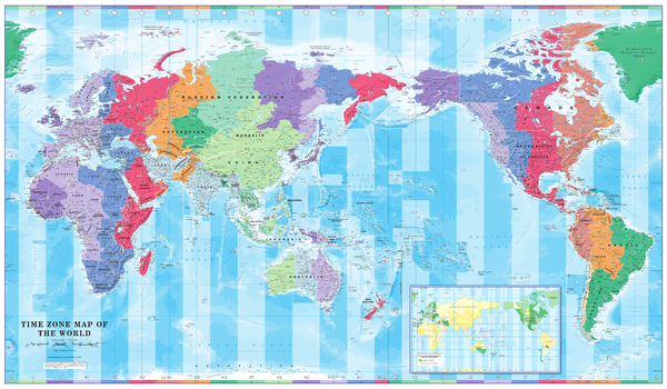
Pacific Centred Time Zone Wall Map of the World - Large
Cosmographics
Centered on the Pacific Ocean a colourful yet informative map. Combined with a detailed political map of the world, contrasting colours are used to accurately depict the different time zones, both on land and in the oceans. Includes an additional map showing countries/states that adopt daylight saving hours.
Page Size: 53.5 x 31.25 in (1355 x 790 mm)
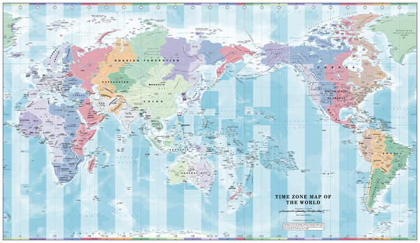
Pacific Centred Time Zone Wall Map of the World - Poster
Cosmographics
Centered on the Pacific Ocean a colourful yet informative map. Combined with a detailed political map of the world, contrasting colours are used to accurately depict the different time zones, both on land and in the oceans.
Page Size: 39 x 22.75 in (991 x 575 mm)

Pacific Centred World & Flags
Hema Maps
A world political map that is bordered by the flags of the world.
Page Size: 40 x 28.5 in (1010 x 720 mm)

Pacific Centred World Political Mega Map
Hema Maps
A huge world political map that features relief shading to accurately depict each country's topography, which combined with an index makes the World Mega Map the perfect educational tool, reference point or decorative map.
Page Size: 91.5 x 57.5 in (2320 x 1460 mm)

Pacific Centred World Political Supermap
Hema Maps
A world political map that features relief shading to accurately depict each country's topography, which combined with an index makes the World Supermap the perfect educational tool, reference point or decorative map.
Page Size: 61.25 x 39 in (1550 x 990 mm)

Pacific Centred World Political Wall Map
Hema Maps
A world political map that features relief shading to accurately depict each country's topography, which combined with an index makes the World Supermap the perfect educational tool, reference point or decorative map.
Page Size: 40 x 25 in (1010 x 635 mm)
No search results