


MapSherpa Catalog
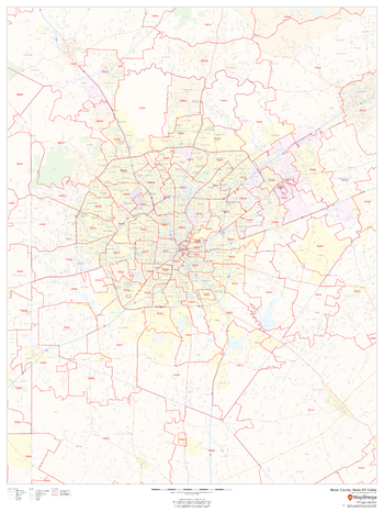
Bexar County, Texas ZIP Codes
MapSherpa
This map of Bexar County, Texas shows ZIP code areas overlaid on a road map. Ideal for planning of deliveries, home services, sales territories, real estate and much more. Base map features include all roads with major roads and highways labelled; neighborhood names; railways; and high level land use such as parks and recreation areas, industrial areas and hospital campuses.
Page Size: 36 x 48 in (914 x 1219 mm)
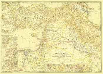
Bible Lands, and the Cradle of Western Civilization - Published 1938
National Geographic
This instructive map is great for collectors or anyone interested in the lands of the Bible. Multiple inset maps detail historical periods such as the route of the Exodus and the Crusades, and the main map contains historical facts as well as information about archaeological finds. Published in December 1938, the map accompanied the article "Change Comes to Bible Lands."
Page Size: 34.75 x 24.75 in (877 x 626 mm)
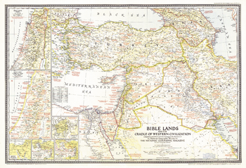
Bible Lands, and the Cradle of Western Civilization - Published 1946
National Geographic
A must-have for Bible scholars and a perfect companion to the Bible Lands map of 1938, this informative map holds an abundance of details about the history of the region. Appearing in National Geographic in December 1946 alongside the article "Syria and Lebanon Taste Freedom," this work captures both the cradle of western civilization in Biblical times and the Holy Land of the late 1940s.
Page Size: 32 x 22 in (810 x 554 mm)
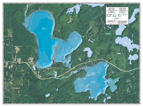
Big & Little Arbor Vitae
Mapping Specialists
An Attractive map of the lake showing a visual 3D representation of the lake bottom. Includes boat launches, rock area and vegetation. Land area is high resolution aerial imagery.
Page Size: 37.25 x 27.75 in (943 x 705 mm)
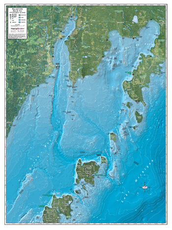
Big & Little Bay de Noc
Mapping Specialists
An Attractive map of the lake showing a visual 3D representation of the lake bottom. Includes boat launches, rock area and vegetation. Land area is high resolution aerial imagery.
Page Size: 27.75 x 37.25 in (705 x 943 mm)
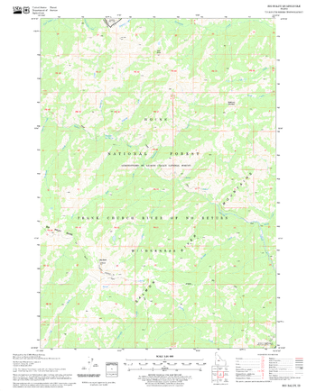
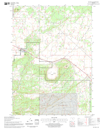
Big Baldy Quadrangle, Idaho
United States Department of Agriculture Forest Service
United States Department of Agriculture Forestry Service topographical map of Big Baldy, Salmon-Chalis National Forest, Idaho.
Page Size: 21.75 x 27 in (552 x 686 mm)
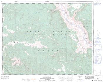
Big Bear Creek - 92 O/1 - British Columbia
Natural Resources Canada
Canadian topographic map of Big Bear Creek, British Columbia. NTS sheet 092O01 Edition 4.
Page Size: 32 x 25.5 in (807 x 642 mm)
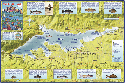
Big Bear Lake California Wall Map
Franko Maps
This map shows Big Bear Lake in detail, with water depths and contours, docks, marinas and launches, beaches, picnic areas, surrounding streets, trails and paths. Illustrations and info on 9 common fish species found in the lake.
Page Size: 36.25 x 24 in (918 x 610 mm)
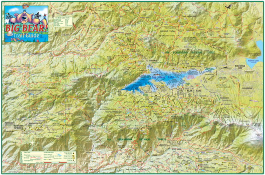
Big Bear Trails California Wall Map
Franko Maps
This map shows the trail networks of the San Bernardino National Forest surrounding Big Bear Lake. Includes Big Bear City, Holcomb Valley and Running Springs.
Page Size: 36.25 x 24 in (921 x 610 mm)
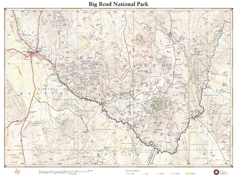
Big Bend National Park
Benchmark Maps
Remote, expansive, and diverse, Big Bend is a tapestry of West Texas landscapes, where the Chisos Mountains reach skyward over the Chihuahuan Desert and the Rio Grande cuts ever deeper into canyons as it rounds the great curve that gives the park its name. The 1,200 square miles of land protected within the park’s boundaries provide habitat for a vast array of flora and fauna, and the night skies are the darkest of any national park found in the Lower 48. This wall map details the terrain and recreation features inside Big Bend National Park and the surrounding network of back roads and drainage features.
Page Size: 26 x 34.75 in (660 x 881 mm)
Big Chief Creek Quadrangle, Idaho
United States Department of Agriculture Forest Service
United States Department of Agriculture Forestry Service topographical map of Big Chief Creek, Salmon-Chalis National Forest, Idaho.
Page Size: 21.75 x 27 in (552 x 686 mm)
Big Hole Pass Quadrangle, Idaho
United States Department of Agriculture Forest Service
United States Department of Agriculture Forestry Service topographical map of Big Hole Pass, Salmon-Chalis National Forest, Idaho.
Page Size: 21.75 x 27 in (552 x 686 mm)
Big Hole Quadrangle, Oregon
United States Department of Agriculture Forest Service
United States Department of Agriculture Forestry Service topographical map of Big Hole, Deschutes National Forest, Oregon.
Page Size: 21.75 x 27 in (552 x 686 mm)
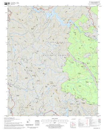
Big Ridge Quadrangle, North Carolina
United States Department of Agriculture Forest Service
United States Department of Agriculture Forestry Service topographical map of Big Ridge, Pisgah National Forest, North Carolina.
Page Size: 21.75 x 27 in (552 x 686 mm)
Big Soldier Mountain Quadrangle, Idaho
United States Department of Agriculture Forest Service
United States Department of Agriculture Forestry Service topographical map of Big Soldier Mountain, Salmon-Chalis National Forest, Idaho.
Page Size: 21.75 x 27 in (552 x 686 mm)

Big St Germain
Mapping Specialists
An Attractive map of the lake showing a visual 3D representation of the lake bottom. Includes boat launches, rock area and vegetation. Land area is high resolution aerial imagery.
Page Size: 37.25 x 27.75 in (943 x 705 mm)
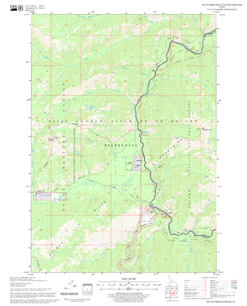
Bighorn Crags Quadrangle, Idaho
United States Department of Agriculture Forest Service
United States Department of Agriculture Forestry Service topographical map of Bighorn Crags, Salmon-Chalis National Forest, Idaho.
Page Size: 21.75 x 27 in (552 x 686 mm)
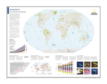
Biodiversity: Life, Protected and Otherwise - Atlas of the World, 10th Edition
National Geographic
Protected Areas; Protected Areas Management Trends; Varied Levels of Biome Protection; Mapping Biodiversity Hotspots; Charting Threatened Species; Pressures on Biodiversity
Page Size: 28 x 22 in (711 x 559 mm)
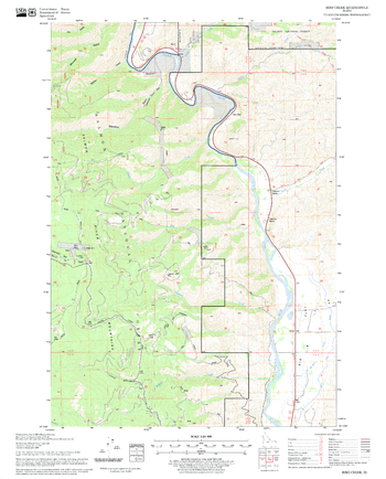
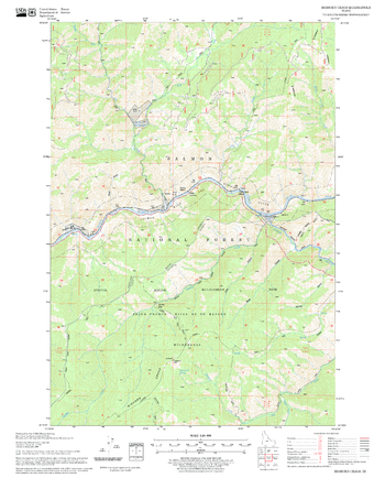
Bird Creek Quadrangle, Idaho
United States Department of Agriculture Forest Service
United States Department of Agriculture Forestry Service topographical map of Bird Creek, Salmon-Chalis National Forest, Idaho.
Page Size: 21.75 x 27 in (552 x 686 mm)
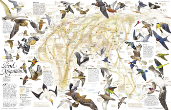
Bird Migration Eastern Hemisphere - Published 2004
National Geographic
This map illustrates the incredible journeys that birds undertake in the Americas each year. The migration paths of sixty seven types of birds are shown on a map of the Americas that is overlaid with pathways that their routes, from nesting grounds to wintering areas. Full-color bird paintings by noted illustrator Arthur Singer show each of the sixty seven species.
Page Size: 31.25 x 20.25 in (791 x 511 mm)
Paper: UPC 749717024762
Matte Plastic: UPC 749717030725
Laminated: UPC 749717018990
Rolled Canvas: UPC 749717053588
No search results