top of page
Big Bend National Park
Benchmark Maps
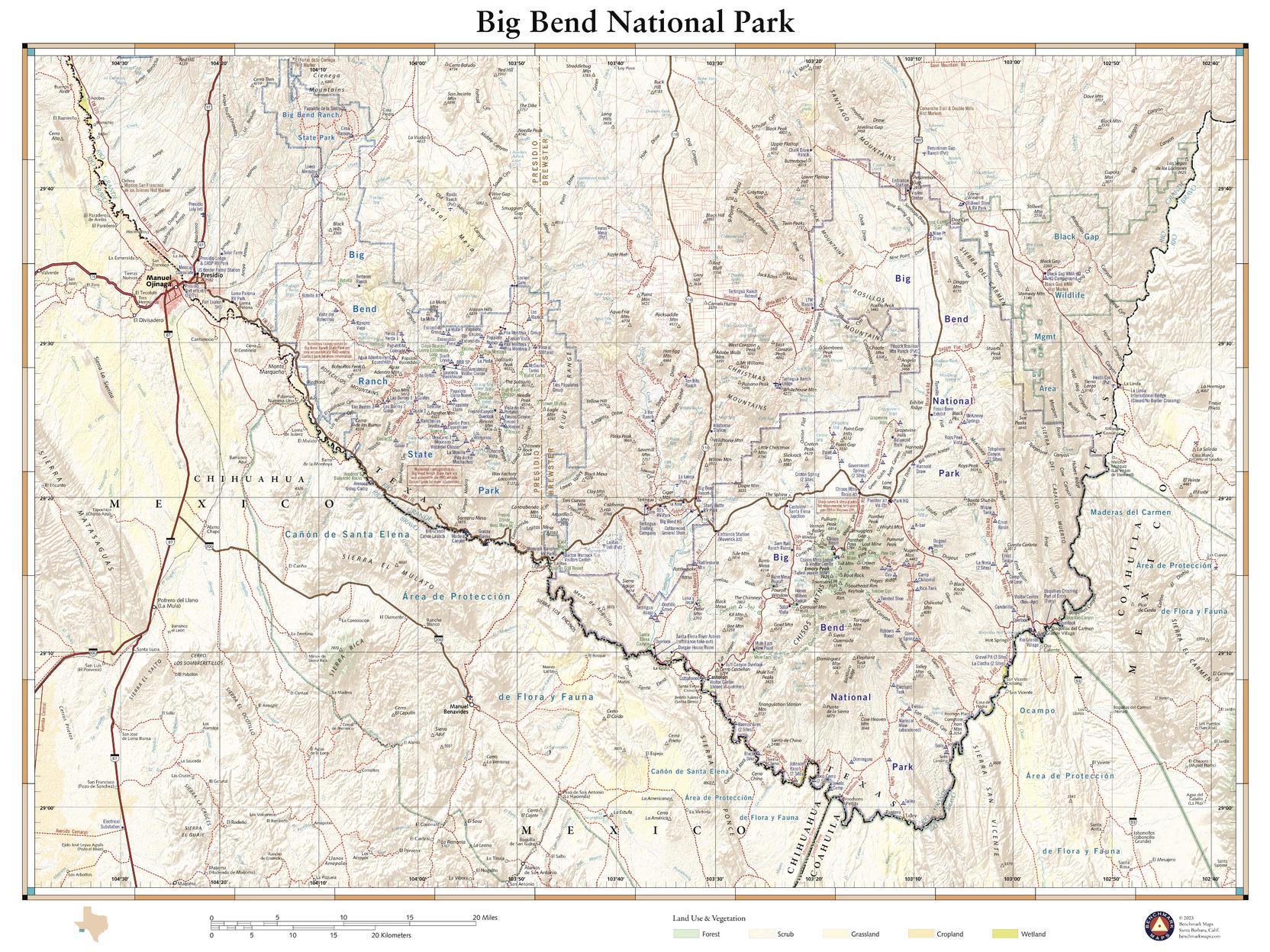
Remote, expansive, and diverse, Big Bend is a tapestry of West Texas landscapes, where the Chisos Mountains reach skyward over the Chihuahuan Desert and the Rio Grande cuts ever deeper into canyons as it rounds the great curve that gives the park its name. The 1,200 square miles of land protected within the park’s boundaries provide habitat for a vast array of flora and fauna, and the night skies are the darkest of any national park found in the Lower 48. This wall map details the terrain and recreation features inside Big Bend National Park and the surrounding network of back roads and drainage features.
Page Size: 26 x 34.75 in (660 x 881 mm)
Buy this map on MapTrove.ca
bottom of page