United States Department of Agriculture Forest Service
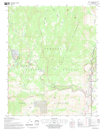
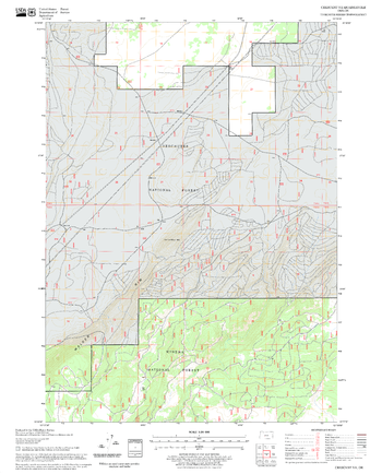
Crag Peak Quadrangle, California
United States Department of Agriculture Forestry Service topographical map of Crag Peak, Sequoia National Forest, California.
Page Size: 21.75 x 27 in (552 x 686 mm)
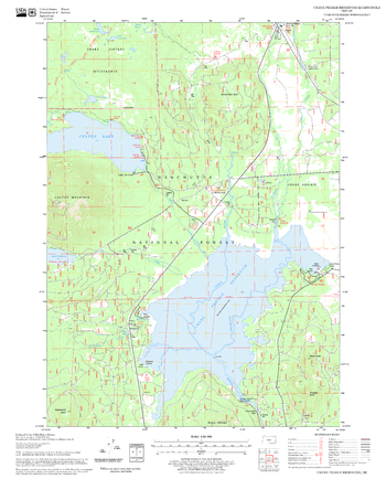
Crane Prairie Reservoir Quadrangle, Oregon
United States Department of Agriculture Forestry Service topographical map of Crane Prairie Reservoir, Deschutes National Forest, Oregon.
Page Size: 21.75 x 27 in (552 x 686 mm)
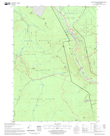
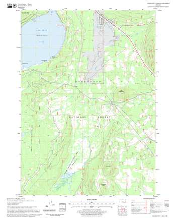
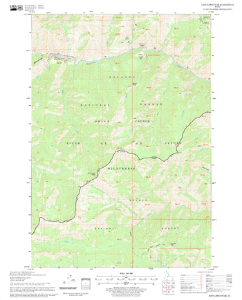
Crawford Notch Quadrangle, New Hampshire-Vermont
United States Forestry Service topographical map of Crawford Notch, New Hampshire-Vermont
Page Size: 21.75 x 27 in (552 x 686 mm)
Crescent Lake Quadrangle, Oregon
United States Department of Agriculture Forestry Service topographical map of Crescent Lake, Deschutes National Forest, Oregon.
Page Size: 21.75 x 27 in (552 x 686 mm)
Crescent NE Quadrangle, Oregon
United States Department of Agriculture Forestry Service topographical map of Crescent NE, Deschutes National Forest, Oregon.
Page Size: 21.75 x 27 in (552 x 686 mm)
Crescent Quadrangle, Oregon
United States Department of Agriculture Forestry Service topographical map of Crescent, Deschutes National Forest, Oregon.
Page Size: 21.75 x 27 in (552 x 686 mm)
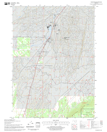
Crockett Peak Quadrangle, California
United States Department of Agriculture Forestry Service topographical map of Crockett Peak, Mendocino National Forest, California.
Page Size: 21.75 x 27 in (552 x 686 mm)
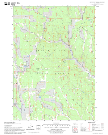
Crooks Tower Quadrangle, South Dakota
United States Department of Agriculture Forestry Service topographical map of Crooks Tower, Black Hills National Forest, South Dakota.
Page Size: 21.75 x 27 in (552 x 686 mm)
Crows Nest Peak Quadrangle, South Dakota
United States Department of Agriculture Forestry Service topographical map of Crows Nest Peak, Black Hills National Forest, South Dakota.
Page Size: 21.75 x 27 in (552 x 686 mm)
Cruso Quadrangle, North Carolina
United States Department of Agriculture Forestry Service topographical map of Cruso, Pisgah National Forest, North Carolina.
Page Size: 21.75 x 27 in (552 x 686 mm)
Cryder Butte Quadrangle, Oregon
United States Department of Agriculture Forestry Service topographical map of Cryder Butte, Deschutes National Forest, Oregon.
Page Size: 21.75 x 27 in (552 x 686 mm)
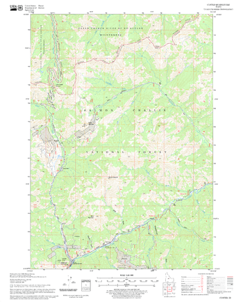
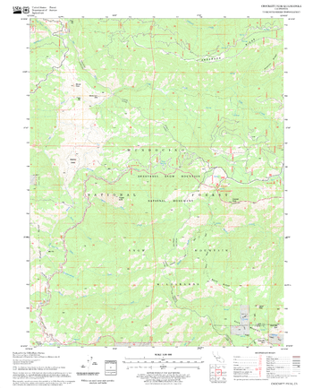
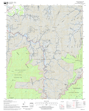
Custer Quadrangle, Idaho
United States Department of Agriculture Forestry Service topographical map of Custer, Salmon-Chalis National Forest, Idaho.
Page Size: 21.75 x 27 in (552 x 686 mm)
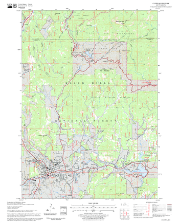
Custer Quadrangle, South Dakota
United States Department of Agriculture Forestry Service topographical map of Custer, Black Hills National Forest, South Dakota.
Page Size: 21.75 x 27 in (552 x 686 mm)
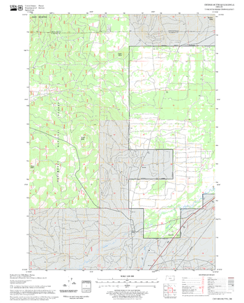
Dane Canyon Quadrangle, Arizona
United States Department of Agriculture Forestry Service topographical map of Dane Canyon, Coconino National Forest, Arizona.
Page Size: 21.75 x 27 in (552 x 686 mm)
Dave Lewis Peak Quadrangle, Idaho
United States Department of Agriculture Forestry Service topographical map of Dave Lewis Peak, Salmon-Chalis National Forest, Idaho.
Page Size: 21.75 x 27 in (552 x 686 mm)
Davis Mountain Quadrangle, Oregon
United States Department of Agriculture Forestry Service topographical map of Davis Mountain, Deschutes National Forest, Oregon.
Page Size: 21.75 x 27 in (552 x 686 mm)
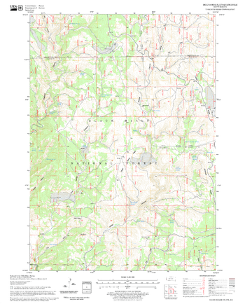
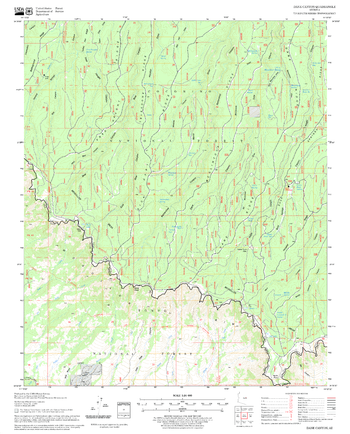
Dead Horse Flats Quadrangle, South Dakota
United States Department of Agriculture Forestry Service topographical map of Dead Horse Flats, Black Hills National Forest, South Dakota.
Page Size: 21.75 x 27 in (552 x 686 mm)
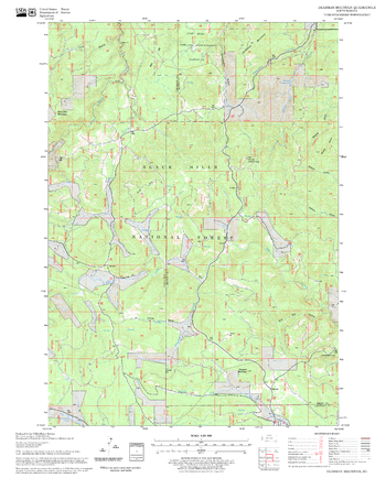
Deadman Mountain Quadrangle, South Dakota
United States Department of Agriculture Forestry Service topographical map of Deadman Mountain, Black Hills National Forest, South Dakota.
Page Size: 21.75 x 27 in (552 x 686 mm)
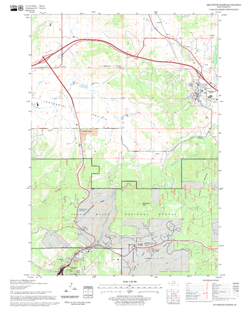
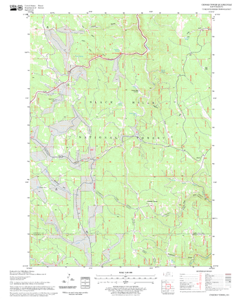
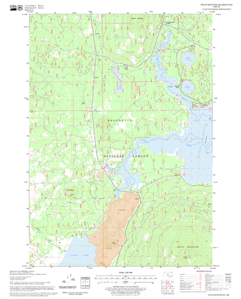
Deadwood North Quadrangle, South Dakota
United States Department of Agriculture Forestry Service topographical map of Deadwood North, Black Hills National Forest, South Dakota.
Page Size: 21.75 x 27 in (552 x 686 mm)
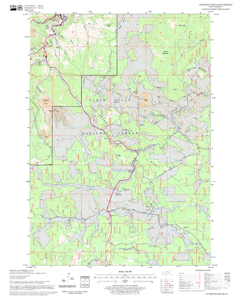
Deadwood South Quadrangle, South Dakota
United States Department of Agriculture Forestry Service topographical map of Deadwood South, Black Hills National Forest, South Dakota.
Page Size: 21.75 x 27 in (552 x 686 mm)