United States Department of Agriculture Forest Service
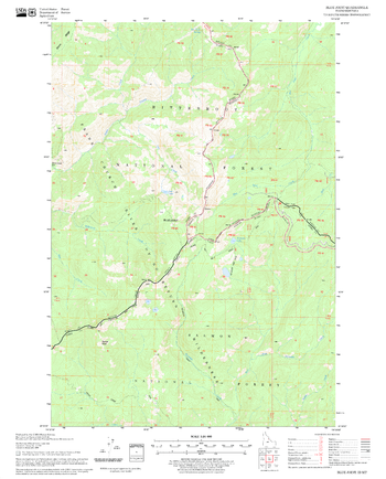
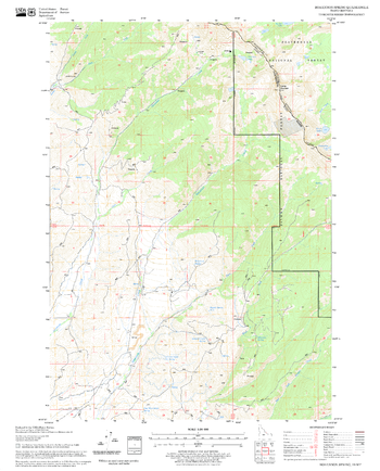
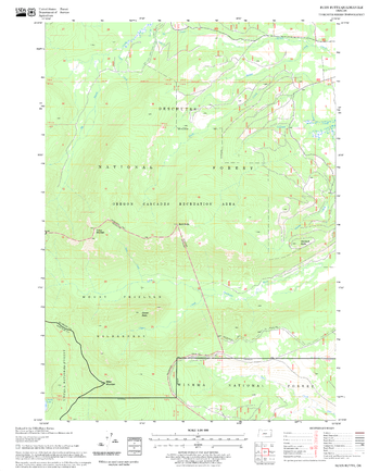
Blue Joint Quadrangle, Idaho
United States Department of Agriculture Forestry Service topographical map of Blue Joint, Salmon-Chalis National Forest, Idaho.
Page Size: 21.75 x 27 in (552 x 686 mm)
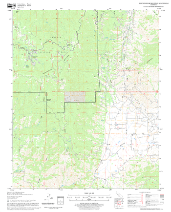
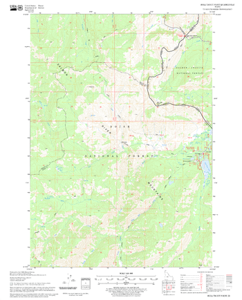
Bluenose Ridge Quadrangle, California
United States Department of Agriculture Forestry Service topographical map of Bluenose Ridge, Mendocino National Forest, California.
Page Size: 21.75 x 27 in (552 x 686 mm)
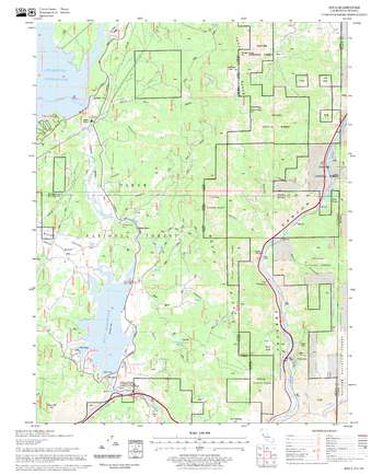
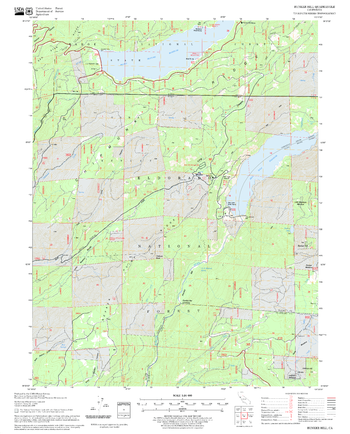
Boca Quadrangle, California
United States Department of Agriculture Forestry Service topographical map of Boca, Tahoe National Forest, California.
Page Size: 21.75 x 27 in (552 x 686 mm)
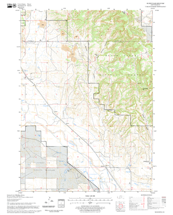
Bogard Buttes Quadrangle, California
United States Department of Agriculture Forestry Service topographical map of Bogard Buttes, Lassen National Forest, California.
Page Size: 21.75 x 27 in (552 x 686 mm)
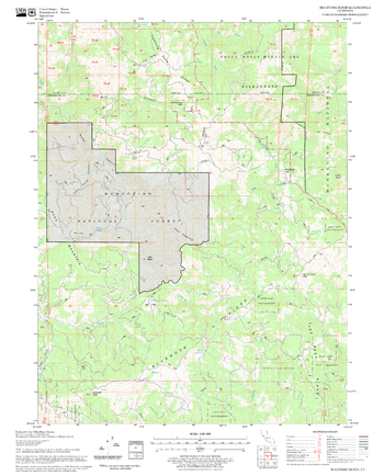
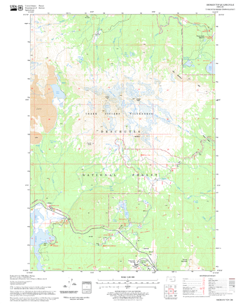
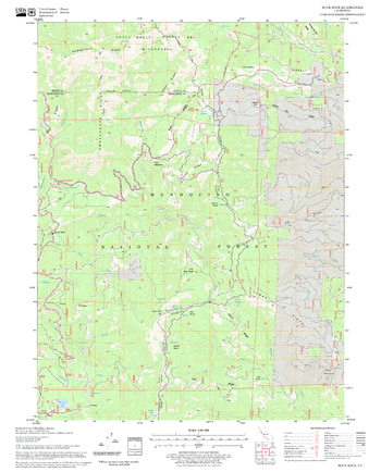
Bohannon Spring Quadrangle, Idaho
United States Department of Agriculture Forestry Service topographical map of Bohannon Spring, Salmon-Chalis National Forest, Idaho.
Page Size: 21.75 x 27 in (552 x 686 mm)
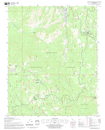
Bonita Meadows Quadrangle, California
United States Department of Agriculture Forestry Service topographical map of Bonita Meadows, Sequoia National Forest, California.
Page Size: 21.75 x 27 in (552 x 686 mm)
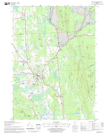
Brandon Quadrangle, New Hampshire-Vermont
United States Forestry Service topographical map of Brandon, New Hampshire-Vermont
Page Size: 21.75 x 27 in (552 x 686 mm)
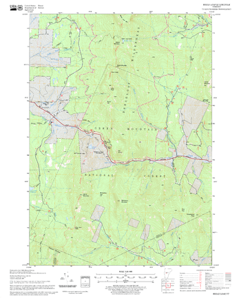
Bread Loaf Quadrangle, New Hampshire-Vermont
United States Forestry Service topographical map of Bread Loaf, New Hampshire-Vermont
Page Size: 21.75 x 27 in (552 x 686 mm)
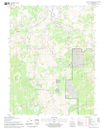
Breckenridge Mountain Quadrangle, California
United States Department of Agriculture Forestry Service topographical map of Breckenridge Mountain, Sequoia National Forest, California.
Page Size: 21.75 x 27 in (552 x 686 mm)
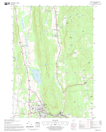
Bristol Quadrangle, New Hampshire-Vermont
United States Forestry Service topographical map of Bristol, New Hampshire-Vermont
Page Size: 21.75 x 27 in (552 x 686 mm)
Broken Top Quadrangle, Oregon
United States Department of Agriculture Forestry Service topographical map of Broken Top, Deschutes National Forest, Oregon.
Page Size: 21.75 x 27 in (552 x 686 mm)
Brushy Mountain Quadrangle, California
United States Department of Agriculture Forestry Service topographical map of Brushy Mountain, Mendocino National Forest, California.
Page Size: 21.75 x 27 in (552 x 686 mm)
Buck Rock Quadrangle, California
United States Department of Agriculture Forestry Service topographical map of Buck Rock, Mendocino National Forest, California.
Page Size: 21.75 x 27 in (552 x 686 mm)

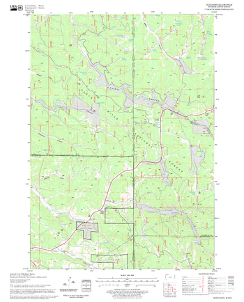
Buckhorn Mountain Quadrangle, Arizona
United States Department of Agriculture Forestry Service topographical map of Buckhorn Mountain, Coconino National Forest, Arizona.
Page Size: 21.75 x 27 in (552 x 686 mm)
Buckhorn Quadrangle, South Dakota
United States Department of Agriculture Forestry Service topographical map of Buckhorn, Black Hills National Forest, South Dakota.
Page Size: 21.75 x 27 in (552 x 686 mm)
Bull Trout Point Quadrangle, Idaho
United States Department of Agriculture Forestry Service topographical map of Bull Trout Point, Salmon-Chalis National Forest, Idaho.
Page Size: 21.75 x 27 in (552 x 686 mm)
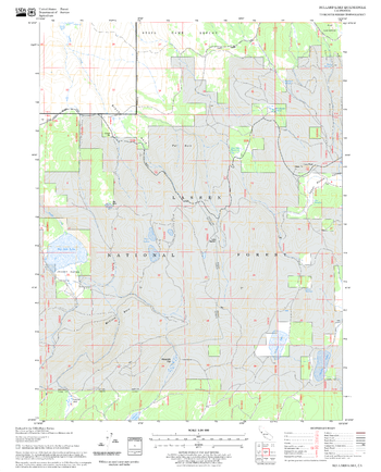
Bullard Lake Quadrangle, California
United States Department of Agriculture Forestry Service topographical map of Bullard Lake, Lassen National Forest, California.
Page Size: 21.75 x 27 in (552 x 686 mm)
Bunker Hill Quadrangle, California
United States Department of Agriculture Forestry Service topographical map of Bunker Hill, Tahoe National Forest, California.
Page Size: 21.75 x 27 in (552 x 686 mm)
Burdock Quadrangle, South Dakota
United States Department of Agriculture Forestry Service topographical map of Burdock, Black Hills National Forest, South Dakota.
Page Size: 21.75 x 27 in (552 x 686 mm)
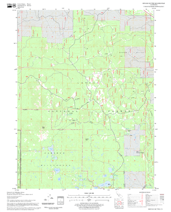
Burn Butte Quadrangle, Oregon
United States Department of Agriculture Forestry Service topographical map of Burn Butte, Deschutes National Forest, Oregon.
Page Size: 21.75 x 27 in (552 x 686 mm)