United States Department of Agriculture Forest Service
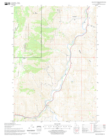
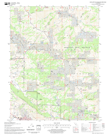
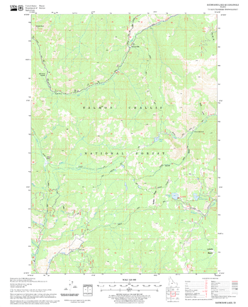
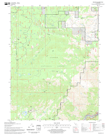
Bald Mountain Quadrangle, Idaho
United States Department of Agriculture Forestry Service topographical map of Bald Mountain, Salmon-Chalis National Forest, Idaho.
Page Size: 21.75 x 27 in (552 x 686 mm)
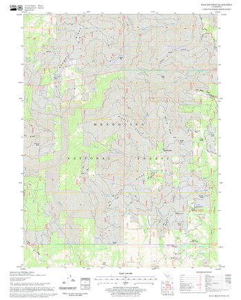
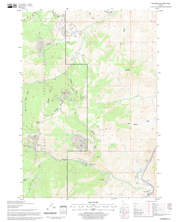
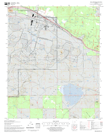
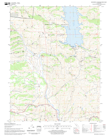
Ball Mountain Quadrangle, California
United States Department of Agriculture Forestry Service topographical map of Ball Mountain, Mendocino National Forest, California.
Page Size: 21.75 x 27 in (552 x 686 mm)
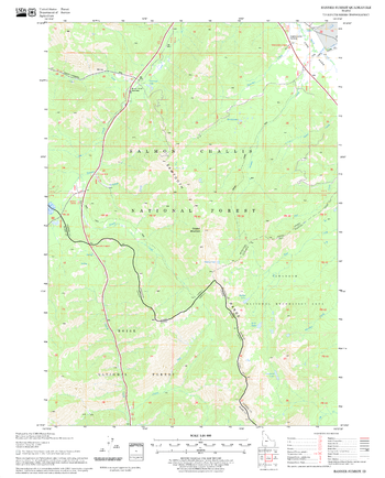
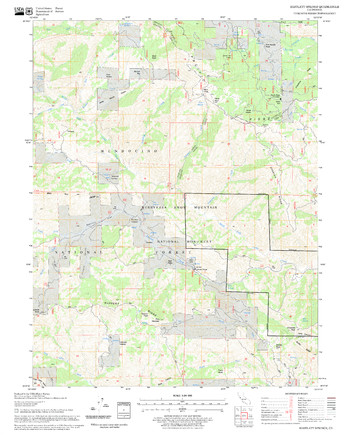
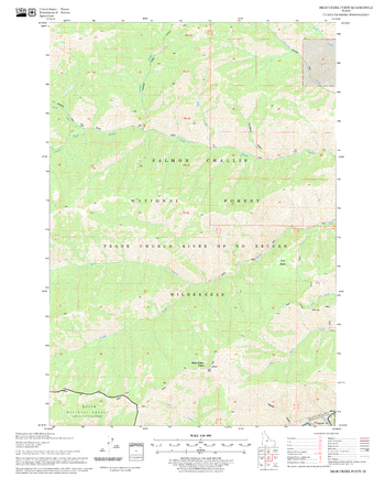
Banner Summit Quadrangle, Idaho
United States Department of Agriculture Forestry Service topographical map of Banner Summit, Salmon-Chalis National Forest, Idaho.
Page Size: 21.75 x 27 in (552 x 686 mm)
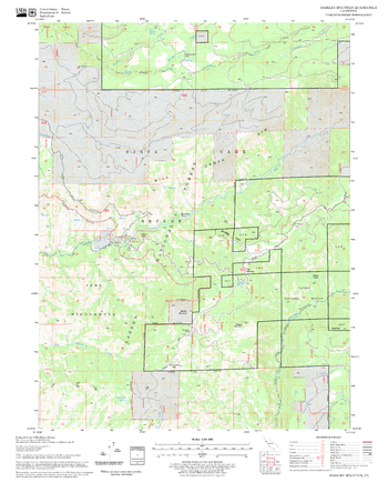
Barkley Mountain Quadrangle, California
United States Department of Agriculture Forestry Service topographical map of Barkley Mountain, Lassen National Forest, California.
Page Size: 21.75 x 27 in (552 x 686 mm)
Bartlett Mountain Quadrangle, California
United States Department of Agriculture Forestry Service topographical map of Bartlett Mountain, Mendocino National Forest, California.
Page Size: 21.75 x 27 in (552 x 686 mm)
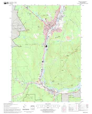
Bartlett Quadrangle, New Hampshire-Vermont
United States Forestry Service topographical map of Bartlett, New Hampshire-Vermont
Page Size: 21.75 x 27 in (552 x 686 mm)
Bartlett Springs Quadrangle, California
United States Department of Agriculture Forestry Service topographical map of Bartlett Springs, Mendocino National Forest, California.
Page Size: 21.75 x 27 in (552 x 686 mm)
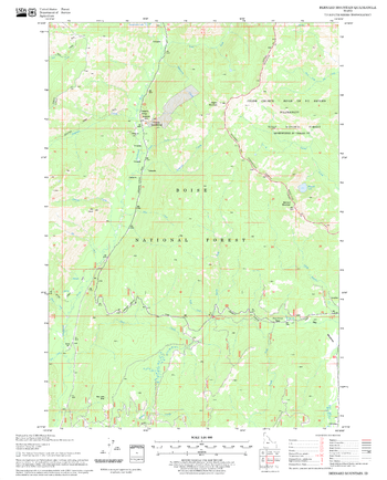
Basin Butte Quadrangle, Idaho
United States Department of Agriculture Forestry Service topographical map of Basin Butte, Salmon-Chalis National Forest, Idaho.
Page Size: 21.75 x 27 in (552 x 686 mm)
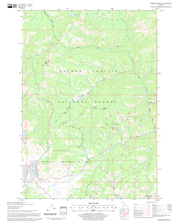
Bayhorse Lake Quadrangle, Idaho
United States Department of Agriculture Forestry Service topographical map of Bayhorse Lake, Salmon-Chalis National Forest, Idaho.
Page Size: 21.75 x 27 in (552 x 686 mm)
Bayhorse Quadrangle, Idaho
United States Department of Agriculture Forestry Service topographical map of Bayhorse, Salmon-Chalis National Forest, Idaho.
Page Size: 21.75 x 27 in (552 x 686 mm)
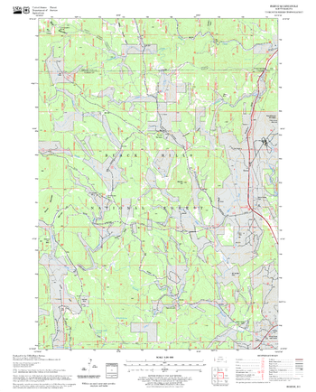
Bear Creek Point Quadrangle, Idaho
United States Department of Agriculture Forestry Service topographical map of Bear Creek Point, Salmon-Chalis National Forest, Idaho.
Page Size: 21.75 x 27 in (552 x 686 mm)
Bear Valley Mountain Quadrangle, Idaho
United States Department of Agriculture Forestry Service topographical map of Bear Valley Mountain, Salmon-Chalis National Forest, Idaho.
Page Size: 21.75 x 27 in (552 x 686 mm)
Belden Quadrangle, California
United States Department of Agriculture Forestry Service topographical map of Belden, Lassen National Forest, California.
Page Size: 21.75 x 27 in (552 x 686 mm)
Bellemont Quadrangle, Arizona
United States Department of Agriculture Forestry Service topographical map of Bellemont, Coconino National Forest, Arizona.
Page Size: 21.75 x 27 in (552 x 686 mm)
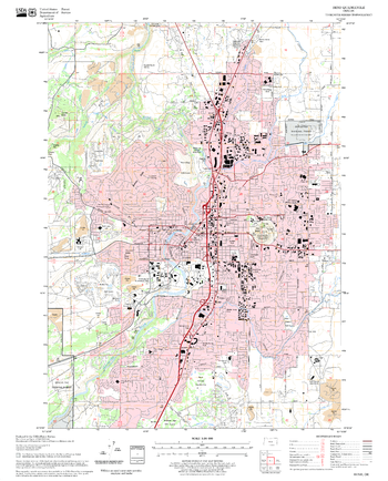
Bend Quadrangle, Oregon
United States Department of Agriculture Forestry Service topographical map of Bend, Deschutes National Forest, Oregon.
Page Size: 21.75 x 27 in (552 x 686 mm)
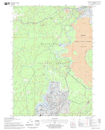
Benham Falls Quadrangle, Oregon
United States Department of Agriculture Forestry Service topographical map of Benham Falls, Deschutes National Forest, Oregon.
Page Size: 21.75 x 27 in (552 x 686 mm)
Benmore Canyon Quadrangle, California
United States Department of Agriculture Forestry Service topographical map of Benmore Canyon, Mendocino National Forest, California.
Page Size: 21.75 x 27 in (552 x 686 mm)
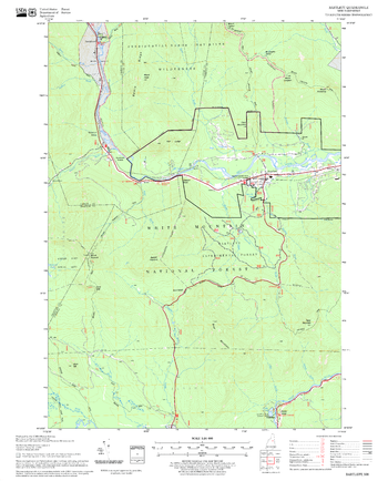
Berlin Quadrangle, New Hampshire-Vermont
United States Department of Agriculture Forestry Service topographical map of Berlin, White Mountains National Forest, New Hampshire-Vermont.
Page Size: 21.75 x 27 in (552 x 686 mm)
Bernard Mountain Quadrangle, Idaho
United States Department of Agriculture Forestry Service topographical map of Bernard Mountain, Salmon-Chalis National Forest, Idaho.
Page Size: 21.75 x 27 in (552 x 686 mm)
Berne Quadrangle, South Dakota
United States Department of Agriculture Forestry Service topographical map of Berne, Black Hills National Forest, South Dakota.
Page Size: 21.75 x 27 in (552 x 686 mm)