The Map Centre
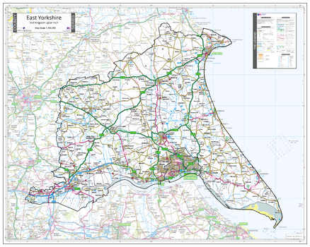
County Map of East Yorkshire
An Ordnance Survey Map covering the whole of the county showing the county boundary including applicable Unitary Authority boundaries. The mapping outside the county boundary is faded to highlight the county. Part of a series of counties maps that cover England Scotland & Wales all using the same background Ordnance Survey Mapping for continuity across the whole series. This map includes Kingston Upon Hull, Beverley
Page Size: 39.5 x 31.5 in (1000 x 800 mm)
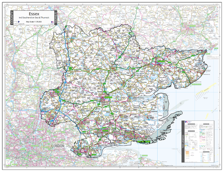
County Map of Essex
An Ordnance Survey Map covering the whole of the county showing the county boundary including applicable Unitary Authority boundaries. The mapping outside the county boundary is faded to highlight the county. Part of a series of counties maps that cover England Scotland & Wales all using the same background Ordnance Survey Mapping for continuity across the whole series. This map includes Colchester, Chelmsford, Thurrock, Southend on Sea
Page Size: 38 x 29.25 in (960 x 740 mm)
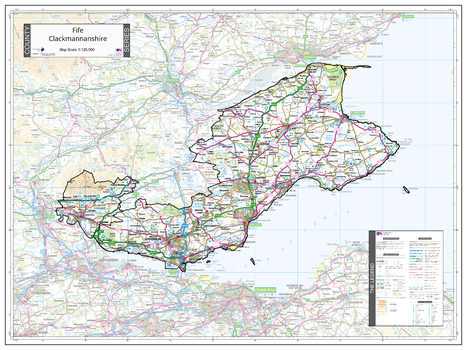
County Map of Fife & Clackmannanshire
An Ordnance Survey Map covering the whole of the county showing the county boundary including applicable Unitary Authority boundaries. The mapping outside the county boundary is faded to highlight the county. Part of a series of counties maps that cover England Scotland & Wales all using the same background Ordnance Survey Mapping for continuity across the whole series. This map includes Dunfermline, St Andrews
Page Size: 34.75 x 26 in (880 x 660 mm)
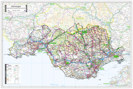
County Map of Glamorgan
An Ordnance Survey Map covering the whole of the county showing the county boundary including applicable Unitary Authority boundaries. The mapping outside the county boundary is faded to highlight the county. Part of a series of counties maps that cover England Scotland & Wales all using the same background Ordnance Survey Mapping for continuity across the whole series. This map includes Cardiff, Newport, Swansea
Page Size: 47.25 x 31.5 in (1200 x 800 mm)
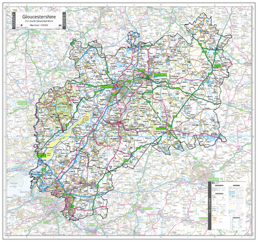
County Map of Gloucestershire
An Ordnance Survey Map covering the whole of the county showing the county boundary including applicable Unitary Authority boundaries. The mapping outside the county boundary is faded to highlight the county. Part of a series of counties maps that cover England Scotland & Wales all using the same background Ordnance Survey Mapping for continuity across the whole series. This map includes Gloucester, Cheltenham
Page Size: 38 x 35.5 in (960 x 900 mm)
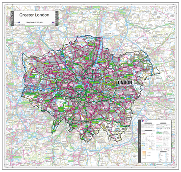
County Map of Greater London
An Ordnance Survey Map covering the whole of the county showing the county boundary including applicable Unitary Authority boundaries. The mapping outside the county boundary is faded to highlight the county. Part of a series of counties maps that cover England Scotland & Wales all using the same background Ordnance Survey Mapping for continuity across the whole series. This map includes City of London, London
Page Size: 30 x 28.5 in (760 x 720 mm)
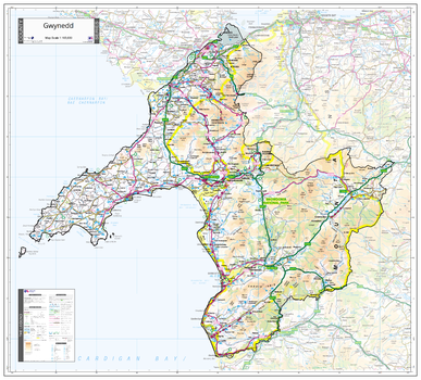
County Map of Gwynedd
An Ordnance Survey Map covering the whole of the county showing the county boundary including applicable Unitary Authority boundaries. The mapping outside the county boundary is faded to highlight the county. Part of a series of counties maps that cover England Scotland & Wales all using the same background Ordnance Survey Mapping for continuity across the whole series. This map includes Portmadog, Barmouth
Page Size: 41 x 37 in (1040 x 940 mm)
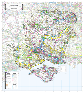
County Map of Hampshire
An Ordnance Survey Map covering the whole of the county showing the county boundary including applicable Unitary Authority boundaries. The mapping outside the county boundary is faded to highlight the county. Part of a series of counties maps that cover England Scotland & Wales all using the same background Ordnance Survey Mapping for continuity across the whole series. This map includes
Page Size: 35.5 x 39.5 in (900 x 1000 mm)
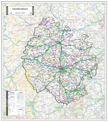
County Map of Herefordshire
An Ordnance Survey Map covering the whole of the county showing the county boundary including applicable Unitary Authority boundaries. The mapping outside the county boundary is faded to highlight the county. Part of a series of counties maps that cover England Scotland & Wales all using the same background Ordnance Survey Mapping for continuity across the whole series. This map includes Hereford, Leominster, Ross on Wye, Ledbury, Fownhope
Page Size: 30.75 x 34.75 in (780 x 880 mm)
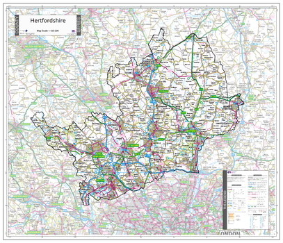
County Map of Hertfordshire
An Ordnance Survey Map covering the whole of the county showing the county boundary including applicable Unitary Authority boundaries. The mapping outside the county boundary is faded to highlight the county. Part of a series of counties maps that cover England Scotland & Wales all using the same background Ordnance Survey Mapping for continuity across the whole series. This map includes Hertford, St Albans, Watford, Stevenage
Page Size: 34 x 29.25 in (860 x 740 mm)
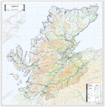
County Map of Highlands
An Ordnance Survey Map covering the whole of the county showing the county boundary including applicable Unitary Authority boundaries. The mapping outside the county boundary is faded to highlight the county. Part of a series of counties maps that cover England Scotland & Wales all using the same background Ordnance Survey Mapping for continuity across the whole series. This map includes Inverness, Fort William
Page Size: 41 x 41.75 in (1040 x 1060 mm)
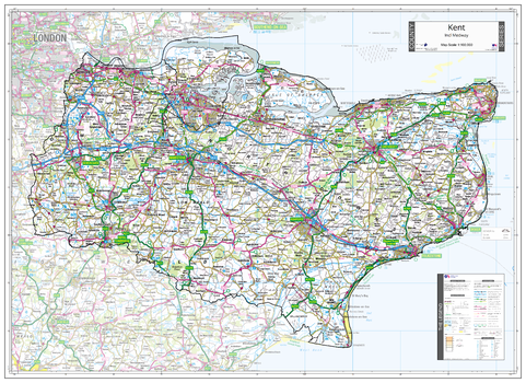
County Map of Kent
An Ordnance Survey Map covering the whole of the county showing the county boundary including applicable Unitary Authority boundaries. The mapping outside the county boundary is faded to highlight the county. Part of a series of counties maps that cover England Scotland & Wales all using the same background Ordnance Survey Mapping for continuity across the whole series. This map includes Tonbridge Wells, Ashford, Maidstone, Dover, Folkestone, Margate
Page Size: 43.5 x 31.5 in (1100 x 800 mm)
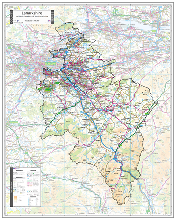
County Map of Lanarkshire
An Ordnance Survey Map covering the whole of the county showing the county boundary including applicable Unitary Authority boundaries. The mapping outside the county boundary is faded to highlight the county. Part of a series of counties maps that cover England Scotland & Wales all using the same background Ordnance Survey Mapping for continuity across the whole series. This map includes Motherwell, Cumbernauld
Page Size: 39.5 x 39.5 in (1000 x 1000 mm)
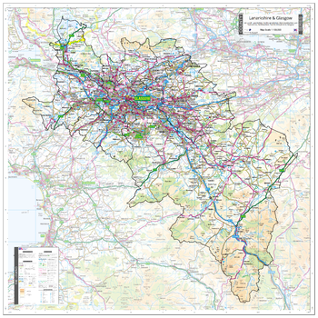
County Map of Lanarkshire & Glasgow
An Ordnance Survey Map covering the whole of the county showing the county boundary including applicable Unitary Authority boundaries. The mapping outside the county boundary is faded to highlight the county. Part of a series of counties maps that cover England Scotland & Wales all using the same background Ordnance Survey Mapping for continuity across the whole series. This map includes Glasgow, Motherwell, Cumbernauld
Page Size: 31.5 x 39.5 in (800 x 1000 mm)
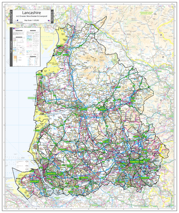
County Map of Lancashire
An Ordnance Survey Map covering the whole of the county showing the county boundary including applicable Unitary Authority boundaries. The mapping outside the county boundary is faded to highlight the county. Part of a series of counties maps that cover England Scotland & Wales all using the same background Ordnance Survey Mapping for continuity across the whole series. This map includes Greater Manchester, Lancaster, Bury, Bolton
Page Size: 32.5 x 38.75 in (820 x 980 mm)
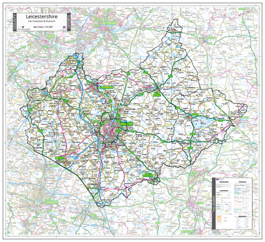
County Map of Leicestershire
An Ordnance Survey Map covering the whole of the county showing the county boundary including applicable Unitary Authority boundaries. The mapping outside the county boundary is faded to highlight the county. Part of a series of counties maps that cover England Scotland & Wales all using the same background Ordnance Survey Mapping for continuity across the whole series. This map includes Leicester, Rutland, Loughborough
Page Size: 36.25 x 33.25 in (920 x 840 mm)
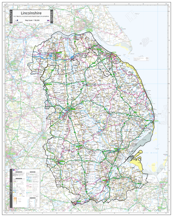
County Map of Lincolnshire
An Ordnance Survey Map covering the whole of the county showing the county boundary including applicable Unitary Authority boundaries. The mapping outside the county boundary is faded to highlight the county. Part of a series of counties maps that cover England Scotland & Wales all using the same background Ordnance Survey Mapping for continuity across the whole series. This map includes Lincoln, Boston, Grimsby
Page Size: 31.5 x 39.5 in (800 x 1000 mm)
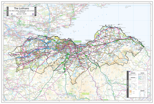
County Map of Lothians
An Ordnance Survey Map covering the whole of the county showing the county boundary including applicable Unitary Authority boundaries. The mapping outside the county boundary is faded to highlight the county. Part of a series of counties maps that cover England Scotland & Wales all using the same background Ordnance Survey Mapping for continuity across the whole series. This map includes Edinburgh, Livingstone, Bathgate
Page Size: 41 x 27.75 in (1040 x 700 mm)
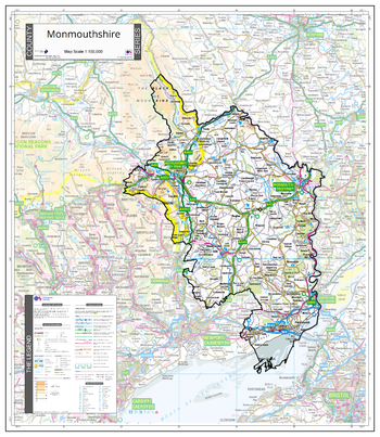
County Map of Monmouthshire
An Ordnance Survey Map covering the whole of the county showing the county boundary including applicable Unitary Authority boundaries. The mapping outside the county boundary is faded to highlight the county. Part of a series of counties maps that cover England Scotland & Wales all using the same background Ordnance Survey Mapping for continuity across the whole series. This map includes Momouth, Abergavenny, Chepstow
Page Size: 26 x 30 in (660 x 760 mm)
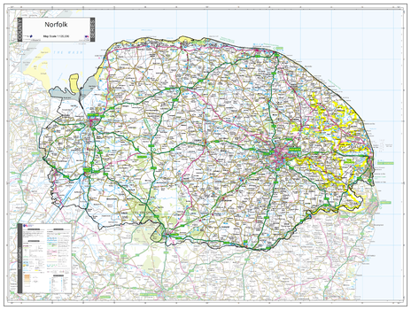
County Map of Norfolk
An Ordnance Survey Map covering the whole of the county showing the county boundary including applicable Unitary Authority boundaries. The mapping outside the county boundary is faded to highlight the county. Part of a series of counties maps that cover England Scotland & Wales all using the same background Ordnance Survey Mapping for continuity across the whole series. This map includes Norwich, Great Yarmouth
Page Size: 41.75 x 31.5 in (1060 x 800 mm)