


National Geographic

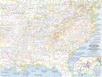
Battlefields of the Civil War - Published 1961
This Civil War map, based on a map upon which General Grant marked his proposed lines of operation, portrays the United States as it was charted in 1863. Published in April 1961 to accompany a map of Civil War battlefields, and the article "The Civil War."
Page Size: 25 x 19 in (633 x 479 mm)
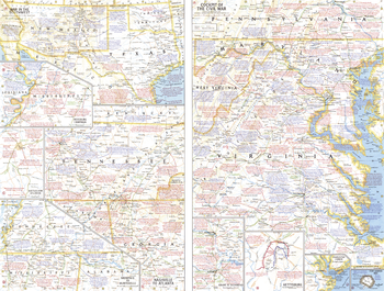
Battlefields of the Civil War Theme - Published 1961
This work features multiple maps of Civil War campaigns, as well as the war's extent in the southwestern United States. Published in April 1961 to accompany a historical map of the Civil War, and the article "The Civil War."
Page Size: 25 x 19 in (633 x 479 mm)
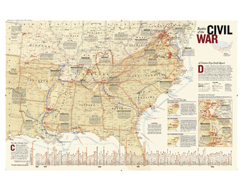
Battles of the Civil War
Created originally as a supplement to the April 2005 National Geographic Magazine, this comprehensive map shows major land campaigns, Union and Confederate troop movements, major Union naval campaigns, roads, railroads, battle outcomes and their impacts on the war, dates of capture by Union forces and more. Two inset maps – Battle for the Capitals and Turning Points of the War – as well as a timeline of battles with map location, casualties and impacts of battles are included. Created with the assistance of the National Park Service, Civil War Preservation Trust, American Battlefield Protection Program, Naval Historical Center, Virginia War Museum, National Museum of Civil War Medicine, and the U.S. Naval Academy.
Page Size: 38 x 30 in (965 x 762 mm)
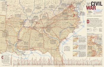
Battles of the Civil War - Published 2005
Determined to preserve a way of life rooted in slavery, 11 southern states declared themselves the independent Confederate States of America in early 1861. President Lincoln asked for 75,000 militiamen to put down this insurrection. The next four years would see three million Americans take up arms against each other, leading to the deaths of at least 620,000 soldiers. This remarkably detailed map of Civil War battles reveals the dates, number of casualties, troop movements, and more in order to gain a better understanding of how this war was fought. Published in April 2005 as half of a two–map set with "A Nation Transformed by Civil War."
Page Size: 31.25 x 20.25 in (790 x 511 mm)
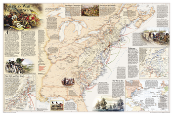
Battles of the Revolutionary War and War of 1812: Side 1
National Geographic's Battles of the Revolutionary War and War of 1812 map is rich with detail, illustrating significant battle sites and routes.<br><br>The map illustrates the American War for Independence fought from 1775-1783, which spread from New England through the Middle Atlantic and into the South. It delineates the boundaries of the British and Spanish territories and the thirteen American colonies as well as the battle sites, which are categorized based on their impact on the war. British Army and Naval bases and the movements of the British, Americans, French, and Spanish forces are also included on the map. Several inset maps are featured, illustrating the War at Sea, and arrival of British forces in New York Harbor in July 1776, and the Battle at Yorktown in 1781. Other key events, including the Saratoga Campaign and the Invasion of Canada, are featured on the map.
Page Size: 36 x 24 in (914 x 610 mm)
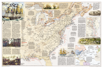
Battles of the Revolutionary War and War of 1812: Side 2
National Geographic's Battles of the Revolutionary War and War of 1812 map is rich with detail, illustrating significant battle sites and routes.<br><br>The map illustrates the War of 1812, which was fought over maritime rights. It delineates the boundaries of the United States, the British territories, and unceded Indian lands, as well as the battle sites, which are categorized based on their impact on the war. British Army and Naval bases and the movements of the British and American forces are also included on the map. Several inset maps are featured, illustrating the Blue Water Naval Engagements and the battles of the Chesapeake, as well as the battles on the Niagra and the Detroit Frontier.
Page Size: 36 x 24 in (914 x 610 mm)
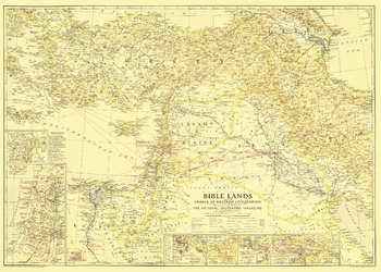
Bible Lands, and the Cradle of Western Civilization - Published 1938
This instructive map is great for collectors or anyone interested in the lands of the Bible. Multiple inset maps detail historical periods such as the route of the Exodus and the Crusades, and the main map contains historical facts as well as information about archaeological finds. Published in December 1938, the map accompanied the article "Change Comes to Bible Lands."
Page Size: 34.75 x 24.75 in (877 x 626 mm)
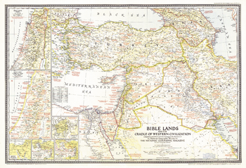
Bible Lands, and the Cradle of Western Civilization - Published 1946
A must-have for Bible scholars and a perfect companion to the Bible Lands map of 1938, this informative map holds an abundance of details about the history of the region. Appearing in National Geographic in December 1946 alongside the article "Syria and Lebanon Taste Freedom," this work captures both the cradle of western civilization in Biblical times and the Holy Land of the late 1940s.
Page Size: 32 x 22 in (810 x 554 mm)
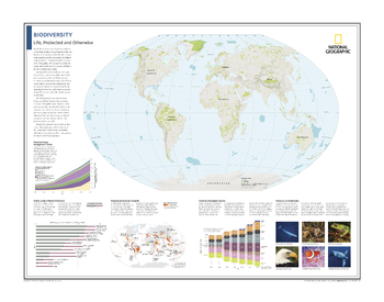
Biodiversity: Life, Protected and Otherwise - Atlas of the World, 10th Edition
Protected Areas; Protected Areas Management Trends; Varied Levels of Biome Protection; Mapping Biodiversity Hotspots; Charting Threatened Species; Pressures on Biodiversity
Page Size: 28 x 22 in (711 x 559 mm)

Bird Migration Eastern Hemisphere - Published 2004
This map illustrates the incredible journeys that birds undertake in the Americas each year. The migration paths of sixty seven types of birds are shown on a map of the Americas that is overlaid with pathways that their routes, from nesting grounds to wintering areas. Full-color bird paintings by noted illustrator Arthur Singer show each of the sixty seven species.
Page Size: 31.25 x 20.25 in (791 x 511 mm)
Paper: UPC 749717024762
Matte Plastic: UPC 749717030725
Laminated: UPC 749717018990
Rolled Canvas: UPC 749717053588
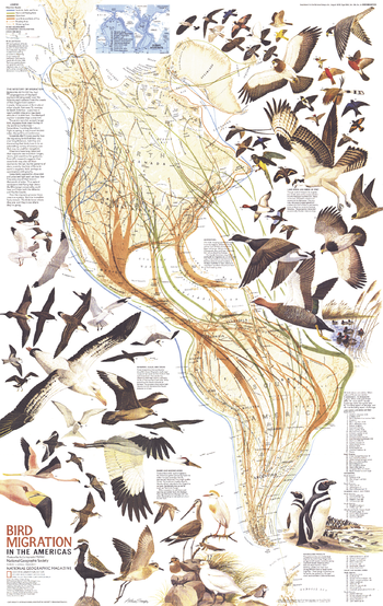
Bird Migration in the Americas - Published 1979
Bird lovers will treasure this educational map of the migratory birds of the Americas. Published in August 1979 in conjunction with a political and physical map of the Americas and the article "Mysteries of Bird Migration," this piece contains an abundance of information on migratory routes as well as beautiful illustrations of 67 bird species.
Page Size: 22.75 x 36 in (575 x 910 mm)
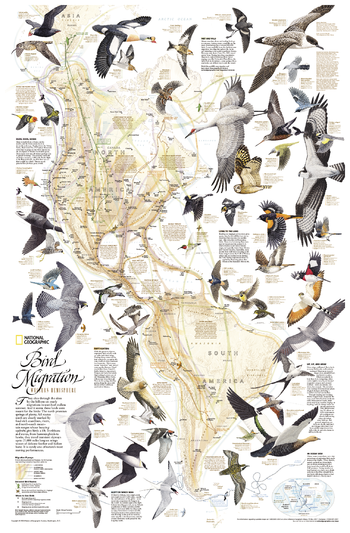
Bird Migration, Western Hemisphere
This National Geographic classic shows the mystery of bird migration and the incredible journeys that birds undertake in the Americas each year. 67 types of birds that migrate are shown on a map of the Americas that is overlaid with pathways that show migration routes from nesting grounds to wintering areas. Full-color bird paintings by noted illustrator Arthur Singer show each of the 67 species, making it easy to identify birds as they fly their amazing journeys.
Page Size: 21 x 32 in (533 x 813 mm)
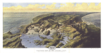
Birds Eye View of the Panama Canal - Published 1912
Published in February 1912 two years before the Panama Canal opened, this stunning relief map-painting illustrates the Panama railroad, locks, breakwater, and other details of the region. One of the largest engineering projects ever undertaken, the canal had an enormous impact on shipping, creating a passage between the Pacific and Atlantic Oceans. Prior to the canal's opening, ships had to travel the long and treacherous route around the tip of South America.
Page Size: 18.75 x 9.75 in (474 x 244 mm)
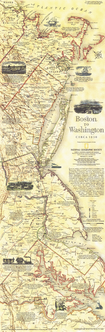
Boston To Washington Circa 1830 - Published 1830
This historical map is based on plates drafted by Henry Schenk Tanner which cover the Atlantic Coast from Boston to Washington, D.C. Features a variety of historical notes and illustrations. Published in July 1994 as half of a two–map set with "Boston to Washington, Megalopolis."
Page Size: 10 x 31.25 in (252 x 792 mm)
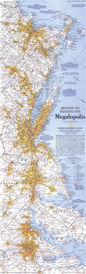
Boston To Washington Megalopolis - Published 1994
This map highlights the region dubbed "Megalopolis" in 1961, comprised of the densely populated 500-mile swath of eastern cities from Boston to Washington, D.C. Published in July 1994 as half of a two–map set with "Boston to Washington, Circa 1830."
Page Size: 10 x 31.25 in (250 x 791 mm)
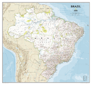
Brazil Classic
National Geographic's Brazil Classic wall map is fittingly one of the largest maps available of the largest country by area in South America, and the fifth largest in the World.<br><br>It shows the entire country in exceptional detail, including Brazil's 26 states and 1 federal district, plus the coastal islands that make up Fernando de Noronha National Marine Park, Abrolhos National Park, and Arquipelago dos Abrolhos.<br><br>The map shows over 1,000 named places including state capitals, primary and secondary towns, political boundaries, important infrastructure, and all key landforms. Brazil's national parks are clearly highlighted and labeled, as is the country's rich network of rivers that feed the Amazon–the world's second longest river.
Page Size: 41 x 38 in (1041 x 965 mm)
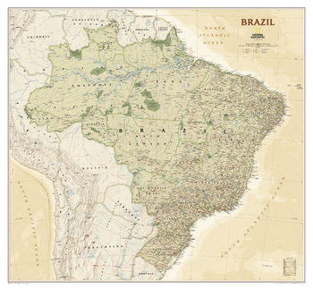
Brazil Executive
National Geographic's Brazil Executive wall map is fittingly one of the largest maps available of the largest country by area in South America, and the fifth largest in the World.<br><br>It shows the entire country in exceptional detail, including Brazil's 26 states and 1 federal district, plus the coastal islands that make up Fernando de Noronha National Marine Park, Abrolhos National Park, and Arquipelago dos Abrolhos.<br><br>The map shows over 1,000 named places including state capitals, primary and secondary towns, political boundaries, important infrastructure, and all key landforms. Brazil's national parks are clearly highlighted and labeled, as is the country's rich network of rivers that feed the Amazon–the world's second longest river.
Page Size: 41 x 38 in (1041 x 965 mm)
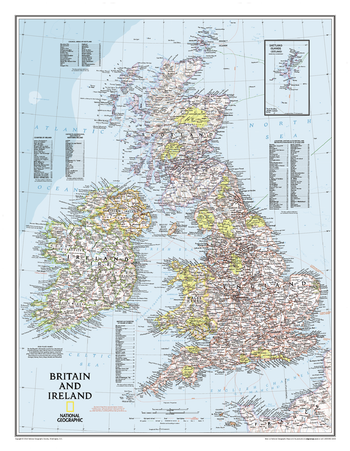
Britain and Ireland Classic
Our classic political map of Britain and Ireland shows country boundaries, thousands of place names, major highways and roads, airports, bodies of water, national parks, and more. Includes England, Ireland , Scotland, and Wales, along with Normandy across the English Channel and an inset map of the Shetland Islands.
Page Size: 23.5 x 30.25 in (597 x 768 mm)
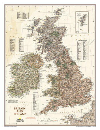
Britain and Ireland Executive
Our executive style political map of Britain and Ireland features country boundaries, place names, bodies of water, airports, major highways and roads, and much more.
Page Size: 23.5 x 30.25 in (597 x 768 mm)
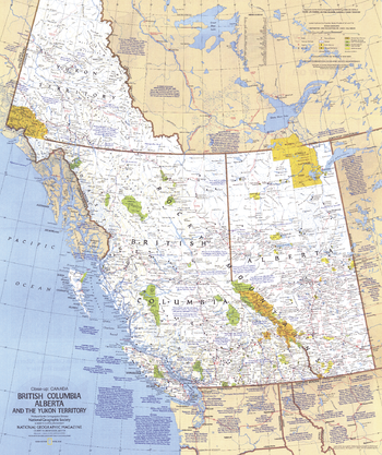
British Columbia, Alberta and the Yukon Territory - Published 1978
This travel map of the Canadian provinces of British Columbia, Alberta and the Yukon Territory shows hundreds of national parks, wilderness areas, campgrounds and ski resorts. It also highlights points of interest in cities such as Vancouver, Victoria, Edmonton, and Dawson. Published in April 1978.
Page Size: 22.75 x 27 in (575 x 686 mm)