


National Geographic

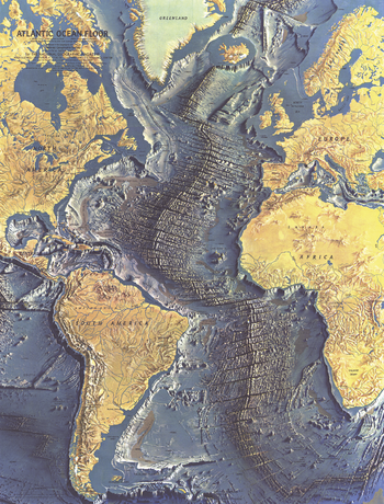
Atlantic Ocean Floor - Published 1968
This distinctive physical map of the Atlantic Ocean floor appeared in the June 1968 issue of National Geographic as a supplement to the map of the Atlantic. The detail of such submarine terrain as continental slopes, abyssal plains, and the mighty Mid-Atlantic Ridge is stunning. A true work of art, and a wonderful companion to the ocean floor maps of the Indian (1967), Pacific (1969), and Arctic (1971).
Page Size: 19 x 25 in (481 x 632 mm)
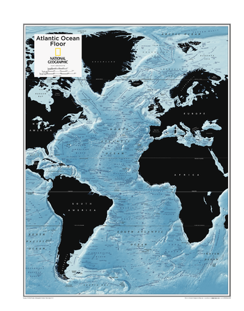
Atlantic Ocean Floor - Atlas of the World, 10th Edition
null
Page Size: 22 x 28 in (559 x 711 mm)
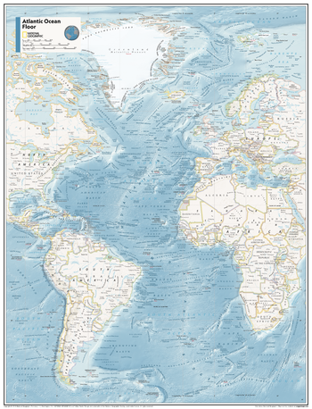
Atlantic Ocean Floor - Atlas of the World, 11th Edition
Showcasing the Atlantic Ocean floor in stunning detail with state-of-the-art cartographic techniques delivering accuracy and exceptional quality, the innovative and engaging design makes the content easily accessible and user-friendly.
Ideal for classrooms with an emphasis on teaching geography or environmental themes. The mapping of the ocean terrain gives your students a unique glimpse into how our world appears under the sea.
This map of the Atlantic Ocean floor uses stunning contrasts to highlight the ocean floor and its physical features. This map is drawn in the Miller Cylindrical projection, an adapted version of the Mercator projection for nautical navigation because it represents lines of constant course, known as rhumb lines or loxodromes, as straight segments which conserve the angles with the meridians.
This map is found in National Geographic's 11th Edition World Atlas and is now available as a stand alone product.
Page Size: 24 x 31.5 in (610 x 798 mm)
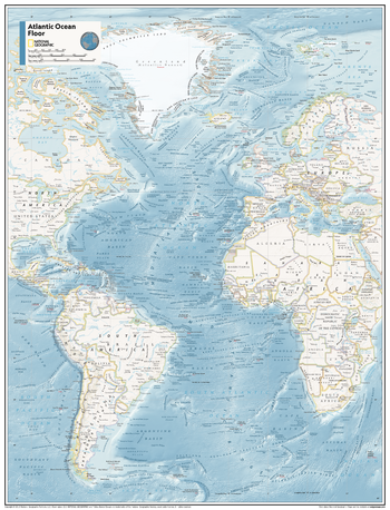
Atlantic Ocean Floor - Atlas of the World, 11th Edition - Compact
Showcasing the Atlantic Ocean floor in stunning detail with state-of-the-art cartographic techniques delivering accuracy and exceptional quality, the innovative and engaging design makes the content easily accessible and user-friendly.
Ideal for classrooms with an emphasis on teaching geography or environmental themes. The mapping of the ocean terrain gives your students a unique glimpse into how our world appears under the sea.
This map of the Atlantic Ocean floor uses stunning contrasts to highlight the ocean floor and its physical features. This map is drawn in the Miller Cylindrical projection, an adapted version of the Mercator projection for nautical navigation because it represents lines of constant course, known as rhumb lines or loxodromes, as straight segments which conserve the angles with the meridians.
This map is found in National Geographic's 11th Edition World Atlas and is now available as a stand alone product.
Page Size: 16.25 x 21.5 in (413 x 540 mm)
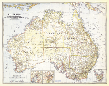
Australia - Published 1948
Published in March 1948 with the article "An Arnhem Land Adventure," this is the earliest National Geographic map of "The Land Down Under." This map captures Australia poised for massive immigration and the change that it brought following World War II. A wonderful companion to the Australia map of 1963.
Page Size: 31.5 x 25 in (798 x 632 mm)
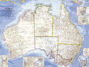
Australia - Published 1963
Explore the diverse ecosystems of the Australian continent with this attractive and detailed map. Printed in September 1963 with the article "The Settled East, the Barrier Reef, the Center."
Page Size: 25 x 19 in (633 x 478 mm)
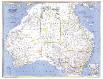
Australia - Published 1979
Known for its stunning Great Barrier Reef and unique wildlife, Australia is a land of adventure and diversity. Published in February 1979 as a companion to the "Australia, Land of Living Fossils" map and the article "Those Kangaroos! They're a Marvelous Mob."
Page Size: 29.5 x 22.75 in (745 x 572 mm)
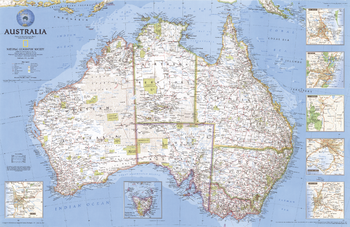
Australia - Published 2000
From red desert sunsets to the Sydney Opera House, Australia is an exciting continent of adventure, culture, and unique wildlife. Explore its many diverse regions with this attractive map. Published in July 2000 as half of a two–map set with "Australia Under Siege."
Page Size: 31.25 x 20.25 in (792 x 514 mm)
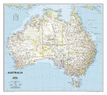
Australia Classic
One of the most authoritative maps of the “Land down under". Features thousands of place names (including primary and secondary towns), accurate boundaries, aboriginal lands, parks and protected areas, infrastructure, and relief. Includes coverage of Tasmania, the Coral Sea Islands, and the Great Barrier Reef.
Page Size: 30.5 x 27.25 in (770 x 689 mm)
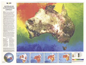
Australia Continental Odyssey - Published 1988
National Geographic celebrated Australia's bicentennial with an entire issue devoted to the continent. This unique map is a photomosaic of computer-enhanced satellite images portraying Australia's physical features and vegetation. Includes a brief history of the continent's formation and a colorful demonstration of the region's temperature gradient. Published in February 1988 as a companion to the map "A Traveler's Look at Australia."
Page Size: 27 x 20.5 in (685 x 516 mm)
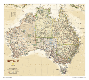
Australia Executive
Highly accurate Australia executive style political map clearly shows state boundaries, place names, bodies of water, parks and preserves, and more. Includes inset maps for Tasmania and major Australian cities.
Page Size: 30.5 x 27.25 in (770 x 689 mm)
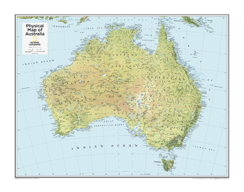
Australia Physical - Atlas of the World, 10th Edition
null
Page Size: 28 x 22 in (711 x 559 mm)
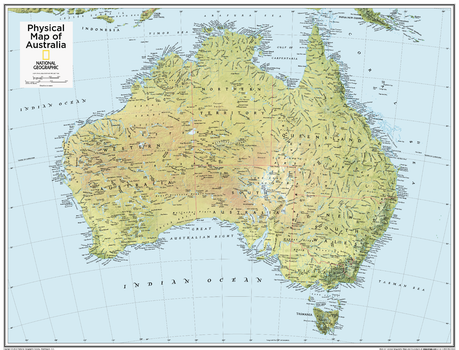
Australia Physical - Atlas of the World, 10th Edition - Compact
Page Size: 21 x 16 in (533 x 406 mm)
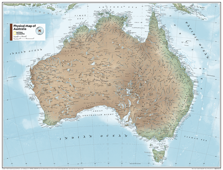
Australia Physical - Atlas of the World, 11th Edition
This physical map of Australia can fit in any space. Showcasing the country in stunning detail with state-of-the-art cartographic techniques delivering accuracy and exceptional quality, the innovative and engaging design makes the content easily accessible and user-friendly.
Ideal for classrooms with an emphasis on teaching geography or environmental themes. The inclusion of physical features gives your students a genuine feel for how our world appears.
This map uses a bright, easy to read color palette featuring blue oceans and stunning shaded relief that has been featured on National Geographic wall maps for over 75 years. Drawn in the Azimuthal Equidistant projection, this map ensures that all points on the map are at proportionally correct distances from the center point.
This map is found in National Geographic's 11th Edition World Atlas and is now available as a stand alone product.
Page Size: 31.5 x 24 in (798 x 610 mm)
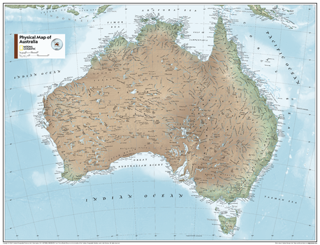
Australia Physical - Atlas of the World, 11th Edition - Compact
This physical map of Australia can fit in any space. Showcasing the country in stunning detail with state-of-the-art cartographic techniques delivering accuracy and exceptional quality, the innovative and engaging design makes the content easily accessible and user-friendly.
Ideal for classrooms with an emphasis on teaching geography or environmental themes. The inclusion of physical features gives your students a genuine feel for how our world appears.
This map uses a bright, easy to read color palette featuring blue oceans and stunning shaded relief that has been featured on National Geographic wall maps for over 75 years. Drawn in the Azimuthal Equidistant projection, this map ensures that all points on the map are at proportionally correct distances from the center point.
This map is found in National Geographic's 11th Edition World Atlas and is now available as a stand alone product.
Page Size: 21.5 x 16.25 in (540 x 413 mm)

Australia Political - Atlas of the World, 10th Edition
null
Page Size: 28 x 22 in (711 x 559 mm)
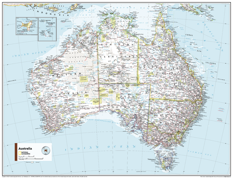
Australia Political - Atlas of the World, 11th Edition
This Australia map of physical and political features can fit in any space. Showcasing the country in stunning detail with state-of-the-art cartographic techniques delivering accuracy and exceptional quality, the innovative and engaging design makes the content easily accessible and user-friendly.
Ideal for classrooms with an emphasis on teaching geography or environmental themes. The inclusion of physical features gives your students a genuine feel for how our world appears.
This map uses a bright, easy to read color palette featuring blue oceans and stunning shaded relief that has been featured on National Geographic wall maps for over 75 years. Drawn in the Azimuthal Equidistant projection, this map ensures that all points on the map are at proportionally correct distances from the center point. Insets of the Cocos Islands and Christmas Island add detail to this classic map.
This map is found in National Geographic's 11th Edition World Atlas and is now available as a stand alone product.
Page Size: 31.5 x 24 in (798 x 610 mm)
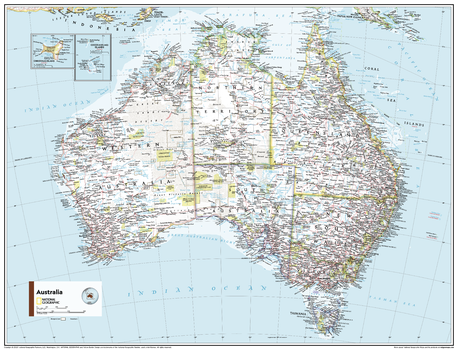
Australia Political - Atlas of the World, 11th Edition - Compact
This Australia map of physical and political features can fit in any space. Showcasing the country in stunning detail with state-of-the-art cartographic techniques delivering accuracy and exceptional quality, the innovative and engaging design makes the content easily accessible and user-friendly.
Ideal for classrooms with an emphasis on teaching geography or environmental themes. The inclusion of physical features gives your students a genuine feel for how our world appears.
This map uses a bright, easy to read color palette featuring blue oceans and stunning shaded relief that has been featured on National Geographic wall maps for over 75 years. Drawn in the Azimuthal Equidistant projection, this map ensures that all points on the map are at proportionally correct distances from the center point. Insets of the Cocos Islands and Christmas Island add detail to this classic map.
This map is found in National Geographic's 11th Edition World Atlas and is now available as a stand alone product.
Page Size: 21.5 x 16.25 in (540 x 413 mm)
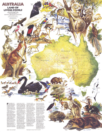
Australia, Land of Living Fossils - Published 1979
This beautiful physical map of Australia and Tasmania includes an introduction to the fascinating wildlife found throughout the continent. Published in February 1979 as a companion to the "Australia" map and the article "Those Kangaroos! They're a Marvelous Mob."
Page Size: 22.75 x 29.5 in (574 x 744 mm)
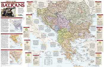
Balkans Conflict - Published 2008
Study the countries of the Balkans with this up-close, detailed look at political boundaries for the region, as well as country flags and facts, history, and helpful inset maps.
Page Size: 31.25 x 20.5 in (794 x 514 mm)