


National Geographic

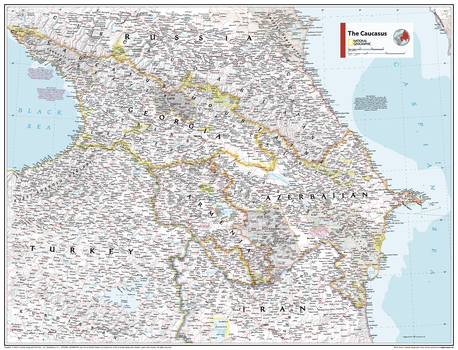
The Caucasus - Atlas of the World, 11th Edition
This Caucasus area map of physical and political features can fit in any space. Showcasing the region in stunning detail with state-of-the-art cartographic techniques delivering accuracy and exceptional quality, the innovative and engaging design makes the content easily accessible and user-friendly.
Ideal for classrooms with an emphasis on teaching geography or environmental themes. The inclusion of physical features gives your students a genuine feel for how our world appears.
This map uses a bright, easy to read color palette featuring blue oceans and stunning shaded relief that has been featured on National Geographic wall maps for over 75 years. It is drawn in Polyconic projection, and features parallels that are represented in non-concentric circular arcs.
Names of geographic features are carefully placed on the map to maintain legibility. This map also includes geological and historical facts of the region.
This map is found in National Geographic's 11th Edition World Atlas and is now available as a stand alone product.
Page Size: 31.5 x 24 in (798 x 610 mm)
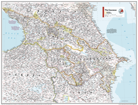
The Caucasus - Atlas of the World, 11th Edition - Compact
This Caucasus area map of physical and political features can fit in any space. Showcasing the region in stunning detail with state-of-the-art cartographic techniques delivering accuracy and exceptional quality, the innovative and engaging design makes the content easily accessible and user-friendly.
Ideal for classrooms with an emphasis on teaching geography or environmental themes. The inclusion of physical features gives your students a genuine feel for how our world appears.
This map uses a bright, easy to read color palette featuring blue oceans and stunning shaded relief that has been featured on National Geographic wall maps for over 75 years. It is drawn in Polyconic projection, and features parallels that are represented in non-concentric circular arcs.
Names of geographic features are carefully placed on the map to maintain legibility. This map also includes geological and historical facts of the region.
This map is found in National Geographic's 11th Edition World Atlas and is now available as a stand alone product.
Page Size: 21.5 x 16.25 in (540 x 413 mm)
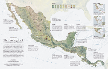
The Dividing Link, Mexico and Central America - Published 2007
When the sweeping tail of the North American continent became a land bridge to South America three million years ago, it changed the world. An ocean that had once flowed freely was now divided into Atlantic and Pacific. Its effect on ocean currents influenced the world's climate and the land bridge became a biological connector as well when species that had developed in isolation began to travel between continents. This detailed physical map of Mexico and Central America includes three maps which track the region's birth, before the final pieces of the geologic jigsaw puzzle completed the land bridge. Published in August 2007, this map was half of a two-map set with a political map of Mexico and Central America.
Page Size: 31.25 x 20.25 in (790 x 510 mm)
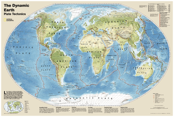
The Dynamic Earth, Plate Tectonics
The Dynamic Earth wall map illustrates plate tectonics and features new bathymetry and naturally colored relief, as well as volcano and earthquake data through 2011.<br><br>Like pieces of a giant jigsaw puzzle, tectonic plates fit together to form the earth's outer shell. The interaction of these plates causes earthquakes and volcanoes and shapes the earth's crust into mountains, valleys and deep-sea trenches. The Dynamic Earth map illustrates 17 major tectonic plates and highlights diffuse plate boundaries, convergent boundaries, spreading boundaries, fault zones, hot spots, notable earthquakes and volcanic eruptions of the 20th and 21st centuries, earthquakes with a magnitude of greater than 6.5 during the 20th and early 21st centuries, and notable volcanic eruptions during the past 10,000 years.
Page Size: 36.25 x 24.25 in (917 x 612 mm)
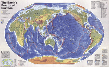
The Earths Fractured Surface - Published 1995
Like the pieces of a jigsaw puzzle, slabs of rocky crust known as tectonic plates fit together to form the outer shell of the Earth. This world map shows the contintents, along with the lines of each tectonic plate, demonstrating the reaction between continental drift, earthquakes and volcanoes.
Page Size: 36.25 x 22.25 in (916 x 563 mm)
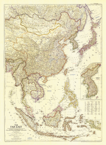
The Far East - Published 1952
In the Far East in early 1950s, two wars raged: the Korean War and the First Indochina War. This map of the region, published in September 1952 with the article "Indochina Faces the Dragon," includes an inset map of Korea with the battle line noted as of
Page Size: 30 x 41 in (761 x 1036 mm)
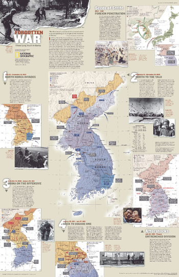
The Forgotten War, Three Long Years in Korea - Published 2003
The Korean War was a three-year-long conflict that began in 1950 when communist North Korea, supported by the Soviet Union and China, invaded South Korea which was supported by a U.S.-led coalition of UN forces. The two countries had only been officially divided at the 38th parallel two years prior, at the end of World War II. More than three million casualties and decades later, the two Koreas remain technically at war, locked in an unending stalemate. This engagin map outlines the events of the Korean War from the seeds of strife to the current entrenched division. Published in July 2003 as half of a two–map set with "The Two Koreas."
Page Size: 20.25 x 31.25 in (511 x 793 mm)
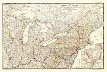
The Great Lakes Region of the United States and Canada - Published 1953
This map showcases the Great Lakes Region of the United States and Canada. Includes four insets: Illinois waterways (Lake Michigan to Lockport), Welland canal (Lake Ontario to Lake Erie), St. Marys River (Lake Huron to Lake Superior), and Detroit and St. Clair Rivers (Lake Erie to Lake Huron). Published in 1953.
Page Size: 43 x 29 in (1089 x 735 mm)
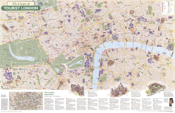
The Heart of Tourist London - Published 2000
London offers a feast of attractions within a metropolis of seven million people. A vibrant theater district complements distinguished art galleries and grand museums. A variety of architectural styles and monuments reflects eras of the city's history from Roman outpost to seat of empire to global trendsetter. Explore this great city with this map. Published in June 2000 as half of a two–map set with "A Traveler's Map of Britain and Ireland."
Page Size: 31.25 x 20.25 in (791 x 512 mm)
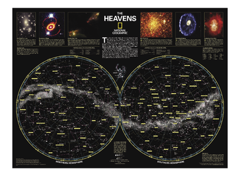
The Heavens
The stars of earth's night sky seem to hang like tranquil lanterns, filling us with wonder. They inspire great works of art, and tempt our imaginations into creating stories and myths from the shapes we see. The Heavens shows star charts and constellations for both the Northern and Southern Hemispheres. All 2,844 of the stars on the chart, plus nebulae and star clusters, can be seen with the unaided eye, making this chart a perfect companion for viewing the night sky.
Page Size: 30.75 x 22.75 in (775 x 578 mm)
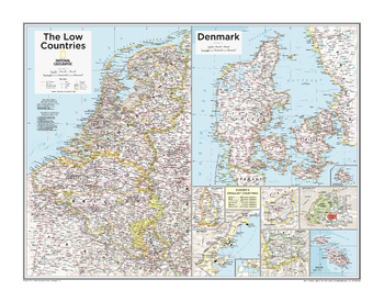
The Low Countries, Denmark, and Europe's Smallest Countries - Atlas of the World, 10th Edition
Andorra, Belgium, Denmark, Liechtenstein, Luxembourg, Malta, Monaco, Netherlands, San Marino, Vatican City
Page Size: 28 x 22 in (711 x 559 mm)
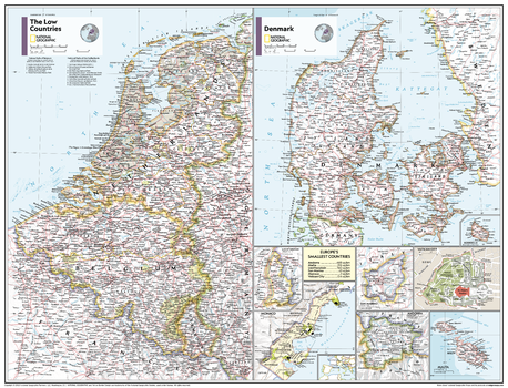
The Low Countries, Denmark, and Europe's Smallest Countries - Atlas of the World, 11th Edition
This Low Countries, Denmark and Europe's Smallest Countries map of physical and political features can fit in any space. Showcasing the countries in stunning detail with state-of-the-art cartographic techniques delivering accuracy and exceptional quality, the innovative and engaging design makes the content easily accessible and user-friendly.
Ideal for classrooms with an emphasis on teaching geography or environmental themes. The inclusion of physical features give your students a genuine feel for how our world appears.
This map uses a bright, easy to read color palette featuring blue oceans and stunning shaded relief that has been featured on National Geographic wall maps for over 75 years. It is drawn in Conic projection, in which an area of the earth is projected onto a cone.
Names of geographic features are carefully placed on the map to maintain legibility. This map of nine regions includes the area of Europe's six smallest nations - Andorra, Malta, Liechtenstein, San Marino, Monaco, and Vatican City.
This map is found in National Geographic's 11th Edition World Atlas and is now available as a stand alone product.
Page Size: 31.5 x 24 in (798 x 610 mm)
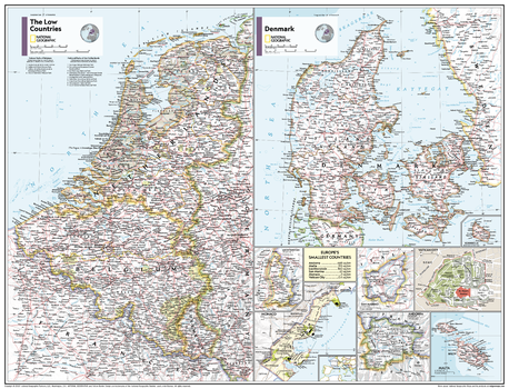
The Low Countries, Denmark, and Europe's Smallest Countries - Atlas of the World, 11th Edition - Compact
This Low Countries, Denmark and Europe's Smallest Countries map of physical and political features can fit in any space. Showcasing the countries in stunning detail with state-of-the-art cartographic techniques delivering accuracy and exceptional quality, the innovative and engaging design makes the content easily accessible and user-friendly.
Ideal for classrooms with an emphasis on teaching geography or environmental themes. The inclusion of physical features give your students a genuine feel for how our world appears.
This map uses a bright, easy to read color palette featuring blue oceans and stunning shaded relief that has been featured on National Geographic wall maps for over 75 years. It is drawn in Conic projection, in which an area of the earth is projected onto a cone.
Names of geographic features are carefully placed on the map to maintain legibility. This map of nine regions includes the area of Europe's six smallest nations - Andorra, Malta, Liechtenstein, San Marino, Monaco, and Vatican City.
This map is found in National Geographic's 11th Edition World Atlas and is now available as a stand alone product.
Page Size: 21.5 x 16.25 in (540 x 413 mm)
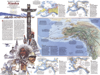
The Making of America, Alaska Theme - Published 1984
Part of the "Making of America" series, this map of Alaska is Side Two of a two-map set. Published in January 1984, this work features an abundance of historical information about the native cultures of the region, Alaska's natural resources, its military importance, and more.
Page Size: 27.25 x 20.5 in (686 x 516 mm)
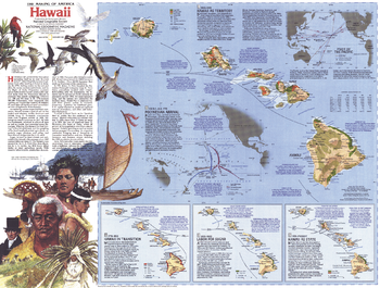
The Making of America, Hawaii Theme - Published 1983
This map details the rich history of the Hawaiian Islands of the United States, from the arrival of the Polynesians to present day. Features multiple inset maps showing specific time periods, illustrations, and a wealth of historical information. Published in November 1983 as part of the "Making of America" series, and half of a two–map set with a Hawaii overview map.
Page Size: 27 x 20.5 in (685 x 519 mm)
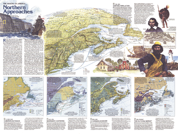
The Making of America, Northern Approaches Theme - Published 1985
This map of the Northern Approaches represents Side Two of a two-map set published in February 1985 as part of the "Making of America" series. Highlighting the rich history of the Maritimes and New England, this educational map includes a physical relief map of the region, an abundance of historical information, and four inset maps representing particular historical periods.
Page Size: 27.25 x 20.5 in (687 x 518 mm)
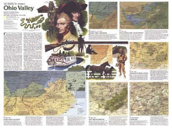
The Making of America, Ohio Valley Theme - Published 1985
Published in December 1985, this map of the Ohio Valley represents Side Two in a two-map set in the "Making of America" series. Multiple maps illustrate the region's change from the frontier settlements of Daniel Boone and his contemporaries, to the agricultural, mining, power, and manufacturing industries of today.
Page Size: 27.25 x 20.5 in (690 x 518 mm)
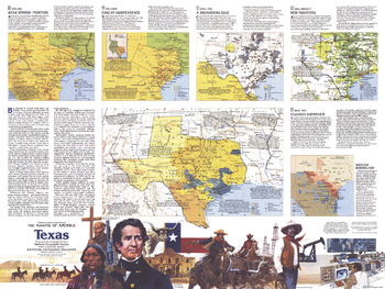
The Making of America, Texas Theme - Published 1986
The exciting history of "The Lone Star State" is highlighted in this map of Texas which appeared in National Geographic in March 1986. Filled with special inset maps and notes detailing historical periods, this map represents Side Two of a two-map set in the "Making of America" series.
Page Size: 27.25 x 20.5 in (690 x 518 mm)
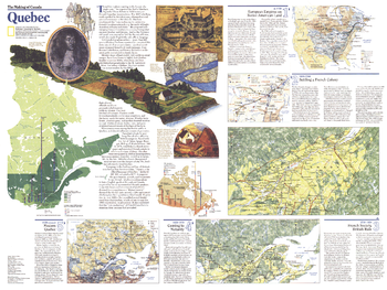
The Making of Canada, Quebec Theme - Published 1991
When the Earl of Durham was dispatched to analyze French-Canadian insurrections in 1838, he condemned the "vain endeavour to preserve a French Canadian nationality in the midst of Anglo-American colonies and states." But Quebec has indeed managed to maintain its French heritage and culture. Published in March 1991 as half of a two-map set with a political map of Quebec, "The Making of Canada: Quebec" reveals a wealth of information about the history of the unique province.
Page Size: 27.25 x 20.5 in (690 x 518 mm)
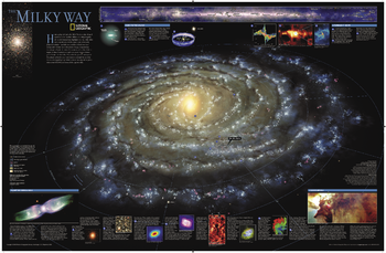
The Milky Way
This computer-generated image of the Milky Way shows the entire galaxy in one perspective of a 3-D model compiled specially for National Geographic. The model incorporates the positions of hundreds of thousands of stars and nebulae within the galaxy, shows Earth's location, and includes additional photographs, descriptions and locations of fascinating phenomena throughout the Milky Way.
Page Size: 32 x 21 in (809 x 529 mm)