


National Geographic

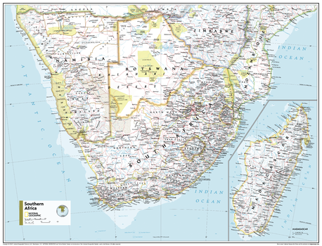
Southern Africa - Atlas of the World, 11th Edition - Compact
This Southern Africa map of physical and political features can fit in any space. Showcasing the region in stunning detail with state-of-the-art cartographic techniques delivering accuracy and exceptional quality, the innovative and engaging design makes the content easily accessible and user-friendly.
Ideal for classrooms with an emphasis on teaching geography or environmental themes. The inclusion of physical features gives your students a genuine feel for how our world appears.
This map uses a bright, easy to read color palette featuring blue oceans and stunning shaded relief that has been featured on National Geographic wall maps for over 75 years. It is drawn in the Transverse Mercator projection, which is a cylindrical map projection for nautical navigation because it represents lines of constant course.
This map is found in National Geographic's 11th Edition World Atlas and is now available as a stand alone product.
Page Size: 21.5 x 16.25 in (540 x 413 mm)
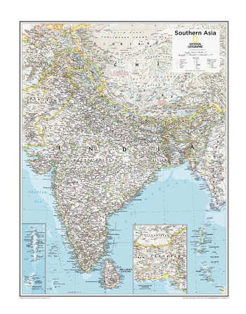
Southern Asia - Atlas of the World, 10th Edition
Bangladesh, Bhutan, India, Maldives, Nepal, Sri Lanka
Page Size: 22 x 28 in (559 x 711 mm)
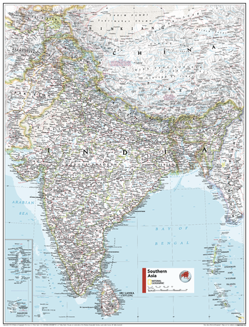
Southern Asia - Atlas of the World, 11th Edition
This Southeast Asia map of physical and political features can fit in any space. Showcasing the region in stunning detail with state-of-the-art cartographic techniques delivering accuracy and exceptional quality, the innovative and engaging design makes the content easily accessible and user-friendly.
Ideal for classrooms with an emphasis on teaching geography or environmental themes. The inclusion of physical features gives your students a genuine feel for how our world appears.
This map uses a bright, easy to read color palette featuring blue oceans and stunning shaded relief that has been featured on National Geographic wall maps for over 75 years. It is drawn in the Transverse Mercator projection, which is a cylindrical map projection for nautical navigation because it represents lines of constant course, ideal for regions near the equator. Insets of the Maldives and continuation of Pakistan are added for further detail.
This map is found in National Geographic's 11th Edition World Atlas and is now available as a stand alone product.
Page Size: 24 x 31.5 in (610 x 798 mm)
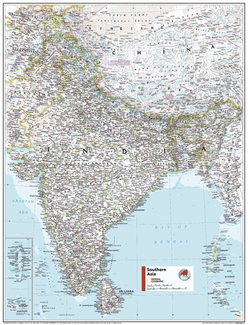
Southern Asia - Atlas of the World, 11th Edition - Compact
This Southeast Asia map of physical and political features can fit in any space. Showcasing the region in stunning detail with state-of-the-art cartographic techniques delivering accuracy and exceptional quality, the innovative and engaging design makes the content easily accessible and user-friendly.
Ideal for classrooms with an emphasis on teaching geography or environmental themes. The inclusion of physical features gives your students a genuine feel for how our world appears.
This map uses a bright, easy to read color palette featuring blue oceans and stunning shaded relief that has been featured on National Geographic wall maps for over 75 years. It is drawn in the Transverse Mercator projection, which is a cylindrical map projection for nautical navigation because it represents lines of constant course, ideal for regions near the equator. Insets of the Maldives and continuation of Pakistan are added for further detail.
This map is found in National Geographic's 11th Edition World Atlas and is now available as a stand alone product.
Page Size: 16.25 x 21.5 in (413 x 540 mm)
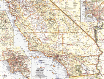
Southern California - Published 1966
This Southern California map contains insets of the General Grant Grove, Giant Forest of Sequoia National Forest, and cities of Los Angeles and San Diego. Published in May 1966 as half of a two–map set with a map of Northern California.
Page Size: 20 x 15.25 in (506 x 383 mm)
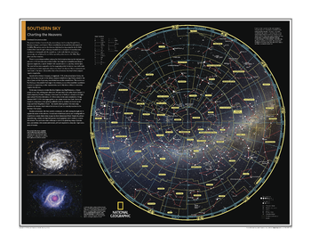
Southern Sky: Charting the Heavens - Atlas of the World, 10th Edition
null
Page Size: 28 x 22 in (711 x 559 mm)
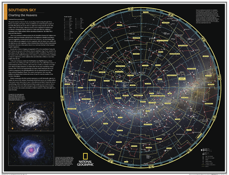
Southern Sky: Charting the Heavens - Atlas of the World, 10th Edition - Compact
Page Size: 21 x 16 in (533 x 406 mm)
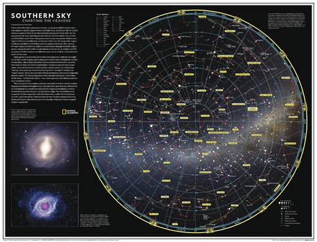
Southern Sky: Charting the Heavens - Atlas of the World, 11th Edition
Once you get far enough away from the ever spreading glow of urban areas and allow your eyes to adjust, a so-called "dark night" looks more like an explosion of illumination. Ancient astronomers peered into the night sky and imagined glittering jewels set in a crystal sphere slowly revolving around Earth from east to west.
Every culture has drawn pictures in the stars, creating constellations that represent animals or mythic figures . This map of the sky as seen from the southern hemisphere features the 88 constellations today recognized by the International Astronomical Union (IAU). These constellations are not just pictures but basic units that partition the sky. As seen on this map, main stars in a constellation have Greek letter designations - alpha for the brightest, beta for the second brightest, and onward. Galaxies, star clusters and nebulae are designated by the letter M, for Messier Catalogue objects, or NGC for New General Catalogue, followed by their number designation.
This map is an attractive product for the stargazer and budding astronomer. It makes an essential companion to Northern Sky: Charting the Heavens, and its size makes it perfect for a gallery wall.
This map is found in National Geographic's 11th Edition World Atlas and is now available as a stand alone product.
Page Size: 31.5 x 24 in (798 x 610 mm)
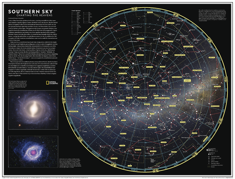
Southern Sky: Charting the Heavens - Atlas of the World, 11th Edition - Compact
Once you get far enough away from the ever spreading glow of urban areas and allow your eyes to adjust, a so-called "dark night" looks more like an explosion of illumination. Ancient astronomers peered into the night sky and imagined glittering jewels set in a crystal sphere slowly revolving around Earth from east to west.
Every culture has drawn pictures in the stars, creating constellations that represent animals or mythic figures . This map of the sky as seen from the southern hemisphere features the 88 constellations today recognized by the International Astronomical Union (IAU). These constellations are not just pictures but basic units that partition the sky. As seen on this map, main stars in a constellation have Greek letter designations - alpha for the brightest, beta for the second brightest, and onward. Galaxies, star clusters and nebulae are designated by the letter M, for Messier Catalogue objects, or NGC for New General Catalogue, followed by their number designation.
This map is an attractive product for the stargazer and budding astronomer. It makes an essential companion to Northern Sky: Charting the Heavens, and its size makes it perfect for a gallery wall.
This map is found in National Geographic's 11th Edition World Atlas and is now available as a stand alone product.
Page Size: 21.5 x 16.25 in (540 x 413 mm)
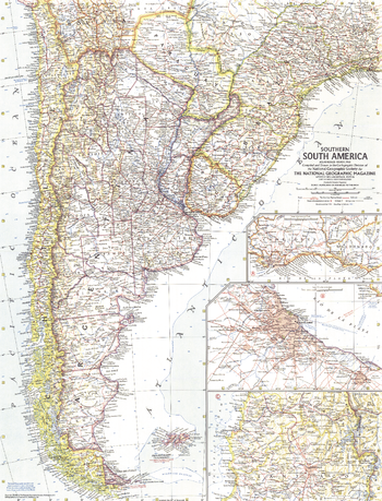
Southern South America - Published 1958
The map of Southern South America features insets of the three most prominent capitals in the region: Buenos Aires, Santiago, and Montevideo. Published in March 1958 with the article "Argentina: Young Giant of the Far South." A fine companion to the 1955 Eastern South America map.
Page Size: 19 x 25 in (480 x 630 mm)
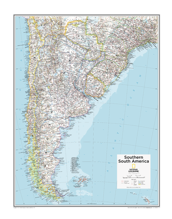
Southern South America - Atlas of the World, 10th Edition
Argentina, Chile, Falkland Islands (U.K.), Uruguay
Page Size: 22 x 28 in (559 x 711 mm)
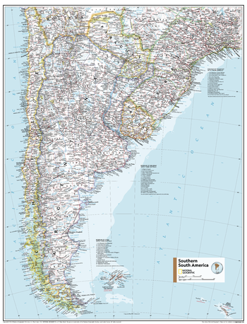
Southern South America - Atlas of the World, 11th Edition
This Southern South America map of physical and political features can fit in any space. Showcasing the region in stunning detail with state-of-the-art cartographic techniques delivering accuracy and exceptional quality, the innovative and engaging design makes the content easily accessible and user-friendly.
Ideal for classrooms with an emphasis on teaching geography or environmental themes. The inclusion of physical features gives students a genuine feel for how our world appears.
This map uses a bright, easy to read color palette featuring blue oceans and stunning shaded relief that has been featured on National Geographic wall maps for over 75 years. Drawn in the Azimuthal Equidistant projection, this map ensures that all points on the map are at proportionally correct distances from the center point.
Names of geographic features are carefully placed on the map to maintain legibility, and this map includes a list of Chile, Paraguay and Uruguay's regions and their capital cities for clarity.
This map is found in National Geographic's 11th Edition World Atlas and is now available as a stand alone product.
Page Size: 24 x 31.5 in (610 x 798 mm)
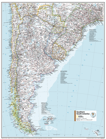
Southern South America - Atlas of the World, 11th Edition - Compact
This Southern South America map of physical and political features can fit in any space. Showcasing the region in stunning detail with state-of-the-art cartographic techniques delivering accuracy and exceptional quality, the innovative and engaging design makes the content easily accessible and user-friendly.
Ideal for classrooms with an emphasis on teaching geography or environmental themes. The inclusion of physical features gives students a genuine feel for how our world appears.
This map uses a bright, easy to read color palette featuring blue oceans and stunning shaded relief that has been featured on National Geographic wall maps for over 75 years. Drawn in the Azimuthal Equidistant projection, this map ensures that all points on the map are at proportionally correct distances from the center point.
Names of geographic features are carefully placed on the map to maintain legibility, and this map includes a list of Chile, Paraguay and Uruguay's regions and their capital cities for clarity.
This map is found in National Geographic's 11th Edition World Atlas and is now available as a stand alone product.
Page Size: 16.25 x 21.5 in (413 x 540 mm)
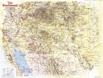
Southwest Side 1 - Published 1982
This Southwestern United States map focuses on the states of Arizona and New Mexico, and their immediate neighbors. It contains a wealth of historical notes and points of interest including Indian reservations, ruins, missions, pueblos, and more. Published in November 1982 as part of the "Making of America" series, and a companion to four articles on the region including "The Anasazi - Riddles in the Ruins."
Page Size: 27.25 x 20.5 in (688 x 518 mm)
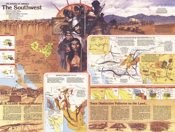
Southwest Side 2 - Published 1982
Part of the "Making of America" series, this map of the Southwest represents Side Two in a two-map set. Published in November 1982, its focus is on the enchanting states of Arizona and New Mexico and the surrounding region. Multiple maps illustrate the fluctuations of the region's occupants and their imprint on the land. This map accompanied four articles on the Southwest including "The Anasazi - Riddles in the Ruins."
Page Size: 27.25 x 20.5 in (688 x 518 mm)
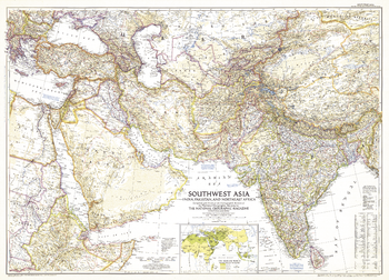
Southwest Asia - Published 1952
This map of Southwest Asia includes parts of eastern Europe and northeast Africa. Published in June 1952, this detailed map also includes an inset of the Moslem world, showing the population of Moslems in the region, and historical notes.
Page Size: 37.5 x 27 in (947 x 683 mm)
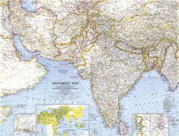
Southwest Asia - Published 1963
This map of Southwest Asia includes inset maps of the cities of Bombay (Mumbai), Calcutta (Kolkata), and Karachi, as well as a map showing the Muslim populations throughout the region. Published in May 1963, and a fine companion to the 1961 map of Southeast Asia.
Page Size: 25 x 19 in (632 x 479 mm)
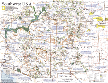
Southwest, USA - Published 1992
This map of the Southwestern United States includes a wealth of tourist attractions and sites including national parks, Indian reservations, ski areas, and more. Published in October 1992 as half of a two–map set with "Southwest U.S.A.: The Land of Open Sky."
Page Size: 20.25 x 15.5 in (512 x 391 mm)
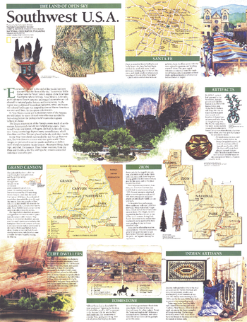
Southwest, USA Map, Land of Open Sky - Published 1992
Published in October 1992, the "Southwest U.S.A.: The Land of Open Sky" map features information about the most popular sites in the region including Grand Canyon and Zion National Parks, Santa Fe, Tombstone, and cliff dwellings. Half of a two-map set, this map accompanied the Southwest map in the same issue.
Page Size: 15.5 x 20.25 in (393 x 511 mm)
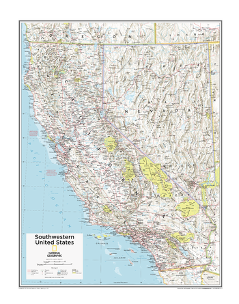
Southwestern U.S. - Atlas of the World, 10th Edition
California, Nevada
Page Size: 22 x 28 in (559 x 711 mm)