


National Geographic

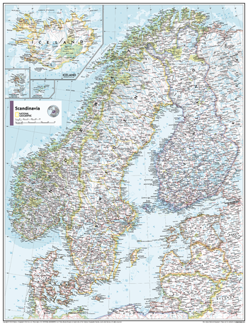
Scandinavia - Atlas of the World, 11th Edition - Compact
This Scandinavia map of physical and political features can fit in any space. Showcasing the countries in stunning detail with state-of-the-art cartographic techniques delivering accuracy and exceptional quality, the innovative and engaging design makes the content easily accessible and user-friendly.
Ideal for classrooms with an emphasis on teaching geography or environmental themes. The inclusion of physical features gives your students a genuine feel for how our world appears.
This map uses a bright, easy to read color palette featuring blue oceans and stunning shaded relief that has been featured on National Geographic wall maps for over 75 years. It is drawn in Conic projection, in which an area of the earth is projected onto a cone whose vertex is usually above one of the poles, then unrolled onto a flat surface.
Names of geographic features are carefully placed on the map to maintain legibility. Insets of Iceland, the Faroe Islands and Jan Mayen Islands add to this classic map.
This map is found in National Geographic's 11th Edition World Atlas and is now available as a stand alone product.
Page Size: 16.25 x 21.5 in (413 x 540 mm)
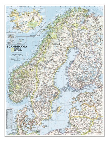
Scandinavia Classic
Wall map of Scandinavia and surrounding countries conforms to National Geographic's demanding cartographic standards. Unparalleled detail shows political boundaries, major cities and towns, fjords and other bodies of water, major highways and roads, airports, national parks, and much more.
Page Size: 23.5 x 30.25 in (597 x 768 mm)
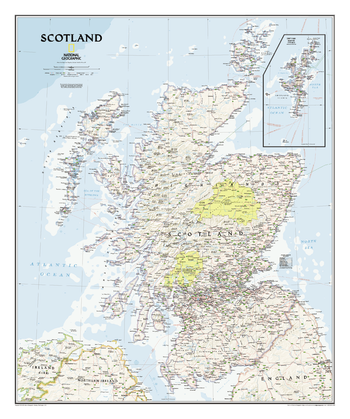
Scotland Classic
The classic-style Scotland wall map is one of the largest and most detailed maps available. Includes hundreds of named places including primary and secondary towns, counties, political boundaries, infrastructure, and selected historical sites. Shows Scotland in its entirety including the Highlands, Southern Uplands, Isle of Skye, Outer Hebrides, Inner Hebrides, Orkney Islands and the Shetland Islands (shown in an inset map). The nine political council areas of Scotland are also clearly identified.
Page Size: 30 x 36 in (762 x 914 mm)
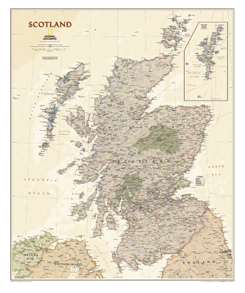
Scotland Executive
The executive-style Scotland wall map is one of the largest and most detailed maps available. Includes hundreds of named places including primary and secondary towns, counties, political boundaries, infrastructure, and selected historical sites. Shows Scotland in its entirety including the Highlands, Southern Uplands, Isle of Skye, Outer Hebrides, Inner Hebrides, Orkney Islands and the Shetland Islands (shown in an inset map). The nine political council areas of Scotland are also clearly identified.
Page Size: 30.75 x 36.75 in (777 x 929 mm)
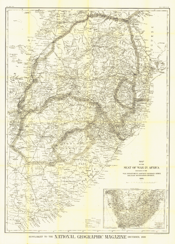
Seat of War in Africa - Published 1899
A truly distinctive work, this map was published in December 1899, shortly after the start of the Second Boer War in South Africa. The intricacy and unique historical context of this map make it a wonderful item for collectors.
Page Size: 35.5 x 49.5 in (898 x 1253 mm)

Seeking Our Origins - Published 1997
Published in February 1997 with the Dawn of Humans map and article, this compelling work contains illustrations of the various hominid species discovered. A timeline and other information puts the dawn of early man into perspective.
Page Size: 20.25 x 31.25 in (513 x 789 mm)
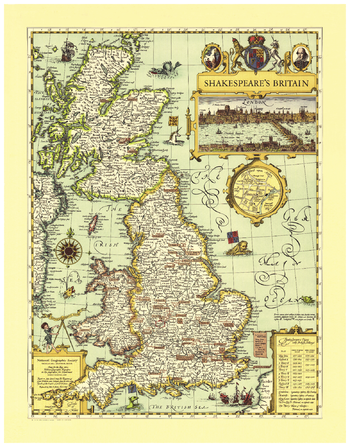
Shakespeare's Britain
First published in the May, 1965 issue of National Geographic Magazine, this map is a one-of-a-kind resource for any true Shakespeare enthusiast. Steeped in the history of the era, Shakespeare's Britain is infused with symbols and icons that show settings of the plays, towns and abbeys, castles, battlefields, forests, and heaths. Special insets include a panoramic view of Shakespeare's London and an enlarged map of Stratford on Avon. Also included is a table of Shakespeare's Plays with British Settings.
Page Size: 21.25 x 27.25 in (536 x 688 mm)
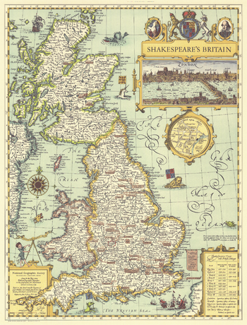
Shakespeares Britain - Published 1964
This elegant and delightfully illustrated map of Shakespeare's Britain shows the settings of plays and various points of interest throughout England, Wales, and Scotland. Published in May 1964, based on John Speed's map "The Kingdome of Great Britaine" from his 1611 atlas "Theatre of the Empire of Great Britaine."
Page Size: 19 x 25 in (481 x 631 mm)
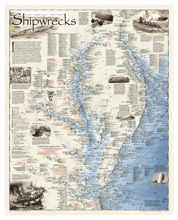
Shipwrecks of Delmarva
Shipwrecks of the Delmarva shows the location of more than 2,400 wrecks from the waters off the Delaware coast to the waters of the Chesapeake Bay, displayed atop beautiful bathymetric and coastal detail. Each wreck site is symbolized to define the class, type, and name of vessel accompanied by their dates of sinking. Locations of lifesaving stations, lighthouses and lightships, along with navigational beacons are accurately marked. Bathymetric and coastal features are clearly labeled, accompanied by inset maps, captions, and drawings used to highlight unique historical events such as the sinking of the U.S.S. Cumberland, the German U-Boat offensives, and the ghost fleet of Mallows Bay — the largest assemblage of wooden ships in the Western Hemisphere.<br><br>Wrecks featured on this map span from the mid-1600s galleons to 20th-century naval ships, those lost in military conflict, foul weather, bloody mutinies, pirate raids, human error, treacherous shoals, and a myriad of other events.
Page Size: 28 x 35 in (711 x 889 mm)
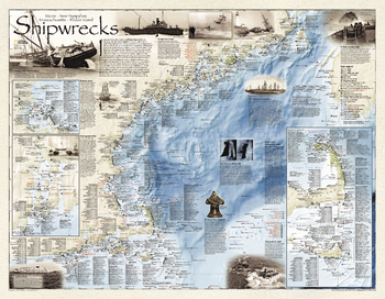
Shipwrecks of the Northeast
Shipwrecks of the Northeast illustrates more than 5,400 known shipwrecks on the untamed Atlantic coast of New England (Maine, Massachusetts, New Hampshire and Rhode Island).<br><br>From Rhode Islands' Narragansett Bay to Maine's St. Croix River, each wreck site is symbolized to define the class, type and name of vessel accompanied by the date of sinking. Icons also indicate whether a ship was lost due to conflict or natural causes.<br><br>Locations of lifesaving stations and lighthouses, along with navigational beacons are also marked. Bathymetric and coastal features are clearly labeled. Captions and drawings highlight unique historical events such as the infamous sinking of the Italian luxury liner Andrea Doria off the coast of Nantucket in 1956. Wrecks featured on this map span from mid-1600s galleons to 20th-century naval ships, those lost in military conflict, foul weather, mutinies, unseen rocks, treacherous shoals, mechanical failures and a myriad of other events.
Page Size: 36 x 28 in (914 x 711 mm)
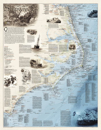
Shipwrecks of the Outer Banks
Shipwrecks of the Outer Bank illustrates more than 1,550 shipwrecks of the Atlantic Coast from Cape Henry, Virginia to Cape Fear, North Carolina.<br><br>Each wreck site is symbolized to define the class, type and name of vessel accompanied by the date of sinking. Icons also indicate whether a ship was lost due to conflict or natural causes.<br><br>Locations of lifesaving stations and lighthouses, along with navigational beacons are also marked. Bathymetric and coastal features are clearly labeled. Captions and drawings highlight unique historical events.
Page Size: 28 x 36 in (711 x 914 mm)
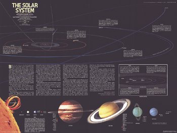
Solar System - Published 1981
Published in July 1981 with a map of Saturn and the article "Voyager 1 at Saturn: Riddles of the Rings," this stunning illustration of the solar system contains information about the sun and the planets, as well as an extensive introduction about the formation of the solar system.
Page Size: 22.5 x 17 in (569 x 429 mm)
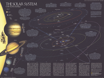
Solar System - Published 1990
This fascinating map of the solar system is teeming with information about the sun, the planets, their satellites, the formation of the solar system and makeup of the celestial bodies. Published in August 1990 with two articles, "Neptune: Voyager's Last Picture Show" and "Voyage of the Century," this map accompanied another work entitled "Portraits of our Celestial Family."
Page Size: 24.25 x 18.25 in (613 x 459 mm)
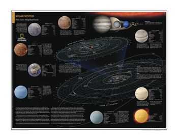
Solar System: The Sun's Neighborhood - Atlas of the World, 10th Edition
null
Page Size: 28 x 22 in (711 x 559 mm)
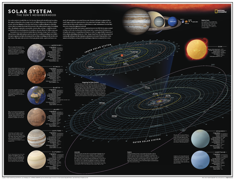
Solar System: The Sun's Neighborhood - Atlas of the World, 11th Edition
Our solar system is mostly the sun. Not in area, perhaps: Measured to its ultimate boundary, the region suffused by solar energy may be 46 billion kilometers (30 billion miles) across, while the diameter of the star itself is just 1.4 million kilometers (865,000 miles). But the sun accounts for about 99.9 percent of the solar system's mass. Everything else - the planets, asteroids, meteroids, comets, and floating dust and gas - could be considered leftovers from the formation of a medium-size star about 4.6 billion years ago.
Explore the sun's neighborhood - with this information-packed map of our solar system! Featuring details on all eight planets and other celestial bodies that impact orbits and the very way that the system functions, this map takes its readers on a celestial journey that provides insight into the reasons why everything is the way it is. The planets are displayed in relative sizes to truly demonstrate the sheer size of the solar system we call home.
This map is an attractive product for the budding astronomer. It makes an essential companion to Milky Way: Earth's Galactic Home, and its size makes it perfect for a gallery wall.
This map is found in National Geographic's 11th Edition World Atlas and is now available as a stand alone product.
Page Size: 31.5 x 24 in (798 x 610 mm)
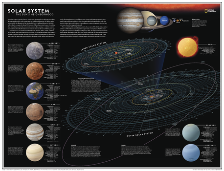
Solar System: The Sun's Neighborhood - Atlas of the World, 11th Edition - Compact
Our solar system is mostly the sun. Not in area, perhaps: Measured to its ultimate boundary, the region suffused by solar energy may be 46 billion kilometers (30 billion miles) across, while the diameter of the star itself is just 1.4 million kilometers (865,000 miles). But the sun accounts for about 99.9 percent of the solar system's mass. Everything else - the planets, asteroids, meteoroids, comets, and floating dust and gas - could be considered leftovers from the formation of a medium-size star about 4.6 billion years ago.
Explore the sun's neighborhood - with this information-packed map of our solar system! Featuring details on all eight planets and other celestial bodies that impact orbits and the very way that the system functions, this map takes its readers on a celestial journey that provides insight into the reasons why everything is the way it is. The planets are displayed in relative sizes to truly demonstrate the sheer size of the solar system we call home.
This map is an attractive product for the budding astronomer. It makes an essential companion to Milky Way: Earth's Galactic Home, and its size makes it perfect for a gallery wall.
This map is found in National Geographic's 11th Edition World Atlas and is now available as a stand alone product.
Page Size: 21.5 x 16.25 in (540 x 413 mm)
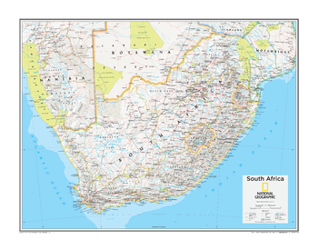
South Africa - Atlas of the World, 10th Edition
Lesotho, South Africa, Swaziland
Page Size: 28 x 22 in (711 x 559 mm)
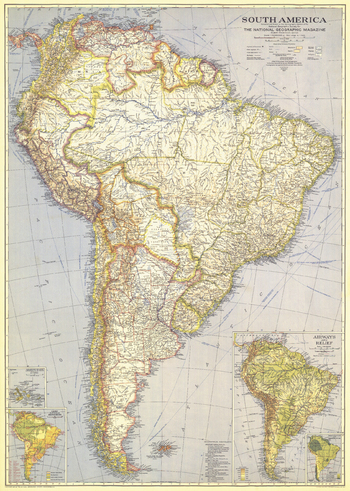
South America - Published 1937
At the time of the publication of this map of South America in December 1937, the continent remained largely a vast expanse of roadless wilderness and unexplored rivers. Colorful and rich in detail, this map also includes insets of the Galapagos Islands and information about the region such as precipitation and temperature, and airways and relief.
Page Size: 26.25 x 37 in (666 x 934 mm)
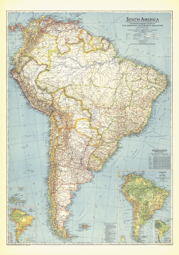
South America - Published 1942
This map of South America, published in October 1942, shows a continent still harboring unexplored rivers and revealing vast roadless areas of wilderness. The article "Air Cruising Through New Brazil" accompanied this map which featured information on the climate and natural resources of the region.
Page Size: 27.75 x 39.5 in (700 x 999 mm)
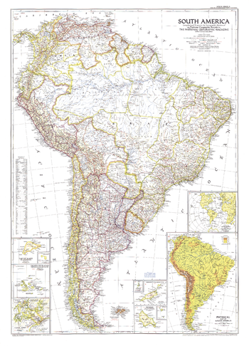
South America - Published 1950
Published in October 1950 with three articles including "Peru, Homeland of the Warlike Inca," this map of South America is the first to show airports on the continent. Land transportation was growing as well at this time, as evidenced by the roads and railways under construction.
Page Size: 29.25 x 40.5 in (738 x 1026 mm)