


National Geographic

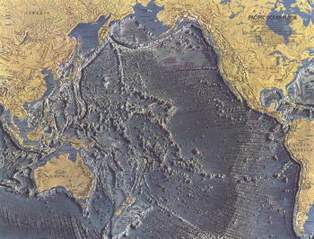
Pacific Ocean Floor - Published 1969
This distinctive physical map of the Pacific Ocean floor appeared in the October 1969 issue of National Geographic as a supplement to the map of the Pacific. The detail of such submarine terrain as continental slopes, fracture zones, and the countless seamounts is stunning. A true work of art, and a wonderful companion to the ocean floor maps of the Indian (1967), Atlantic (1968), and Arctic (1971).
Page Size: 25 x 19 in (632 x 480 mm)
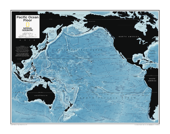
Pacific Ocean Floor - Atlas of the World, 10th Edition
null
Page Size: 28 x 22 in (711 x 559 mm)
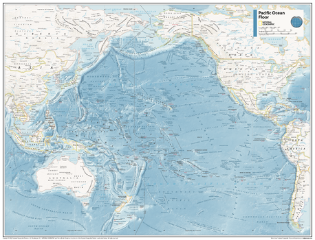
Pacific Ocean Floor - Atlas of the World, 11th Edition
This map of seafloor features can fit in any space. Showcasing the Pacific Ocean floor in stunning detail with state-of-the-art cartographic techniques delivering accuracy and exceptional quality, the innovative and engaging design makes the content easily accessible and user-friendly.
Ideal for classrooms with an emphasis on teaching geography or environmental themes. The mapping of the ocean terrain gives your students a unique glimpse into how our world appears under the sea.
This physical map of the Pacific Ocean floor uses stunning contrasts to highlight the ocean floor and its physical features. This map is drawn in the Miller Cylindrical projection, an adapted version of the Mercator projection for nautical navigation because it represents lines of constant course, known as rhumb lines or loxodromes, as straight segments which conserve the angles with the meridians.
This map is found in National Geographic's 11th Edition World Atlas and is now available as a stand alone product.
Page Size: 31.5 x 24 in (798 x 610 mm)
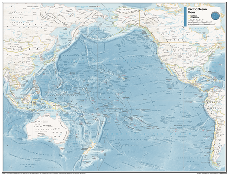
Pacific Ocean Floor - Atlas of the World, 11th Edition - Compact
This map of seafloor features can fit in any space. Showcasing the Pacific Ocean floor in stunning detail with state-of-the-art cartographic techniques delivering accuracy and exceptional quality, the innovative and engaging design makes the content easily accessible and user-friendly.
Ideal for classrooms with an emphasis on teaching geography or environmental themes. The mapping of the ocean terrain gives your students a unique glimpse into how our world appears under the sea.
This physical map of the Pacific Ocean floor uses stunning contrasts to highlight the ocean floor and its physical features. This map is drawn in the Miller Cylindrical projection, an adapted version of the Mercator projection for nautical navigation because it represents lines of constant course, known as rhumb lines or loxodromes, as straight segments which conserve the angles with the meridians.
This map is found in National Geographic's 11th Edition World Atlas and is now available as a stand alone product.
Page Size: 21.5 x 16.25 in (540 x 413 mm)
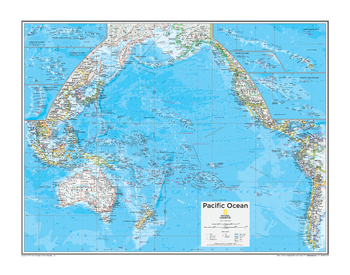
Pacific Ocean Political - Atlas of the World, 10th Edition
Pacific overview map with insets of: Caroline Islands, Hawaiian Islands (U.S.), Mariana Islands (U.S.), Marshall Islands, Society Islands (Fr.), and Tuamotu Archipelago (Fr.)
Page Size: 28 x 22 in (711 x 559 mm)
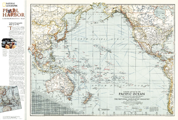
Pacific Ocean Theater of War 1942 - Published 2001
An exceptional historical piece, this map was published in February 1942 with an article entitled "Facts about the Philippines." Time zones, ship routes, and naval bases, make this a valuable map for collectors and those interested in World War II.
Page Size: 34 x 22.75 in (860 x 578 mm)
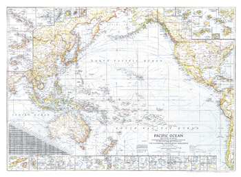
Pacific Ocean, and the Bay of Bengal - Published 1943
Published in September 1943 during World War II, this map of the Pacific Ocean and the Bay of Bengal contains an abundance of detail. With inset maps of over fifty islands, boundaries and notes showing the political administration of islands, typical storm tracks, time zones, and both airline and nautical distances, this work makes a fine addition to any map collection.
Page Size: 37.25 x 27.5 in (944 x 696 mm)
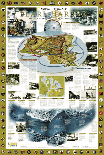
Pearl Harbor - Published 2001
This wall map was issued on the 60th anniversary of the attack on Pearl Harbor. This port through the Japanese attack, led to the entry of the United States in the second world war. Over 2,400 US Americans lost in the attack on Pearl Harbor life. Many texts give detailed information about this event.
Page Size: 23 x 34 in (579 x 860 mm)
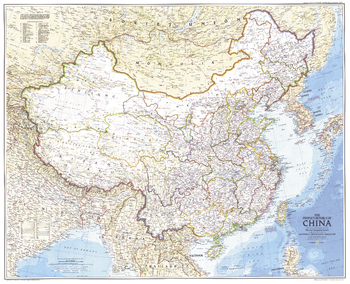
Peoples Republic of China - Published 1980
This map was created just one year after the Tiananmen Square protests, when students, intellectuals, and labor activists stood up against the might of the China's Communist government. Published in July 1980 as a companion to the "Peoples of China" map and the article "Shanghai: Born-again Giant."
Page Size: 37.5 x 30.5 in (950 x 771 mm)
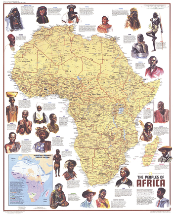
Peoples of Africa - Published 1971
This map features Africa's ethnic groups, identified by name and language. Includes beautiful illustrations and interesting facts about the diverse peoples that inhabit the continent. Published in December 1971 as half of a two–map set with the "Heritage of Africa" map, and as a companion to the article "The Zulus: Black Nation in a Land of Aparteid."
Page Size: 22.75 x 28.25 in (575 x 716 mm)
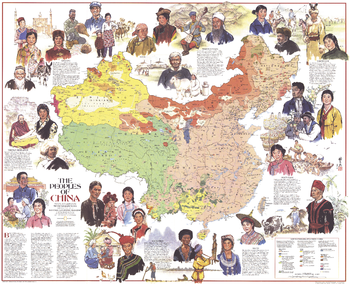
Peoples of China - Published 1980
This informative map shows China's diverse ethnicities and language groups, along with an abundance of illustrations. Published in July 1980 as a companion to the "Peoples Republic of China" map and the article "Shanghai: Born-again Giant."
Page Size: 37.5 x 30.5 in (950 x 771 mm)
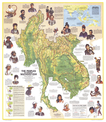
Peoples of Mainland Southeast Asia - Published 1971
Discover the varied cultures and ethnicities of the peoples of mainland Southeast Asia with this educational map. Published in March 1971 to accompany a map of Asia and the article "Pagan, on the Road to Mandalay."
Page Size: 32.5 x 37.5 in (824 x 952 mm)
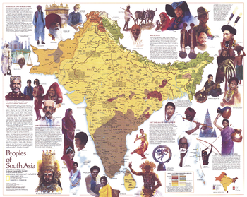
Peoples of South Asia - Published 1984
An informative map featuring the peoples of South Asia, this work includes compelling illustrations and notes about the religions, history, languages, and ways of life of these diverse groups. Published in December 1984 as a companion to the "South Asia with Afghanistan and Burma" map and an article on monsoons.
Page Size: 28.5 x 22.75 in (720 x 575 mm)
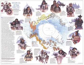
Peoples of the Arctic - Published 1983
This beautiful map contains a large quantity of information about the diverse peoples who inhabit the Arctic region. Of particular note is the demonstration of the approximate boundaries of the various inhabitants circa 1825. Published in February 1983 as a companion to the "Arctic Ocean" map and four articles, including "Hunters of the Lost Spirit."
Page Size: 29.5 x 22.75 in (748 x 577 mm)
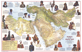
Peoples of the Middle East - Published 1972
A beautiful relief map of the Middle East that also contains a wealth of information about its diverse population. Includes compelling illustrations and details about the history, religions, languages, trades, and lifestyles of the region's inhabitants. Published in July 1972.
Page Size: 35.75 x 22.75 in (903 x 573 mm)
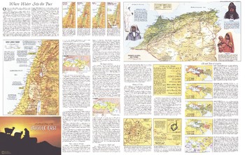
Peoples of the Middle East Theme - Published 1972
Half of a two-map set, the Peoples of the Middle East map is filled with a wealth of information about the region and its inhabitants including their work, religions, languages, the role of women, politics, and more. Published in July 1972, this map contains over a dozen maps detailing historical periods, religious sites, land use, and ethnic groups.
Page Size: 35.75 x 22.75 in (903 x 573 mm)
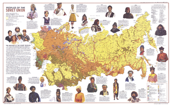
Peoples of the Soviet Union - Published 1976
This map provides a wealth of information about the amazing cultural diversity of the former Soviet Union. Twenty-four ethnicities are highlighted, showing their territorial extents as well as illustrations and information about their cultures. Published in February 1976 as half of a two–map set with the "Soviet Union" map.
Page Size: 37 x 23 in (939 x 579 mm)
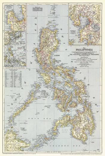
Philippines - Published 1945
The Philippines were liberated from the Japanese by MacArthur's forces just months before this map was published in March 1945. This map, which accompanied the article "What Luzon Means to Uncle Sam," features the provinces and their capitals as well as airfields. A fine collectible for those interested in World War II era maps.
Page Size: 17.5 x 26 in (443 x 658 mm)
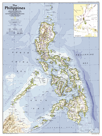
Philippines - Published 1986
This map of the Philippines was created following the country's Epifanio de los Santos Avenue (EDSA) Revolution and the installation of Corazon Aquino as president. Published in July 1986 as a companion to the map "The History of the Philippines" and the article "Hope and Danger in the Philippines."
Page Size: 20.5 x 27.25 in (518 x 688 mm)
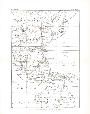
Philippines - Published 1900
This historic black and white map, entitled "The Philippine Islands as the Geographical Center of the Far East," shows the Far East in 1900--two years after the Philippines were taken, then purchased from Spain by the US following the Spanish American War.
Page Size: 10 x 12.75 in (251 x 318 mm)