MapSherpa
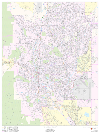
Colorado Springs, Colorado Inner Metro - Portrait
This portrait-oriented map of central Colorado Springs, Colorado shows detailed street level information including extensive street labeling. Ideal for planning of deliveries, home services, sales territories, real estate and much more. Base map features include all roads with major roads and highways labelled; neighborhood names; railways; high level land use such as parks and recreation areas, industrial areas and hospital campuses; and a variety of points of interest including schools, libraries, stadiums, museums, border crossings and more.
Page Size: 36 x 48 in (914 x 1219 mm)
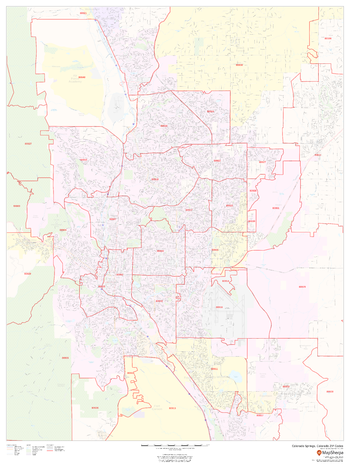
Colorado Springs, Colorado ZIP Codes
This map of Colorado Springs, Colorado shows ZIP code areas overlaid on a road map. Ideal for planning of deliveries, home services, sales territories, real estate and much more. Base map features include all roads with major roads and highways labelled; neighborhood names; railways; and high level land use such as parks and recreation areas, industrial areas and hospital campuses.
Page Size: 36 x 48 in (914 x 1219 mm)
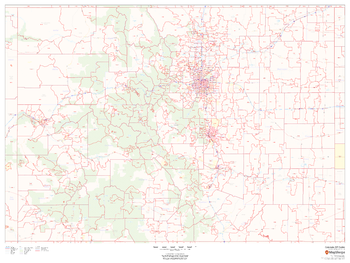
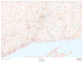
Colorado ZIP Code Map
This map of Colorado shows ZIP codes overlaid on a road map. Base map features include municipality and county boundaries, major road network features, and state and national parks and conservation areas.
Page Size: 48 x 36 in (1219 x 914 mm)

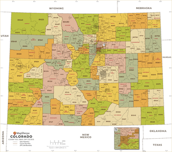
Colorado ZIP Code Map with Counties - Extra Large
This map has been created exclusively for MapSherpa, and designed for business or reference use. Clear and clean colors & fonts matched with cartographic research makes this Colorado Zip Code Map with Counties easily readable and useful. The map shows the 64 counties of Colorado and the borders of the over 500 zip codes across the Centennial State.
Page Size: 60 x 53.25 in (1524 x 1347 mm)
Colorado ZIP Code Map with Counties - Large
This map has been created exclusively for MapSherpa, and designed for business or reference use. Clear and clean colors & fonts matched with cartographic research makes this Colorado Zip Code Map with Counties easily readable and useful. The map shows the 64 counties of Colorado and the borders of the over 500 zip codes across the Centennial State.
Page Size: 48 x 42.5 in (1219 x 1078 mm)

Colorado ZIP Code Map with Counties - Standard
This map has been created exclusively for MapSherpa, and designed for business or reference use. Clear and clean colors & fonts matched with cartographic research makes this Colorado Zip Code Map with Counties easily readable and useful. The map shows the 64 counties of Colorado and the borders of the over 500 zip codes across the Centennial State.
Page Size: 36 x 32 in (914 x 808 mm)
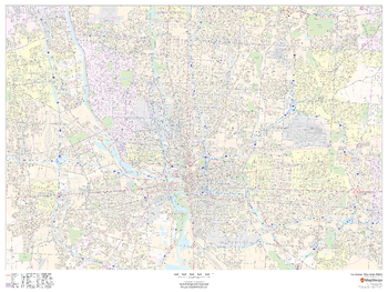
Columbus, Ohio Inner Metro - Landscape
This landscape-oriented map of central Columbus, Ohio shows detailed street level information including extensive street labeling. Ideal for planning of deliveries, home services, sales territories, real estate and much more. Base map features include all roads with major roads and highways labelled; neighborhood names; railways; high level land use such as parks and recreation areas, industrial areas and hospital campuses; and a variety of points of interest including schools, libraries, stadiums, museums, border crossings and more.
Page Size: 48 x 36 in (1219 x 914 mm)
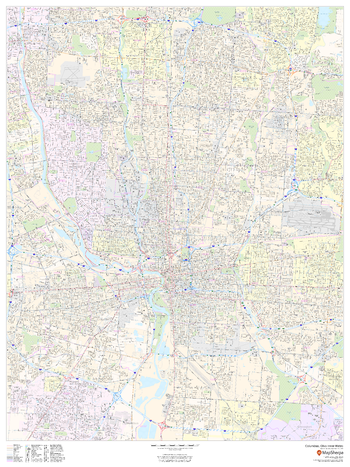
Columbus, Ohio Inner Metro - Portrait
This portrait-oriented map of central Columbus, Ohio shows detailed street level information including extensive street labeling. Ideal for planning of deliveries, home services, sales territories, real estate and much more. Base map features include all roads with major roads and highways labelled; neighborhood names; railways; high level land use such as parks and recreation areas, industrial areas and hospital campuses; and a variety of points of interest including schools, libraries, stadiums, museums, border crossings and more.
Page Size: 36 x 48 in (914 x 1219 mm)
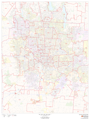
Columbus, Ohio ZIP Codes
This map of Columbus shows ZIP code areas overlaid on a road map. Ideal for planning of deliveries, home services, sales territories, real estate and much more. Base map features include all roads with major roads and highways labelled; neighborhood names; railways; and high level land use such as parks and recreation areas, industrial areas and hospital campuses.
Page Size: 36 x 48 in (914 x 1219 mm)

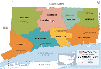
Connecticut Counties Map - Extra Large
This map has been created exclusively for MapSherpa, and designed for reference or business use. Clear and clean colors & fonts matched with cartographic research makes this map of the 8 Connecticut counties easily readable and useful.
Page Size: 60 x 41.25 in (1524 x 1047 mm)

Connecticut Counties Map - Large
This map has been created exclusively for MapSherpa, and designed for reference or business use. Clear and clean colors & fonts matched with cartographic research makes this map of the 8 Connecticut counties easily readable and useful.
Page Size: 48 x 33 in (1219 x 837 mm)
Connecticut Counties Map - Standard
This map has been created exclusively for MapSherpa, and designed for reference or business use. Clear and clean colors & fonts matched with cartographic research makes this map of the 8 Connecticut counties easily readable and useful.
Page Size: 36 x 24.75 in (914 x 628 mm)
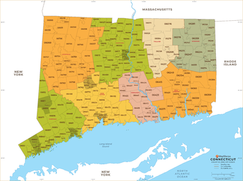
Connecticut ZIP Code Map
This map of Connecticut shows ZIP code areas overlaid on a road map. Ideal for planning of deliveries, home services, sales territories, real estate and much more. Base map features include all roads with major roads and highways labelled; municipality and county boundaries; neighborhood names; railways; and high level land use such as parks and recreation areas, industrial areas and hospital campuses.
Page Size: 48 x 36 in (1219 x 914 mm)

Connecticut ZIP Code Map with Counties - Extra Large
This map has been created exclusively for MapSherpa, and designed for business or reference use. Clear and clean colors & fonts matched with cartographic research makes this map of Connecticut's counties and ZIP codes easily readable and useful.
Page Size: 60 x 44.75 in (1524 x 1131 mm)
Connecticut ZIP Code Map with Counties - Large
This map has been created exclusively for MapSherpa, and designed for business or reference use. Clear and clean colors & fonts matched with cartographic research makes this map of Connecticut's counties and ZIP codes easily readable and useful.
Page Size: 48 x 35.75 in (1219 x 905 mm)

Connecticut ZIP Code Map with Counties - Standard
This map has been created exclusively for MapSherpa, and designed for business or reference use. Clear and clean colors & fonts matched with cartographic research makes this map of Connecticut's counties and ZIP codes easily readable and useful.
Page Size: 36 x 26.75 in (914 x 679 mm)
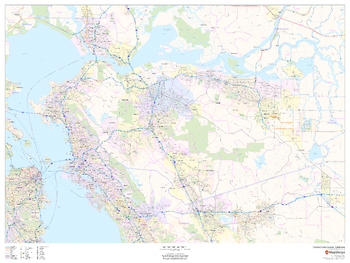
Contra Costa County, California
This map of Contra Costa County, California shows regional level information. Base map features include highways and major roads with labelling; neighborhood names; railways; high level land use such as parks and recreation areas, industrial areas and hospital campuses; and a selection of points of interest including transportation hubs like airports and train stations, tourist information, police stations and shopping centres. ZIP code boundaries are shown as a secondary map feature.
Page Size: 48 x 36 in (1219 x 914 mm)
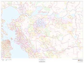
Contra Costa County, California ZIP Codes
This map of Contra Costa County, California shows ZIP code areas overlaid on a road map. Ideal for planning of deliveries, home services, sales territories, real estate and much more. Base map features include all roads with major roads and highways labelled; neighborhood names; railways; and high level land use such as parks and recreation areas, industrial areas and hospital campuses.
Page Size: 48 x 36 in (1219 x 914 mm)
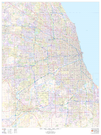
Cook County, Illinois
This map of Cook County, Illinois shows regional level information. Base map features include highways and major roads with labelling; railways; high level land use such as parks and recreation areas; and a selection of points of interest including transportation hubs like airports and train stations, tourist information and police stations. ZIP code boundaries are shown as a secondary map feature.
Page Size: 36 x 48 in (914 x 1219 mm)
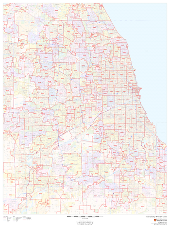
Cook County, Illinois ZIP Codes
This map of Cook County, Illinois shows ZIP code areas overlaid on a road map. Ideal for planning of deliveries, home services, sales territories, real estate and much more. Base map features include all roads with major roads and highways labelled; neighborhood names; railways; and high level land use such as parks and recreation areas, industrial areas and hospital campuses.
Page Size: 36 x 48 in (914 x 1219 mm)