MapSherpa
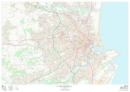
Aberdeen
This map of Aberdeen shows detailed street level information including extensive street labelling. Ideal for planning of deliveries, home services, sales territories, real estate and much more.
Page Size: 47 x 33.25 in (1189 x 841 mm)
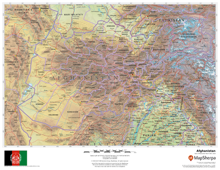
Afghanistan
This beautiful map shows physical and political features for Afghanistan and surrounding areas. Relief shading and the use of different colours by height above sea level are both informative and attractive.
Page Size: 22 x 17 in (559 x 432 mm)

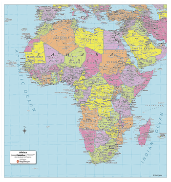
Africa Political Map
Explore the African continent with this map created specifically for MapSherpa. New and up-to-date, this Map shows the 54 countries that make up the continent. Stretching from the Mediterranean in the north to the edge of Asia, and to the Cape of Good Hope in the south, this map prominently shows; national capitals, primary cities & towns, primary water features, mountain ranges and all time zones. With multiple sizes available, this is the perfect reference map for home, office, or school use.
Page Size: 24 x 25 in (610 x 635 mm)
Africa Political Map - Compact
Explore the African continent with this map created specifically for MapSherpa. New and up-to-date, this Map shows the 54 countries that make up the continent. Stretching from the Mediterranean in the north to the edge of Asia, and to the Cape of Good Hope in the south, this map prominently shows; national capitals, primary cities & towns, primary water features, mountain ranges and all time zones. With multiple sizes available, this is the perfect reference map for home, office, or school use.
Page Size: 16 x 17 in (406 x 432 mm)
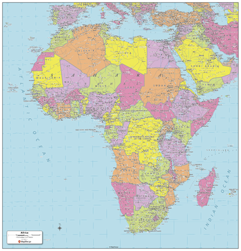
Africa Political Map - Extra Large
Explore the African continent with this map created specifically for MapSherpa. New and up-to-date, this Map shows the 54 countries that make up the continent. Stretching from the Mediterranean in the north to the edge of Asia, and to the Cape of Good Hope in the south, this map prominently shows; national capitals, primary cities & towns, primary water features, mountain ranges and all time zones. With multiple sizes available, this is the perfect reference map for home, office, or school use.
Page Size: 48 x 50 in (1219 x 1270 mm)

Africa Political Map - Large
Explore the African continent with this map created specifically for MapSherpa. New and up-to-date, this Map shows the 54 countries that make up the continent. Stretching from the Mediterranean in the north to the edge of Asia, and to the Cape of Good Hope in the south, this map prominently shows; national capitals, primary cities & towns, primary water features, mountain ranges and all time zones. With multiple sizes available, this is the perfect reference map for home, office, or school use.
Page Size: 32 x 33.5 in (813 x 851 mm)

Alabama Counties Map - Extra Large
This map has been created exclusively for MapSherpa, and designed for reference or business use. Clear and clean colors & fonts matched with cartographic research makes this map of the 67 Alabama counties easily readable and useful.
Page Size: 60 x 80 in (1524 x 2028 mm)

Alabama Counties Map - Large
This map has been created exclusively for MapSherpa, and designed for reference or business use. Clear and clean colors & fonts matched with cartographic research makes this map of the 67 Alabama counties easily readable and useful.
Page Size: 48 x 64 in (1219 x 1622 mm)
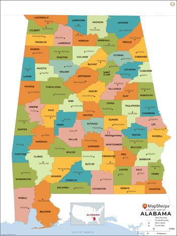
Alabama Counties Map - Standard
This map has been created exclusively for MapSherpa, and designed for reference or business use. Clear and clean colors & fonts matched with cartographic research makes this map of the 67 Alabama counties easily readable and useful.
Page Size: 36 x 48 in (914 x 1217 mm)
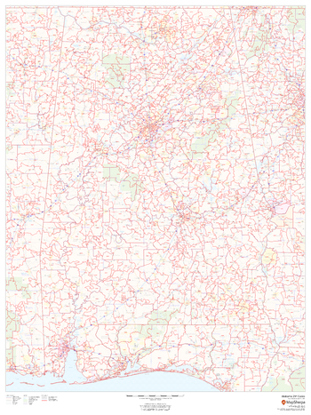
Alabama ZIP Code Map
This map of Alabama shows ZIP codes overlaid on a road map. Base map features include municipality and county boundaries, major road network features, and state and national parks and conservation areas.
Page Size: 36 x 48 in (914 x 1219 mm)

Alabama ZIP Code Map with Counties - Extra Large
This map has been created exclusively for MapSherpa, and designed for business or reference use. Clear and clean colors & fonts matched with cartographic research makes this map of Alabama's counties and ZIP codes easily readable and useful.
Page Size: 60 x 89.25 in (1524 x 2266 mm)
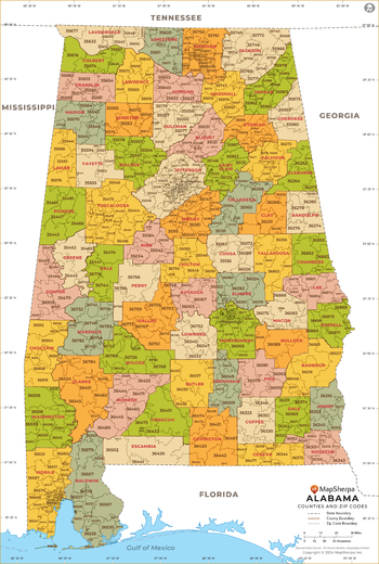
Alabama ZIP Code Map with Counties - Large
This map has been created exclusively for MapSherpa, and designed for business or reference use. Clear and clean colors & fonts matched with cartographic research makes this map of Alabama's counties and ZIP codes easily readable and useful.
Page Size: 48 x 71.5 in (1219 x 1813 mm)

Alabama ZIP Code Map with Counties - Standard
This map has been created exclusively for MapSherpa, and designed for business or reference use. Clear and clean colors & fonts matched with cartographic research makes this map of Alabama's counties and ZIP codes easily readable and useful.
Page Size: 36 x 53.75 in (914 x 1360 mm)
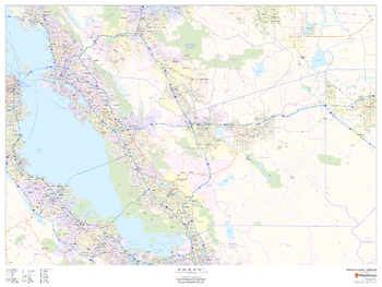
Alameda County, California
This map of Alameda County, California shows regional level information. Base map features include highways and major roads with labelling; neighborhood names; railways; high level land use such as parks and recreation areas, industrial areas and hospital campuses; and a selection of points of interest including transportation hubs like airports and train stations, tourist information, police stations and shopping centres. ZIP code boundaries are shown as a secondary map feature.
Page Size: 48 x 36 in (1219 x 914 mm)
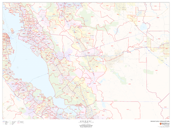
Alameda County, California ZIP Codes
This map of Alameda County, California shows ZIP code areas overlaid on a road map. Ideal for planning of deliveries, home services, sales territories, real estate and much more. Base map features include all roads with major roads and highways labelled; neighborhood names; railways; and high level land use such as parks and recreation areas, industrial areas and hospital campuses.
Page Size: 48 x 36 in (1219 x 914 mm)

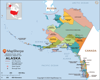
Alaska Boroughs and Census Areas (Counties) Map - Extra Large
This map has been created exclusively for MapSherpa, and designed for reference or business use. Clear and clean colors & fonts matched with cartographic research makes this map of the 30 Alaska boroughs and census areas easily readable and useful.
Page Size: 60 x 48 in (1524 x 1213 mm)

Alaska Boroughs and Census Areas (Counties) Map - Large
This map has been created exclusively for MapSherpa, and designed for reference or business use. Clear and clean colors & fonts matched with cartographic research makes this map of the 30 Alaska boroughs and census areas easily readable and useful.
Page Size: 48 x 38.25 in (1219 x 970 mm)
Alaska Boroughs and Census Areas (Counties) Map - Standard
This map has been created exclusively for MapSherpa, and designed for reference or business use. Clear and clean colors & fonts matched with cartographic research makes this map of the 30 Alaska boroughs and census areas easily readable and useful.
Page Size: 36 x 28.75 in (914 x 728 mm)
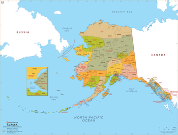
Alaska ZIP Code Map with Boroughs and Census Areas (Counties) - Extra Large
This map has been created exclusively for MapSherpa, and designed for business or reference use. Clear and clean colors & fonts matched with cartographic research makes this map of Alaska's boroughs, census areas and ZIP codes easily readable and useful.
Page Size: 60 x 46 in (1524 x 1164 mm)

Alaska ZIP Code Map with Boroughs and Census Areas (Counties) - Large
This map has been created exclusively for MapSherpa, and designed for business or reference use. Clear and clean colors & fonts matched with cartographic research makes this map of Alaska's boroughs, census areas and ZIP codes easily readable and useful.
Page Size: 48 x 36.75 in (1219 x 931 mm)