Maps International
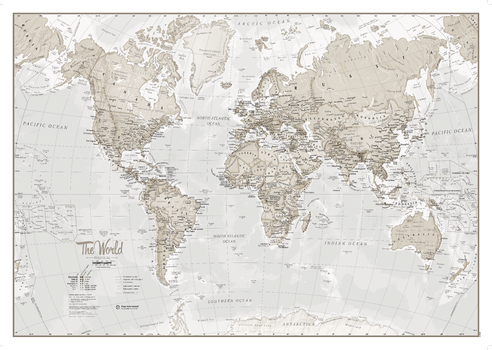
Neutral World as Art
The World is Art is a unique range of World Maps created to look fantastic on your wall. This version is beautifully designed with neutral colour tones for the stylish wall space in your home, these maps are sure to impress. The World Map features major towns and cities and also contains hill and sea shading.
Page Size: 33.25 x 23.5 in (841 x 594 mm)
North America Physical
This physical map of North America features the natural terrain of the land, with countries marked and international borders shown. The map's key helps to identify the land elevation and water depth. This North American physical map also contains city population detail, capital cities and all the major towns and cities in this continent of North America.
North America Political
This political map of North America features countries shown in different colours, international boundaries and major transport networks. Also shown is city population detail, capital cities and all the major towns and cities in this continent of North America
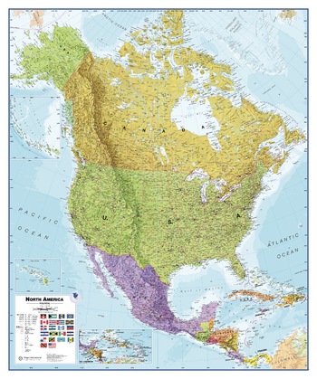
North America Political Wall Map
Maps International's North America political wall map covers a huge expanse of land from Alaska and Canada through the United States down to Mexico, Central America and the Caribbean. North American political map detail: This political wall map of North America features countries shown in different colours, international boundaries and major transport networks. The wall map also contains a panel of flags relating to the countries shown in this North American continent map. Also shown is city population detail, capital cities and all the major towns and cities in this continent of North America.
Page Size: 39.5 x 47.25 in (1000 x 1200 mm)
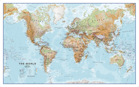
Physical World Wall Map
This World physical wall map is a high quality map which is a fantastic representation of the world's physical terrain. Map details: Our physical world wall map features the natural terrain of the land as well as the different physical areas. Country borders and major cities are shown. The map's key helps to identify the different land terrain.
Page Size: 54.25 x 34 in (1377 x 857 mm)
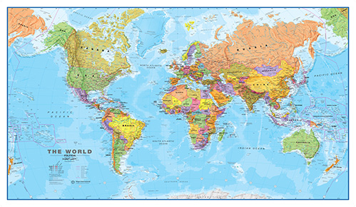
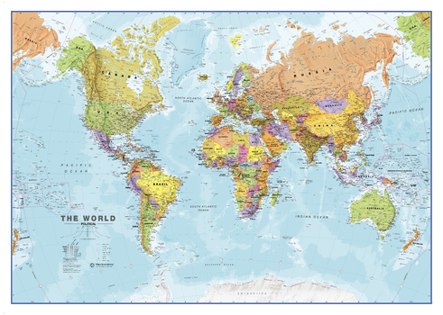
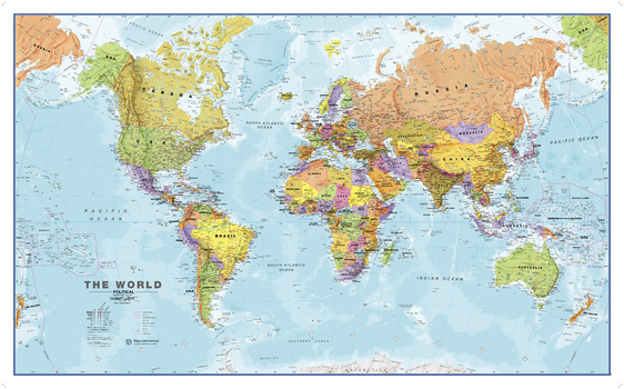
Political World Map - Huge
One of our best selling world maps that can be an educational resource as well as a stylish feature on your wall. Politically coloured world wall map features every country as a different colour. All major towns and cities are featured on this map and capital cities are clearly marked. Hill and sea shading add to the vibrant overall effect in this political world wall map.
Page Size: 77.75 x 46 in (1970 x 1165 mm)
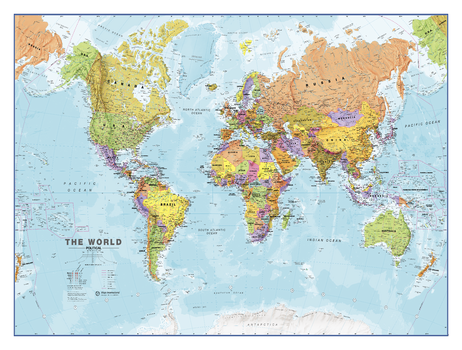
Political World Map - Large
One of our best selling world maps that can be an educational resource as well as a stylish feature on your wall. Politically coloured world wall map features every country as a different colour. All major towns and cities are featured on this map and capital cities are clearly marked. Hill and sea shading add to the vibrant overall effect in this political world wall map.
Page Size: 47 x 33.25 in (1189 x 841 mm)
Political World Map - Large
One of our best selling world maps that can be an educational resource as well as a stylish feature on your wall. Politically coloured world wall map features every country as a different colour. All major towns and cities are featured on this map and capital cities are clearly marked. Hill and sea shading add to the vibrant overall effect in this political world wall map.
Page Size: 48 x 36 in (1219 x 914 mm)
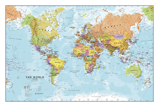
Political World Map - Medium
One of our best selling world maps that can be an educational resource as well as a stylish feature on your wall. Politically coloured world wall map features every country as a different colour. All major towns and cities are featured on this map and capital cities are clearly marked. Hill and sea shading add to the vibrant overall effect in this political world wall map.
Page Size: 36 x 24 in (914 x 610 mm)

Political World Map - Medium
One of our best selling world maps that can be an educational resource as well as a stylish feature on your wall. Politically coloured world wall map features every country as a different colour. All major towns and cities are featured on this map and capital cities are clearly marked. Hill and sea shading add to the vibrant overall effect in this political world wall map.
Page Size: 33.25 x 23.5 in (841 x 594 mm)

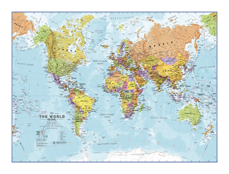
Political World Map - Small
One of our best selling world maps that can be an educational resource as well as a stylish feature on your wall. Politically coloured world wall map features every country as a different colour. All major towns and cities are featured on this map and capital cities are clearly marked. Hill and sea shading add to the vibrant overall effect in this political world wall map.
Page Size: 23.5 x 16.75 in (594 x 420 mm)
Political World Map - Small
One of our best selling world maps that can be an educational resource as well as a stylish feature on your wall. Politically coloured world wall map features every country as a different colour. All major towns and cities are featured on this map and capital cities are clearly marked. Hill and sea shading add to the vibrant overall effect in this political world wall map.
Page Size: 24 x 18 in (610 x 457 mm)
Political World Wall Map
One of the best selling world maps that can be an educational resource as well as a stylish feature on your wall. Politically coloured world wall map features every country as a different colour. All major towns and cities are featured on this map and capital cities are clearly marked. Hill and sea shading add to the vibrant overall effect in this political world wall map.
Page Size: 53.75 x 33.25 in (1360 x 840 mm)
Portugal Topographic
This topographic map of Portugal shows features including cities and towns, highways with labels, major roads, streets, pathways, railways, train and metro stations, airports, parks and green space, waterways, contour lines with 25m interval, and peaks with elevation noted.
South America Physical
This physical map of South America features the natural terrain of the land, with countries marked and international borders shown. The map's key helps to identify the land elevation and water depth. This South American physical map also contains city population detail, capital cities and all the major towns and cities in this continent of South America.
South America Political
This political map of South America features countries marked in different colours, with international borders clearly shown. This South American political map also contains city population detail, capital cities and all the major towns and cities in this continent of South America.
Spain Topographic
This topographic map of Spain shows features including cities and towns, highways with labels, major roads, streets, pathways, railways, train and metro stations, airports, parks and green space, waterways, contour lines with 25m interval, and peaks with elevation noted.
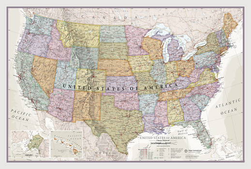
USA Classic
This Classic USA Map is a real talking point that will help you learn about several USA states and expand your horizons. This map has been designed by specialist expert map makers, and our philosophy of 'good cartography' is what we hope people will love and appreciate . Detail as well as design is what we do best. It features every state in a different color, with boundaries clearly shown and all major USA towns and cities highlighted.
Page Size: 34 x 22 in (864 x 559 mm)
USA Political
This USA map clearly depicts all the cities, major roads and also shows all the state areas and boundaries.
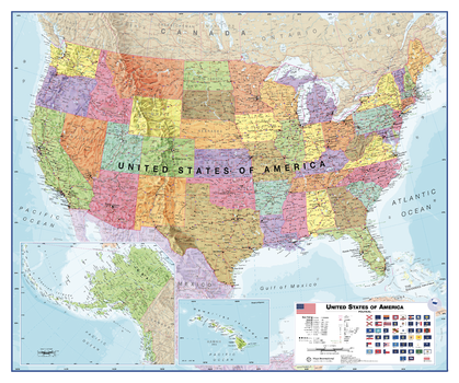
USA Political Wall Map
This USA map clearly depicts all the cities, major roads and also shows all the state areas and boundaries. Flags of the States are also displayed. The Map is politically up to date with cartographic changes.
Page Size: 47.25 x 39.5 in (1200 x 1000 mm)