


MapSherpa Catalog
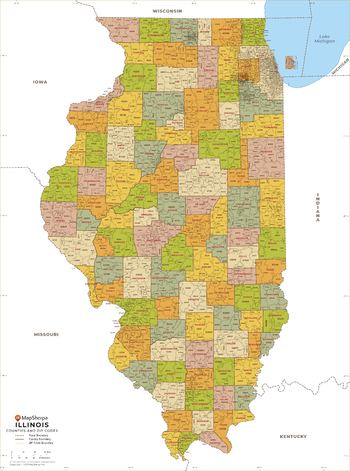
Illinois ZIP Code Map
MapSherpa
This map of Illinois shows ZIP codes overlaid on a road map. Base map features include municipality and county boundaries, major road network features, and state and national parks and conservation areas.
Page Size: 36 x 48 in (914 x 1219 mm)

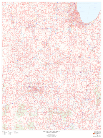
Illinois ZIP Code Map with Counties - Extra Large
MapSherpa
This map has been created exclusively for MapSherpa, and designed for business or reference use. Clear and clean colors & fonts matched with cartographic research makes this Illinois Zip Code Map with Counties easily readable and useful. The map shows the 102 counties of Illinois and the borders of the over 1,500 zip codes across the Land of Lincoln.
Page Size: 60 x 81 in (1524 x 2053 mm)

Illinois ZIP Code Map with Counties - Large
MapSherpa
This map has been created exclusively for MapSherpa, and designed for business or reference use. Clear and clean colors & fonts matched with cartographic research makes this Illinois Zip Code Map with Counties easily readable and useful. The map shows the 102 counties of Illinois and the borders of the over 1,500 zip codes across the Land of Lincoln.
Page Size: 48 x 64.75 in (1219 x 1642 mm)
Illinois ZIP Code Map with Counties - Standard
MapSherpa
This map has been created exclusively for MapSherpa, and designed for business or reference use. Clear and clean colors & fonts matched with cartographic research makes this Illinois Zip Code Map with Counties easily readable and useful. The map shows the 102 counties of Illinois and the borders of the over 1,500 zip codes across the Land of Lincoln.
Page Size: 36 x 48.5 in (914 x 1232 mm)
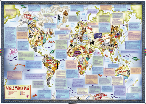
Illustrated Trivia World Map
Maps International
This is a fun illustrated world map with some added fascinating facts. Did you know... "Every year the Netherlands sends 20,000 tulip bulbs to Canada to thank them for their help in World War II". This uniquely illustrated world map is packed with awesome things to learn about the world we live in.
Page Size: 33.25 x 23.5 in (841 x 594 mm)
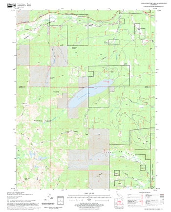
Independence Lake Quadrangle, California
United States Department of Agriculture Forest Service
United States Department of Agriculture Forestry Service topographical map of Independence Lake, Tahoe National Forest, California.
Page Size: 21.75 x 27 in (552 x 686 mm)
Index for Collins Central London Map
Collins
Index to streets to accompnay the Collins Central London Map
Page Size: 28.5 x 22.25 in (720 x 560 mm)
Index for Collins Cotswolds Map
Collins
Index to towns, villages and places of interest to accompany the Collins Cotswolds Map
Page Size: 32 x 22.25 in (810 x 560 mm)
Index for Collins Devon Map
Collins
Index to towns, villages and places of interest to accompany the Collins Devon Map
Page Size: 28.5 x 22.25 in (720 x 560 mm)
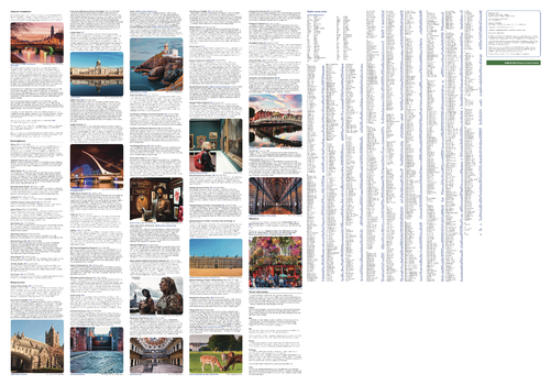
Index for Collins Dublin Map
Collins
General tourist information and photographs of the vibrant city of Dublin along with detailed street index for the Collins Dublin Map.
Page Size: 32 x 22.25 in (810 x 560 mm)
Index for Collins Edinburgh Map
Collins
General tourist information and photographs of the vibrant city of Edinburgh along with detailed street index for the Collins Edinburgh Map.
Page Size: 32 x 22.25 in (810 x 560 mm)
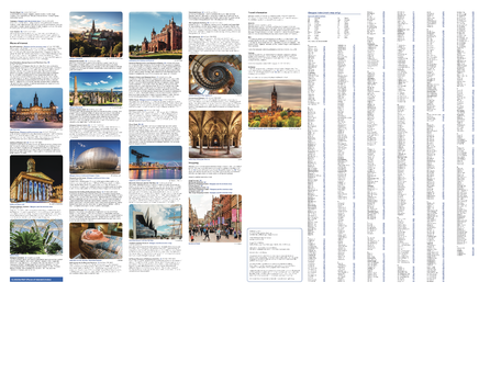
Index for Collins Glasgow Map
Collins
General tourist information and photographs of the vibrant city of Glasgow along with detailed street index for the Collins Glasgow Map.
Page Size: 28.5 x 22.25 in (720 x 560 mm)
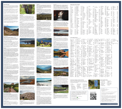
Index for Collins NC500 Map
Collins
General tourist information and photographs of NC500 along with detailed street index for the Collins NC500 Map.
Page Size: 25 x 22.25 in (630 x 560 mm)
Index for Collins Northern Ireland Map
Collins
General tourist information and photographs of Northern Ireland along with detailed street index for the Collins Northern Ireland Map.
Page Size: 28.5 x 22.25 in (720 x 560 mm)
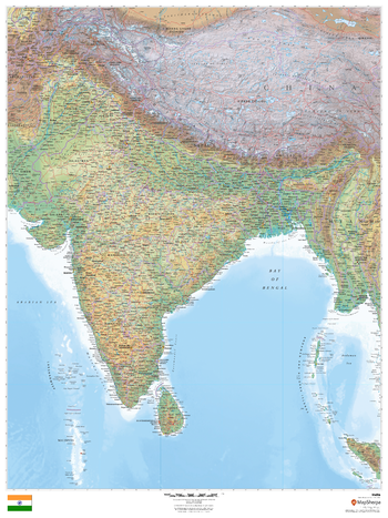
India
MapSherpa
This beautiful map shows physical and political features for India and surrounding areas. Relief shading and the use of different colours by height above sea level are both informative and attractive.
Page Size: 36 x 48 in (914 x 1219 mm)
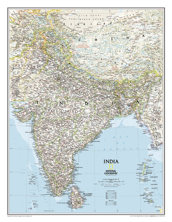
India Classic
National Geographic
One of the most detailed and comprehensive maps ever published for India and southern Asia. It includes India, Sri Lanka, Nepal, Bangladesh, Bhutan, Tajikistan, and portions of China, Pakistan, Afghanistan, and Myanmar. The India map is punctuated with thousands of place names, and embellished with shaded relief which highlights the region's dramatic topography in such places as the Tibetan Plateau and the Himalaya.
Page Size: 23.5 x 30.25 in (597 x 768 mm)
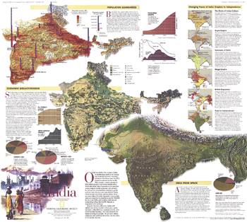
India Theme - Published 1997
National Geographic
National Geographic celebrated India's fifty years of independence in May 1997 with an article and this educational map of the country. This map contains a wealth of information including details on the population, history, geography, and economy of the second most populous nation in the world. A map of South Asia was printed as a companion to this map in the same issue.
Page Size: 23 x 20.5 in (578 x 520 mm)
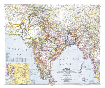
India and Burma - Published 1946
National Geographic
Published in April 1946 just a year before India and Pakistan gained their independence, this map of India and Burma details the numerous provinces of the region. Half of a two-map set, it accompanied the "Political Subdivisions of India" map and three articles on India.
Page Size: 31.25 x 26 in (787 x 660 mm)
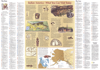
Indian America - Published 1991
National Geographic
This map provides a history of the first inhabitants of the United States, including Alaska and the peoples of the Arctic. Also displays illustrations of artifacts. Published in October 1991 as a companion to (and complete index of) the "Native American Heritage" map.
Page Size: 29 x 20.5 in (735 x 517 mm)
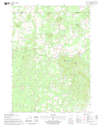
Indian Butte Quadrangle, Oregon
United States Department of Agriculture Forest Service
United States Department of Agriculture Forestry Service topographical map of Indian Butte, Deschutes National Forest, Oregon.
Page Size: 21.75 x 27 in (552 x 686 mm)
No search results