


MapSherpa Catalog
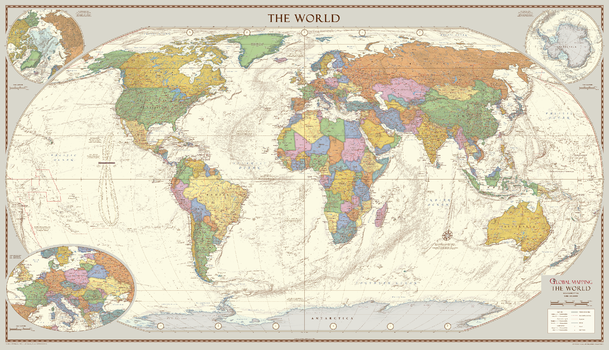
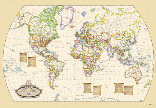
Antique Style World Map - Large
Global Mapping
The classic design of muted colours and hill shading give an antique feel to the map. The map features insets of the two polar regions as well as an enlargement of Central Europe. Uniquely, the map also includes explanatory text about the Tropics of Cancer and Capricorn, the Arctic and Antarctic Circles as well as an Analemma which shows which day of the year the sun is directly overhead and how sun time compares to clock time.
Best Printed Map 2013 from the British Cartographic Society (BCS) who also awarded it the BCS Cup for the best overall map.
Page Size: 52.5 x 30.25 in (1333 x 766 mm)
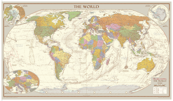
Antique Style World Map - Medium
Global Mapping
A classic design for this map from Global Mapping, the larger version won the award for Best Wall Map 2013 from the British Cartographic Society. This very attractive map features insets of the two polar regions as well as an enlargement of Central Europe. Uniquely, the map also includes explanatory text about the Tropics of Cancer and Capricorn, the Arctic and Antarctic Circles as well as an Analemma which shows which day of the year the sun is directly overhead and how sun time compares to clock time. The muted colours and hill shading give an antique feel to the map.
ISBN 9781905755738
Page Size: 39.25 x 22.75 in (1000 x 575 mm)
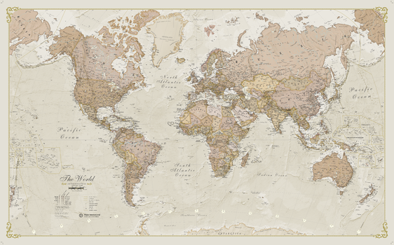
Antique World Map
Maps International
A popular antique world map with its artistic antique-style muted tones; it looks simply stunning and rather elegant. Splendid wall map art of the world in vintage style. Complete with political detail (countries shaded in different tones), country boundaries and cities shown.
Page Size: 53.75 x 33.25 in (1364 x 844 mm)
Antique World Wall Map - English and French
Lucidmap
This world wall map has been designed with all text in both French and English, making this an ideal product in Canada for schools, businesses and public areas.
The map has been designed in an antique style that makes for classy and visually appealing wall art.
Page Size: 39.5 x 27.25 in (1003 x 692 mm)
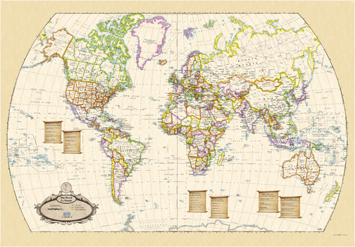
Antique World Wall Map - English and French - Large
Lucidmap
This large world wall map has been designed with all text in both French and English, making this an ideal product in Canada for schools, businesses and public areas.
The map has been designed in an antique style that makes for classy and visually appealing wall art.
Page Size: 54 x 37.5 in (1372 x 953 mm)
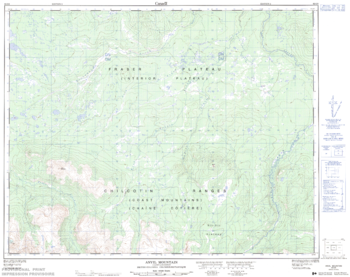
Anvil Mountain - 92 O/6 - British Columbia
Natural Resources Canada
Canadian topographic map of Anvil Mountain, British Columbia. NTS sheet 092O06 Edition 2.
Page Size: 31.75 x 25.25 in (802 x 636 mm)
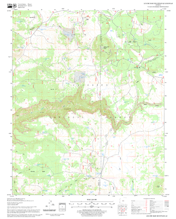
Apache Maid Mountain Quadrangle, Arizona
United States Department of Agriculture Forest Service
United States Department of Agriculture Forestry Service topographical map of Apache Maid Mountain, Coconino National Forest, Arizona.
Page Size: 21.75 x 27 in (552 x 686 mm)
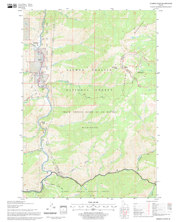
Aparejo Point Quadrangle, Idaho
United States Department of Agriculture Forest Service
United States Department of Agriculture Forestry Service topographical map of Aparejo Point, Salmon-Chalis National Forest, Idaho.
Page Size: 21.75 x 27 in (552 x 686 mm)

Apostle Islands
Mapping Specialists
An Attractive map of the lake showing a visual 3D representation of the lake bottom. Includes boat launches, rock area and vegetation. Land area is high resolution aerial imagery.
Page Size: 37.25 x 27.75 in (946 x 705 mm)
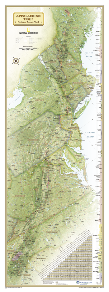
Appalachian Trail Wall Map
National Geographic
National Geographic's wall map of the Appalachian Trail is ideal for fans and hikers of this magnificent national scenic trail.
Developed in cooperation with the Appalachian Trail Conservancy, this beautiful poster, measuring 48" x 18", shows the entire length of the trail from Maine to Georgia. A unique elevation profiles highlight the trail's peaks and valleys and an informative mileage chart shows the distance between key locations. Also highlighted on the map are National Forests, National Park Service lands, State Forests and Parks, and major highways and interstates. Points of interest include Appalachian Trail information centers and shelters.
Net proceeds from the sale of this map support National Geographic's vital exploration, conservation, research, and education programs.
Page Size: 18 x 48 in (457 x 1219 mm)
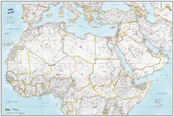
Arab World Map - in Arabic
National Geographic
National Geographic, in association with the Qatar Foundation International, have teamed up to create this Arab World Map. This 2019 map utilizes National Geographic’s exacting cartographic standards and marries them with the Qatar Foundation International’s commitment to Arabic languages, producing a unique and definitive map of the region.
What makes this map unique is that the text is all in Arabic.
The area mapped includes north Africa and southern Europe and stretches south to the Equator. It includes the whole of Turkey, Saudi Arabia and east to Iran.
At a scale of 1:9,500,00 the map is a perfect reference for Arabic speakers and helps bring context to the region. Areas in dispute are noted, and their defacto status and borders are shown.
Page Size: 37.75 x 25.5 in (959 x 648 mm)
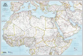
Arab World Map - in English
National Geographic
National Geographic, in association with the Qatar Foundation International, have teamed up to create this Arab World Map. This 2019 map utilizes National Geographic’s exacting cartographic standards and marries them with the Qatar Foundation International’s commitment to Arabic languages, producing a unique and definitive map of the region.
The area mapped includes north Africa and southern Europe and stretches south to the Equator. It includes the whole of Turkey, Saudi Arabia and east to Iran.
At a scale of 1:9,500,00 the map perfect for reference and helps bring context to the region. Areas in dispute are noted, and their defacto status and borders are shown.
Page Size: 37.75 x 25.5 in (959 x 648 mm)
Arabian Peninsula - Atlas of the World, 10th Edition
National Geographic
Bahrain, Kuwait, Oman, Qatar, Saudi Arabia, United Arab Emirates, Yemen
Page Size: 28 x 22 in (711 x 559 mm)
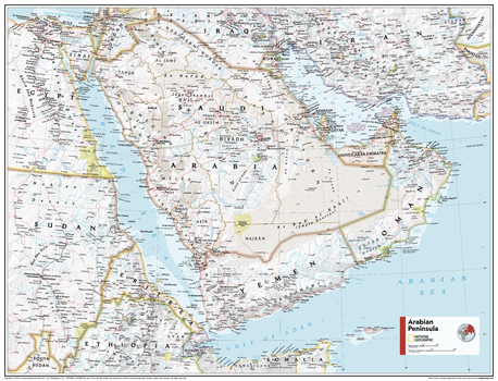
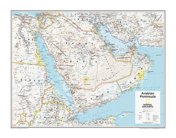
Arabian Peninsula - Atlas of the World, 11th Edition
National Geographic
This Arabian Peninsula map of physical and political features can fit in any space. Showcasing the region in stunning detail with state-of-the-art cartographic techniques delivering accuracy and exceptional quality, the innovative and engaging design makes the content easily accessible and user-friendly.
Ideal for classrooms with an emphasis on teaching geography or environmental themes. The inclusion of physical features gives your students a genuine feel for how our world appears.
This map uses a bright, easy to read color palette featuring blue oceans and stunning shaded relief that has been featured on National Geographic wall maps for over 75 years. It is drawn in the Transverse Mercator projection, which is a cylindrical map projection for nautical navigation because it represents lines of constant course.
This map is found in National Geographic's 11th Edition World Atlas and is now available as a stand alone product.
Page Size: 31.5 x 24 in (798 x 610 mm)

Arabian Peninsula - Atlas of the World, 11th Edition - Compact
National Geographic
This Arabian Peninsula map of physical and political features can fit in any space. Showcasing the region in stunning detail with state-of-the-art cartographic techniques delivering accuracy and exceptional quality, the innovative and engaging design makes the content easily accessible and user-friendly.
Ideal for classrooms with an emphasis on teaching geography or environmental themes. The inclusion of physical features gives your students a genuine feel for how our world appears.
This map uses a bright, easy to read color palette featuring blue oceans and stunning shaded relief that has been featured on National Geographic wall maps for over 75 years. It is drawn in the Transverse Mercator projection, which is a cylindrical map projection for nautical navigation because it represents lines of constant course.
This map is found in National Geographic's 11th Edition World Atlas and is now available as a stand alone product.
Page Size: 21.5 x 16.25 in (540 x 413 mm)
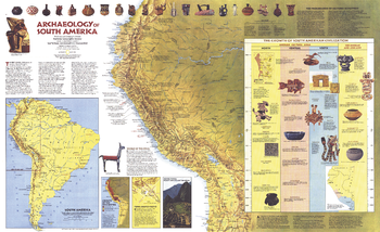
Archaeology of South America - Published 1982
National Geographic
Explore the fascinating world of the Inca and other South American civilizations with this informative "Archaeology of South America" map. Published in March 1982 with the "Indians of South America" map, this work is filled with illustrations and information about pre-Columbian artifacts and archeological sites including Cuzco and Machu Picchu.
Page Size: 37 x 22.75 in (938 x 573 mm)
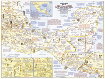
Archeological of Middle America - Published 1968
National Geographic
Take an archeaological adventure through the "Land of the Feathered Serpent." This educational map of Middle America features an abundance of information on the region's intriguing civilizations and the temples, pyramids, and ruins they left behind. Published in October 1968.
Page Size: 25 x 19 in (632 x 480 mm)
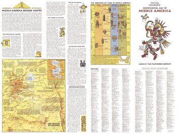
Archeological of Middle America Theme - Published 1968
National Geographic
Half of a two-map set published in October 1968, this Archeological Map of Middle America features a wealth of information on the Aztec and Maya civilizations that inhabited the region before the arrival of Cortes. This map includes an index for side one of the two-map set.
Page Size: 25 x 19 in (632 x 480 mm)
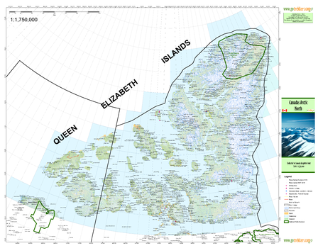
Arctic 1 North
GoTrekkers
Arctic 1 North
Page Size: 41 x 32 in (1041 x 813 mm)
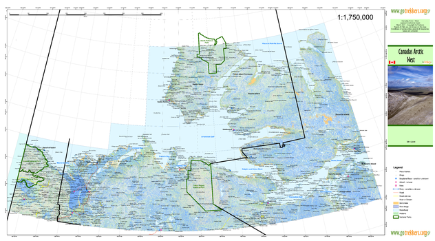
Arctic 2 West
GoTrekkers
Arctic 2 West
Page Size: 41.5 x 23 in (1054 x 584 mm)
No search results