


MapSherpa Catalog
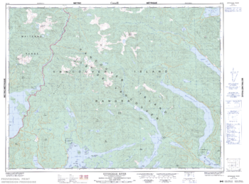
Effingham River - 92 F/3 - British Columbia
Natural Resources Canada
Canadian topographic map of Effingham River, British Columbia. NTS sheet 092F03 Edition 5.
Page Size: 34 x 25.25 in (861 x 638 mm)
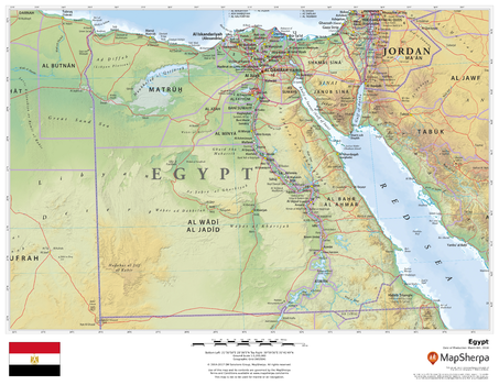
Egypt
MapSherpa
This beautiful map shows physical and political features for Egypt and surrounding areas. Relief shading and the use of different colours by height above sea level are both informative and attractive.
Page Size: 22 x 17 in (559 x 432 mm)
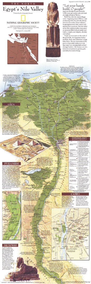
Egypts Nile Valley North - Published 1995
National Geographic
Explore the wonder and mysteries of the northern Nile Valley with this fascinating and educational map. Both a modern map of the rich Nile Valley and a guide through Egypt's magnificent past, this vibrant work features a chronological legend indicating the period best represented by each site. Published in January 1995, this map accompanied the "Egypt's Nile Valley South" map and the article "Age of the Pyramids: Egypt's Old Kingdom."
Page Size: 10 x 31.25 in (254 x 793 mm)
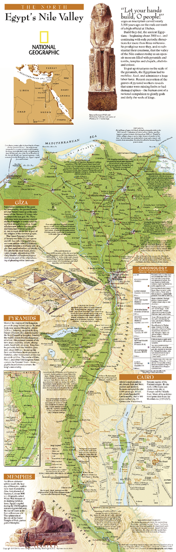
Egypts Nile Valley North - Published 2005
National Geographic
Explore the wonder and mysteries of the northern Nile Valley with this educational map. A map of the rich Nile Valley and a guide through Egypt's magnificent past, this vibrant work features a chronological legend indicating the period best represented by each site. A must have for anyone interested in archaeology or history.
Page Size: 10 x 31.25 in (254 x 794 mm)
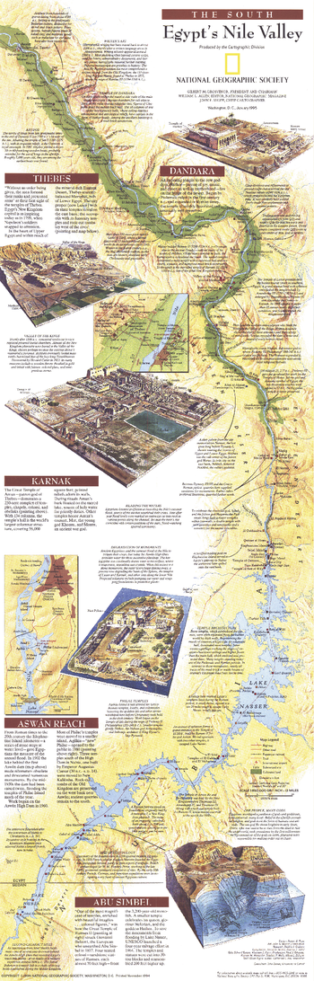
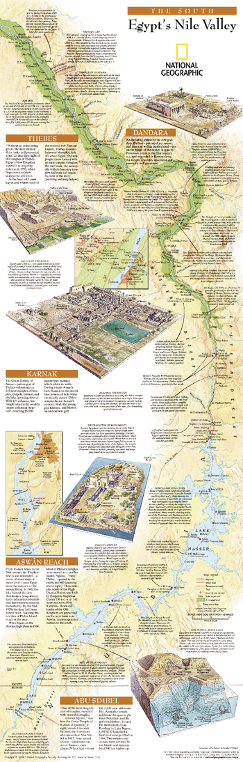
Egypts Nile Valley South - Published 1995
National Geographic
Explore the wonder and mysteries of the southern Nile Valley with this fascinating and educational map. Both a modern map and a guide through Egypt's magnificent past, this vibrant work features considerable details about archaeological sites and early Egyptian civilization. Published in January 1995, this map accompanied the "Egypt's Nile Valley North" map and the article "Age of the Pyramids: Egypt's Old Kingdom."
Page Size: 10 x 31.25 in (254 x 793 mm)
Egypts Nile Valley South - Published 2005
National Geographic
This map of the southern Nile Valley is your guide through Egypt's magnificent past, this vibrant work features a chronological legend indicating the period best represented by each site. A must have for anyone interested in archaeology or history.
Page Size: 10.25 x 31.25 in (254 x 794 mm)
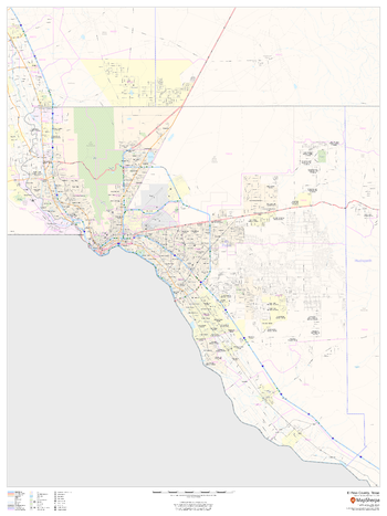
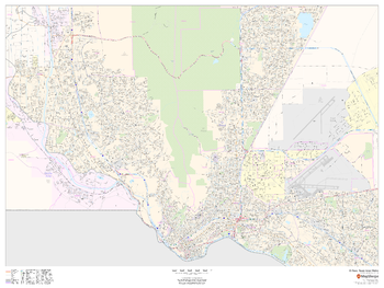
El Paso County, Texas
MapSherpa
This map of El Paso County, Texas shows regional level information. Base map features include highways and major roads with labelling; neighborhood names; railways; high level land use such as parks and recreation areas, industrial areas and hospital campuses; and a selection of points of interest including transportation hubs like airports and train stations, tourist information, police stations and shopping centres. ZIP code boundaries are shown as a secondary map feature.
Page Size: 36 x 48 in (914 x 1219 mm)
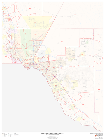
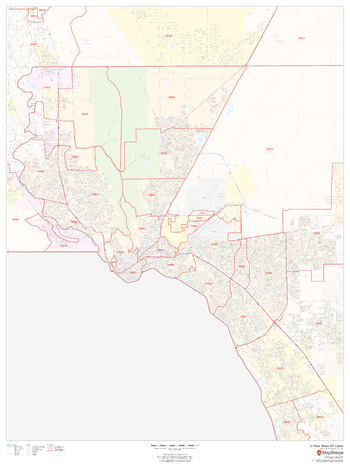
El Paso County, Texas ZIP Codes
MapSherpa
This map of El Paso County, Texas shows ZIP code areas overlaid on a road map. Ideal for planning of deliveries, home ervices, sales territories, real estate and much more. Base map features include all roads with major roads and highways labelled; neighborhood names; railways; and high level land use such as parks and recreation areas, industrial areas and hospital campuses.
Page Size: 36 x 48 in (914 x 1219 mm)
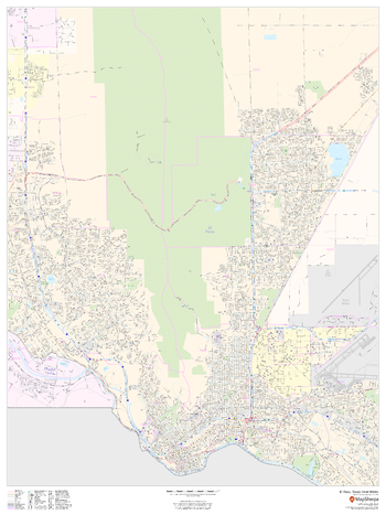
El Paso, Texas Inner Metro - Landscape
MapSherpa
This landscape-oriented map of central El Paso, Texas shows detailed street level information including extensive street labeling. Ideal for planning of deliveries, home services, sales territories, real estate and much more. Base map features include all roads with major roads and highways labelled; neighborhood names; railways; high level land use such as parks and recreation areas, industrial areas and hospital campuses; and a variety of points of interest including schools, libraries, stadiums, museums, border crossings and more.
Page Size: 48 x 36 in (1219 x 914 mm)
El Paso, Texas Inner Metro - Portrait
MapSherpa
This portrait-oriented map of central El Paso, Texas shows detailed street level information including extensive street labeling. Ideal for planning of deliveries, home services, sales territories, real estate and much more. Base map features include all roads with major roads and highways labelled; neighborhood names; railways; high level land use such as parks and recreation areas, industrial areas and hospital campuses; and a variety of points of interest including schools, libraries, stadiums, museums, border crossings and more.
Page Size: 36 x 48 in (914 x 1219 mm)
El Paso, Texas ZIP Codes
MapSherpa
This map of El Paso shows ZIP code areas overlaid on a road map. Ideal for planning of deliveries, home services, sales territories, real estate and much more. Base map features include all roads with major roads and highways labelled; neighborhood names; railways; and high level land use such as parks and recreation areas, industrial areas and hospital campuses.
Page Size: 36 x 48 in (914 x 1219 mm)
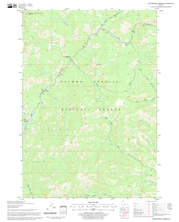
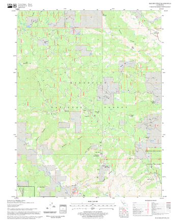
Elevenmile Creek Quadrangle, Idaho
United States Department of Agriculture Forest Service
United States Department of Agriculture Forestry Service topographical map of Elevenmile Creek, Salmon-Chalis National Forest, Idaho.
Page Size: 21.75 x 27 in (552 x 686 mm)
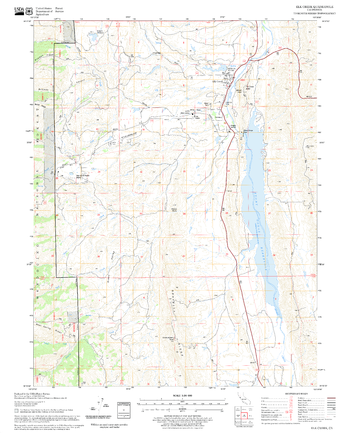
Elk Creek Quadrangle, California
United States Department of Agriculture Forest Service
United States Department of Agriculture Forestry Service topographical map of Elk Creek, Mendocino National Forest, California.
Page Size: 21.75 x 27 in (552 x 686 mm)
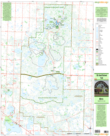
Elk Island National Park
GoTrekkers
Elk Island National Park
Page Size: 33 x 41 in (838 x 1041 mm)
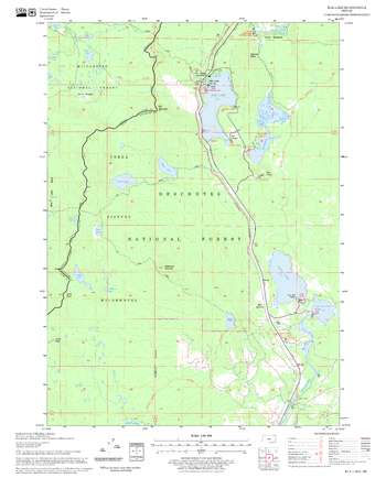
Elk Lake Quadrangle, Oregon
United States Department of Agriculture Forest Service
United States Department of Agriculture Forestry Service topographical map of Elk Lake, Deschutes National Forest, Oregon.
Page Size: 21.75 x 27 in (552 x 686 mm)
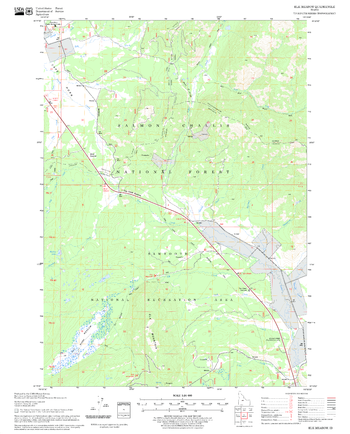
Elk Meadow Quadrangle, Idaho
United States Department of Agriculture Forest Service
United States Department of Agriculture Forestry Service topographical map of Elk Meadow, Salmon-Chalis National Forest, Idaho.
Page Size: 21.75 x 27 in (552 x 686 mm)
Elk Mountain Quadrangle, California
United States Department of Agriculture Forest Service
United States Department of Agriculture Forestry Service topographical map of Elk Mountain, Mendocino National Forest, California.
Page Size: 21.75 x 27 in (552 x 686 mm)
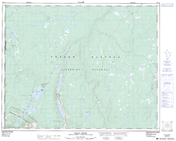
Elkin Creek - 92 O/12 - British Columbia
Natural Resources Canada
Canadian topographic map of Elkin Creek, British Columbia. NTS sheet 092O12 Edition 2.
Page Size: 31.5 x 25.5 in (800 x 642 mm)
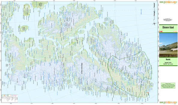
Ellesmere Island
GoTrekkers
Ellesmere Island
Page Size: 41.5 x 24.5 in (1054 x 622 mm)
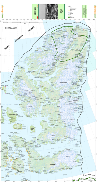
Ellesmere Island Ad Astra
GoTrekkers
Ellesmere Island Ad Astra
Page Size: 29 x 53 in (737 x 1346 mm)
No search results