


MapSherpa Catalog
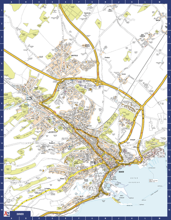
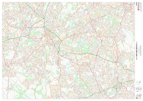
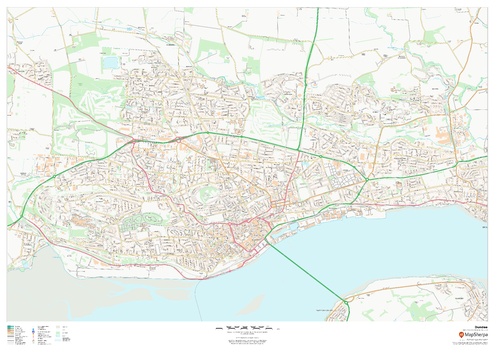
Dover A-Z Street Map
A-Z Maps
The perfect reference map for finding your way around Dover. This up-to-date detailed A-Z town plan includes more than 800 streets in and around Dover. Detailed coverage of an area extending from Napchester in the north to the harbour in the south, and from beyond Jubilee Way to the east and Kearsney in the west. The highly detailed 1 mile to 4.5 inch street map includes places of interest, among other features.
Page Size: 22.25 x 28.5 in (560 x 718 mm)
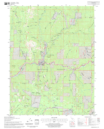
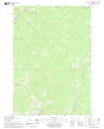
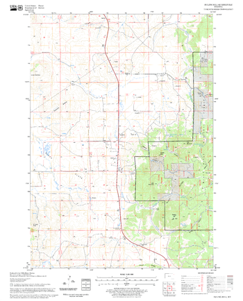
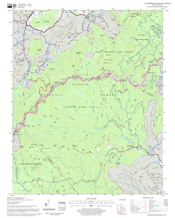
Downieville Quadrangle, California
United States Department of Agriculture Forest Service
United States Department of Agriculture Forestry Service topographical map of Downieville, Tahoe National Forest, California.
Page Size: 21.75 x 27 in (552 x 686 mm)
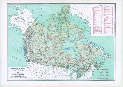
Drainage Basins (1906)
Natural Resources Canada
Contained within the 1st Edition (1906) of the Atlas of Canada is a map that shows the delineation of drainage basins. The geographic extent of each drainage basin is delineated and the total area drained for each basin is provided in square miles. This includes the great oceanic drainage basin and the Hudson Bay basin. Only the Canadian drainage area is indicated on the map for basins that lie partly in the United States. There is also a table listing the lengths of major rivers of Canada and their principal tributaries.
Page Size: 24.25 x 17.25 in (611 x 432 mm)
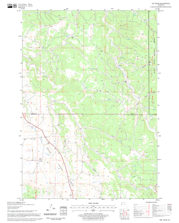
Dry Draw Quadrangle, South Dakota
United States Department of Agriculture Forest Service
United States Department of Agriculture Forestry Service topographical map of Dry Draw, Black Hills National Forest, South Dakota.
Page Size: 21.75 x 27 in (552 x 686 mm)
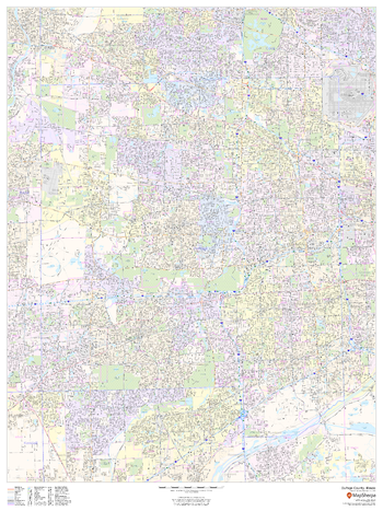
DuPage County, Illinois
MapSherpa
This map of DuPage County, Illinois shows street level information including street labeling. Base map features include all roads with major roads and highways labelled; neighborhood names; railways; high level land use such as parks and recreation areas, industrial areas and hospital campuses; and a variety of points of interest including libraries, stadiums, museums, border crossings and more. ZIP code boundaries are shown as a secondary map feature.
Page Size: 36 x 48 in (914 x 1219 mm)
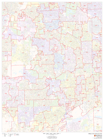
DuPage County, Illinois ZIP Codes
MapSherpa
This map of DuPage County, Illinois shows ZIP code areas overlaid on a road map. Ideal for planning of deliveries, home ervices, sales territories, real estate and much more. Base map features include all roads with major roads and highways labelled; neighborhood names; railways; and high level land use such as parks and recreation areas, industrial areas and hospital campuses.
Page Size: 36 x 48 in (914 x 1219 mm)
Duck Creek Point Quadrangle, Idaho
United States Department of Agriculture Forest Service
United States Department of Agriculture Forestry Service topographical map of Duck Creek Point, Salmon-Chalis National Forest, Idaho.
Page Size: 21.75 x 27 in (552 x 686 mm)
Dudley
MapSherpa
This map of Dudley shows detailed street level information including extensive street labelling. Ideal for planning of deliveries, home services, sales territories, real estate and much more.
Page Size: 47 x 33.25 in (1189 x 841 mm)

Dudley - DY - Postcode Wall Map
XYZ Maps
The Dudley Postcode Sector Wall Map shows detailed postcode sector boundaries (DY1 1, DY1 2) on a comprehensive background and is perfect for determining postcode boundaries for sales areas, planning mailshots and also an excellent reference for logistics. This wall map covers the whole of the DY Postcode Area.
Page Size: 47 x 33.25 in (1189 x 841 mm)
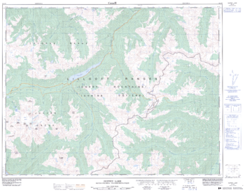
Duffey Lake - 92 J/8 - British Columbia
Natural Resources Canada
Canadian topographic map of Duffey Lake, British Columbia. NTS sheet 092J08 Edition 2.
Page Size: 32.25 x 25.5 in (818 x 642 mm)
Duling Hill Quadrangle, South Dakota
United States Department of Agriculture Forest Service
United States Department of Agriculture Forestry Service topographical map of Duling Hill, Black Hills National Forest, South Dakota.
Page Size: 21.75 x 27 in (552 x 686 mm)

Dumfries & Galloway - DG - Postcode Wall Map
XYZ Maps
The Dumfries & Galloway Postcode Sector Wall Map shows detailed postcode sector boundaries (DG1 1, DG1 2) on a comprehensive background and is perfect for determining postcode boundaries for sales areas, planning mailshots and also an excellent reference for logistics. This wall map covers the whole of the DG Postcode Area.
Page Size: 47 x 33.25 in (1189 x 841 mm)
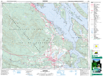
Duncan - 92 B/13 - British Columbia
Natural Resources Canada
Canadian topographic map of Duncan, British Columbia. NTS sheet 092B13 Edition 5.
Page Size: 35 x 26 in (883 x 659 mm)
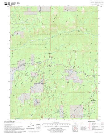
Duncan Peak Quadrangle, California
United States Department of Agriculture Forest Service
United States Department of Agriculture Forestry Service topographical map of Duncan Peak, Tahoe National Forest, California.
Page Size: 21.75 x 27 in (552 x 686 mm)
Dundee
MapSherpa
This map of Dundee shows detailed street level information including extensive street labelling. Ideal for planning of deliveries, home services, sales territories, real estate and much more.
Page Size: 47 x 33.25 in (1189 x 841 mm)

Dundee - DD - Postcode Wall Map
XYZ Maps
The Dundee Postcode Sector Wall Map shows detailed postcode sector boundaries (DD1 1, DD1 2) on a comprehensive background and is perfect for determining postcode boundaries for sales areas, planning mailshots and also an excellent reference for logistics. This wall map covers the whole of the DD Postcode Area.
Page Size: 47 x 33.25 in (1189 x 841 mm)
Dunsmore Mountain Quadrangle, North Carolina
United States Department of Agriculture Forest Service
United States Department of Agriculture Forestry Service topographical map of Dunsmore Mountain, Pisgah National Forest, North Carolina.
Page Size: 21.75 x 27 in (552 x 686 mm)

Durham - DH - Postcode Wall Map
XYZ Maps
The Durham Postcode Sector Wall Map shows detailed postcode sector boundaries (DH1 1, DH1 2) on a comprehensive background and is perfect for determining postcode boundaries for sales areas, planning mailshots and also an excellent reference for logistics. This wall map covers the whole of the DH Postcode Area.
Page Size: 47 x 33.25 in (1189 x 841 mm)
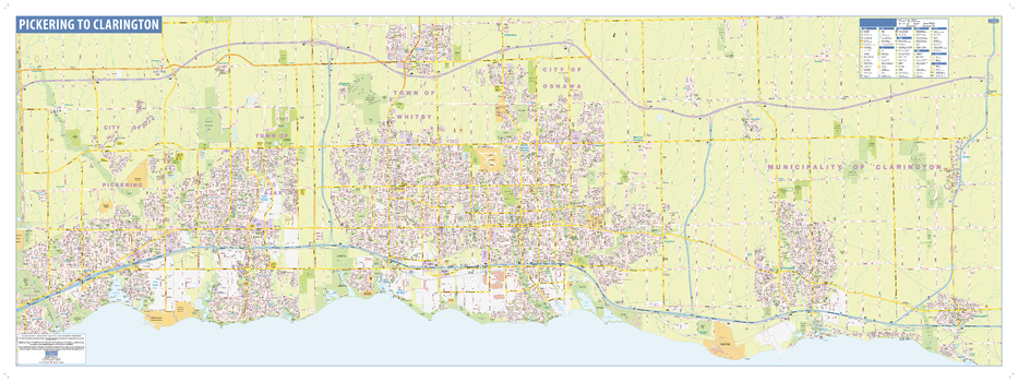
Durham Wall Map - Street Detail
Lucidmap
This wall map shows highly detailed local information for the Region of Durham. Full street labeling along with transit information, parks, schools, churches and landmarks throughout the city are displayed.
The map has been designed in a very clear and legible manner with a traditional Canadian street map style embraced by map buyers over many years.
Page Size: 63 x 23 in (1600 x 584 mm)
Durrwood Creek Quadrangle, California
United States Department of Agriculture Forest Service
United States Department of Agriculture Forestry Service topographical map of Durrwood Creek, Sequoia National Forest, California.
Page Size: 21.75 x 27 in (552 x 686 mm)
No search results