


MapSherpa Catalog
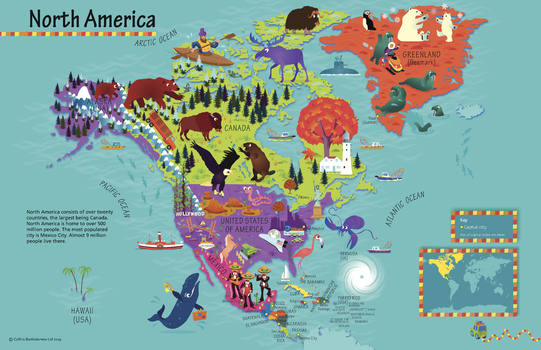
Collins Children's North America Wall Map
Collins
This highly illustrated pictorial map is designed to take children on a journey of discovery around the countries of North America. The mapping is clear, colourful and highly informative and shows countries and capital cities. Stunning illustrations are used to depict themes such as national emblems, customs, food, birds, animals, buildings and sports to help younger readers gain an understanding of peoples around the world. The perfect introduction to maps for 4-8 year olds. Illustrated by Steve Evans.
Page Size: 30 x 19.5 in (760 x 492 mm)
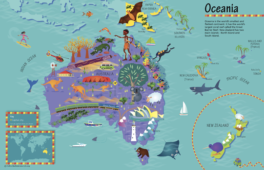
Collins Children's Oceania Wall Map
Collins
This highly illustrated pictorial map is designed to take children on a journey of discovery around the countries of Oceania. The mapping is clear, colourful and highly informative and shows countries and capital cities. Stunning illustrations are used to depict themes such as national emblems, customs, food, birds, animals, buildings and sports to help younger readers gain an understanding of peoples around the world. The perfect introduction to maps for 4-8 year olds. Illustrated by Steve Evans.
Page Size: 30 x 19.5 in (760 x 492 mm)
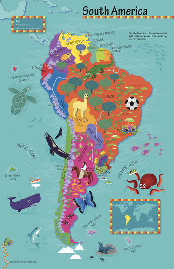
Collins Children's South America Wall Map
Collins
This highly illustrated pictorial map is designed to take children on a journey of discovery around the countries of South America. The mapping is clear, colourful and highly informative and shows countries and capital cities. Stunning illustrations are used to depict themes such as national emblems, customs, food, birds, animals, buildings and sports to help younger readers gain an understanding of peoples around the world. The perfect introduction to maps for 4-8 year olds. Illustrated by Steve Evans.
Page Size: 19.5 x 30 in (492 x 760 mm)
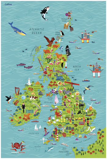
Collins Children's Wall Map of the United Kingdom & Ireland
Collins
This highly illustrated pictorial map is designed to take children on a journey of discovery around the United Kingdom and Ireland. The mapping is clear, colourful and highly informative and shows countries and capital cities. Stunning illustrations are used to depict themes such as national emblems, customs, food, birds, animals, buildings and sports to help younger readers gain an understanding of peoples around the world. The perfect introduction to maps for 4-8 year olds. Illustrated by Steve Evans.
Page Size: 24.25 x 36.25 in (610 x 915 mm)
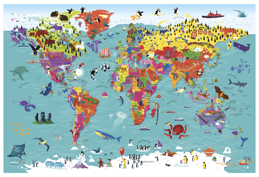
Collins Children's World Wall Map
Collins
This highly illustrated pictorial map is designed to take children on a journey of discovery around the countries of the world. The mapping is clear, colourful and highly informative and shows countries and capital cities. Stunning illustrations are used to depict themes such as national emblems, customs, food, birds, animals, buildings and sports to help younger readers gain an understanding of peoples around the world. The perfect introduction to maps for 4-8 year olds. Illustrated by Steve Evans.
Page Size: 36.25 x 24.25 in (915 x 610 mm)
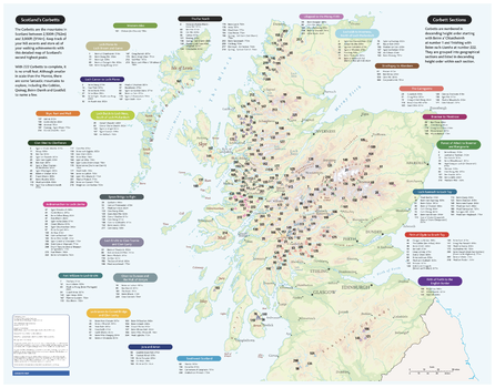
Collins Corbetts Map
Collins
With clear mapping and a high level of detail, explore Scotland’s Corbetts easily with maps from Collins. Corbetts are the mountains in Scotland between 2500 and 3000 feet high, with at least 500 feet of descent on all sides.
Page Size: 28.5 x 22.25 in (720 x 560 mm)
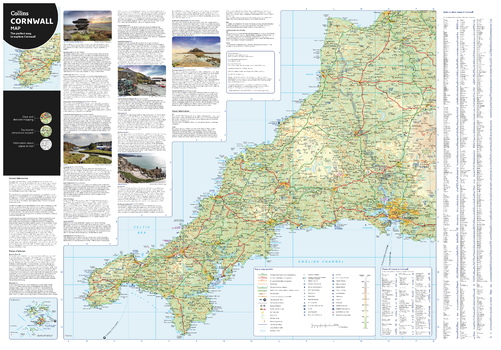
Collins Cornwall Map
Collins
With clear mapping and a high level of detail, explore Cornwall easily with maps from Collins. An ideal guide for tourists and residents alike, this map identifies many tourist attractions, places to stay, and golf courses. An essential map for any visitors to Cornwall.
Page Size: 32 x 22.25 in (810 x 560 mm)
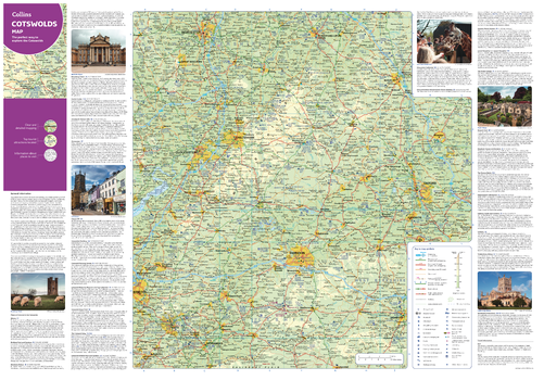
Collins Cotswolds Map
Collins
With clear mapping and a high level of detail, explore the Cotswolds easily with maps from Collins. An ideal guide for tourists and residents alike, this map identifies many tourist attractions, places to stay, and golf courses. An essential map for any visitors to the Cotswolds.
Page Size: 32 x 22.25 in (810 x 560 mm)
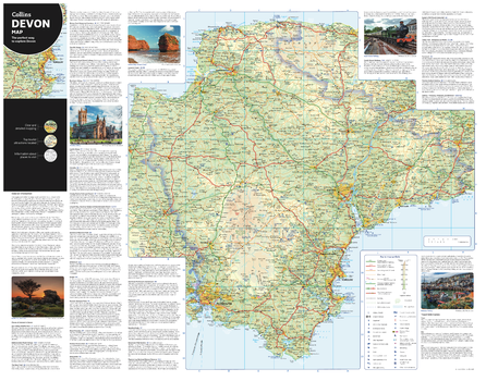
Collins Devon Map
Collins
With clear mapping and a high level of detail, explore Devon easily with maps from Collins. An ideal guide for tourists and residents alike, this map identifies many tourist attractions, places to stay, and cafes and restaurants. An essential map for any visitors to Devon.
Page Size: 28.5 x 22.25 in (720 x 560 mm)
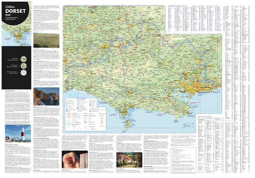
Collins Dorset Map
Collins
With clear mapping and a high level of detail, explore Dorset easily with maps from Collins. An ideal guide for tourists and residents alike, this map identifies many tourist attractions, places to stay, and cafes and restaurants. An essential map for any visitors to Dorset.
Page Size: 32 x 22.25 in (810 x 560 mm)
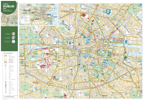
Collins Dublin Map
Collins
With clear mapping and a high level of detail, explore Dublin easily with maps from Collins. This map identifies tourist attractions, places to stay, and transport links, as well as restaurants and tourist information sites, making it an essential map for any visitors or residents exploring Ireland’s Capital city.
Page Size: 32 x 22.25 in (810 x 560 mm)
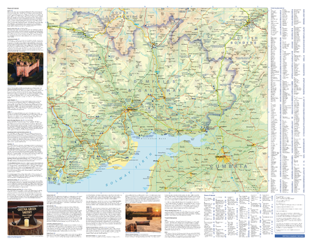
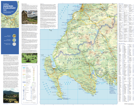
Collins Dumfries and Galloway Map - East
Collins
With clear mapping and a high level of detail, explore Dumfries & Galloway easily with maps from Collins. This map of the Eastern half of the council area identifies many tourist attractions and places to stay, as well as restaurants and tourist information sites, making it an essential map for any visitors or residents exploring southwest Scotland.
Page Size: 28.5 x 22.25 in (720 x 560 mm)
Collins Dumfries and Galloway Map - West
Collins
With clear mapping and a high level of detail, explore Dumfries & Galloway easily with maps from Collins. This map of the western half of the council area identifies many tourist attractions and places to stay, as well as restaurants and tourist information sites, making it an essential map for any visitors or residents exploring southwest Scotland.
Page Size: 28.5 x 22.25 in (720 x 560 mm)
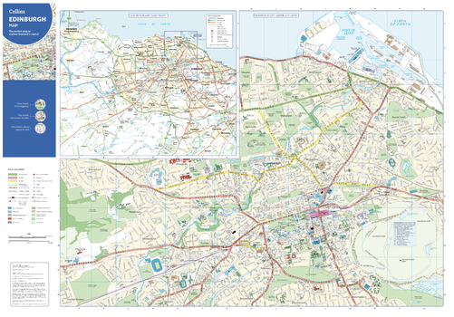
Collins Edinburgh Map
Collins
With clear mapping and a high level of detail, explore Edinburgh easily with maps from Collins. An ideal guide for tourists and residents alike, this map identifies many tourist attractions, places to stay, and cafes and restaurants Covering an area from Leith in the north to The Meadows in the south, and Edinburgh Zoo in the west to Holyrood Park in the east, this is an essential map for any visitors to Edinburgh.
Page Size: 32 x 22.25 in (810 x 560 mm)
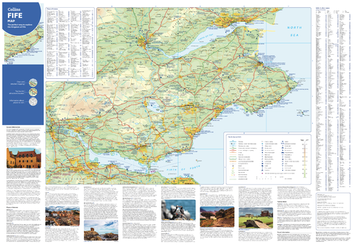
Collins Fife Map
Collins
With clear mapping and a high level of detail, explore Fife easily with maps from Collins. From Dundee in the north, the Edinburgh in the south, Fife coast in the east to Stirling in the west. Including major cities and tourist information, this inclusive map is the perfect guide to Fife for tourists and residents alike.
Page Size: 32 x 22.25 in (810 x 560 mm)
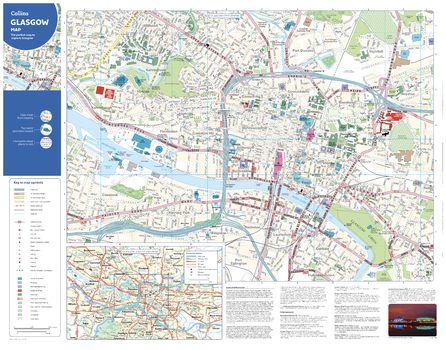
Collins Glasgow Map
Collins
With clear mapping and a high level of detail, explore Glasgow easily with maps from Collins. An ideal guide for tourists and residents alike, this map identifies many tourist attractions, places to stay, and cafes and restaurants Covering an area from the park of Glasgow Green to the bustling West End, this is an essential map for any visitors exploring Glasgow.
Page Size: 28.5 x 22.25 in (720 x 560 mm)
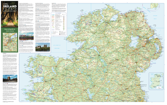
Collins Ireland Film and TV Map - North
Collins
With clear mapping and a high level of detail, explore the most popular filming locations in the Northern half of Ireland and Northern Ireland with maps from Collins. An ideal guide for tourists and locals alike, this map reveals the locations behind some of the most iconic scenes in Hollywood and Bollywood. From Winterfell to Derry, this map is the ideal companion for anyone planning an unforgettable trip to the Emerald Isle.
Page Size: 35.5 x 22.25 in (900 x 560 mm)
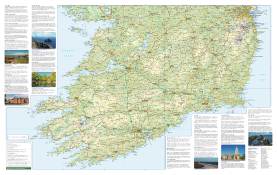
Collins Ireland Film and TV Map - South
Collins
With clear mapping and a high level of detail, explore the most popular filming locations in the southern half of Ireland with maps from Collins. An ideal guide for tourists and locals alike, this map reveals the locations behind some of the most iconic scenes in Hollywood and Bollywood. From Winterfell to Derry, this map is the ideal companion for anyone planning an unforgettable trip to the Emerald Isle.
Page Size: 35.5 x 22.25 in (900 x 560 mm)
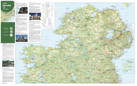
Collins Ireland Map - North
Collins
With clear mapping and a high level of detail, explore north half of Ireland and Northern Ireland easily with maps from Collins. An ideal guide for tourists and locals alike, this map covers the south of Ireland extending from the southern coast up to and including Dublin. It identifies tourist attractions, filming locations, places to stay, cafes, and restaurants. An essential companion or souvenir for anyone visiting the Emerald Isle.
Page Size: 35.5 x 22.25 in (900 x 560 mm)
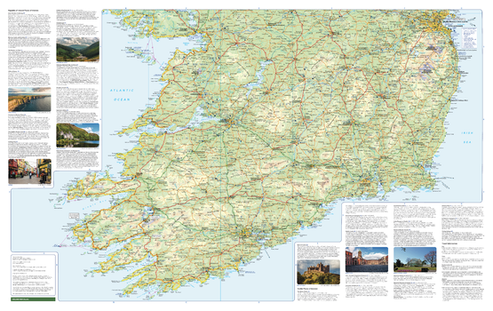
Collins Ireland Map - South
Collins
With clear mapping and a high level of detail, explore southern Ireland easily with maps from Collins. An ideal guide for tourists and locals alike, this map covers the south of Ireland extending from the southern coast up to and including Dublin. It identifies tourist attractions, filming locations, places to stay, cafes, and restaurants. An essential companion or souvenir for anyone visiting the Emerald Isle.
Page Size: 35.5 x 22.25 in (900 x 560 mm)
No search results