


MapSherpa Catalog
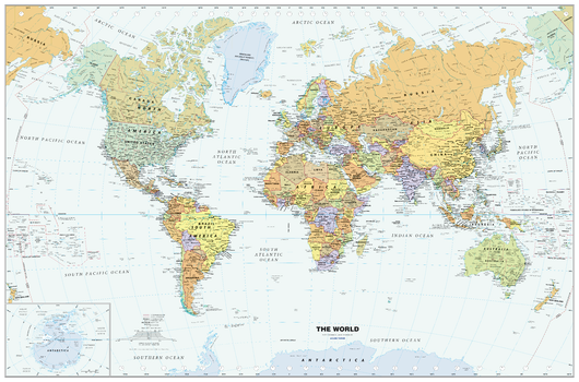
Classic World Wall Map - Large
Globe Turner
Perfect for home, business, or school, this Classic World Wall Map combines warm, traditional colors with high-detailed cartography. Details on this World Wall Map include: international boundaries and national capitals along with other major cities; major physical features such as mountain ranges, major mountain peaks, island chains, and deserts; and major water features such as oceans, seas, gulfs, and rivers. Special features include light blue-colored oceans, a white border, and an inset of Antarctica. This map of the world uses the Van Der Grinten projection. This 2024 edition map from Globe Turner reflects the name change of Kazakhstan’s capital city from Nur-Sultan to Astana, the addition of a second capital city symbol in Indonesia to reflect the move of the capital from Jakarta to Nusantara in August 2024, and the addition of the place name for the world’s newest desert, the Aralkum—in what had been the lakebed of the Aral Sea along the border of Kazakhstan and Uzbekistan.
Page Size: 50 x 33 in (1270 x 838 mm)
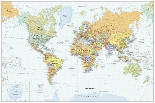
Classic World Wall Map - Poster
Globe Turner
Perfect for home, business, or school, this Classic World Wall Map combines warm, traditional colors with high-detailed cartography. Details on this World Wall Map include: international boundaries and national capitals along with other major cities; major physical features such as mountain ranges, major mountain peaks, island chains, and deserts; and major water features such as oceans, seas, gulfs, and rivers. Special features include light blue-colored oceans, a white border, and an inset of Antarctica. This map of the world uses the Van Der Grinten projection. This 2024 edition map from Globe Turner reflects the name change of Kazakhstan’s capital city from Nur-Sultan to Astana, the addition of a second capital city symbol in Indonesia to reflect the move of the capital from Jakarta to Nusantara in August 2024, and the addition of the place name for the world’s newest desert, the Aralkum—in what had been the lakebed of the Aral Sea along the border of Kazakhstan and Uzbekistan.
Page Size: 36 x 24 in (914 x 610 mm)
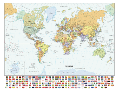
Classic World Wall Map with Flags - Large
Globe Turner
Perfect for home, business, or school, this Classic World Wall Map combines warm, traditional colors with high-detailed cartography. Details on this World Wall Map include: international boundaries and national capitals along with other major cities; major physical features such as mountain ranges, major mountain peaks, island chains, and deserts; and major water features such as oceans, seas, gulfs, and rivers. Special features include light blue-colored oceans, a white border, and an inset of Antarctica. This map of the world uses the Van Der Grinten projection. This 2024 edition map from Globe Turner reflects the name change of Kazakhstan’s capital city from Nur-Sultan to Astana, the addition of a second capital city symbol in Indonesia to reflect the move of the capital from Jakarta to Nusantara in August 2024, and the addition of the place name for the world’s newest desert, the Aralkum—in what had been the lakebed of the Aral Sea along the border of Kazakhstan and Uzbekistan. The flags of countries around the world are listed in alphabetical order with the latest colors and dimensions used as approved by each country—including updates to the flags of Barbados and Kyrgyzstan.
Page Size: 53 x 40.5 in (1346 x 1029 mm)
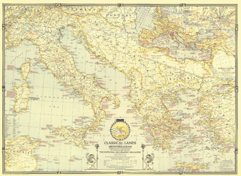
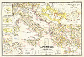
Classical Lands of the Mediterranean - Published 1940
National Geographic
This map was published in March 1940 in an issue of National Geographic entirely devoted to the Classical Lands of the Mediterranean. An abundance of historical notes and detailed inset maps of ancient Athens, ancient Rome, and the Roman Empire illustrate the rich history of the region. This educational map also features an attractive border showing the twelve signs of the zodiac.
Page Size: 35.25 x 25.75 in (893 x 652 mm)
Classical Lands of the Mediterranean - Published 1949
National Geographic
Following World War II, Greece endured a bitter civil war that ended a couple months before this map was published in December 1949. The Classical Lands of the Mediterranean map celebrates the magnificent history of the Greek, Roman, and Phoenician civilizations with informative inset maps and an abundance of notes about historical and mythological sites.
Page Size: 32 x 22 in (809 x 553 mm)
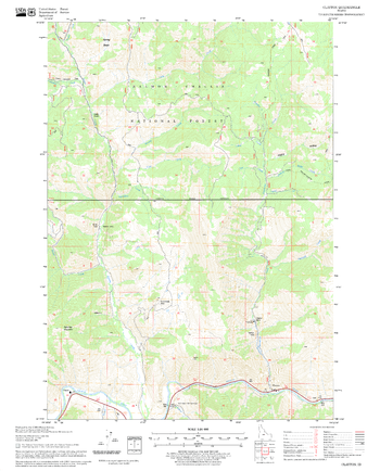
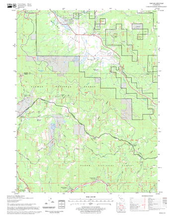
Clayton Quadrangle, Idaho
United States Department of Agriculture Forest Service
United States Department of Agriculture Forestry Service topographical map of Clayton, Salmon-Chalis National Forest, Idaho.
Page Size: 21.75 x 27 in (552 x 686 mm)
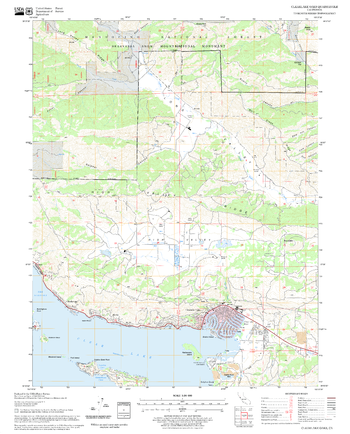
Clearlake Oaks Quadrangle, California
United States Department of Agriculture Forest Service
United States Department of Agriculture Forestry Service topographical map of Clearlake Oaks, Mendocino National Forest, California.
Page Size: 21.75 x 27 in (552 x 686 mm)
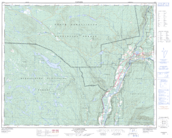
Clearwater - 92 P/9 - British Columbia
Natural Resources Canada
Canadian topographic map of Clearwater, British Columbia. NTS sheet 092P09 Edition 2.
Page Size: 31.5 x 25.5 in (799 x 643 mm)
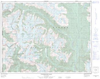
Clendenning Creek - 92 J/5 - British Columbia
Natural Resources Canada
Canadian topographic map of Clendenning Creek, British Columbia. NTS sheet 092J05 Edition 1.
Page Size: 32.25 x 25.5 in (813 x 641 mm)
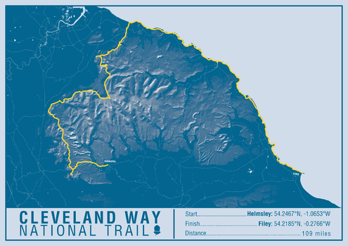
Cleveland Way National Trail Map Print
A-Z Maps
This map print highlights the National Trail route of the Cleveland Way, showing the start and finish points on an attractive relief base and created in the official National Trail colours.
Page Size: 23.5 x 16.75 in (594 x 420 mm)
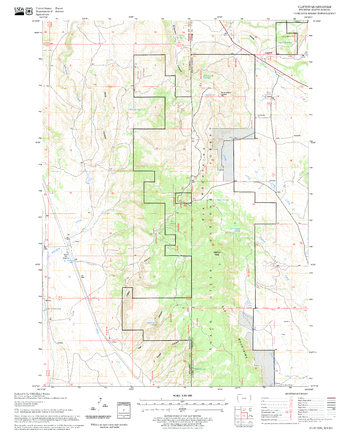
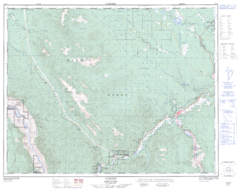
Clifton Quadrangle, South Dakota
United States Department of Agriculture Forest Service
United States Department of Agriculture Forestry Service topographical map of Clifton, Black Hills National Forest, South Dakota.
Page Size: 21.75 x 27 in (552 x 686 mm)
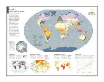
Climate: Shifting Winds and Weather - Atlas of the World, 10th Edition
National Geographic
Climatic Zones; Shrinking Polar Ice; Mapping Precipitation; Taking the Planet's Rising Temperature; Mapping the Health Toll of Climate Change; Charting Sea-Level Change
Page Size: 28 x 22 in (711 x 559 mm)
Clinton - 92 P/4 - British Columbia
Natural Resources Canada
Canadian topographic map of Clinton, British Columbia. NTS sheet 092P04 Edition 2.
Page Size: 32 x 25.5 in (812 x 643 mm)
Clio Quadrangle, California
United States Department of Agriculture Forest Service
United States Department of Agriculture Forestry Service topographical map of Clio, Tahoe National Forest, California.
Page Size: 21.75 x 27 in (552 x 686 mm)
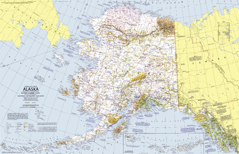
Close-up USA, Alaska - Published 1975
National Geographic
This map of Alaska, the largest state in the United States, lets you discover the region's incomparable wilderness and compelling history. Features parks, forests, and wildlife refuges, showing both existing sites and proposed areas. Published in June 1975 as part of the "Close-up: U.S.A." series, with two articles including "Preserving America's Last Great Wilderness."
Page Size: 35 x 22.75 in (888 x 572 mm)
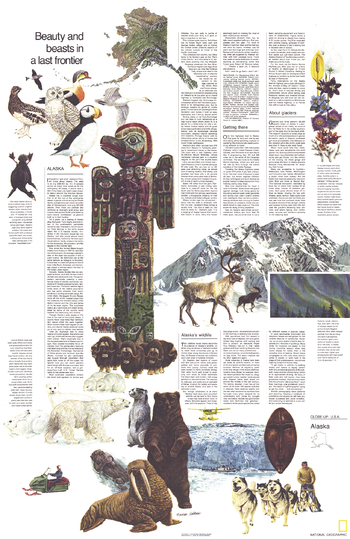
Close-up USA, Alaska Theme - Published 1975
National Geographic
The "Alaska: Beauty and Beasts in a Last Frontier" travel poster is half of a two-map set published in June 1975 as part of the "Close-up: U.S.A" series. A wonderful companion to the Alaska map, this poster contains a wealth of information on the wildlife, sites of interest, and travel options in Alaska including tips on driving there via the Alaskan Highway.
Page Size: 22.75 x 35 in (575 x 886 mm)
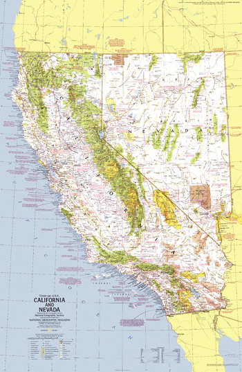
Close-up USA, California and Nevada - Published 1974
National Geographic
This map of California ("The Golden State") and its neighbor, Nevada ("The Silver State"), lets you explore the remarkable diversity of this region of the United States. Features a wealth of travel and tourism information as well as an abundance of historical notes. Published in June 1974 as part of the "Close-up: U.S.A." series, with the travel poster "California and Nevada: Storied Realm of Glitter and Greenery."
Page Size: 23 x 35 in (578 x 887 mm)
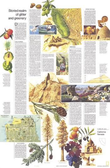
Close-up USA, California and Nevada Theme - Published 1974
National Geographic
Half of a two-piece set, the "California and Nevada: Storied Realm of Glitter and Greenery" travel poster accompanied the California and Nevada map in the "Close-up: U.S.A" series. Published in June 1974, this work features a map of San Francisco and an abundance of information about the history, tourist activities, and geography of these two exciting states.
Page Size: 23 x 35 in (578 x 887 mm)
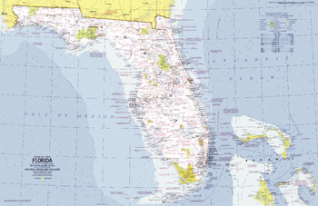
Close-up USA, Florida - Published 1973
National Geographic
This informative map lets you explore Florida, the "Sunshine State", including the wilderness of the Everglades, Miami's cosmopolitan beaches, and the fun of Disney World. Published in November 1973 as part of the "Close-up: U.S.A." series.
Page Size: 35.25 x 23 in (890 x 578 mm)
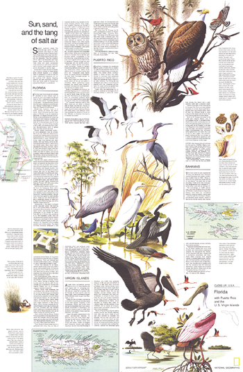
Close-up USA, Florida Theme - Published 1973
National Geographic
The "Florida, Puerto Rico, and the U.S. Virgin Islands: Sun, Sand, and the Tang of Salt Air" map is half of a two-map set. Published in November 1973, this travel map contains historical information about these three regions as well an introduction to the various tourist activities that abound in these tropical paradises.
Page Size: 23 x 35 in (582 x 889 mm)
No search results