


MapSherpa Catalog
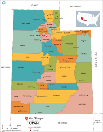
Utah Counties Map - Standard
MapSherpa
This map has been created exclusively for MapSherpa, and designed for reference or business use. Clear and clean colors & fonts matched with cartographic research makes this map of Utah Counties Map easily readable and useful. The map shows the 29 counties of Utah and their borders across the Beehive State.
Page Size: 36 x 46.25 in (914 x 1175 mm)
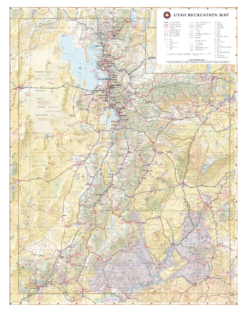
Utah Recreation Wall Map
Benchmark Maps
Utah boasts what is perhaps the best concentration of national parks in the world, known as The Mighty Five: Zion, Bryce Canyon, Capitol Reef, Canyonlands, and Arches. These diverse and iconic desert landscapes, along with the Great Salt Lake and world-class alpine skiing in the north, draw travelers to The Beehive State year-round.
Page Size: 28 x 35.5 in (711 x 896 mm)
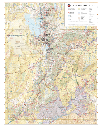
Utah Recreation Wall Map – 26 inch
Benchmark Maps
Utah boasts what is perhaps the best concentration of national parks in the world, known as The Mighty Five: Zion, Bryce Canyon, Capitol Reef, Canyonlands, and Arches. These diverse and iconic desert landscapes, along with the Great Salt Lake and world-class alpine skiing in the north, draw travelers to The Beehive State year-round.
Page Size: 26 x 32.5 in (660 x 826 mm)
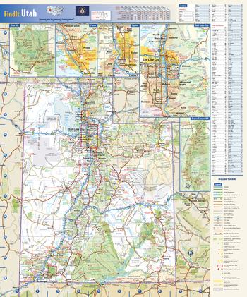
Utah State Wall Map
Globe Turner
This colorful, easy-to-read state map of Utah identifies all major thoroughfares, secondary roads, freeway interchanges, rest areas, distance markers, landmarks, recreational areas, and more. Shaded relief on the state map provides a three-dimensional sense of Utah’s topography. Detailed city inset maps of Provo, Ogden, and Salt Lake City are based on the latest street information from our cartographic experts. Up-to-date insets of Bryce Canyon National Park and Zion National Park provide must-see information on these tourist areas. County and city indices make it simple to locate even the smallest town. City type sizes reflect the 2020 U.S. Census.
Page Size: 14.75 x 17.75 in (375 x 451 mm)
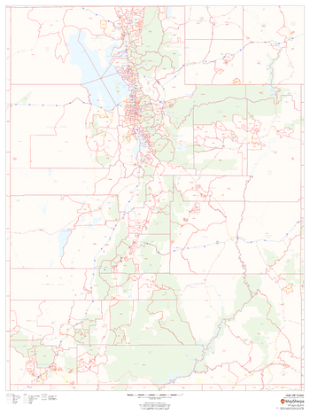
Utah ZIP Code Map
MapSherpa
This map of Utah shows ZIP codes overlaid on a road map. Base map features include municipality and county boundaries, major road network features, and state and national parks and conservation areas.
Page Size: 36 x 48 in (914 x 1219 mm)
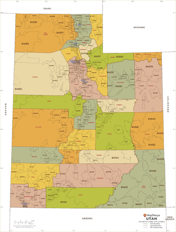
Utah ZIP Code Map with Counties - Extra Large
MapSherpa
This map has been created exclusively for MapSherpa, and designed for business or reference use. Clear and clean colors & fonts matched with cartographic research makes this Utah Zip Code Map with Counties easily readable and useful. The map shows the 29 counties of Utah and the borders of the over 200 zip codes across the Beehive State.
Page Size: 60 x 79.25 in (1524 x 2008 mm)
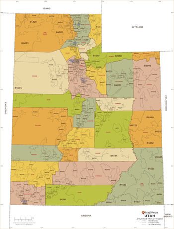
Utah ZIP Code Map with Counties - Large
MapSherpa
This map has been created exclusively for MapSherpa, and designed for business or reference use. Clear and clean colors & fonts matched with cartographic research makes this Utah Zip Code Map with Counties easily readable and useful. The map shows the 29 counties of Utah and the borders of the over 200 zip codes across the Beehive State.
Page Size: 48 x 63.5 in (1219 x 1607 mm)
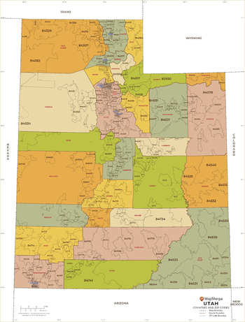
Utah ZIP Code Map with Counties - Standard
MapSherpa
This map has been created exclusively for MapSherpa, and designed for business or reference use. Clear and clean colors & fonts matched with cartographic research makes this Utah Zip Code Map with Counties easily readable and useful. The map shows the 29 counties of Utah and the borders of the over 200 zip codes across the Beehive State.
Page Size: 36 x 47.5 in (914 x 1205 mm)
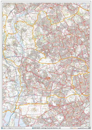
Uxbridge - UB - Postcode Wall Map
XYZ Maps
The Uxbridge Postcode Sector Wall Map shows detailed postcode sector boundaries (UB1 1, UB1 2) on a comprehensive background and is perfect for determining postcode boundaries for sales areas, planning mailshots and also an excellent reference for logistics. This wall map covers the whole of the UB Postcode Area.
Page Size: 33.25 x 47 in (841 x 1189 mm)
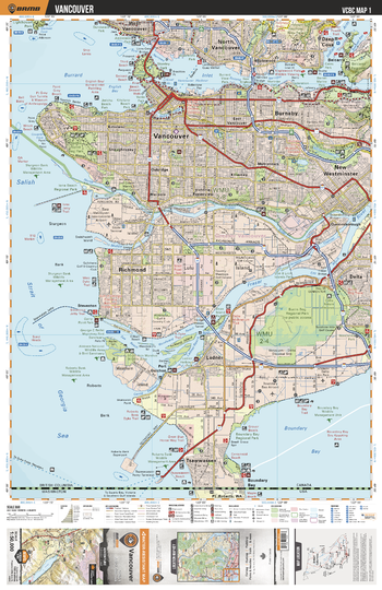
VCBC01 Vancouver - Vancouver Coast & Mountains BC Topo
Backroad Mapbooks
This recreation topographic map for the Vancouver area highlights all the logging roads, trails and recreational Points of Interest including hunting, camping, hiking, mountain biking, canoeing, kayaking, backcountry skiing, wildlife viewing, ATVing, snowmobiling and more. No other map provides you with this level of recreational and topographic detail for the Vancouver area. Covering 1,090 km2 (420 mi2), this 1:50,000 scale map measures 29 x 38 km (18 x 24 mi) and covers Belcarra, Boundary Bay, Burnaby, Burns Bog, Burrard Inlet, Delta, Fraser River, Indian Arm, Ladner, Lynn Canyon Park, Mount Seymour Provincial Park, New Westminster, North Vancouver, Pacific Sprit Regional Park, Richmond, Stanley Park, Steveston, Tsawwassen and more!
Page Size: 24 x 37 in (610 x 940 mm)
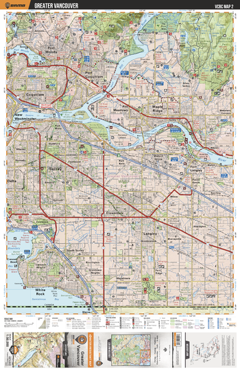
VCBC02 Greater Vancouver - Vancouver Coast & Mountains BC Topo
Backroad Mapbooks
This recreation topographic map for the Greater Vancouver area highlights all the logging roads, trails and recreational Points of Interest including hunting, camping, hiking, mountain biking, canoeing, kayaking, backcountry skiing, wildlife viewing, ATVing, snowmobiling and more. No other map for the area provides you with this level of recreational or topographic detail. Covering 1,090 km2 (420 mi2), this 1:50,000 scale map measures 29 x 38 km (18 x 24 mi) and covers Fraser River, Pinecone Burke Provincial Park, Golden Ears Provincial Park, Cloverdale Athletic Park, Campbell Valley Regional Park and more!
Page Size: 24 x 37 in (610 x 940 mm)
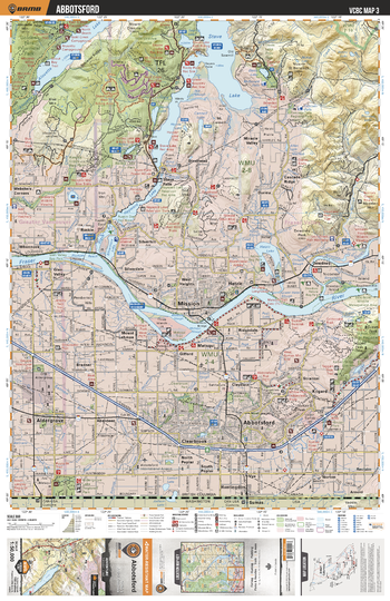
VCBC03 Abbotsford - Vancouver Coast & Mountains BC Topo
Backroad Mapbooks
This recreation topographic map for the Abbotsford area highlights all the logging roads, trails and recreational Points of Interest including hunting, camping, hiking, mountain biking, canoeing, kayaking, backcountry skiing, wildlife viewing, ATVing, snowmobiling and more. No other map for the area provides you with this level of recreational or topographic detail. Covering 1,090 km2 (420 mi2), this 1:50,000 scale map measures 29 x 38 km (18 x 24 mi) and covers Abbotsford, Mission Interpretive Forest, Alouette Lake, Stave Lake, Hayward Lake, Hatzic Lake, Centennial Park, Aldergrove Lake Regional Park and more!
Page Size: 24 x 37 in (610 x 940 mm)
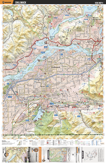
VCBC04 Chilliwack - Vancouver Coast & Mountains BC Topo
Backroad Mapbooks
This recreation topographic map for the Chilliwack area highlights all the logging roads, trails and recreational Points of Interest including hunting, camping, hiking, mountain biking, canoeing, kayaking, backcountry skiing, wildlife viewing, ATVing, snowmobiling and more. No other map for the area provides you with this level of recreational or topographic detail. Covering 1,090 km2 (420 mi2), this 1:50,000 scale map measures 29 x 38 km (18 x 24 mi) and covers Chilliwack, Fraser River, Harrison River, Harrison Lake, Cultus Lake Provincial Park, International Ridge Recreation Area, Bridal Veil Falls Provincial Park and more!
Page Size: 24 x 37 in (610 x 940 mm)
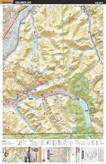
VCBC05 Chilliwack Lake - Vancouver Coast & Mountains BC Topo
Backroad Mapbooks
This recreation topographic map for the Chilliwack Lake area highlights all the logging roads, trails and recreational Points of Interest including hunting, camping, hiking, mountain biking, canoeing, kayaking, backcountry skiing, wildlife viewing, ATVing, snowmobiling and more. No other map for the area provides you with this level of recreational or topographic detail. Covering 1,090 km2 (420 mi2), this 1:50,000 scale map measures 29 x 38 km (18 x 24 mi) and covers Chilliwack Lake, Chilliwack Lake Provincial Park, Jones Lake, Silver Lake Provincial Lake, Chilliwack River, Silverhope Creek, Laidlaw and more!
Page Size: 24 x 37 in (610 x 940 mm)
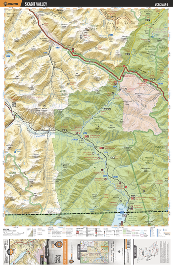
VCBC06 Skagit Valley - Vancouver Coast & Mountains BC Topo
Backroad Mapbooks
This recreation topographic map for the Skagit Valley area highlights all the logging roads, trails and recreational Points of Interest including hunting, camping, hiking, mountain biking, canoeing, kayaking, backcountry skiing, wildlife viewing, ATVing, snowmobiling and more. No other map for the area provides you with this level of recreational or topographic detail. Covering 1,090 km2 (420 mi2), this 1:50,000 scale map measures 29 x 38 km (18 x 24 mi) and covers E.C. Manning Provincial Park, Sumallo River, Skagit River, Klesikwa River, Skagit Valley Provincial Park, Maselpanik Creek and more!
Page Size: 24 x 37 in (610 x 940 mm)
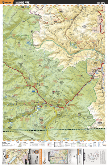
VCBC07 Manning Park - Vancouver Coast & Mountains BC Topo
Backroad Mapbooks
This recreation topographic map for the Manning Park area highlights all the logging roads, trails and recreational Points of Interest including hunting, camping, hiking, mountain biking, canoeing, kayaking, backcountry skiing, wildlife viewing, ATVing, snowmobiling and more. No other map for the area provides you with this level of recreational or topographic detail. Covering 1,090 km2 (420 mi2), this 1:50,000 scale map measures 29 x 38 km (18 x 24 mi) and covers Manning Park, Skagit River, Similkameen River, Thunder Lake, Garrison Lakes, Nicomen Lake, Skaist River, Copper Creek and more!
Page Size: 24 x 37 in (610 x 940 mm)
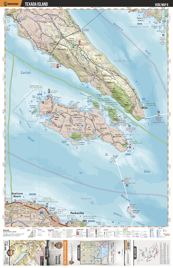
VCBC08 Texada Island - Vancouver Coast & Mountains BC Topo
Backroad Mapbooks
This recreation topographic map for the Texada Island area highlights all the logging roads, trails and recreational Points of Interest including hunting, camping, hiking, mountain biking, canoeing, kayaking, backcountry skiing, wildlife viewing, ATVing, snowmobiling and more. No other map for the area provides you with this level of recreational or topographic detail. Covering 1,090 km2 (420 mi2), this 1:50,000 scale map measures 29 x 38 km (18 x 24 mi) and covers Malispina Strait, Sabine Channel, South Texada Island Provincial Park, Sabine Channel Provincial Park, Jedediah Island Provincial Marine Park and more!
Page Size: 24 x 37 in (610 x 940 mm)
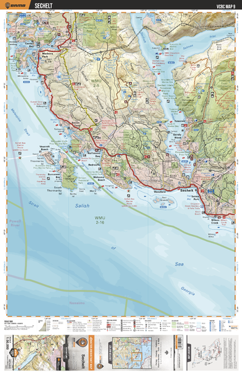
VCBC09 Sechelt - Vancouver Coast & Mountains BC Topo
Backroad Mapbooks
This recreation topographic map for the Sechelt area highlights all the logging roads, trails and recreational Points of Interest including hunting, camping, hiking, mountain biking, canoeing, kayaking, backcountry skiing, wildlife viewing, ATVing, snowmobiling and more. No other map for the area provides you with this level of recreational or topographic detail. Covering 1,090 km2 (420 mi2), this 1:50,000 scale map measures 29 x 38 km (18 x 24 mi) and covers Schelt, Salish Sea, Spipiyus Provincial Park, Mount Richardson Provincial Park, Smuggler Cove Provincial Marine Park, Sunshine Coast Community Forest and more!
Page Size: 24 x 37 in (610 x 940 mm)
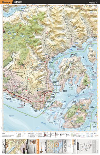
VCBC10 Gibsons - Vancouver Coast & Mountains BC Topo
Backroad Mapbooks
This recreation topographic map for the Gibsons area highlights all the logging roads, trails and recreational Points of Interest including hunting, camping, hiking, mountain biking, canoeing, kayaking, backcountry skiing, wildlife viewing, ATVing, snowmobiling and more. No other map for the area provides you with this level of recreational or topographic detail. Covering 1,090 km2 (420 mi2), this 1:50,000 scale map measures 29 x 38 km (18 x 24 mi) and covers Gibsons, Tetrahedron Provincial Park, Salmon Inlet, Thornbrough Channel, Collingwood Channel, Mount Gardner Park and more!
Page Size: 24 x 37 in (610 x 940 mm)
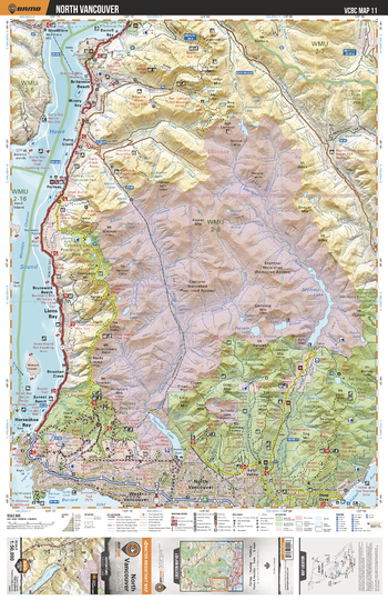
VCBC11 North Vancouver - Vancouver Coast & Mountains BC Topo
Backroad Mapbooks
This recreation topographic map for the North Vancouver area highlights all the logging roads, trails and recreational Points of Interest including hunting, camping, hiking, mountain biking, canoeing, kayaking, backcountry skiing, wildlife viewing, ATVing, snowmobiling and more. No other map for the area provides you with this level of recreational or topographic detail. Covering 1,090 km2 (420 mi2), this 1:50,000 scale map measures 29 x 38 km (18 x 24 mi) and covers North Vancouver, Lower Seymour Conservation Reserve, Capilano Lake, Capilano River, Seymour River, Lynn Headwaters Regional Park and more!
Page Size: 24 x 37 in (610 x 940 mm)
No search results