


MapSherpa Catalog
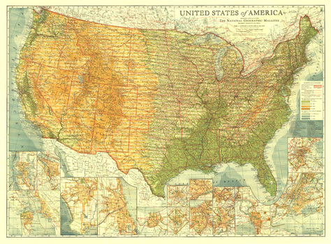
United States of America - Published 1923
National Geographic
Long before Interstate highways criss-crossed the US, the nation was threaded together by highways with names like Lakes-to-Gulf Highway and King of Trails. Spectacular detail and artistry come together in this map--the first US map published by National Geographic. This beautiful US map, published in 1923, is a cartographic time capsule, and a must-have for any map collector.
Page Size: 38 x 28 in (960 x 709 mm)
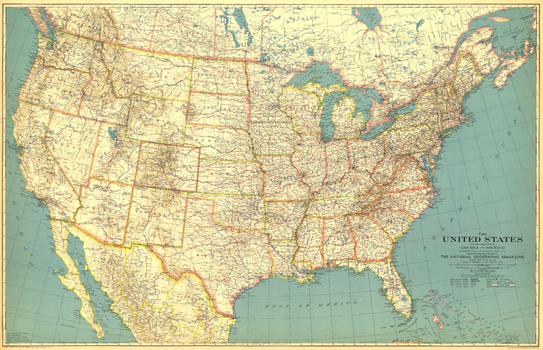
United States of America - Published 1933
National Geographic
This beautiful US map, first published in May of 1933, accompanied a National Geographic article entitled, "How the United States Grew." Perhaps a sign of the times, the cartographers employed decidedly muted tones for the map. Wonderful typography and incredible attention to detail make this a map that is perfect for any collection.
Page Size: 40.75 x 26.25 in (1033 x 665 mm)
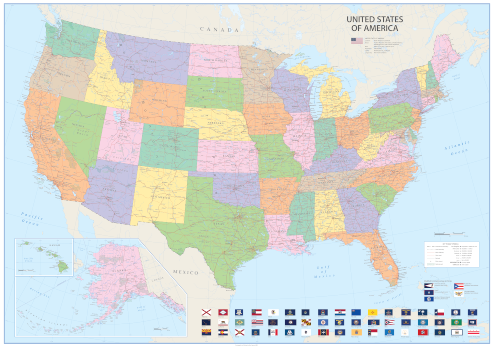
United States of America - Vibrant
Sparrow Maps
An alternative look to the Vintage USA map using brighter colours, clearer symbology and modern fonts but retaining all the same features. Settlements are classified by population with state capitals highlighted. Major highways, roads and railroads are shown as well as major airports. National Parks are included and main physical features named. Hawaii (same scale as main map) and Alaska (at 1:9,330,000) are shown in an inset. Illustrated with flags of the states and the US overseas territories. A bright, colourful, political map of the USA in clear, vibrant colours - ideal for a more modern décor.
Page Size: 47 x 33.25 in (1188 x 841 mm)
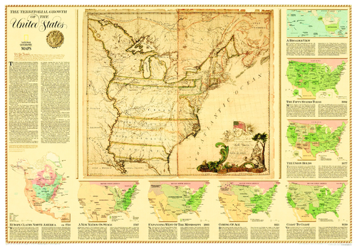
United States, Territorial Growth - Published 2000
National Geographic
The centerpiece of this fascinating collection of maps is a reproduction of a 1784 map by Connecticut engraver Abel Buell. That map presents, as though settled, an issue that threatened to pull the new nation apart: Who controlled the West - the area beyond the Appalachians? An excellent overview describing the issues, conflicts, and opportunities that were at the center of how land was acquired, usurped, and annexed as the United States took form. Includes maps that show Europe Claims in North America ca. 1750, A New Nation on Stage 1787, Expanding West of the Mississippi 1803, Coming of Age 1821, Coast to Coast 1850, The Union Holds 1877, and the Fifty States Today.
Page Size: 43.25 x 30.25 in (1095 x 765 mm)
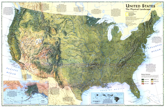
United States, the Physical Landscape - Published 1996
National Geographic
A spectacular physical features portrait of the United States and look at the physical forces that have shaped its landscape. Published in October 1996 as a companion to "Federal Lands in the Fifty States."
Page Size: 31.25 x 20.5 in (793 x 518 mm)
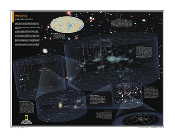
Universe: Vast and Expanding - Atlas of the World, 10th Edition
National Geographic
Page Size: 28 x 22 in (711 x 559 mm)
Universe: Vast and Expanding - Atlas of the World, 11th Edition
National Geographic
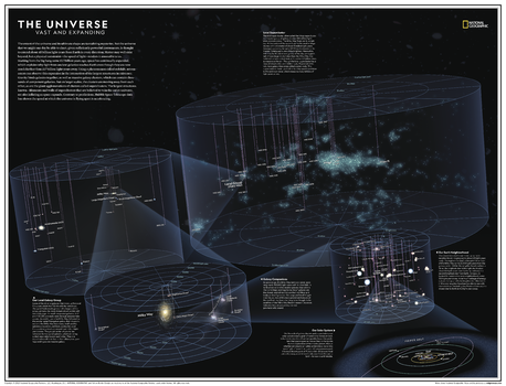
The extent of the universe and its ultimate shape are tantalizing mysteries. But the universe that we might one day be able to chart, given sufficiently powerful instruments, is thought to extend about 45 billion light-years from Earth in every direction. Matter may well exist beyond, but a physical constraint - the speed of light - renders it just outside our reach.
Explore the universe with this gorgeous and informative map! This map of the universe uses graphic leaps of scales to show how our solar system fits within the vastness of the universe. From our solar system, made up of our sun and its eight planets, our neighborhood (stretching 20 light years in all directions), our galactic realm, our local group, to the entirety of the known universe itself, this map offers a compelling and comprehensive look into the sheer size of existence itself.
This map is an attractive product for the budding astronomer. It makes an essential companion to Milky Way: Earth's Galactic Home.
This map is found in National Geographic's 11th Edition World Atlas and is now available as a stand alone product.
Page Size: 31.5 x 24 in (798 x 610 mm)
Universe: Vast and Expanding - Atlas of the World, 11th Edition - Compact
National Geographic
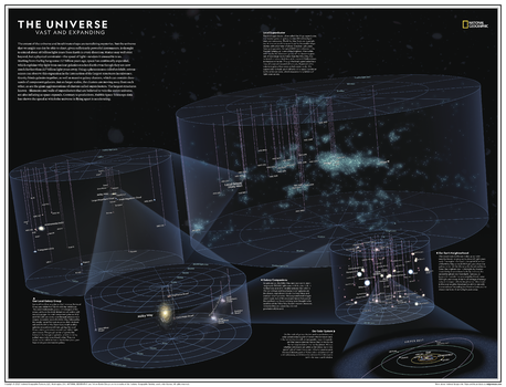
The extent of the universe and its ultimate shape are tantalizing mysteries. But the universe that we might one day be able to chart, given sufficiently powerful instruments, is thought to extend about 45 billion light-years from Earth in every direction. Matter may well exist beyond, but a physical constraint - the speed of light - renders it just outside our reach.
Explore the universe with this gorgeous and informative map! This map of the universe uses graphic leaps of scales to show how our solar system fits within the vastness of the universe. From our solar system, made up of our sun and its eight planets, our neighborhood (stretching 20 light years in all directions), our galactic realm, our local group, to the entirety of the known universe itself, this map offers a compelling and comprehensive look into the sheer size of existence itself.
This map is an attractive product for the budding astronomer. It makes an essential companion to Milky Way: Earth's Galactic Home.
This map is found in National Geographic's 11th Edition World Atlas and is now available as a stand alone product.
Page Size: 21.5 x 16.25 in (540 x 413 mm)
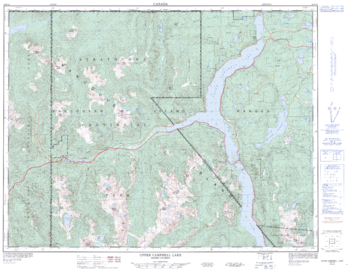
Upper Campbell Lake - 92 F/13 - British Columbia
Natural Resources Canada
Canadian topographic map of Upper Campbell Lake, British Columbia. NTS sheet 092F13 Edition 3.
Page Size: 32.75 x 25.5 in (828 x 643 mm)
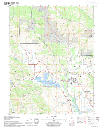
Upper Lake Quadrangle, California
United States Forest Service
United States Department of Agriculture Forestry Service topographical map of Upper Lake, Mendocino National Forest, California.
Page Size: 21.75 x 27 in (552 x 686 mm)
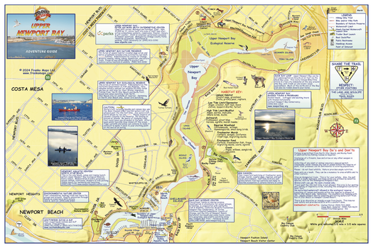
Upper Newport Bay California Wall Map
Franko Maps
A detailed map of this aquatic and recreational playground. Includes paved bike/hike trails, hiking only trails, trailer boat launches, boat docks/piers, bird watching and preserve information.
Page Size: 36 x 24 in (914 x 610 mm)
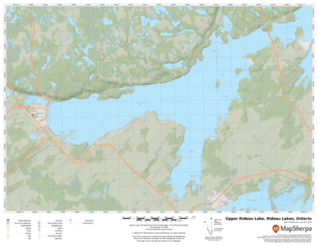
Upper Rideau Lake, Rideau Lakes, Ontario
MapSherpa
A cartographically beautiful map of Upper Rideau Lake, Rideau Lakes, Ontario ideal for showing off cottages, resorts, lakes and other favourite places.
Page Size: 22 x 17 in (559 x 432 mm)
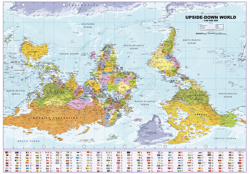
Upside Down World Political Wall Map
XYZ Maps
Wall map of the world with a twist! An alternative view of the World with this wall map with everything turned on its head raising the questioning conventional wisdom and asking which way is truly up?
Page Size: 39.25 x 27.5 in (996 x 695 mm)

Upside Down World Wall Map
Hema Maps
Ever wonder what the world would look like if you turned it around, and Australia and South America were on top? The upside down map of the world will have your guests intrigued, and help you rethink the world as you know it.
Page Size: 33.25 x 23.5 in (840 x 595 mm)
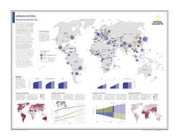
Urbanization: Moving Toward the City - Atlas of the World, 10th Edition
National Geographic
Locating Urban Centers; Regionalizing Urbanization; Urbanization and Development; Comparing Urbanization Rates; Shifting to an Urban Majority; Mapping Urban Growth Rates
Page Size: 28 x 22 in (711 x 559 mm)
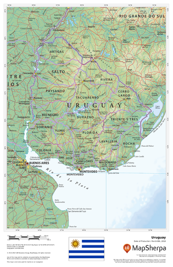
Uruguay
MapSherpa
This beautiful map shows physical and political features for Uruguay and surrounding areas. Relief shading and the use of different colours by height above sea level are both informative and attractive.
Page Size: 11 x 17 in (279 x 432 mm)
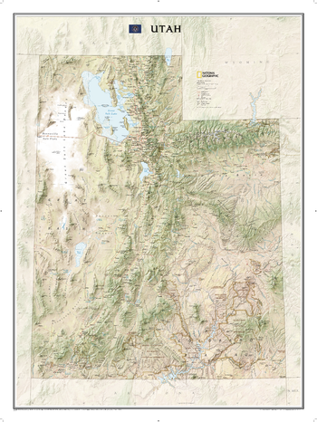
Utah
National Geographic
Explore the diverse and iconic landscapes of Utah with this striking National Geographic wall map. From the Bonneville Salt Flats and the Great Salt Lake to the Uinta Mountains and the extraordinary parks along the Colorado Plateau, the state is rendered in dramatic detail. Stunning shaded relief and vibrant colorization depicts mountain ranges, forests, deserts, canyons, and other physical topography. Prominent peaks, major lakes, rivers, and reservoirs, and other geographic features are highlighted. In addition to hundreds of place names, this map includes the locations of cities, major roadways and railways, airports, military bases, national and state parks, and recreation areas. Part of a growing series of State Wall Maps, this expertly designed map makes an attractive addition to any office or study.
Page Size: 30.25 x 40.5 in (768 x 1029 mm)
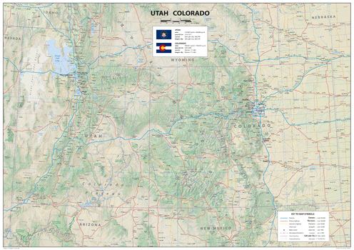
Utah Colorado
Sparrow Maps
A detailed physical map of Utah and Colorado, USA, with land cover and relief features and including National Parks showing administrative divisions, state capitals, county seats and other settlements, roads and airports. The state flag, area and population are included for each state. One of a series of attractive maps of US states giving a comprehensive overview.
Page Size: 33.25 x 23.5 in (841 x 594 mm)
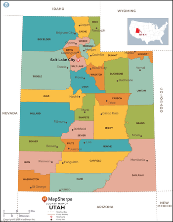
Utah Counties Map - Extra Large
MapSherpa
This map has been created exclusively for MapSherpa, and designed for reference or business use. Clear and clean colors & fonts matched with cartographic research makes this map of Utah Counties Map easily readable and useful. The map shows the 29 counties of Utah and their borders across the Beehive State.
Page Size: 60 x 77.25 in (1524 x 1958 mm)
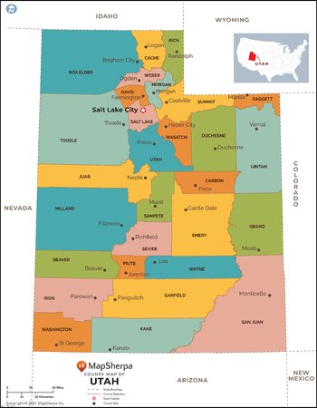
Utah Counties Map - Large
MapSherpa
This map has been created exclusively for MapSherpa, and designed for reference or business use. Clear and clean colors & fonts matched with cartographic research makes this map of Utah Counties Map easily readable and useful. The map shows the 29 counties of Utah and their borders across the Beehive State.
Page Size: 48 x 61.75 in (1219 x 1566 mm)
No search results