


MapSherpa Catalog
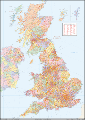
UK Political Postcode District Wall Map (D8)
XYZ Maps
This huge UK Political Postcode District Wall Map is 2A in size (1189mm x 1682mm, 4ft x 6ft). We believe it is the only single wall map to cover the United Kingdom at postcode district level. The map features a political map base showing the counties and unitary authorities in pastel colours.
Page Size: 47 x 66.25 in (1189 x 1682 mm)
UK Postcode Sectors
Collins
Detailed and up-to-date postcode data. Detailed boundary information for approximately 9,500 Sector postcodes in England, Wales, Scotland, Northern Ireland, the Isle of Man and the Channel Islands.
UK Roads
MapSherpa
A multi-scale Road map product based on Ordnance Survey data and cartographic styles. Make a map of anywhere in England, Scotland and Wales. This product provides continuous coverage in the U.K between the scales of 1:10,000 and 1:1,000,000. Updated twice a year this product provides detailed ‘street level’ mapping. Features on the map can include: buildings, roads, railways, rivers, forests, place names and points of interest such as schools, hospitals, police and train stations.
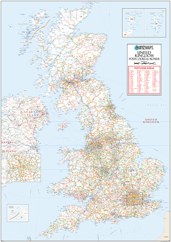
UK Roads Postcode Areas Large Wall Map (AR5)
XYZ Maps
This UK Roads Postcode Areas Large Wall Map clearly shows the 124 postcode area boundaries on a comprehensive background including motorways and trunk roads and is excellent for determining national postcode boundaries, national planning, logistics or as a national reference guide.
Page Size: 39.5 x 55.75 in (1000 x 1414 mm)
UK Street View
MapSherpa
This product provides Ordnance Survey street-level mapping that has been specifically designed to cartographically emphasize road carriageways, road names and their Department for Transport numbers. Major public buildings are also highlighted and annotated. Maps can be created at a range of scales between 1:5,000 and 1:15,000.
UK Street View - Fixed Scale
MapSherpa
This product provides Ordnance Survey street-level mapping that has been specifically designed to cartographically emphasize road carriageways, road names and their Department for Transport numbers. Major public buildings are also highlighted and annotated. Maps can be created at a fixed scale of 1:10,000.
UK Streets Open Map
MapSherpa
Make a map of anywhere in England, Scotland and Wales. This product provides continuous coverage in the U.K with optimal design at 1:10,000 scale. Updated twice a year this street level product highlights features that include buildings, roads, railways, rivers, forests, place names and points of interest such as schools, hospitals, police and train stations.This street map product has been cartographically optimized by the Ordnance Survey.
UK Streets Open Map Wallpaper
MapSherpa
Make Wallpaper Maps based on the Ordnance Survey 1:10,000 Open Map - Local content.
UK Topographic
MapSherpa
This product provides Ordnance Survey mapping for your leisure activities and outdoor recreation pursuits. Create maps for anywhere in the United Kingdom from the popular OS Explorer and OS Landranger series. The detailed mapping at large scales (most zoomed in) means that features such as walking routes or cycle trails are clearly displayed on the map. At regional scales the maps provide information on landscape features such as golf courses and National Trust properties. Maps include topographic detail with contour information. Maps can be created at a range of scales between 1:12,000 and 1:100,000.
UK Topographic - Fixed Scale
MapSherpa
This product provides Ordnance Survey mapping for your leisure activities and outdoor recreation pursuits. Create maps for anywhere in the United Kingdom from the popular OS Explorer and OS Landranger series. The detailed mapping at large scales (most zoomed in) means that features such as walking routes or cycle trails are clearly displayed on the map. At regional scales the maps provide information on landscape features such as golf courses and National Trust properties. Maps include topographic detail with contour information. Maps can be created at fixed scales of 1:25,000 and 1:50,000.
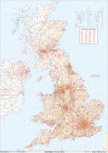
UK White Background Postcode District Wall (D11)
XYZ Maps
This huge UK white Background Postcode District Wall Map is 2A in size (1189mm x 1682mm, 4ft x 6ft). We believe it is the only single wall map to cover the United Kingdom at postcode districtlLevel. The map features a plain white map base with roads and towns.
Page Size: 47 x 66.25 in (1189 x 1682 mm)
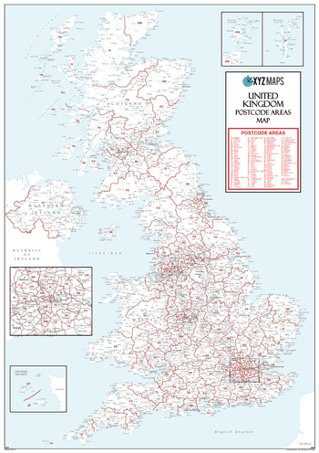
UK White Postcode Area Medium Wall Map (AR4)
XYZ Maps
This UK White Postcode Area Medium Wall Map clearly shows the 124 postcode area boundaries on a white background and is perfect for determining national postcode boundaries, national planning logistics, or as a national reference guide.
Page Size: 23.5 x 33.25 in (594 x 841 mm)
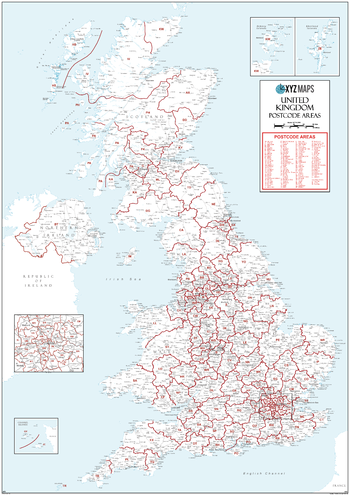
UK White Postcode Areas Large Wall Map (AR3)
XYZ Maps
This UK White Postcode Areas Large Wall Map clearly shows the 124 postcode area boundaries and associated postcode labels on a white background and is perfect for determining national postcode boundaries, national planning, logistics or as a national reference guide.
Page Size: 39.5 x 55.75 in (1000 x 1414 mm)
US Travelers Atlas - Alaska
Mapping Specialists
Alaska Regional data based on a 1:5 million scale dataset. Perfect for the creation of regional and state level maps. Includes highways, cities & towns, points of interest, and shaded relief. Each map includes projection information and scale.
US Travelers Atlas - Continental US
Mapping Specialists
U.S. Regional data based on a 1:1 million scale dataset. Perfect for the creation of regional and state level maps. Includes highways, cities & towns, points of interest, and shaded relief. Each map includes projection information and scale.
US Travelers Atlas - Hawaii
Mapping Specialists
Hawaii Regional data based on a 1:1 million scale dataset. Perfect for the creation of regional and state level maps. Includes highways, cities & towns, points of interest, and shaded relief. Each map includes projection information and scale.
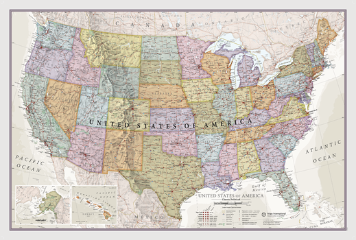
USA Classic
Maps International
This Classic USA Map is a real talking point that will help you learn about several USA states and expand your horizons. This map has been designed by specialist expert map makers, and our philosophy of 'good cartography' is what we hope people will love and appreciate . Detail as well as design is what we do best. It features every state in a different color, with boundaries clearly shown and all major USA towns and cities highlighted.
Page Size: 36 x 24.25 in (914 x 610 mm)
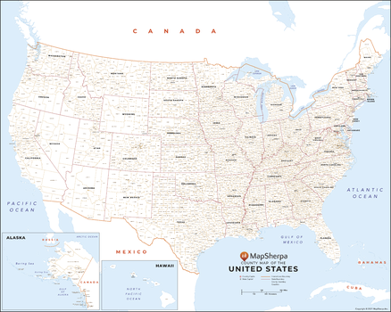
USA County Names Map
MapSherpa
This map has been created exclusively for MapSherpa, and designed for reference or business use. Clear and clean colors & fonts matched with cartographic research makes this map of USA Map wth County Names easily readable and useful. The map shows the the over 3,000 counties, parishes and boroughs of the United States and their borders.
Page Size: 33.5 x 27 in (851 x 680 mm)
USA Explorer
MapSherpa
This versatile product allows you to get a topo map of anywhere in the USA. It has been designed so you can create a map for your next outdoor adventure.This product has been designed to make custom topographic maps suitable for short hikes to week long back-country adventures or hunting trips and anything in between. Back-country roads and trails are featured prominently on this map along with key points of interest such as campsites, trailheads, and landmarks. Also included are traditional topographic features such as elevation contours, landforms, lakes, and rivers along with roads, rails, trails, and park boundaries.The details of this map make it ideal to plan an excursion and take it with you. Invaluable for outdoor recreation activities such as hunting, fishing, ATV, camping, hiking, and mountain biking.
USA Imagery
MapSherpa
This product leverages the USGS National Agriculture Imagery Program (NAIP) imagery service from The National Map to generate natural colour maps of the Lower 48 US states.
No search results