


MapSherpa Catalog
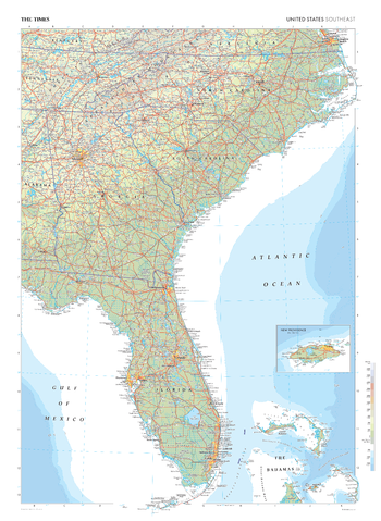
The Times Map of the United States (Southeast)
The Times
This map of the US Southeast stands as a benchmark of cartographic excellence, sourced from the industry-leading Times Comprehensive Atlas of the World. Published in full colour, this map offers a comprehensive and updated view of the landscapes that characterise this region. Encompassing states such as Florida, Georgia, North and South Carolina and cities including: Miami, Orlando and Atlanta. Notably, the map includes an inset map of New Providence, adding an extra layer of detail to this island in the Bahamas. With meticulous attention to detail, this map is an indispensable guide to the geographic intricacies of Southeast US.
Page Size: 26.75 x 36.5 in (675 x 924 mm)
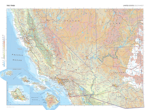
The Times Map of the United States (Southeast)
The Times
This map of the US Southwest stands as a benchmark of cartographic excellence, sourced from the industry-leading Times Comprehensive Atlas of the World. Published in full colour, this map offers a comprehensive and updated view of the diverse landscapes that characterise this region. Encompassing states such as California, Arizona, Utah, Nevada, and more, this map includes prominent features such as the Great Basin, the Sierra Nevada mountain range, Central Valley and cities including: Phoenix, Los Angeles and San Francisco. An additional inset map also shows the Hawai'ian Islands adding further detail to this state. With meticulous attention to detail, this map is an indispensable guide to the geographic intricacies of the US Southwest.
Page Size: 36.5 x 26.75 in (924 x 675 mm)
The Times Map of the United States (Southeast) - Compact
The Times
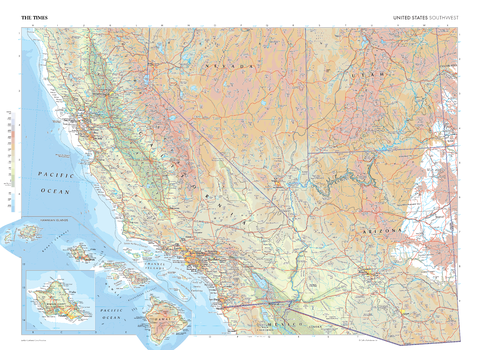
This map of the US Southwest stands as a benchmark of cartographic excellence, sourced from the industry-leading Times Comprehensive Atlas of the World. Published in full colour, this map offers a comprehensive and updated view of the diverse landscapes that characterise this region. Encompassing states such as California, Arizona, Utah, Nevada, and more, this map includes prominent features such as the Great Basin, the Sierra Nevada mountain range, Central Valley and cities including: Phoenix, Los Angeles and San Francisco. An additional inset map also shows the Hawai'ian Islands adding further detail to this state. With meticulous attention to detail, this map is an indispensable guide to the geographic intricacies of the US Southwest.
Page Size: 22.25 x 16.25 in (561 x 410 mm)
The Times Map of the United States (Southeast) - Compact
The Times
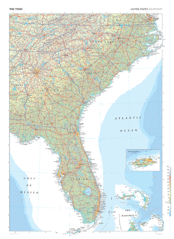
This map of the US Southeast stands as a benchmark of cartographic excellence, sourced from the industry-leading Times Comprehensive Atlas of the World. Published in full colour, this map offers a comprehensive and updated view of the landscapes that characterise this region. Encompassing states such as Florida, Georgia, North and South Carolina and cities including: Miami, Orlando and Atlanta. Notably, the map includes an inset map of New Providence, adding an extra layer of detail to this island in the Bahamas. With meticulous attention to detail, this map is an indispensable guide to the geographic intricacies of Southeast US.
Page Size: 16.25 x 22.25 in (410 x 561 mm)
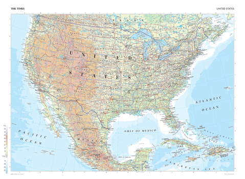
The Times Map of the United States - Compact
The Times
This map of the United States is a benchmark of cartographic excellence, taken from the industry leading Times Comprehensive Atlas of the World. There is a high level of detail packed into the map, yet the positioning of every element is carefully chosen to make the map coherent and attractive. Major cities such as New York City, Los Angeles, Chicago and Houston are easily identifiable, as is the capital, Washington D.C. International borders are clearly marked as are state borders. Geographical features including the Rocky Mountain range and major lakes are also shown. Each element is carefully chosen to make the map a coherent and attractive visual guide to the United States.
Page Size: 22.25 x 16.25 in (561 x 410 mm)
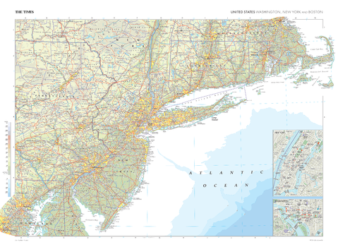
The Times Map of the Washington, New York and Boston (United States)
The Times
This map of Washington, New York, and Boston in the US stands as a benchmark of cartographic excellence, sourced from the industry-leading Times Comprehensive Atlas of the World. Published in full colour, this map offers a comprehensive and updated view of states including Pennsylvania, Washington, New York, New Jersey, Connecticut and Massachusetts. This plate also includes prominent features on the US east coast such as the iconic cities of New York City and Washington D.C., both shown with street level detail from inset city plans, the Appalachian Mountains and Long Island Sound. With meticulous attention to detail, this map is an indispensable guide to the geographic intricacies of Washington, New York, and Boston.
Page Size: 36.5 x 26.75 in (924 x 675 mm)
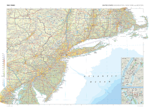
The Times Map of the Washington, New York and Boston (United States) - Compact
The Times
This map of Washington, New York, and Boston in the US stands as a benchmark of cartographic excellence, sourced from the industry-leading Times Comprehensive Atlas of the World. Published in full colour, this map offers a comprehensive and updated view of states including Pennsylvania, Washington, New York, New Jersey, Connecticut and Massachusetts. This plate also includes prominent features on the US east coast such as the iconic cities of New York City and Washington D.C., both shown with street level detail from inset city plans, the Appalachian Mountains and Long Island Sound. With meticulous attention to detail, this map is an indispensable guide to the geographic intricacies of Washington, New York, and Boston.
Page Size: 22.25 x 16.25 in (561 x 410 mm)
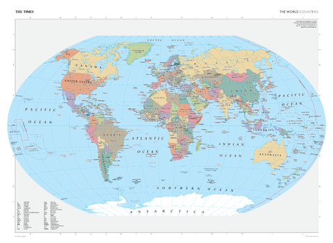
The Times Map of the World (Countries)
The Times
This world map has been fully revised and updated to show the most up to date country boundaries. Clearly identifying each country and marking them in contrasting colours, this map is readily accessible to the general reader who needs an up-to-date map to follow reports of world events in newspapers, on radio and on the television. All country names are written in full in English, where space allows, with an additional key provided when initials are used. Capital cities are also clearly marked, as are additional major cities within each country. It is perfect for the home and office.
Page Size: 36.5 x 26.75 in (924 x 675 mm)
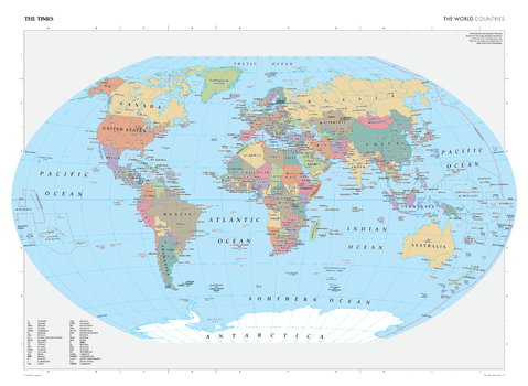
The Times Map of the World (Countries) - Compact
The Times
This world map has been fully revised and updated to show the most up to date country boundaries. Clearly identifying each country and marking them in contrasting colours, this map is readily accessible to the general reader who needs an up-to-date map to follow reports of world events in newspapers, on radio and on the television. All country names are written in full in English, where space allows, with an additional key provided when initials are used. Capital cities are also clearly marked, as are additional major cities within each country. It is perfect for the home and office.
Page Size: 22.25 x 16.25 in (561 x 410 mm)
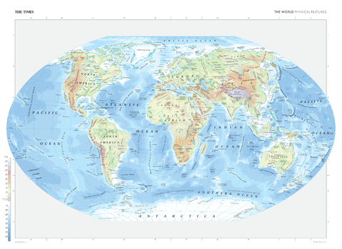
The Times Map of the World (Physical Features)
The Times
This map contains all major geographical features of the world including deserts, mountain ranges, oceans, and lakes. Local name forms are used for all towns and cities with the English or historical alternative shown in brackets e.g. Qingzang Gaoyuan (Plateau of Tibet) when needed. Continents are clearly marked, as are seas and oceans. This makes the map readily accessible to the general reader who needs an up-to-date map to follow reports of world events in newspapers, on radio and television. It is perfect for the home and office.
Page Size: 36.5 x 26.75 in (924 x 675 mm)
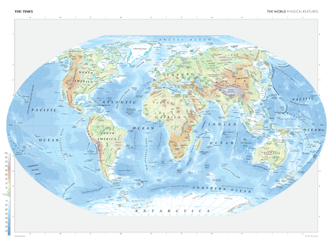
The Times Map of the World (Physical Features) - Compact
The Times
This map contains all major geographical features of the world including deserts, mountain ranges, oceans, and lakes. Local name forms are used for all towns and cities with the English or historical alternative shown in brackets e.g. Qingzang Gaoyuan (Plateau of Tibet) when needed. Continents are clearly marked, as are seas and oceans. This makes the map readily accessible to the general reader who needs an up-to-date map to follow reports of world events in newspapers, on radio and television. It is perfect for the home and office.
Page Size: 22.25 x 16.25 in (561 x 410 mm)
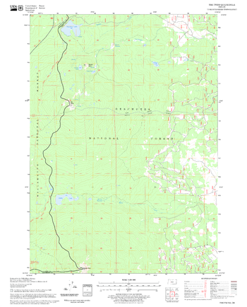
The Twins Quadrangle, Oregon
United States Forest Service
United States Department of Agriculture Forestry Service topographical map of The Twins, Deschutes National Forest, Oregon.
Page Size: 21.75 x 27 in (552 x 686 mm)
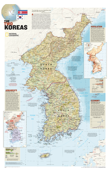
The Two Koreas
National Geographic
Korea was divided in 1948 following World War II, but war erupted again in 1950 when North Korea invaded South Korea. Decades later, old tensions still exist across the fragile Demilitarized Zone that separates the communist north from the democratic south. This attractive political map contains information about the population, economy, and armaments of the two countries. Published in July 2003 as half of a two-map set with "The Forgotten War: Three Long Years in Korea." Reprinted in 2007.
Page Size: 23.25 x 36 in (588 x 909 mm)
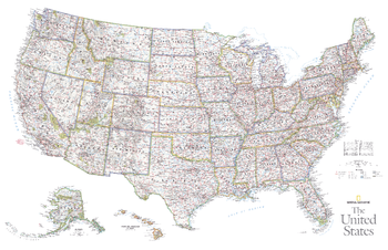
The United States - Published 2006
National Geographic
This vibrant political map of the United States was published in October 2006 as half of a two–map set with a physical map of the country. Features state boundaries, cities, highways, airports, and national parks.
Page Size: 37.25 x 24 in (946 x 610 mm)
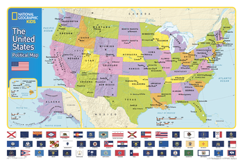
The United States for Kids
National Geographic
National Geographic's The United States for Kids wall map is an enticing and engaging United States map perfect for classroom, home or library. Recommended by geography educators for ages 7 - 12, this map features an optimized map design for readability and easy, intuitive learning. All 50 states and the District of Columbia are shown with their official, colorful flags, The flags are arranged in alphabetical order for ease-of-use. Expertly researched, The United States for Kids map is an essential reference tool for today's well informed student of geography.
Page Size: 36 x 24 in (914 x 610 mm)
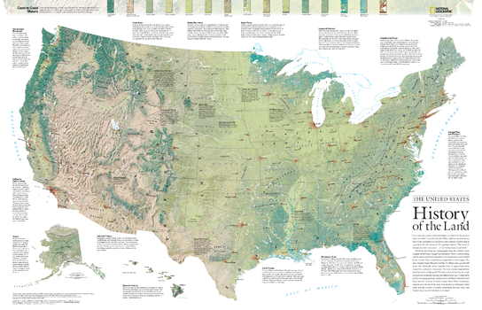
The United States, History of the Land - Published 2006
National Geographic
Viewed in one sweep on a topographical map, the United States seems roughly divided into a jagged mountainous West, a central rolling prairie, and an East both muscled by the Appalachians and soothed by the Coastal Plain. Grand forces of tectonic shifts, glaciation, and lava flows shaped those broad stages. This detailed physical map of the United States depicts the wide range of land cover including forests, grasslands, row crops, bare ground, wetlands and more. Published in October 2006 as half of a two-map set with a political map of the United States.
Page Size: 37.25 x 24 in (945 x 609 mm)
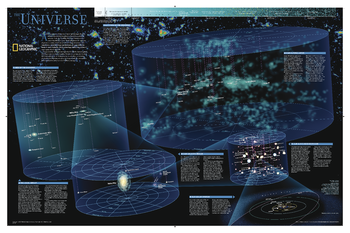
The Universe
National Geographic
As far as we can see with our ever-improving telescopes, there are at least a hundred billion galaxies arrayed throughout the universe. Each, like the Milky Way, is an island galaxy containing billions of stars. This map uses graphic leaps of scales to show how our solar system fits within the vastness of the universe. The map also includes a universe timeline and a description of its evolution.
Page Size: 31.25 x 20.25 in (794 x 514 mm)
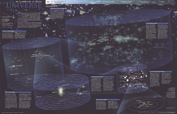
The Universe - Published 1999
National Geographic
Published in October 1999, this fascinating poster contains five maps of our solar system and beyond including: the solar system, our sun's neighborhood, our galactic realm, our local group, and our supercluster. Half of a two-map set in the "Millennium In Maps" series, its companion map entitled "The Milky Way" is also available. Together, the two maps present a striking portrait of the universe as we know it and a hint at what might lie beyond.
Page Size: 31.25 x 20.25 in (793 x 511 mm)
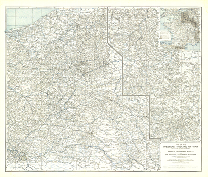
The Western Theatre of War - Published 1918
National Geographic
Printed in May 1918 a short time before the end of World War I, this map shows the western theatre of war in France and Belgium. Details of battle lines make this map a unique and compelling historical piece perfect for collectors.
Page Size: 33 x 28 in (834 x 711 mm)
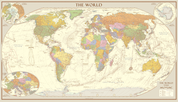
The World
Sparrow Maps
A political map of the world in muted colours with hill shading giving a vintage look. Capital cities and other major cities are shown together with major physical features, roads and airports. Insets of the Arctic and Antarctica and an enlargement of Central Europe. The map also includes world time zones and explanatory notes about the Tropics of Cancer and Capricorn, the Arctic and Antarctic Circles as well as an analemma which shows which day of the year the sun is directly overhead and how sun time compares to clock time. A beautiful map with present day content but made to look old.
Page Size: 39.5 x 22.75 in (1000 x 575 mm)
No search results