


MapSherpa Catalog

Telegraphs Manitoba, Saskatchewan and Alberta (1906)
Natural Resources Canada
Contained within the 1st Edition (1906) Atlas of the Canada is a map that shows the telegraph network for Manitoba, Saskatchewan, and Alberta. Two or more lines may follow the same route, but only one line is indicated on the map. Therefore, well-settled portions of the country may have two or three telegraph lines serving the principal towns along each route indicated. Most telegraph lines follow alongside railway lines. Major cities, counties, rivers, major bodies of water and the railway systems are also included. The map displays the rectangular survey system which records the land that is available to the public. This grid like system is divided into sections, townships, range, and meridian from mid-Manitoba to Alberta.
Page Size: 24 x 17.25 in (609 x 434 mm)

Telegraphs Ontario and Quebec (1906)
Natural Resources Canada
Contained within the 1st Edition (1906) of the Atlas of Canada is a map that shows the telegraph network for Ontario and western Quebec. Two or more lines may follow the same route, but only one line is indicated on the map. Therefore, well-settled portions of the country like Southern Ontario and Southern Quebec may have two or three telegraph lines serving the principal towns along each route indicated. Most telegraph lines follow alongside railway lines. The map indicates the shore portions of the various cable lines. It also includes major cities, counties, rivers, major bodies of water the railway systems.
Page Size: 24.25 x 17.25 in (610 x 434 mm)

Telegraphs Quebec and Maritime Provinces (1906)
Natural Resources Canada
Contained within the 1st Edition (1906) of the Atlas of Canada is a map that shows the network and destinations of telegraph lines in Quebec and Maritime Provinces. More then one line may have followed the same route, but only one line is indicated on the map, especially in larger cities. Therefore, well-settled portions of the country are likely to have more then one telegraph line serving the principal towns along each route indicated. Most telegraph lines are alongside railways. The map includes the routes and destinations of underwater cables. It also indicates the shore portions of the various cable lines, including the Marconi stations on the Atlantic coast of Canada, magnified and placed in the bottom left corner. The map also includes major cities, counties, rivers, major bodies of water and the railway system.
Page Size: 24 x 17.25 in (608 x 434 mm)

Telephones Maritime Provinces and Quebec (1906)
Natural Resources Canada
Contained within the 1st Edition (1906) of the Atlas of Canada is a map that shows the telephone network for the Maritime Provinces and Quebec circa 1906. Due to the scale of the map the inclusion of all the telephone lines in the vicinity of the larger cities and towns were not permitted. Thus, several lines may follow the same route, but only one line is indicated on the map. The map shows the shore line portions of various cable lines running along the Atlantic coast of Canada. Some telephone lines follow alongside railway networks, while their paths and end nodes are displayed as grey/purple thick lines. The map also includes major cities, counties, rivers, major bodies of water, the railway systems running past the border and into part of the U.S.
Page Size: 24 x 17.25 in (608 x 434 mm)

Telephones Ontario, Quebec, Western Canada and Yukon (1906)
Natural Resources Canada
Contained within the 1st Edition (1906) of the Atlas of Canada is a plate that shows five maps. The maps show the telephone network for Ontario, Quebec, Manitoba, Saskatchewan, Alberta, British Columbia and Yukon. Two or more lines may follow the same route, but due to the scale of the map the inclusion of all the telephone lines in the vicinity of the larger cities and towns were not permitted. The telephone lines and their end nodes are represented as solid grey lines, and many lines follow alongside railway tracks. The map indicates the shore line portions of the various cable lines, the Pacific ocean in British Columbia, and inland waters in Alberta, central Saskatchewan, and Manitoba. Each segment is magnified into separate boundaries, and divided from one another. The maps includes major cities, counties, rivers, major bodies of water, and the railway systems running past the border and into part of the U.S.
Page Size: 17.25 x 24.25 in (434 x 612 mm)
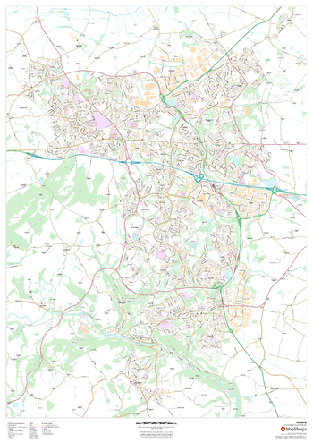
Telford
MapSherpa
This map of Telford shows detailed street level information including extensive street labelling. Ideal for planning of deliveries, home services, sales territories, real estate and much more.
Page Size: 33.25 x 47 in (841 x 1189 mm)
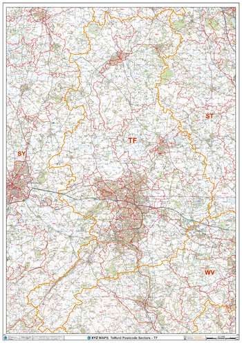
Telford - TF - Postcode Wall Map
XYZ Maps
The Telford Postcode Sector Wall Map shows detailed postcode sector boundaries (E1 1, E1 2) on a comprehensive background and is perfect for determining postcode boundaries for sales areas, planning mailshots and also an excellent reference for logistics. This wall map covers the whole of the E Postcode Area.
Page Size: 33.25 x 47 in (841 x 1189 mm)
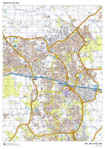
Telford A-Z Street Map
A-Z Maps
This up-to-date A-Z street map covers Telford, including the town centre together with the surrounding districts of Dawley, Donnington, Hadley, Ketley, and Wellington.
Page Size: 23.5 x 33.25 in (594 x 841 mm)
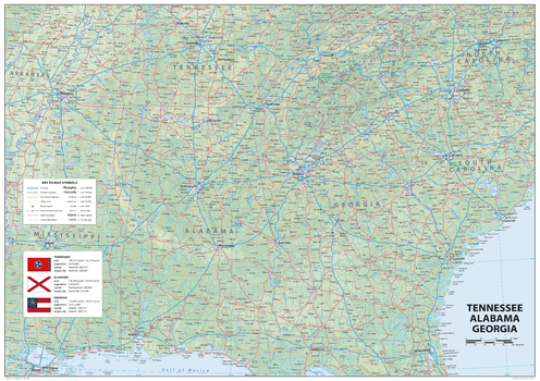
Tennessee Alabama Georgia
Sparrow Maps
A detailed physical map of Tennessee, Alabama and Georgia, USA, with land cover and relief features and including National Parks showing administrative divisions, state capitals, county seats and other settlements, roads and airports. The state flag, area and population are included for each state. One of a series of attractive maps of US states giving a comprehensive overview.
Page Size: 33.25 x 23.5 in (841 x 594 mm)
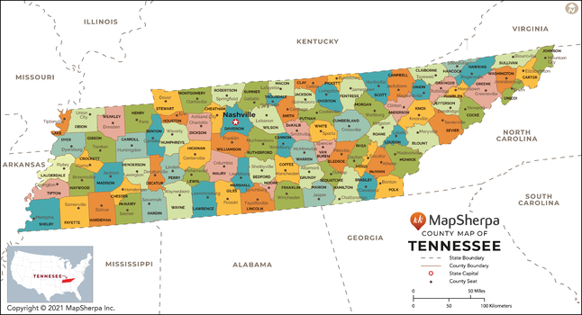
Tennessee Counties Map - Extra Large
MapSherpa
This map has been created exclusively for MapSherpa, and designed for reference or business use. Clear and clean colors & fonts matched with cartographic research makes this map of Tennessee Counties Map easily readable and useful. The map shows the 95 counties of Tennessee and their borders across the Volunteer State.
Page Size: 60 x 32.5 in (1524 x 825 mm)
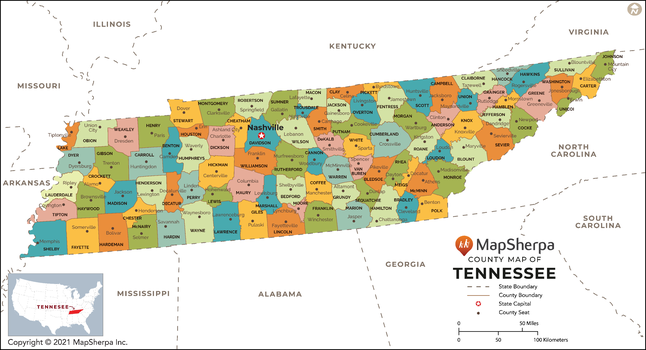
Tennessee Counties Map - Large
MapSherpa
This map has been created exclusively for MapSherpa, and designed for reference or business use. Clear and clean colors & fonts matched with cartographic research makes this map of Tennessee Counties Map easily readable and useful. The map shows the 95 counties of Tennessee and their borders across the Volunteer State.
Page Size: 48 x 26 in (1219 x 660 mm)
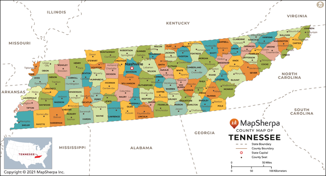
Tennessee Counties Map - Standard
MapSherpa
This map has been created exclusively for MapSherpa, and designed for reference or business use. Clear and clean colors & fonts matched with cartographic research makes this map of Tennessee Counties Map easily readable and useful. The map shows the 95 counties of Tennessee and their borders across the Volunteer State.
Page Size: 36 x 19.5 in (914 x 495 mm)
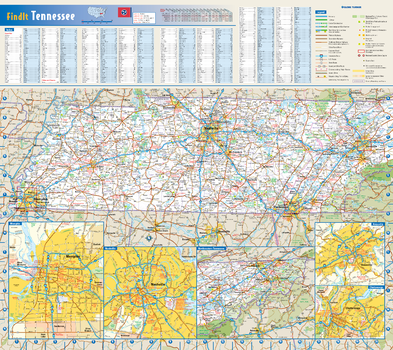
Tennessee State Wall Map
Globe Turner
This colorful, easy-to-read state map of Tennessee identifies all major thoroughfares, secondary roads, freeway interchanges, rest areas, distance markers, landmarks, recreational areas, and more. Shaded relief on the state map provides a three-dimensional sense of Tennessee's topography. Detailed city inset maps of Chattanooga, Knoxville, Memphis, and Nashville are based on the latest street information from our cartographic experts. County and city indices make it simple to locate even the smallest town.
Page Size: 20.75 x 18.5 in (524 x 467 mm)
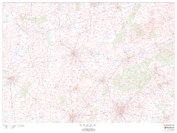
Tennessee ZIP Code Map
MapSherpa
This map of Tennessee shows ZIP codes overlaid on a road map. Base map features include county boundaries, major road network features, and state and national parks and conservation areas.
Page Size: 48 x 36 in (1219 x 914 mm)
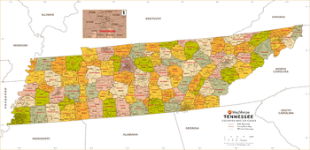
Tennessee ZIP Code Map with Counties - Extra Large
MapSherpa
This map has been created exclusively for MapSherpa, and designed for business or reference use. Clear and clean colors & fonts matched with cartographic research makes this Tennessee Zip Code Map with Counties easily readable and useful. The map shows the 95 counties of Tennessee and the borders of the 627 zip codes across the Volunteer State.
Page Size: 60 x 29.25 in (1524 x 739 mm)
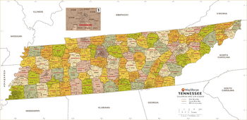
Tennessee ZIP Code Map with Counties - Large
MapSherpa
This map has been created exclusively for MapSherpa, and designed for business or reference use. Clear and clean colors & fonts matched with cartographic research makes this Tennessee Zip Code Map with Counties easily readable and useful. The map shows the 95 counties of Tennessee and the borders of the 627 zip codes across the Volunteer State.
Page Size: 48 x 23.5 in (1219 x 591 mm)
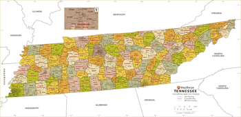
Tennessee ZIP Code Map with Counties - Standard
MapSherpa
This map has been created exclusively for MapSherpa, and designed for business or reference use. Clear and clean colors & fonts matched with cartographic research makes this Tennessee Zip Code Map with Counties easily readable and useful. The map shows the 95 counties of Tennessee and the borders of the 627 zip codes across the Volunteer State.
Page Size: 36 x 17.5 in (914 x 443 mm)
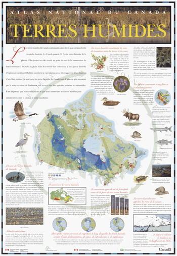
Terres humides
Natural Resources Canada
La série de cartes-affiches de l'Atlas du Canada contient une affiche qui décrit la nature des terres humides, en utilisant des photos et du texte pour décrire divers types de terres humides. Une autre série de photos et de textes décrit l'importance des terres humides et les pressions exercées sur les zones humides par les activités humaines. La carte centrale sur l'affiche, une carte du Canada à l'échelle d'environ 1: 20 000 000, montre la répartition des terres humides au Canada et les voies de migration des oiseaux migrateurs (car ces oiseaux dépendent fortement des terres humides pour migrer).
Page Size: 26.75 x 38.75 in (679 x 984 mm)

Territorial Divisions (1906)
Natural Resources Canada
Contained within the 1st Edition (1906) of the Atlas of Canada is a map that shows the territorial divisions of Canada. The map displays 1,922.735 sq. miles of unsettled North West Territories, covering what is now Northern Ontario. In addition to this is the northern half of Quebec, which includes the southern part of Labrador. Manitoba is considerably smaller with its width mainly in the south, but only going a third as far north to the middle of Lake Winnipeg. Using a variety of colours the map emphasizes large proportion of the Dominion in the North West Territories, and well as the other territorial divisions. The boundaries of the Yukon, British Columbia, Alberta, Saskatchewan, New Brunswick, Nova Scotia and Prince Edward Island, is represented as they are found in the present day. Newfoundland is not yet a part of Canada, thus omitted as one of the Canadian provinces.
Page Size: 24 x 17 in (604 x 432 mm)
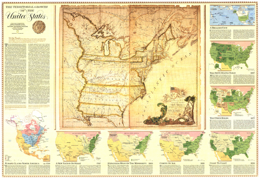
Territorial Growth of the United States - Published 1987
National Geographic
Explore the growth of the United States from its thirteen original colonies to its present range. This map features eight individual insets higlighting various historical periods, and also contains an antique 1783 map of the the country. Published in September 1987 as half of a two-map set with the "United States" map.
Page Size: 42.5 x 29.25 in (1077 x 742 mm)
No search results