


MapSherpa Catalog
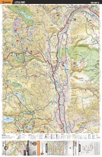
TOBC33 Little Fort - Thompson Okanagan BC Topo Map
Backroad Mapbooks
This recreation topographic map for the Little Fort area highlights all the logging roads, trails and recreational Points of Interest including hunting, camping, hiking, mountain biking, canoeing, kayaking, backcountry skiing, snowshoeing, cross-country skiing, wildlife viewing, ATVing, snowmobiling and more. No other map for the area provides you with this level of recreational or topographic detail. Special features include private land and countless roads, trails and recreational Points of Interest. Covering 1,950 km2 (750 mi2) in total, this 1:65,000 scale map measures 38 x 51 km (23.5 x 32 mi) and includes Little Fort, Dunn Peak Protected Area, Emar Lakes Provincial Park, North Thompson River, Taweel Provincial Park and more!
Page Size: 24 x 37 in (610 x 940 mm)
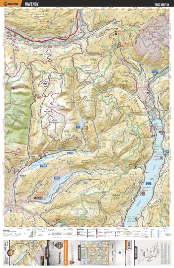
TOBC34 Vavenby - Thompson Okanagan BC Topo Map
Backroad Mapbooks
This recreation topographic map for the Vavenby area highlights all the logging roads, trails and recreational Points of Interest including hunting, camping, hiking, mountain biking, canoeing, kayaking, backcountry skiing, snowshoeing, cross-country skiing, wildlife viewing, ATVing, snowmobiling and more. No other map for the area provides you with this level of recreational or topographic detail. Special features include private land and countless roads, trails and recreational Points of Interest. Covering 1,950 km2 (750 mi2) in total, this 1:65,000 scale map measures 38 x 51 km (23.5 x 32 mi) and includes Adams Lake, North Thompson River, North Barriere Lake, East Barrie Lake, Dunn Peak Protected Area and more!
Page Size: 24 x 37 in (610 x 940 mm)
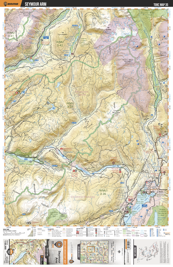
TOBC35 Seymour Arm - Thompson Okanagan BC Topo Map
Backroad Mapbooks
This recreation topographic map for the Seymour Arm area highlights all the logging roads, trails and recreational Points of Interest including hunting, camping, hiking, mountain biking, canoeing, kayaking, backcountry skiing, snowshoeing, cross-country skiing, wildlife viewing, ATVing, snowmobiling and more. No other map for the area provides you with this level of recreational or topographic detail. Special features include private land and countless roads, trails and recreational Points of Interest. Covering 1,950 km2 (750 mi2) in total, this 1:65,000 scale map measures 38 x 51 km (23.5 x 32 mi) and includes Seymour Arm, Anstey Hunakwa Provincial Park, Shuswap Lake, Hugamilt Lake, Seymout River, Upper Seymour River Provincial Park and more!
Page Size: 24 x 37 in (610 x 940 mm)
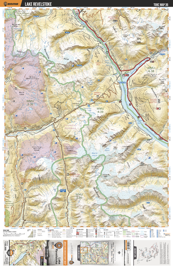
TOBC36 Lake Revelstoke - Thompson Okanagan BC Topo Map
Backroad Mapbooks
This recreation topographic map for the Lake Revelstoke area highlights all the logging roads, trails and recreational Points of Interest including hunting, camping, hiking, mountain biking, canoeing, kayaking, backcountry skiing, snowshoeing, cross-country skiing, wildlife viewing, ATVing, snowmobiling and more. No other map for the area provides you with this level of recreational or topographic detail. Special features include private land and countless roads, trails and recreational Points of Interest. Covering 1,950 km2 (750 mi2) in total, this 1:65,000 scale map measures 38 x 51 km (23.5 x 32 mi) and includes Lake Revelstoke, Lake Revelstoke, Upper Seymour River Provincial Park, Downie Arm, Perry River, Caribou Basin and more!
Page Size: 24 x 37 in (610 x 940 mm)
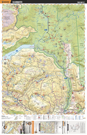
TOBC37 Clearwater - Thompson Okanagan BC Topo Map
Backroad Mapbooks
This recreation topographic map for the Clearwater area highlights all the logging roads, trails and recreational Points of Interest including hunting, camping, hiking, mountain biking, canoeing, kayaking, backcountry skiing, snowshoeing, cross-country skiing, wildlife viewing, ATVing, snowmobiling and more. No other map for the area provides you with this level of recreational or topographic detail. Special features include private land and countless roads, trails and recreational Points of Interest. Covering 1,950 km2 (750 mi2) in total, this 1:65,000 scale map measures 38 x 51 km (23.5 x 32 mi) and includes Clearwater, Mahood Lake, Clearwater River, Mahood River, Spanish Lake, Pendelton Lakes, Reflector Lake, Wells Gray Provincial Park and more!
Page Size: 24 x 37 in (610 x 940 mm)
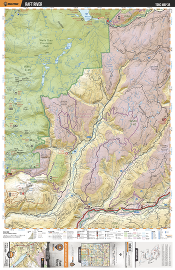
TOBC38 Raft River - Thompson Okanagan BC Topo Map
Backroad Mapbooks
This recreation topographic map for the Raft River area highlights all the logging roads, trails and recreational Points of Interest including hunting, camping, hiking, mountain biking, canoeing, kayaking, backcountry skiing, snowshoeing, cross-country skiing, wildlife viewing, ATVing, snowmobiling and more. No other map for the area provides you with this level of recreational or topographic detail. Special features include private land and countless roads, trails and recreational Points of Interest. Covering 1,950 km2 (750 mi2) in total, this 1:65,000 scale map measures 38 x 51 km (23.5 x 32 mi) and includes Raft River, Wells Gray Provincial Park, North Thompson River, Mad River, Murtle Lake, Callgata Lake Provincial Park and more!
Page Size: 24 x 37 in (610 x 940 mm)
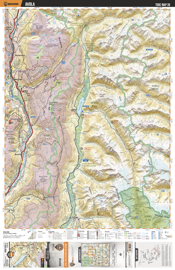
TOBC39 Avola - Thompson Okanagan BC Topo Map
Backroad Mapbooks
This recreation topographic map for the Avola area highlights all the logging roads, trails and recreational Points of Interest including hunting, camping, hiking, mountain biking, canoeing, kayaking, backcountry skiing, snowshoeing, cross-country skiing, wildlife viewing, ATVing, snowmobiling and more. No other map for the area provides you with this level of recreational or topographic detail. Special features include private land and countless roads, trails and recreational Points of Interest. Covering 1,950 km2 (750 mi2) in total, this 1:65,000 scale map measures 38 x 51 km (23.5 x 32 mi) and includes Avola, Adams River, Finn Creek Provincial Park, Upper Adams River Provincial Park, Wire Cache Provincial Park and more!
Page Size: 24 x 37 in (610 x 940 mm)
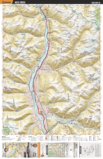
TOBC40 Mica Creek - Thompson Okanagan BC Topo Map
Backroad Mapbooks
This recreation topographic map for the Mica Creek area highlights all the logging roads, trails and recreational Points of Interest including hunting, camping, hiking, mountain biking, canoeing, kayaking, backcountry skiing, snowshoeing, cross-country skiing, wildlife viewing, ATVing, snowmobiling and more. No other map for the area provides you with this level of recreational or topographic detail. Special features include private land and countless roads, trails and recreational Points of Interest. Covering 1,950 km2 (750 mi2) in total, this 1:65,000 scale map measures 38 x 51 km (23.5 x 32 mi) and includes Mica Creek, Lake Revelstoke, Goldstream River, Mculloch Creek, Bigmouth Creek, French Creek, Pat Creek and more!
Page Size: 24 x 37 in (610 x 940 mm)
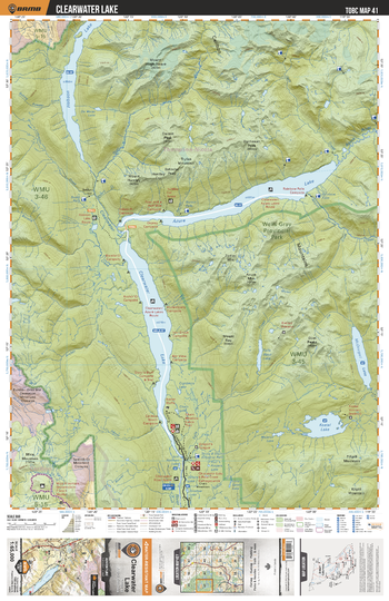
TOBC41 Clearwater Lake - Thompson Okanagan BC Topo Map
Backroad Mapbooks
This recreation topographic map for the Clearwater Lake area highlights all the logging roads, trails and recreational Points of Interest including hunting, camping, hiking, mountain biking, canoeing, kayaking, backcountry skiing, snowshoeing, cross-country skiing, wildlife viewing, ATVing, snowmobiling and more. No other map for the area provides you with this level of recreational or topographic detail. Special features include private land and countless roads, trails and recreational Points of Interest. Covering 1,950 km2 (750 mi2) in total, this 1:65,000 scale map measures 38 x 51 km (23.5 x 32 mi) and includes Clearwater Lake, Azure Lake, Hobson Lake, Wells Gray Provincial Park, Clearwater River, Goat Creek, Kostal Lake and more!
Page Size: 24 x 37 in (610 x 940 mm)
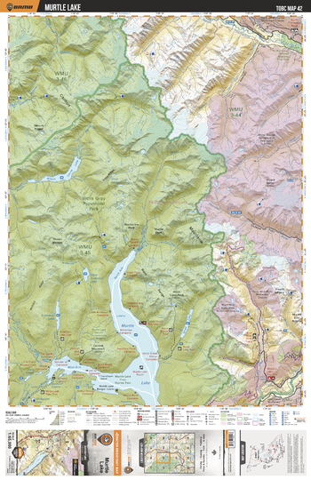
TOBC42 Murtle Lake - Thompson Okanagan BC Topo Map
Backroad Mapbooks
This recreation topographic map for the Murtle Lake area highlights all the logging roads, trails and recreational Points of Interest including hunting, camping, hiking, mountain biking, canoeing, kayaking, backcountry skiing, snowshoeing, cross-country skiing, wildlife viewing, ATVing, snowmobiling and more. No other map for the area provides you with this level of recreational or topographic detail. Special features include private land and countless roads, trails and recreational Points of Interest. Covering 1,950 km2 (750 mi2) in total, this 1:65,000 scale map measures 38 x 51 km (23.5 x 32 mi) and includes Murtle Lake, Thunder River, Murtle River, Angus Horne Lake, Azure River, North Thompson Oxbows Manteau Provinbcial Park and more!
Page Size: 24 x 37 in (610 x 940 mm)
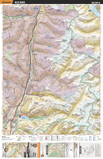
TOBC43 Blue River - Thompson Okanagan BC Topo Map
Backroad Mapbooks
This recreation topographic map for the Blue River area highlights all the logging roads, trails and recreational Points of Interest including hunting, camping, hiking, mountain biking, canoeing, kayaking, backcountry skiing, snowshoeing, cross-country skiing, wildlife viewing, ATVing, snowmobiling and more. No other map for the area provides you with this level of recreational or topographic detail. Special features include private land and countless roads, trails and recreational Points of Interest. Covering 1,950 km2 (750 mi2) in total, this 1:65,000 scale map measures 38 x 51 km (23.5 x 32 mi) and includes Blue River, North Thompson River, Mud Lake, Mud Lake Delta Provincial Park, Blue River Pine Provincial Park and more!
Page Size: 24 x 37 in (610 x 940 mm)
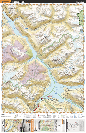
TOBC44 Kinbasket Lake - Thompson Okanagan BC Topo Map
Backroad Mapbooks
This recreation topographic map for the Kinbasket Lake area highlights all the logging roads, trails and recreational Points of Interest including hunting, camping, hiking, mountain biking, canoeing, kayaking, backcountry skiing, snowshoeing, cross-country skiing, wildlife viewing, ATVing, snowmobiling and more. No other map for the area provides you with this level of recreational or topographic detail. Special features include private land and countless roads, trails and recreational Points of Interest. Covering 1,950 km2 (750 mi2) in total, this 1:65,000 scale map measures 38 x 51 km (23.5 x 32 mi) and includes Kinbasket Lake, Canoe Reach, Jasper National Park, Hugh Allan Creek, Mount Cummins, Foster Arm Protected Area and more!
Page Size: 24 x 37 in (610 x 940 mm)
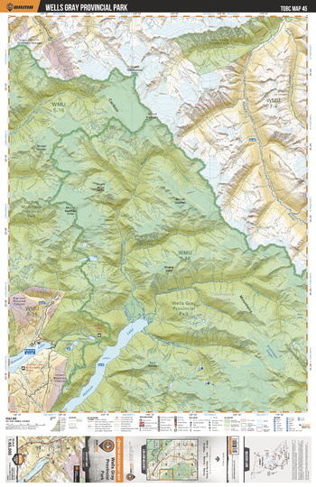
TOBC45 Wells Gray Provincial Park - Thompson Okanagan BC Topo Map
Backroad Mapbooks
This recreation topographic map for the Wells Gray Provincial Park area highlights all the logging roads, trails and recreational Points of Interest including hunting, camping, hiking, mountain biking, canoeing, kayaking, backcountry skiing, snowshoeing, cross-country skiing, wildlife viewing, ATVing, snowmobiling and more. No other map for the area provides you with this level of recreational or topographic detail. Special features include private land and countless roads, trails and recreational Points of Interest. Covering 1,950 km2 (750 mi2) in total, this 1:65,000 scale map measures 38 x 51 km (23.5 x 32 mi) and includes Wells Gray Provincial Park, Cariboo Mountains Provincial Park, Quesnel Lake, Hobson Lake, Raush River, Black Martin Creek and more!
Page Size: 24 x 37 in (610 x 940 mm)
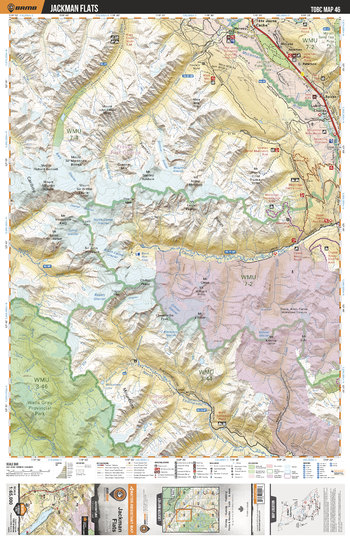
TOBC46 Jackman Flats - Thompson Okanagan BC Topo Map
Backroad Mapbooks
This recreation topographic map for the Jackman Flats area highlights all the logging roads, trails and recreational Points of Interest including hunting, camping, hiking, mountain biking, canoeing, kayaking, backcountry skiing, snowshoeing, cross-country skiing, wildlife viewing, ATVing, snowmobiling and more. No other map for the area provides you with this level of recreational or topographic detail. Special features include private land and countless roads, trails and recreational Points of Interest. Covering 1,950 km2 (750 mi2) in total, this 1:65,000 scale map measures 38 x 51 km (23.5 x 32 mi) and includes Jackman Flats, McLennan River, Canoe River, North Thompson River, Jackman Flats Provincial Park, Kiwa Creek and more!
Page Size: 24 x 37 in (610 x 940 mm)
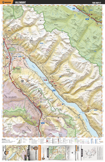
TOBC47 Valemount - Thompson Okanagan BC Topo Map
Backroad Mapbooks
This recreation topographic map for the Valemount area highlights all the logging roads, trails and recreational Points of Interest including hunting, camping, hiking, mountain biking, canoeing, kayaking, backcountry skiing, snowshoeing, cross-country skiing, wildlife viewing, ATVing, snowmobiling and more. No other map for the area provides you with this level of recreational or topographic detail. Special features include private land and countless roads, trails and recreational Points of Interest. Covering 1,950 km2 (750 mi2) in total, this 1:65,000 scale map measures 38 x 51 km (23.5 x 32 mi) and includes Valemont, Mount Robson Provincial Park, Canoe Reach, Mount Terry Fox Provincial Park, Moose Lake, Fraser River and more!
Page Size: 24 x 37 in (610 x 940 mm)
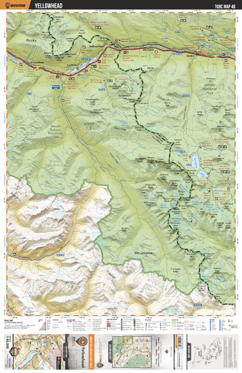
TOBC48 Yellowhead - Thompson Okanagan BC Topo Map
Backroad Mapbooks
This recreation topographic map for the Yellowhead area highlights all the logging roads, trails and recreational Points of Interest including hunting, camping, hiking, mountain biking, canoeing, kayaking, backcountry skiing, snowshoeing, cross-country skiing, wildlife viewing, ATVing, snowmobiling and more. No other map for the area provides you with this level of recreational or topographic detail. Special features include private land and countless roads, trails and recreational Points of Interest. Covering 1,950 km2 (750 mi2) in total, this 1:65,000 scale map measures 38 x 51 km (23.5 x 32 mi) and includes Yellowhead, Mount Robson Provincial Park, Jasper National Park, Ptarmigan Creek, Amathyst Lakes, Yellowhead Lake and more!
Page Size: 24 x 37 in (610 x 940 mm)
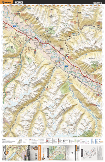
TOBC49 McBride - Thompson Okanagan BC Topo Map
Backroad Mapbooks
This recreation topographic map for the McBride area highlights all the logging roads, trails and recreational Points of Interest including hunting, camping, hiking, mountain biking, canoeing, kayaking, backcountry skiing, snowshoeing, cross-country skiing, wildlife viewing, ATVing, snowmobiling and more. No other map for the area provides you with this level of recreational or topographic detail. Special features include private land and countless roads, trails and recreational Points of Interest. Covering 1,950 km2 (750 mi2) in total, this 1:65,000 scale map measures 38 x 51 km (23.5 x 32 mi) and includes McBride, Fraser River, Sunbeam Creek Ecological Reserve, Dore River, Raush River, Castle Creek, Holmes River and more!
Page Size: 24 x 37 in (610 x 940 mm)
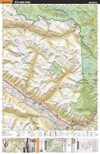
TOBC50 Tete Juane Cache - Thompson Okanagan BC Topo Map
Backroad Mapbooks
This recreation topographic map for the Tete Juane Cache area highlights all the logging roads, trails and recreational Points of Interest including hunting, camping, hiking, mountain biking, canoeing, kayaking, backcountry skiing, snowshoeing, cross-country skiing, wildlife viewing, ATVing, snowmobiling and more. No other map for the area provides you with this level of recreational or topographic detail. Special features include private land and countless roads, trails and recreational Points of Interest. Covering 1,950 km2 (750 mi2) in total, this 1:65,000 scale map measures 38 x 51 km (23.5 x 32 mi) and includes Tete Juane Cache, Mount Robson Provincial Park, Small River Caves Provincial Park, Willmore Wilderness Provincial Park and more!
Page Size: 24 x 37 in (610 x 940 mm)
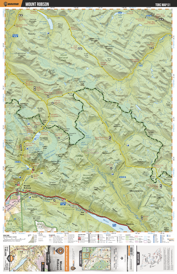
TOBC51 Mount Robson - Thompson Okanagan BC Topo Map
Backroad Mapbooks
This recreation topographic map for the Mount Robson area highlights all the logging roads, trails and recreational Points of Interest including hunting, camping, hiking, mountain biking, canoeing, kayaking, backcountry skiing, snowshoeing, cross-country skiing, wildlife viewing, ATVing, snowmobiling and more. No other map for the area provides you with this level of recreational or topographic detail. Special features include private land and countless roads, trails and recreational Points of Interest. Covering 1,950 km2 (750 mi2) in total, this 1:65,000 scale map measures 38 x 51 km (23.5 x 32 mi) and includes Mount Robson, Fraser River, Moose Lake, Moose River, Robson River, Berg Lake, Jasper National Park, Mount Robson Corridor Protected Area and more!
Page Size: 24 x 37 in (610 x 940 mm)
Tactical Pilotage Charts
MapSherpa
Published by the United States government in the 1980s and 1990s, Tactical Pilotage Charts are topographic maps with detailed aeronautical information. Towns, villages, pipelines, roads, railroads and similar cultural information are also indicated. Coverage includes the Mediterranean, Africa, the Middle East, across the Himalayas to Japan. Individual map sheets have been combined into a seamless layer. Suitable for print maps between 1:250,000 and 1:1,000,000.
No search results