


MapSherpa Catalog
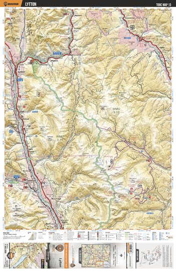
TOBC13 Lytton - Thompson Okanagan BC Topo Map
Backroad Mapbooks
This recreation topographic map for the Lytton area highlights all the logging roads, trails and recreational Points of Interest including hunting, camping, hiking, mountain biking, canoeing, kayaking, backcountry skiing, snowshoeing, cross-country skiing, wildlife viewing, ATVing, snowmobiling and more. No other map for the area provides you with this level of recreational or topographic detail. Special features include private land and countless roads, trails and recreational Points of Interest. Covering 1,950 km2 (750 mi2) in total, this 1:65,000 scale map measures 38 x 51 km (23.5 x 32 mi) and includes Lytton, Nahatlatch River, Fraser River, Thompson River, Nicola River, Skihist Provincial Park, Prospect Creek and more!
Page Size: 24 x 37 in (610 x 940 mm)
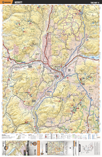
TOBC14 Merrit - Thompson Okanagan BC Topo Map
Backroad Mapbooks
This recreation topographic map for the Merrit area highlights all the logging roads, trails and recreational Points of Interest including hunting, camping, hiking, mountain biking, canoeing, kayaking, backcountry skiing, snowshoeing, cross-country skiing, wildlife viewing, ATVing, snowmobiling and more. No other map for the area provides you with this level of recreational or topographic detail. Special features include private land and countless roads, trails and recreational Points of Interest. Covering 1,950 km2 (750 mi2) in total, this 1:65,000 scale map measures 38 x 51 km (23.5 x 32 mi) and includes Merrit, Nicola Lake, Nicola River, Coldwater Lake, Kentucky Alleyne Provincial Park, Nicola, Lundbom Lake and more!
Page Size: 24 x 37 in (610 x 940 mm)
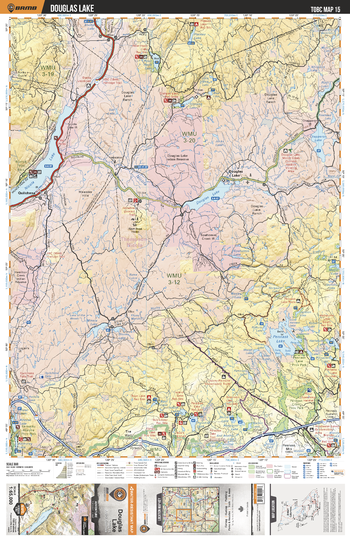
TOBC15 Douglas lake - Thompson Okanagan BC Topo Map
Backroad Mapbooks
This recreation topographic map for the Douglas lake area highlights all the logging roads, trails and recreational Points of Interest including hunting, camping, hiking, mountain biking, canoeing, kayaking, backcountry skiing, snowshoeing, cross-country skiing, wildlife viewing, ATVing, snowmobiling and more. No other map for the area provides you with this level of recreational or topographic detail. Special features include private land and countless roads, trails and recreational Points of Interest. Covering 1,950 km2 (750 mi2) in total, this 1:65,000 scale map measures 38 x 51 km (23.5 x 32 mi) and includes Douglas Lake, Nicola Lake, Chapperon Lake, Pennask Lake, Nicola River, Pennask Creek Provincial Park, Quilchena and more!
Page Size: 24 x 37 in (610 x 940 mm)
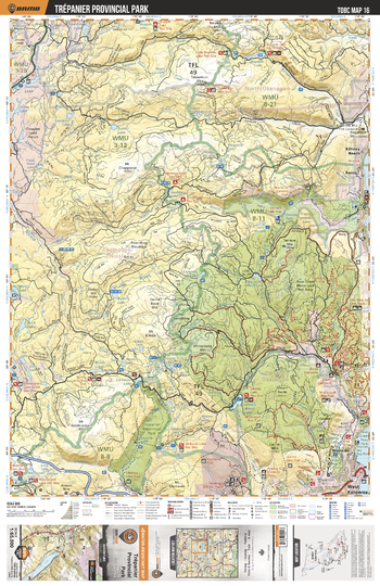
TOBC16 Trepanier Provincial Park - Thompson Okanagan BC Topo Map
Backroad Mapbooks
This recreation topographic map for the Trepanier Provincial Park area highlights all the logging roads, trails and recreational Points of Interest including hunting, camping, hiking, mountain biking, canoeing, kayaking, backcountry skiing, snowshoeing, cross-country skiing, wildlife viewing, ATVing, snowmobiling and more. No other map for the area provides you with this level of recreational or topographic detail. Special features include private land and countless roads, trails and recreational Points of Interest. Covering 1,950 km2 (750 mi2) in total, this 1:65,000 scale map measures 38 x 51 km (23.5 x 32 mi) and includes Trepanier Provicnial Park, Salmon River, Bear Creek Provincial Park, Raymer Bay Regional Park and more!
Page Size: 24 x 37 in (610 x 940 mm)
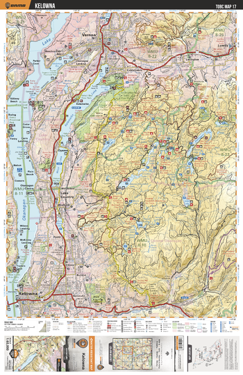
TOBC17 Kelowna - Thompson Okanagan BC Topo Map
Backroad Mapbooks
This recreation topographic map for the Kelowna area highlights all the logging roads, trails and recreational Points of Interest including hunting, camping, hiking, mountain biking, canoeing, kayaking, backcountry skiing, snowshoeing, cross-country skiing, wildlife viewing, ATVing, snowmobiling and more. No other map for the area provides you with this level of recreational or topographic detail. Special features include private land and countless roads, trails and recreational Points of Interest. Covering 1,950 km2 (750 mi2) in total, this 1:65,000 scale map measures 38 x 51 km (23.5 x 32 mi) and includes Kelowna, Kalamalka Lake Provincial Park, Okanagan Lake, Wood Lake, Kalamalka Lake, Rutland, Oyama and more!
Page Size: 24 x 37 in (610 x 940 mm)
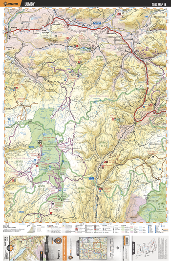
TOBC18 Lumby - Thompson Okanagan BC Topo Map
Backroad Mapbooks
This recreation topographic map for the Lumby area highlights all the logging roads, trails and recreational Points of Interest including hunting, camping, hiking, mountain biking, canoeing, kayaking, backcountry skiing, snowshoeing, cross-country skiing, wildlife viewing, ATVing, snowmobiling and more. No other map for the area provides you with this level of recreational or topographic detail. Special features include private land and countless roads, trails and recreational Points of Interest. Covering 1,950 km2 (750 mi2) in total, this 1:65,000 scale map measures 38 x 51 km (23.5 x 32 mi) and includes Lumby, Graystokes Provincial Park, Granby Provincial Park, Echo Lake Provincial Park, Kettle River and more!
Page Size: 24 x 37 in (610 x 940 mm)
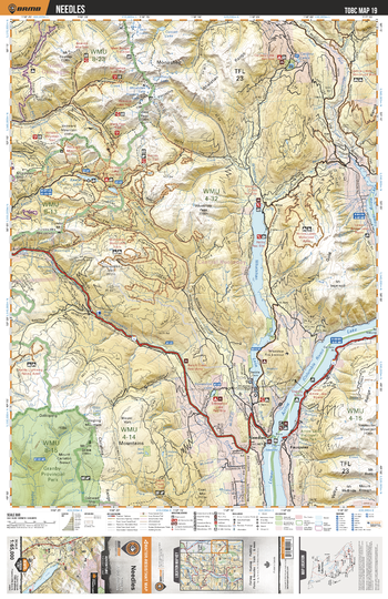
TOBC19 Needles - Thompson Okanagan BC Topo Map
Backroad Mapbooks
This recreation topographic map for the Needles area highlights all the logging roads, trails and recreational Points of Interest including hunting, camping, hiking, mountain biking, canoeing, kayaking, backcountry skiing, snowshoeing, cross-country skiing, wildlife viewing, ATVing, snowmobiling and more. No other map for the area provides you with this level of recreational or topographic detail. Special features include private land and countless roads, trails and recreational Points of Interest. Covering 1,950 km2 (750 mi2) in total, this 1:65,000 scale map measures 38 x 51 km (23.5 x 32 mi) and includes Needles, Lower Arrow Lake, Whatshan Lake, Granby Provincial Park, Arrow Lakes Provincial Park, Lower Arrow Lake and more!
Page Size: 24 x 37 in (610 x 940 mm)
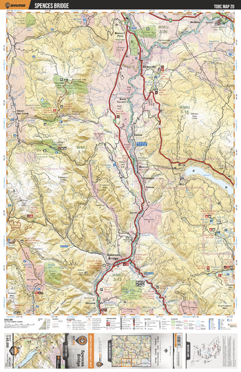
TOBC20 Spences Bridge - Thompson Okanagan BC Topo Map
Backroad Mapbooks
This recreation topographic map for the Spences Bridge area highlights all the logging roads, trails and recreational Points of Interest including hunting, camping, hiking, mountain biking, canoeing, kayaking, backcountry skiing, snowshoeing, cross-country skiing, wildlife viewing, ATVing, snowmobiling and more. No other map for the area provides you with this level of recreational or topographic detail. Special features include private land and countless roads, trails and recreational Points of Interest. Covering 1,950 km2 (750 mi2) in total, this 1:65,000 scale map measures 38 x 51 km (23.5 x 32 mi) and includes Spences Bridge, Thompson River, Nicola River, Skwaha Lake Ecological Reserve, Soap Lake Ecological Reserve and more!
Page Size: 24 x 37 in (610 x 940 mm)
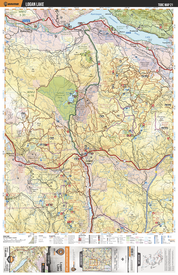
TOBC21 Logan Lake - Thompson Okanagan BC Topo Map
Backroad Mapbooks
This recreation topographic map for the Logan Lake area highlights all the logging roads, trails and recreational Points of Interest including hunting, camping, hiking, mountain biking, canoeing, kayaking, backcountry skiing, snowshoeing, cross-country skiing, wildlife viewing, ATVing, snowmobiling and more. No other map for the area provides you with this level of recreational or topographic detail. Special features include private land and countless roads, trails and recreational Points of Interest. Covering 1,950 km2 (750 mi2) in total, this 1:65,000 scale map measures 38 x 51 km (23.5 x 32 mi) and includes Logan Lake, Kamloops Lake, Thompson River, Tunkwa Provincial Park, Mount Savona Provincial Park, Tunkwa Lake and more!
Page Size: 24 x 37 in (610 x 940 mm)
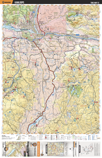
TOBC22 Kamloops - Thompson Okanagan BC Topo Map
Backroad Mapbooks
This recreation topographic map for the Kamloops area highlights all the logging roads, trails and recreational Points of Interest including hunting, camping, hiking, mountain biking, canoeing, kayaking, backcountry skiing, snowshoeing, cross-country skiing, wildlife viewing, ATVing, snowmobiling and more. No other map for the area provides you with this level of recreational or topographic detail. Special features include private land and countless roads, trails and recreational Points of Interest. Covering 1,950 km2 (750 mi2) in total, this 1:65,000 scale map measures 38 x 51 km (23.5 x 32 mi) and includes Kamloops, Paul Lake Provincial Park, Thompson River, Roche Lake Provincial Park, Lac le Jeune Provincial Park and more!
Page Size: 24 x 37 in (610 x 940 mm)
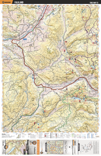
TOBC23 Falkland - Thompson Okanagan BC Topo Map
Backroad Mapbooks
This recreation topographic map for the Falkland area highlights all the logging roads, trails and recreational Points of Interest including hunting, camping, hiking, mountain biking, canoeing, kayaking, backcountry skiing, snowshoeing, cross-country skiing, wildlife viewing, ATVing, snowmobiling and more. No other map for the area provides you with this level of recreational or topographic detail. Special features include private land and countless roads, trails and recreational Points of Interest. Covering 1,950 km2 (750 mi2) in total, this 1:65,000 scale map measures 38 x 51 km (23.5 x 32 mi) and includes Monte Creek, Salmon River, South Thompson River, Pinaus Lake, Monte Lake, Tuktakamin Mountain and more!
Page Size: 24 x 37 in (610 x 940 mm)
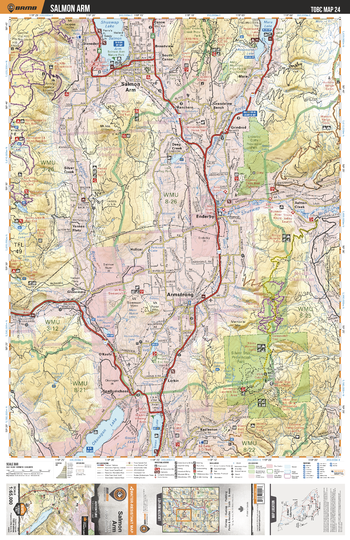
TOBC24 Salmon Arm - Thompson Okanagan BC Topo Map
Backroad Mapbooks
This recreation topographic map for the Salmon Arm area highlights all the logging roads, trails and recreational Points of Interest including hunting, camping, hiking, mountain biking, canoeing, kayaking, backcountry skiing, snowshoeing, cross-country skiing, wildlife viewing, ATVing, snowmobiling and more. No other map for the area provides you with this level of recreational or topographic detail. Special features include private land and countless roads, trails and recreational Points of Interest. Covering 1,950 km2 (750 mi2) in total, this 1:65,000 scale map measures 38 x 51 km (23.5 x 32 mi) and includes Salmon Arm, Okanagan Lake, Silver Star Provincial Park, Enderby Cliffs Provincial Park, Shuswap Lake, Mara Lake and more!
Page Size: 24 x 37 in (610 x 940 mm)
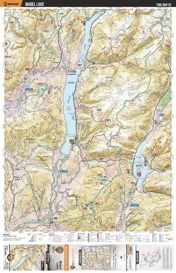
TOBC25 Mabel Lake - Thompson Okanagan BC Topo Map
Backroad Mapbooks
This recreation topographic map for the Mabel Lake area highlights all the logging roads, trails and recreational Points of Interest including hunting, camping, hiking, mountain biking, canoeing, kayaking, backcountry skiing, snowshoeing, cross-country skiing, wildlife viewing, ATVing, snowmobiling and more. No other map for the area provides you with this level of recreational or topographic detail. Special features include private land and countless roads, trails and recreational Points of Interest. Covering 1,950 km2 (750 mi2) in total, this 1:65,000 scale map measures 38 x 51 km (23.5 x 32 mi) and includes Mabel Lake, Shuswap River, Sugar Lake, Mable Lake Provincial Park, Hidden Lake Regional Reserve and more!
Page Size: 24 x 37 in (610 x 940 mm)
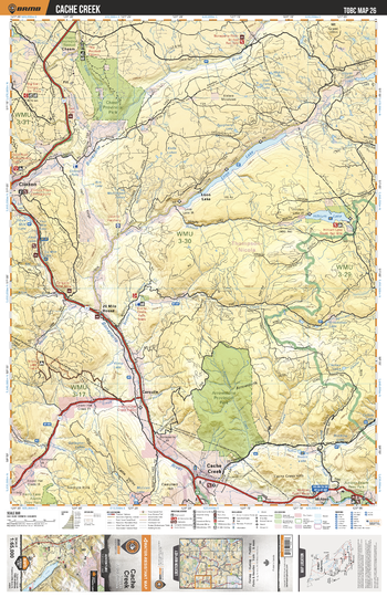
TOBC26 Cache Creek - Thompson Okanagan BC Topo Map
Backroad Mapbooks
This recreation topographic map for the Cache Creek area highlights all the logging roads, trails and recreational Points of Interest including hunting, camping, hiking, mountain biking, canoeing, kayaking, backcountry skiing, snowshoeing, cross-country skiing, wildlife viewing, ATVing, snowmobiling and more. No other map for the area provides you with this level of recreational or topographic detail. Special features include private land and countless roads, trails and recreational Points of Interest. Covering 1,950 km2 (750 mi2) in total, this 1:65,000 scale map measures 38 x 51 km (23.5 x 32 mi) and includes Cache Creek, Chasm Provincial Park, Loon Lake, Boneaparte River, Hihium Lake, Bonaparte River, Arrowstone Provincial Park and more!
Page Size: 24 x 37 in (610 x 940 mm)
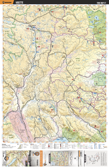
TOBC27 Vidette - Thompson Okanagan BC Topo Map
Backroad Mapbooks
This recreation topographic map for the Vidette area highlights all the logging roads, trails and recreational Points of Interest including hunting, camping, hiking, mountain biking, canoeing, kayaking, backcountry skiing, snowshoeing, cross-country skiing, wildlife viewing, ATVing, snowmobiling and more. No other map for the area provides you with this level of recreational or topographic detail. Special features include private land and countless roads, trails and recreational Points of Interest. Covering 1,950 km2 (750 mi2) in total, this 1:65,000 scale map measures 38 x 51 km (23.5 x 32 mi) and includes Bonaparte Provincial Park, Deadman River, Kamloops Lake, Tranquille River, Porcupine Meadows Provincial Park and more!
Page Size: 24 x 37 in (610 x 940 mm)
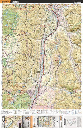
TOBC28 Barriere - Thompson Okanagan BC Topo Map
Backroad Mapbooks
This recreation topographic map for the Barriere area highlights all the logging roads, trails and recreational Points of Interest including hunting, camping, hiking, mountain biking, canoeing, kayaking, backcountry skiing, snowshoeing, cross-country skiing, wildlife viewing, ATVing, snowmobiling and more. No other map for the area provides you with this level of recreational or topographic detail. Special features include private land and countless roads, trails and recreational Points of Interest. Covering 1,950 km2 (750 mi2) in total, this 1:65,000 scale map measures 38 x 51 km (23.5 x 32 mi) and includes Barriere, Bonaparte Provincial Park, North Thompson River, Lac du Bois Grasslands Provincial Park, Heffley Lake and more!
Page Size: 24 x 37 in (610 x 940 mm)
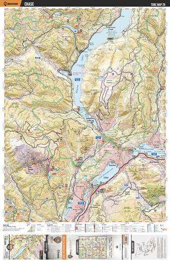
TOBC29 Chase - Thompson Okanagan BC Topo Map
Backroad Mapbooks
This recreation topographic map for the Chase area highlights all the logging roads, trails and recreational Points of Interest including hunting, camping, hiking, mountain biking, canoeing, kayaking, backcountry skiing, snowshoeing, cross-country skiing, wildlife viewing, ATVing, snowmobiling and more. No other map for the area provides you with this level of recreational or topographic detail. Special features include private land and countless roads, trails and recreational Points of Interest. Covering 1,950 km2 (750 mi2) in total, this 1:65,000 scale map measures 38 x 51 km (23.5 x 32 mi) and includes Chase, Adams Lake, Little Shuswap Lake, Shuswap Lake, Niskonlith Lake, Roderick Haig-Brown Provincial Park and more!
Page Size: 24 x 37 in (610 x 940 mm)
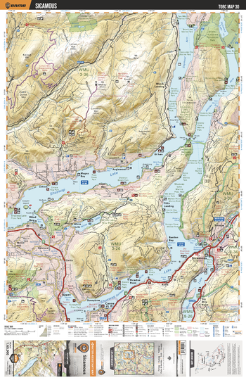
TOBC30 Sicamous - Thompson Okanagan BC Topo Map
Backroad Mapbooks
This recreation topographic map for the Sicamous area highlights all the logging roads, trails and recreational Points of Interest including hunting, camping, hiking, mountain biking, canoeing, kayaking, backcountry skiing, snowshoeing, cross-country skiing, wildlife viewing, ATVing, snowmobiling and more. No other map for the area provides you with this level of recreational or topographic detail. Special features include private land and countless roads, trails and recreational Points of Interest. Covering 1,950 km2 (750 mi2) in total, this 1:65,000 scale map measures 38 x 51 km (23.5 x 32 mi) and includes Sicamous, Mara Lake, Shuswap Lake, Tappen Bay, Anstey Arm, Syemour Arm, Anstey Hunakwa Provincial Park and more!
Page Size: 24 x 37 in (610 x 940 mm)
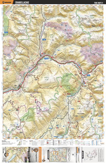
TOBC31 Craigellachie - Thompson Okanagan BC Topo Map
Backroad Mapbooks
This recreation topographic map for the Craigellachie area highlights all the logging roads, trails and recreational Points of Interest including hunting, camping, hiking, mountain biking, canoeing, kayaking, backcountry skiing, snowshoeing, cross-country skiing, wildlife viewing, ATVing, snowmobiling and more. No other map for the area provides you with this level of recreational or topographic detail. Special features include private land and countless roads, trails and recreational Points of Interest. Covering 1,950 km2 (750 mi2) in total, this 1:65,000 scale map measures 38 x 51 km (23.5 x 32 mi) and includes Craigellachie, Eagle River, Perry River, Wap Lake, Malakwa, Wap Creek Provincial Park, Mabel Lake and more!
Page Size: 24 x 37 in (610 x 940 mm)
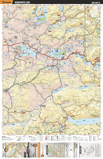
TOBC32 Bonaparte Lake - Thompson Okanagan BC Topo Map
Backroad Mapbooks
This recreation topographic map for the Bonaparte Lake area highlights all the logging roads, trails and recreational Points of Interest including hunting, camping, hiking, mountain biking, canoeing, kayaking, backcountry skiing, snowshoeing, cross-country skiing, wildlife viewing, ATVing, snowmobiling and more. No other map for the area provides you with this level of recreational or topographic detail. Special features include private land and countless roads, trails and recreational Points of Interest. Covering 1,950 km2 (750 mi2) in total, this 1:65,000 scale map measures 38 x 51 km (23.5 x 32 mi) and includes Bonaparte Lake, Eagan Lake, Machete Lake, Sheridan Lake, Bridge Lake, Deka Lake, Sulphurous Lake, Apollo Lake and more!
Page Size: 24 x 37 in (610 x 940 mm)
No search results