


MapSherpa Catalog
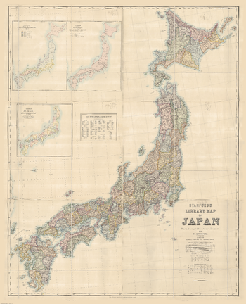
Stanford's Map of Japan (1879)
Stanfords
The Stanford's Library Map of Japan is from a fascinating series of reproductions from our Edward Stanford Cartographic Collection archive.
Page Size: 53.75 x 66.5 in (1365 x 1685 mm)
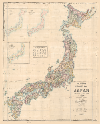
Stanford's Map of Japan (1879) - Resized to 2A0 width
Stanfords
Resized so that the short side is equivalent to 2A0 short side. The Stanford's Library Map of Japan is from a fascinating series of reproductions from our Edward Stanford Cartographic Collection archive.
Page Size: 47 x 58 in (1189 x 1468 mm)
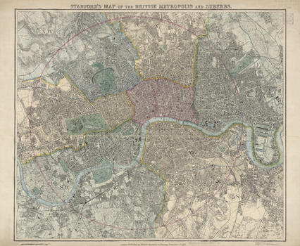
Stanford's Map of the British Metropolis (1877)
Stanfords
The Stanford's Map of the British Metropolis is from a fascinating series of reproductions from our Edward Stanford Cartographic Collection archive.
Page Size: 27.5 x 33.5 in (696 x 848 mm)
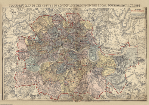
Stanford's Map of the County of London (1888)
Stanfords
This map is from a fascinating series of reproductions from our Edward Stanford Cartographic Collection archive. The Stanford's Map of the County of London, According to the Local Government Act 1888, to give it its full title, presenting the administrative division of the capital and indicating the boundaries of both the Electoral Divisions returning two members to the County Council and of the Urban Sanitary Districts with control of main roads under the Highways and Locomotives (Amendment) Act of 1878. The colouring and the boundaries are overlaid on a street plan with names of main and selected smaller streets, graphics indicating parks and other common land, railway lines, etc. Hachures show the topography with the hills of north and south London clearly marked. This is London which, administratively, extends north of the Thames between Hammersmith, Hampstead, Stamford Hill and Poplar, and south of the river between Putney, Streatham, Lower Sydenham and Eltham (although the map itself extends a bit further out, particularly in the north-east). An interesting feature is the inclusion within the County of London of a small area outside its overall boundary - the site of the present day Leg of Mutton Nature Reserve in Barnes.
Page Size: 28 x 39.5 in (707 x 1000 mm)
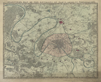
Stanford's Map of the Environs of Paris (1870)
Stanfords
The Stanford's Map of the environs of Paris is from a fascinating series of reproductions from our Edward Stanford Cartographic Collection archive. The text reads 'Stanford's map of the environs of Paris shewing the fortifications.' It is dated September 1st 1870 (nineteen years before the Eiffel Tower was erected). The map covers the centre of Paris (indicated in pink) and extends well outside the present day Boulevard Périphérique, the course of which is indicated on the map by the old city walls. Coverage of the north includes St Danis up to Montmorency. The East includes the Château de Vincennes, most of Champigny-sur-Marne to the north-eastern Bondy. Coverage of the south shows Villejuif down to Forêt Domaniale de Verrières. In the west the map takes us beyond the northward bend in the Seine to include all of the Bois de Boulogne, the Parc de St. Cloud all the way up to St-Germain-en-Laye. This reproduction has been taken from the original cartographic scale of [1:60,000] on an 18.5"x23" map. Various districts of the city, as well as surrounding villages are named. No street names are shown. The map has no legend but topographic artistry shows elevated areas and other details. This lovely map will appeal to anyone interested in this great city.
Page Size: 20 x 24.5 in (502 x 620 mm)
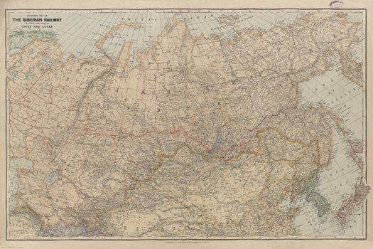
Stanford's Map of the Siberian Railway (1904)
Stanfords
The Stanford's Map of the Siberian Railway is from a fascinating series of reproductions from our Edward Stanford Cartographic Collection archive. Depicting the great land route to China and Korea, this map was published by Edward Stanford, Long Acre on the 1st February 1904. This vital rail route was also known as the Moscow Highway or the Tea Route because of the large quantities of tea exported from China. It connected European Russia to Siberia and China. Construction started in 1730 and was not completed until the mid 19th-century. Until the Tran-Siberian Railway was built in 1916, the Siberian Railway route was the longest and most famous. This is a beautifully detailed map that will appeal to anyone with an interest in railway history.
Page Size: 30 x 45 in (760 x 1140 mm)
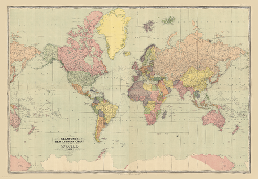
Stanford's New Library Chart of the World (1920)
Stanfords
The Stanford's New Library Chart of the World is from a fascinating series of reproductions from our Edward Stanford Cartographic Collection archive. This map was published by Stanfords in January 1920 and says 'drawn to an equatorial scale of 350 nautical miles to 1 inch'. Displays submarine telegraph cables. Published just after World War I the boundaries are as per the Treaty of Versailles. The British Empire, at its height, is shown in dark pink. This is a very interesting map for anyone with an interest in history as it shows the world as it was in the 1920s from a British cartographer's viewpoint.
Page Size: 52 x 75 in (1321 x 1902 mm)
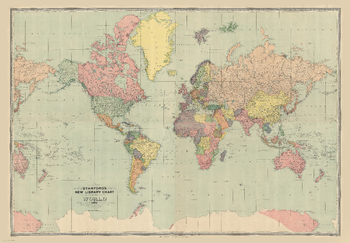
Stanford's New Library Chart of the World (1920) - Resized to 2A0 height
Stanfords
Resized so that the short side is equivalent to 2A0 short side. The Stanford's New Library Chart of the World is from a fascinating series of reproductions from our Edward Stanford Cartographic Collection archive. This map was published by Stanfords in January 1920 and says 'drawn to an equatorial scale of 350 nautical miles to 1 inch'. Displays submarine telegraph cables. Published just after World War I the boundaries are as per the Treaty of Versailles. The British Empire, at its height, is shown in dark pink. This is a very interesting map for anyone with an interest in history as it shows the world as it was in the 1920s from a British cartographer's viewpoint.
Page Size: 47 x 67.5 in (1189 x 1712 mm)
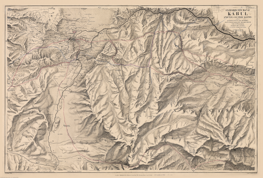
Stanford's New Map of Kabul (1880)
Stanfords
The Stanford's New Map of Kabul is from a fascinating series of reproductions from our Edward Stanford Cartographic Collection archive. This map was published by Stanfords in January 1880 and says 'Stanford's New Map of Kabul and the country round as far as Kohistan, Tagao, and Lughman: Gandamak, Kurram, and Shutargardan; The Upper Logar; Maidan and Argandi; with the sites of all the recent conflicts.' The whole map is tonal except for a few red and blue lines. One of which indicates the route of Lieutenant Vincent Eyre and the other captives. Another shows General Roberts' advance. This is a beautiful historic map with lots of regions fascinatingly still marked as 'unexplored'.
Page Size: 27 x 40 in (685 x 1010 mm)
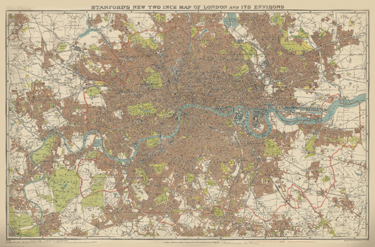
Stanford's New Two Inch Map of London (1913)
Stanfords
The Stanford's New Two Inch Map of London is from a fascinating series of reproductions from our Edward Stanford Cartographic Collection archive.
Page Size: 28.75 x 43.5 in (725 x 1100 mm)
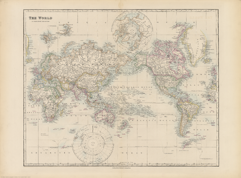
Stanford's Pacific-centred World Map (1884)
Stanfords
The Stanford's Pacific-centred World Map is from a fascinating series of reproductions from our Edward Stanford Cartographic Collection archive. Originally published in 1884, this political wall map is drawn on a Mercator's projection presenting the world with the Pacific Ocean at its centre. Political boundaries are coloured in bold, gradually shading lighter as is typical in maps from this time. Latitude and longitude lines are at 10° intervals. Europe and Africa look very different from today, Asia with many changes mainly in the Middle East, but the Americas mostly unchanged. A particularly interesting feature of the map is the difference in the presentation of the two Polar Regions: the Arctic Ocean with most of its coastline already there, whilst the Antarctic is still in the early stages of exploration and only segments of its coast already mapped. Separate panels show lands contiguous to the North and South Poles, drawn to the equatorial scale of the map.
Page Size: 21.75 x 29.25 in (546 x 741 mm)
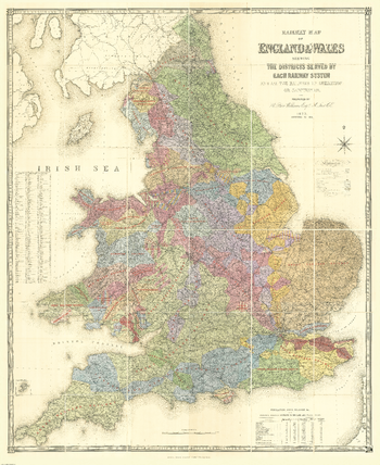
Stanford's Railway Map of England and Wales (1873/4)
Stanfords
The Stanford's Railway Map of England and Wales is from a fascinating series of reproductions from our Edward Stanford Cartographic Collection archive.
Page Size: 71 x 86.75 in (1800 x 2201 mm)
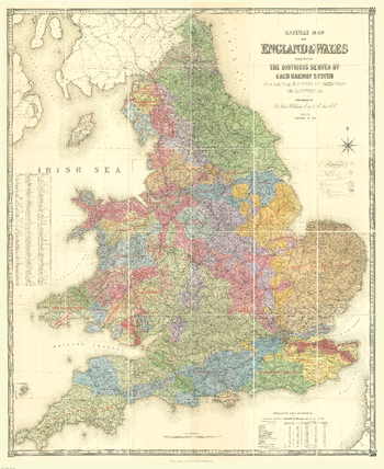
Stanford's Railway Map of England and Wales (1873/4) - Resized to 2A0 width
Stanfords
Resized so that the short side is equivalent to 2A0 short side. The Stanford's Railway Map of England and Wales is from a fascinating series of reproductions from our Edward Stanford Cartographic Collection archive.
Page Size: 47 x 57.25 in (1189 x 1454 mm)
Stanford's Railway and Road Map of England and Wales (1856)
Stanfords
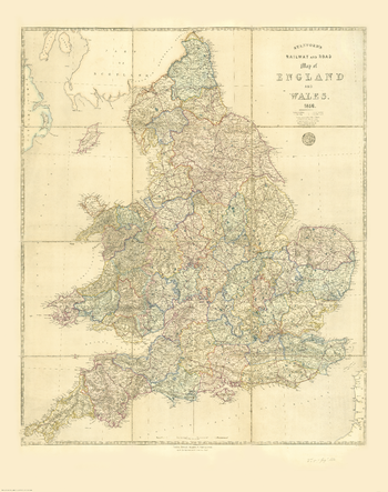
The Stanford's Railway and Road Map of England and Wales is from a fascinating series of reproductions from our Edward Stanford Cartographic Collection archive.
Page Size: 34.5 x 43.5 in (870 x 1100 mm)
Stanford's Route Map of the Earth Black and White (1853)
Stanfords
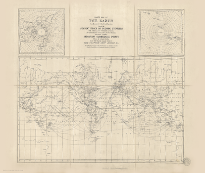
The Stanford's Route Map of the Earth in Black and White is from a fascinating series of reproductions from our Edward Stanford Cartographic Collection archive.
Page Size: 21.75 x 25.75 in (550 x 650 mm)
Stanford's Route Map of the Earth Colour (1854)
Stanfords
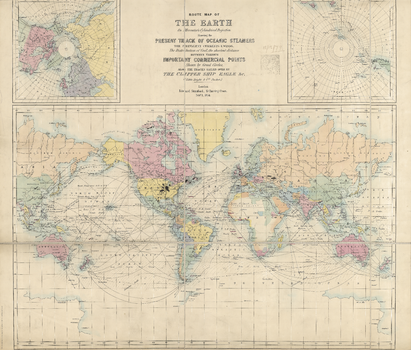
The Stanford's New Map of the Earth of London is from a fascinating series of reproductions from our Edward Stanford Cartographic Collection archive.
Page Size: 22 x 25.75 in (553 x 650 mm)
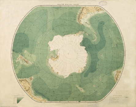
Stanford's South Polar Chart (1901)
Stanfords
The Stanford's South Polar Chart is from a fascinating series of reproductions from our Edward Stanford Cartographic Collection archive. Published by E. Stanford. Ltd., London in 1901, this map displays beautiful aqua tones through the contours that show depth in fathoms from sea level. An interesting feature of this chart is that it shows routes of previous polar explorations. The tracks of the following three expeditions are given: The Challenger 1873-76 The German Expedition 'Valdivia' 1898-99 The Belgian Expedition 'Belgia' 1898-99 Other lines engraved on the chart are: The appropriate limit of the Pack Ice during the Austral Summer Months. Line of freezing point in the air. Northern limit of icebergs.
Page Size: 17.25 x 21.75 in (434 x 550 mm)
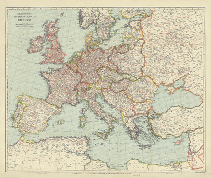
Stanford's Tourist's Map of Europe (1928)
Stanfords
The Stanford's Tourist Map of Europe is from a fascinating series of reproductions from our Edward Stanford Cartographic Collection archive. Published by Stanford's Geographical Establishment in May 1928, this map shows country borders in contrasting colours and the network on main and subsidiary railway lines. Coverage includes the southern coastline of the Mediterranean, extends to the eastern coast of the Black Sea, but in the north only the southern part of Scandinavia is included. The map shows Europe with its post-Versailles borders; British Isles have the same red border for both GB and the whole of Ireland, but acknowledging the existence of the "Irish Free State". International borders along the southern and the eastern Mediterranean indicate colonial or mandated possessions. Within all the countries map shows main and subsidiary railway lines, displaying the great contrast between the extensive networks within Germany, most of England or northern France and the less densely covered eastern and south-eastern parts of Europe. Within Russia the railway linking St. Petersburg to Moscow with the kink (straightened in 2001) in the line known as the "Tsar's finger" catches one's eye. Latitude and longitude lines are drawn at 2° intervals.
Page Size: 27 x 32 in (680 x 809 mm)
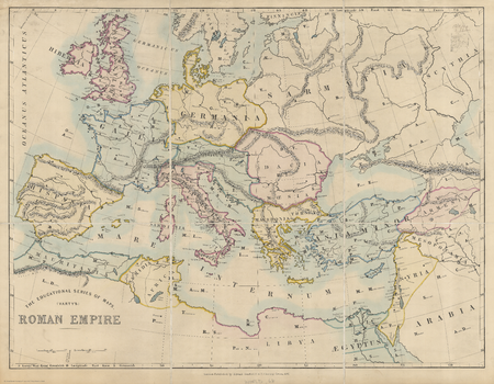
Stanford's Varty's Roman Empire Map (1879)
Stanfords
The Stanford's Varty's Roman Empire Map is from a fascinating series of reproductions from our Edward Stanford Cartographic Collection archive. This educational map of the Roman Empire was published by Edward Stanford in 1879. Featuring Latin place names, this is a beautifully simple historic map that will appeal to anyone with an interest in the history of the Roman Empire.
Page Size: 26 x 33.25 in (656 x 843 mm)
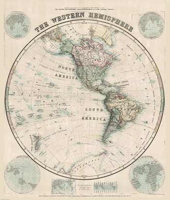
Stanford's Western Hemisphere Map (1877)
Stanfords
The Stanford's Map of The Western Hemisphere is from a fascinating series of reproductions from our Edward Stanford Cartographic Collection archive. The original map from 1877 was drawn by Stanford's Geographical Establishment and "published under the direction of the Committee of General Literature and Education Appointed by The Society for Promoting Christian Knowledge and of the National Society". On this stereographic projection, individual countries are presented in gentle pastel hues typical of hand-coloured maps, with their borders outlined in stronger colours. The publication date of 1877 gives us the Americas more or less as we know it now but Antarctica with only a handful of coastal places named and believed to be flat. Hachures are used to show the mountain ranges and many other features of contemporary cartography are included: ocean currents and trade winds, surrounding frames showing the tropical zones and the position of the sun, etc. Latitude and longitude lines are drawn at 10° intervals. Additional panels on this map of the Western Hemisphere give examples of six different map projections, including Mercator's projection and the gores of a globe complete on the same scale at the equator.
Page Size: 52.25 x 61.5 in (1326 x 1558 mm)
No search results