


MapSherpa Catalog
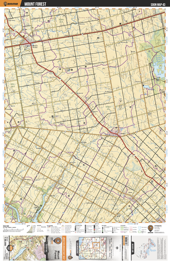
SOON43 Mount Forest - Southern Ontario Topo
Backroad Mapbooks
This recreation topographic map for Mount Forest highlights all the logging/resource roads, hunting areas, fishing lakes & streams, campsites, paddling routes for canoeing and kayaking, wildlife viewing areas, multi-use trails for hiking, biking, horseback riding, cross-country skiing and snowshoeing, motorized trails for ATVing and snowmobiling & more. Covering 1,090 km2 (420 mi2), this 1:50,000 scale map measures 29 x 38 km (18 x 24 mi), providing you with more topographic and recreational detail for the Niagara-on-the-Lake area than any other map on the market. New features include expanded road and trail data and countless recreational Points of Interest. Included on this map are Luther Lake, Arthur, Mount Forest, Drayton, Alma, Salem, Conestogo Lake, Conestogo River, Damascus, Wyandot and more.
Page Size: 24 x 37 in (610 x 940 mm)
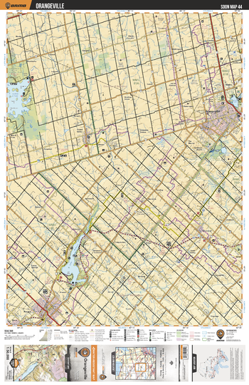
SOON44 Orangeville - Southern Ontario Topo
Backroad Mapbooks
This recreation topographic map for Orangeville highlights all the logging/resource roads, hunting areas, fishing lakes & streams, campsites, paddling routes for canoeing and kayaking, wildlife viewing areas, multi-use trails for hiking, biking, horseback riding, cross-country skiing and snowshoeing, motorized trails for ATVing and snowmobiling & more. Covering 1,090 km2 (420 mi2), this 1:50,000 scale map measures 29 x 38 km (18 x 24 mi), providing you with more topographic and recreational detail for the Niagara-on-the-Lake area than any other map on the market. New features include expanded road and trail data and countless recreational Points of Interest. Included on this map are Luther Lake, Orangeville, Erin, Hillsburgh, Fergus, Elora, Grand Valley, Lake Belwood, Caledon Lake, Island Lake and more.
Page Size: 24 x 37 in (610 x 940 mm)
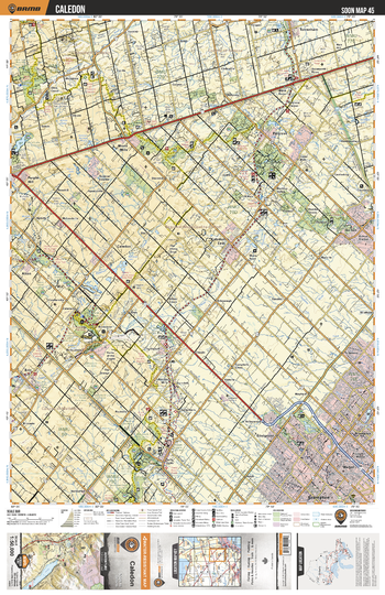
SOON45 Caledon - Southern Ontario Topo
Backroad Mapbooks
This recreation topographic map for Caledon highlights all the logging/resource roads, hunting areas, fishing lakes & streams, campsites, paddling routes for canoeing and kayaking, wildlife viewing areas, multi-use trails for hiking, biking, horseback riding, cross-country skiing and snowshoeing, motorized trails for ATVing and snowmobiling & more. Covering 1,090 km2 (420 mi2), this 1:50,000 scale map measures 29 x 38 km (18 x 24 mi), providing you with more topographic and recreational detail for the Niagara-on-the-Lake area than any other map on the market. New features include expanded road and trail data and countless recreational Points of Interest. Included on this map are Brampton, Madoc, Terra Cotta, Caledon, Erin, Bolton, Palgrave,Mono Mills, Alton, Purple Hill, Hockley Valley Provincial Nature Reserve and more.
Page Size: 24 x 37 in (610 x 940 mm)
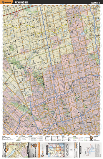
SOON46 Richmond Hill - Southern Ontario Topo
Backroad Mapbooks
This recreation topographic map for Richmond Hill highlights all the logging/resource roads, hunting areas, fishing lakes & streams, campsites, paddling routes for canoeing and kayaking, wildlife viewing areas, multi-use trails for hiking, biking, horseback riding, cross-country skiing and snowshoeing, motorized trails for ATVing and snowmobiling & more. Covering 1,090 km2 (420 mi2), this 1:50,000 scale map measures 29 x 38 km (18 x 24 mi), providing you with more topographic and recreational detail for the Niagara-on-the-Lake area than any other map on the market. New features include expanded road and trail data and countless recreational Points of Interest. Included on this map are Toronto, North York, Aurora, Richmond Hill, Malton, Brampton, York, King City, Nobleton, Bolton and more.
Page Size: 24 x 37 in (610 x 940 mm)
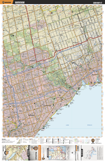
SOON47 Markham - Southern Ontario Topo
Backroad Mapbooks
This recreation topographic map for Markham highlights all the logging/resource roads, hunting areas, fishing lakes & streams, campsites, paddling routes for canoeing and kayaking, wildlife viewing areas, multi-use trails for hiking, biking, horseback riding, cross-country skiing and snowshoeing, motorized trails for ATVing and snowmobiling & more. Covering 1,090 km2 (420 mi2), this 1:50,000 scale map measures 29 x 38 km (18 x 24 mi), providing you with more topographic and recreational detail for the Niagara-on-the-Lake area than any other map on the market. New features include expanded road and trail data and countless recreational Points of Interest. Included on this map are Toronto, Scarborough, Pickering, Lake Ontario, Markham, Ajax, Stouffville, East York and more.
Page Size: 24 x 37 in (610 x 940 mm)
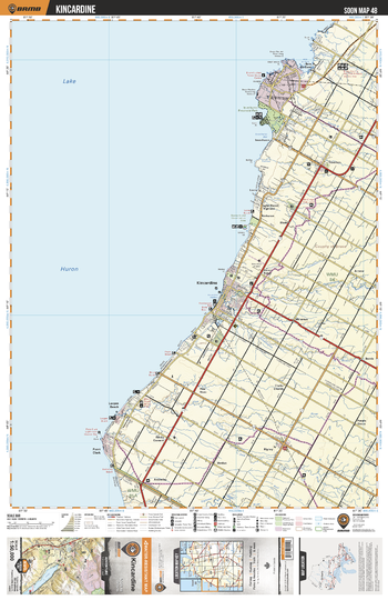
SOON48 Kincardine - Southern Ontario Topo
Backroad Mapbooks
This recreation topographic map for Kincardine highlights all the logging/resource roads, hunting areas, fishing lakes & streams, campsites, paddling routes for canoeing and kayaking, wildlife viewing areas, multi-use trails for hiking, biking, horseback riding, cross-country skiing and snowshoeing, motorized trails for ATVing and snowmobiling & more. Covering 1,090 km2 (420 mi2), this 1:50,000 scale map measures 29 x 38 km (18 x 24 mi), providing you with more topographic and recreational detail for the Niagara-on-the-Lake area than any other map on the market. New features include expanded road and trail data and countless recreational Points of Interest. Included on this map are Lake Huron, Kincardine, Inverhuron Provincial Park, Tiverton, Ripley, Point Clark, Lurgan Beach and more.
Page Size: 24 x 37 in (610 x 940 mm)
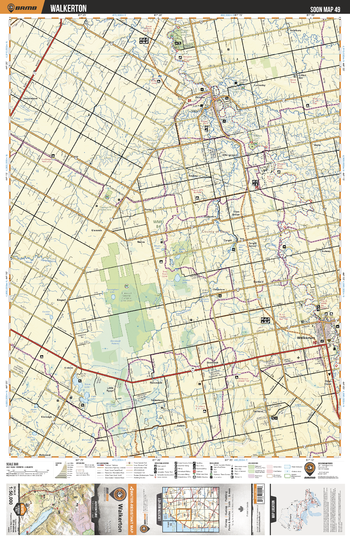
SOON49 Walkerton - Southern Ontario Topo
Backroad Mapbooks
This recreation topographic map for Walkerton highlights all the logging/resource roads, hunting areas, fishing lakes & streams, campsites, paddling routes for canoeing and kayaking, wildlife viewing areas, multi-use trails for hiking, biking, horseback riding, cross-country skiing and snowshoeing, motorized trails for ATVing and snowmobiling & more. Covering 1,090 km2 (420 mi2), this 1:50,000 scale map measures 29 x 38 km (18 x 24 mi), providing you with more topographic and recreational detail for the Niagara-on-the-Lake area than any other map on the market. New features include expanded road and trail data and countless recreational Points of Interest. Included on this map are Walkerton, Greenoch Swamp Complex Conservation Area, Silver Lake, Paisley, Teeswater River, Saugeen River and more.
Page Size: 24 x 37 in (610 x 940 mm)
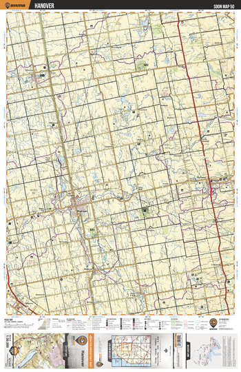
SOON50 Hanover - Southern Ontario Topo
Backroad Mapbooks
This recreation topographic map for Hanover highlights all the logging/resource roads, hunting areas, fishing lakes & streams, campsites, paddling routes for canoeing and kayaking, wildlife viewing areas, multi-use trails for hiking, biking, horseback riding, cross-country skiing and snowshoeing, motorized trails for ATVing and snowmobiling & more. Covering 1,090 km2 (420 mi2), this 1:50,000 scale map measures 29 x 38 km (18 x 24 mi), providing you with more topographic and recreational detail for the Niagara-on-the-Lake area than any other map on the market. New features include expanded road and trail data and countless recreational Points of Interest. Included on this map are Hanover, Durham, Chesley, Allans Park Conservation Area, Kinghurst, Mulock, Saugeen River, Ayton, Mildmay and more.
Page Size: 24 x 37 in (610 x 940 mm)
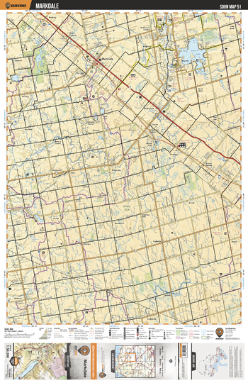
SOON51 Markdale - Southern Ontario Topo
Backroad Mapbooks
This recreation topographic map for Markdale highlights all the logging/resource roads, hunting areas, fishing lakes & streams, campsites, paddling routes for canoeing and kayaking, wildlife viewing areas, multi-use trails for hiking, biking, horseback riding, cross-country skiing and snowshoeing, motorized trails for ATVing and snowmobiling & more. Covering 1,090 km2 (420 mi2), this 1:50,000 scale map measures 29 x 38 km (18 x 24 mi), providing you with more topographic and recreational detail for the Niagara-on-the-Lake area than any other map on the market. New features include expanded road and trail data and countless recreational Points of Interest. Included on this map are Eugene Lake, Markdale, Mount Pleasant, Bells Lake, Saugeen River, Holstein, Wilcox Lake, Beaver River, Wilder Lake, Priceville and more.
Page Size: 24 x 37 in (610 x 940 mm)
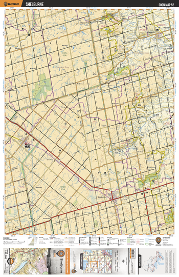
SOON52 Shelburne - Southern Ontario Topo
Backroad Mapbooks
This recreation topographic map for Shelburne highlights all the logging/resource roads, hunting areas, fishing lakes & streams, campsites, paddling routes for canoeing and kayaking, wildlife viewing areas, multi-use trails for hiking, biking, horseback riding, cross-country skiing and snowshoeing, motorized trails for ATVing and snowmobiling & more. Covering 1,090 km2 (420 mi2), this 1:50,000 scale map measures 29 x 38 km (18 x 24 mi), providing you with more topographic and recreational detail for the Niagara-on-the-Lake area than any other map on the market. New features include expanded road and trail data and countless recreational Points of Interest. Included on this map are Shelburne, Boyne Balley Provincial Park, Mono Cliffs Provincial Park, Dundalk, Greemore, Singhampton, Saugeen River, Feversham, Noisy River Provincial Nature Reserve Park and more.
Page Size: 24 x 37 in (610 x 940 mm)
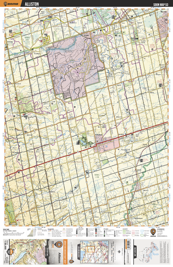
SOON53 Alliston - Southern Ontario Topo
Backroad Mapbooks
This recreation topographic map for Alliston highlights all the logging/resource roads, hunting areas, fishing lakes & streams, campsites, paddling routes for canoeing and kayaking, wildlife viewing areas, multi-use trails for hiking, biking, horseback riding, cross-country skiing and snowshoeing, motorized trails for ATVing and snowmobiling & more. Covering 1,090 km2 (420 mi2), this 1:50,000 scale map measures 29 x 38 km (18 x 24 mi), providing you with more topographic and recreational detail for the Niagara-on-the-Lake area than any other map on the market. New features include expanded road and trail data and countless recreational Points of Interest. Included on this map are Borden, Barrie, Alliston, Beeton, Nottawasaga River, Mono Cliffs Provincial Park, Everett, Earl Rowe Provincial Park, Thornton, Minesing Swamp and more.
Page Size: 24 x 37 in (610 x 940 mm)
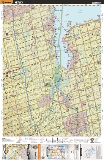
SOON54 Keswick - Southern Ontario Topo
Backroad Mapbooks
This recreation topographic map for Keswick highlights all the logging/resource roads, hunting areas, fishing lakes & streams, campsites, paddling routes for canoeing and kayaking, wildlife viewing areas, multi-use trails for hiking, biking, horseback riding, cross-country skiing and snowshoeing, motorized trails for ATVing and snowmobiling & more. Covering 1,090 km2 (420 mi2), this 1:50,000 scale map measures 29 x 38 km (18 x 24 mi), providing you with more topographic and recreational detail for the Niagara-on-the-Lake area than any other map on the market. New features include expanded road and trail data and countless recreational Points of Interest. Included on this map are Keswick,Lake Simcoe,Holland River,Newmarket,Cook's Bay,Barrie,Holland Marsh Wildlife Area,Scanion Creek Conservation Area,Maskinonge Park and more.
Page Size: 24 x 37 in (610 x 940 mm)
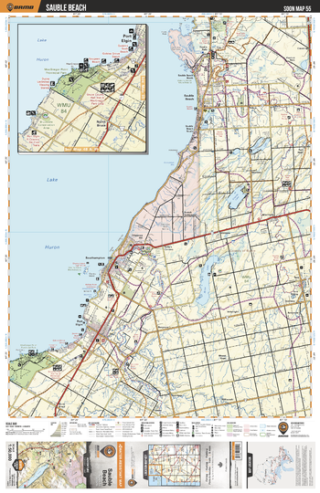
SOON55 Sauble Beach - Southern Ontario Topo
Backroad Mapbooks
This recreation topographic map for Sauble Beach highlights all the logging/resource roads, hunting areas, fishing lakes & streams, campsites, paddling routes for canoeing and kayaking, wildlife viewing areas, multi-use trails for hiking, biking, horseback riding, cross-country skiing and snowshoeing, motorized trails for ATVing and snowmobiling & more. Covering 1,090 km2 (420 mi2), this 1:50,000 scale map measures 29 x 38 km (18 x 24 mi), providing you with more topographic and recreational detail for the Niagara-on-the-Lake area than any other map on the market. New features include expanded road and trail data and countless recreational Points of Interest. Included on this map are Lake Huron, MacGregor Point Provincial Park, Southampton, Port Elgin, Arran Lake, Saugeen River, Sauble Beach, Chesley Lake, Sauble Falls Provincial Park, Gould Lake and more.
Page Size: 24 x 37 in (610 x 940 mm)
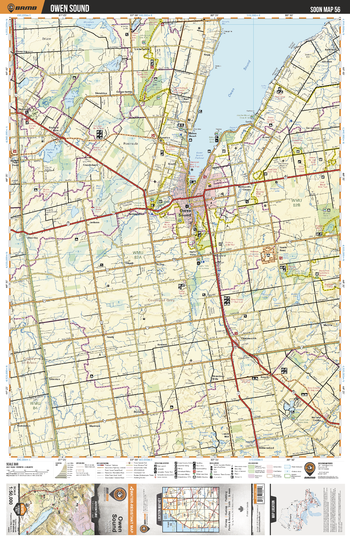
SOON56 Owen Sound - Southern Ontario Topo
Backroad Mapbooks
This recreation topographic map for Owen Sound highlights all the logging/resource roads, hunting areas, fishing lakes & streams, campsites, paddling routes for canoeing and kayaking, wildlife viewing areas, multi-use trails for hiking, biking, horseback riding, cross-country skiing and snowshoeing, motorized trails for ATVing and snowmobiling & more. Covering 1,090 km2 (420 mi2), this 1:50,000 scale map measures 29 x 38 km (18 x 24 mi), providing you with more topographic and recreational detail for the Niagara-on-the-Lake area than any other map on the market. New features include expanded road and trail data and countless recreational Points of Interest. Included on this map are Owen Sound, McNab Lake, Shallow Lake, Inglis Falls, Chatsworth, Holland Centre, Sydenham River, Williams Lake, Bognor Marsh, Francis Lake and more.
Page Size: 24 x 37 in (610 x 940 mm)
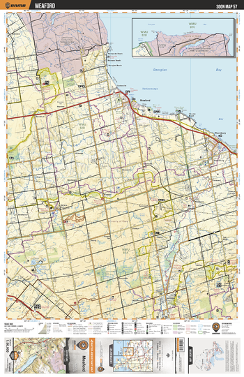
SOON57 Meaford - Southern Ontario Topo
Backroad Mapbooks
This recreation topographic map for Meaford highlights all the logging/resource roads, hunting areas, fishing lakes & streams, campsites, paddling routes for canoeing and kayaking, wildlife viewing areas, multi-use trails for hiking, biking, horseback riding, cross-country skiing and snowshoeing, motorized trails for ATVing and snowmobiling & more. Covering 1,090 km2 (420 mi2), this 1:50,000 scale map measures 29 x 38 km (18 x 24 mi), providing you with more topographic and recreational detail for the Niagara-on-the-Lake area than any other map on the market. New features include expanded road and trail data and countless recreational Points of Interest. Included on this map are Georgian Bay, Meaford, Thornbury, Little Germany, Kimberley, Beaver River, Bighead River, Land Forces Central Area Training Center, Sunnyside Beach, Bognor Marsh and more.
Page Size: 24 x 37 in (610 x 940 mm)
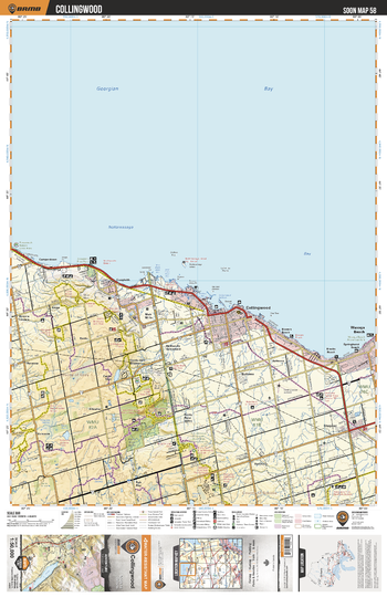
SOON58 Collingwood - Southern Ontario Topo
Backroad Mapbooks
This recreation topographic map for Collingwood highlights all the logging/resource roads, hunting areas, fishing lakes & streams, campsites, paddling routes for canoeing and kayaking, wildlife viewing areas, multi-use trails for hiking, biking, horseback riding, cross-country skiing and snowshoeing, motorized trails for ATVing and snowmobiling & more. Covering 1,090 km2 (420 mi2), this 1:50,000 scale map measures 29 x 38 km (18 x 24 mi), providing you with more topographic and recreational detail for the Niagara-on-the-Lake area than any other map on the market. New features include expanded road and trail data and countless recreational Points of Interest. Included on this map are Georgian Bay,Nottawasaga Bay,Collingwood,Wasaga Beach,Beaver River,Wasaga Beach Provincial Park,Craigleith Provincial Park and more.
Page Size: 24 x 37 in (610 x 940 mm)
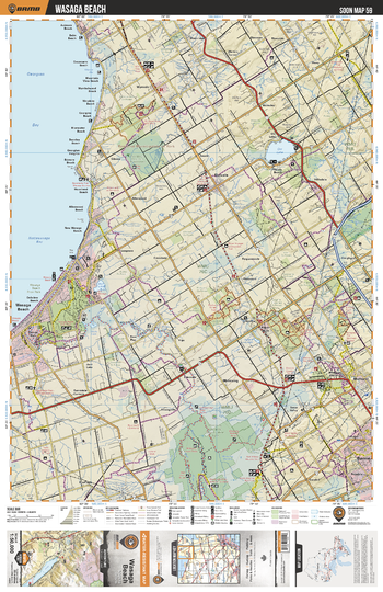
SOON59 Wasaga Beach - Southern Ontario Topo
Backroad Mapbooks
This recreation topographic map for Wasaga Beach highlights all the logging/resource roads, hunting areas, fishing lakes & streams, campsites, paddling routes for canoeing and kayaking, wildlife viewing areas, multi-use trails for hiking, biking, horseback riding, cross-country skiing and snowshoeing, motorized trails for ATVing and snowmobiling & more. Covering 1,090 km2 (420 mi2), this 1:50,000 scale map measures 29 x 38 km (18 x 24 mi), providing you with more topographic and recreational detail for the Niagara-on-the-Lake area than any other map on the market. New features include expanded road and trail data and countless recreational Points of Interest. Included on this map are Georgian Bay, Nottawasaga Bay, Collingwood, Wasaga Beach, Stayner, Nottawa, Pretty River Valley Provinchail Park, Kolapore, Craigleith Provincial Park, Duntroon and more.
Page Size: 24 x 37 in (610 x 940 mm)
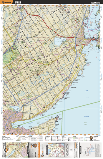
SOON60 Barrie - Southern Ontario Topo
Backroad Mapbooks
This recreation topographic map for Barrie highlights all the logging/resource roads, hunting areas, fishing lakes & streams, campsites, paddling routes for canoeing and kayaking, wildlife viewing areas, multi-use trails for hiking, biking, horseback riding, cross-country skiing and snowshoeing, motorized trails for ATVing and snowmobiling & more. Covering 1,090 km2 (420 mi2), this 1:50,000 scale map measures 29 x 38 km (18 x 24 mi), providing you with more topographic and recreational detail for the Niagara-on-the-Lake area than any other map on the market. New features include expanded road and trail data and countless recreational Points of Interest. Included on this map are Barrie,Copeland Forest Management Area,Lake Simcoe,Lake Couchiching,Bass Lake,Bass Lake Provincial Park,Kampenfelt Bay,Orilla and more.
Page Size: 24 x 37 in (610 x 940 mm)
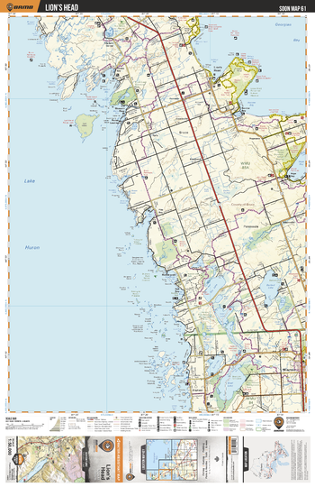
SOON61 Lion's Head - Southern Ontario Topo
Backroad Mapbooks
This recreation topographic map for Lion's Head highlights all the logging/resource roads, hunting areas, fishing lakes & streams, campsites, paddling routes for canoeing and kayaking, wildlife viewing areas, multi-use trails for hiking, biking, horseback riding, cross-country skiing and snowshoeing, motorized trails for ATVing and snowmobiling & more. Covering 1,090 km2 (420 mi2), this 1:50,000 scale map measures 29 x 38 km (18 x 24 mi), providing you with more topographic and recreational detail for the Niagara-on-the-Lake area than any other map on the market. New features include expanded road and trail data and countless recreational Points of Interest. Included on this map are Georgian Bay, Wiarton, Boat Lake, Spry Lake, Berford Lake, Sky Lake, Isaac Lake, Hope Bay, Lion's Head, Lyal Island, Fishing Islands and more.
Page Size: 24 x 37 in (610 x 940 mm)
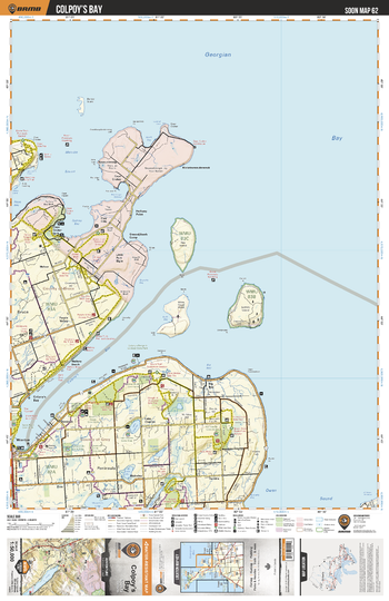
SOON62 Colpoy's Bay - Southern Ontario Topo
Backroad Mapbooks
This recreation topographic map for Colpoy's Bay highlights all the logging/resource roads, hunting areas, fishing lakes & streams, campsites, paddling routes for canoeing and kayaking, wildlife viewing areas, multi-use trails for hiking, biking, horseback riding, cross-country skiing and snowshoeing, motorized trails for ATVing and snowmobiling & more. Covering 1,090 km2 (420 mi2), this 1:50,000 scale map measures 29 x 38 km (18 x 24 mi), providing you with more topographic and recreational detail for the Niagara-on-the-Lake area than any other map on the market. New features include expanded road and trail data and countless recreational Points of Interest. Included on this map are Colpoy's Bay, Griffith Island, Skinner's Bluff, Lake Charles, Bruce Peninsula, Neyaashiinigmiing First Nation, Melville Sound, Georgian Bay, Cape Croker Park, Dodds Hill and more.
Page Size: 24 x 37 in (610 x 940 mm)
No search results