


MapSherpa Catalog
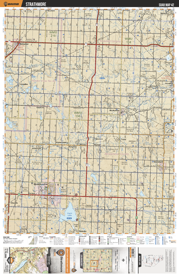
SOAB42 Strathmore - Southern Alberta Topo
Backroad Mapbooks
This recreation topographic map for the Strathmore area highlights all the logging and resource roads, multi-use trails for hikers, mountain bikers, horseback riders, cross-country skiers and snowshoers, motorized trails for ATVers and snowmobilers, fishing lakes and rivers, recreation areas, campgrounds, day-use areas, viewpoints, backcountry campsites, work camps, oil & gas sites, backcountry huts and cabins and more. No other map for the area provides you with this level of recreational or topographic detail. Covering 2,465 km2 (950 mi2) in total, this 1:75,000 scale map measures 43 x 57 km (27 x 35.5 mi). Special features include Crown Forest Management Areas, Public Land Use Zones, labelled fish species, enhanced oil & gas data and countless roads, trails and recreational Points of Interest. This map includes Eagle Lake, Beiseker, Strathmore, Craigdhu, Standard, Barnett Lake, Crowfoot Creek, Redland, Bruce Lake, Cheadle and more!
Page Size: 24 x 37 in (610 x 940 mm)
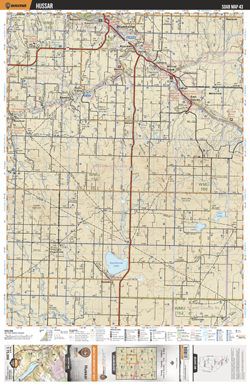
SOAB43 Hussar - Southern Alberta Topo
Backroad Mapbooks
This recreation topographic map for the Hussar area highlights all the logging and resource roads, multi-use trails for hikers, mountain bikers, horseback riders, cross-country skiers and snowshoers, motorized trails for ATVers and snowmobilers, fishing lakes and rivers, recreation areas, campgrounds, day-use areas, viewpoints, backcountry campsites, work camps, oil & gas sites, backcountry huts and cabins and more. No other map for the area provides you with this level of recreational or topographic detail. Covering 2,465 km2 (950 mi2) in total, this 1:75,000 scale map measures 43 x 57 km (27 x 35.5 mi). Special features include Crown Forest Management Areas, Public Land Use Zones, labelled fish species, enhanced oil & gas data and countless roads, trails and recreational Points of Interest. This map includes Drumheller, Red Deer River, Deadhorse Lake, Hussar, Mattoyekiu Lake, Seiu Lake, Rosebud River, Rosedale, East Coulee, Chancellor and more!
Page Size: 24 x 37 in (610 x 940 mm)
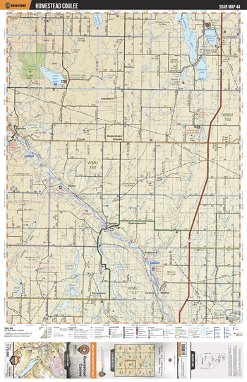
SOAB44 Homestead Coulee - Southern Alberta Topo
Backroad Mapbooks
This recreation topographic map for the Homestead Coulee area highlights all the logging and resource roads, multi-use trails for hikers, mountain bikers, horseback riders, cross-country skiers and snowshoers, motorized trails for ATVers and snowmobilers, fishing lakes and rivers, recreation areas, campgrounds, day-use areas, viewpoints, backcountry campsites, work camps, oil & gas sites, backcountry huts and cabins and more. No other map for the area provides you with this level of recreational or topographic detail. Covering 2,465 km2 (950 mi2) in total, this 1:75,000 scale map measures 43 x 57 km (27 x 35.5 mi). Special features include Crown Forest Management Areas, Public Land Use Zones, labelled fish species, enhanced oil & gas data and countless roads, trails and recreational Points of Interest. This map includes Coleman Lake, Oakland Lake, Little Fish Lake Prov Park, Homestead Coulee, Hand Hills Eco Reserve, Dorothy, Red Deer River, Canalta Slough, Hutton, Finnegan and more!
Page Size: 24 x 37 in (610 x 940 mm)
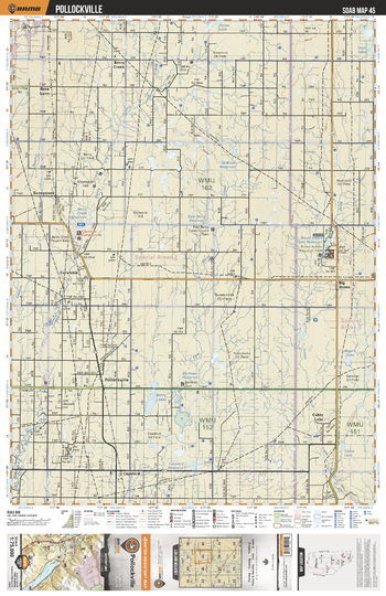
SOAB45 Pollockville - Southern Alberta Topo
Backroad Mapbooks
This recreation topographic map for the Pollockville area highlights all the logging and resource roads, multi-use trails for hikers, mountain bikers, horseback riders, cross-country skiers and snowshoers, motorized trails for ATVers and snowmobilers, fishing lakes and rivers, recreation areas, campgrounds, day-use areas, viewpoints, backcountry campsites, work camps, oil & gas sites, backcountry huts and cabins and more. No other map for the area provides you with this level of recreational or topographic detail. Covering 2,465 km2 (950 mi2) in total, this 1:75,000 scale map measures 43 x 57 km (27 x 35.5 mi). Special features include Crown Forest Management Areas, Public Land Use Zones, labelled fish species, enhanced oil & gas data and countless roads, trails and recreational Points of Interest. This map includes Big Stone, Blood Indian Regional Park, Berry Creek Reservoir, Sunnynook, Pollockville, Berry Creek, Cabin Lake, Berry Lakes, Cessford Reservoir, Carolside and more!
Page Size: 24 x 37 in (610 x 940 mm)
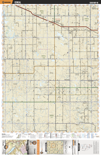
SOAB46 Cereal - Southern Alberta Topo
Backroad Mapbooks
This recreation topographic map for the Cereal area highlights all the logging and resource roads, multi-use trails for hikers, mountain bikers, horseback riders, cross-country skiers and snowshoers, motorized trails for ATVers and snowmobilers, fishing lakes and rivers, recreation areas, campgrounds, day-use areas, viewpoints, backcountry campsites, work camps, oil & gas sites, backcountry huts and cabins and more. No other map for the area provides you with this level of recreational or topographic detail. Covering 2,465 km2 (950 mi2) in total, this 1:75,000 scale map measures 43 x 57 km (27 x 35.5 mi). Special features include Crown Forest Management Areas, Public Land Use Zones, labelled fish species, enhanced oil & gas data and countless roads, trails and recreational Points of Interest. This map includes Cereal, Cappon, Brosten Reservoir, Lanfine, Excel, Chinook, Sunnydale, Helmsdale, Buffalo Bird Hill and more!
Page Size: 24 x 37 in (610 x 940 mm)
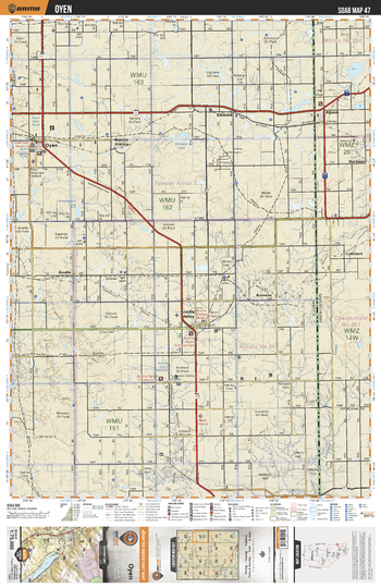
SOAB47 Oyen - Southern Alberta Topo
Backroad Mapbooks
This recreation topographic map for the Oyen area highlights all the logging and resource roads, multi-use trails for hikers, mountain bikers, horseback riders, cross-country skiers and snowshoers, motorized trails for ATVers and snowmobilers, fishing lakes and rivers, recreation areas, campgrounds, day-use areas, viewpoints, backcountry campsites, work camps, oil & gas sites, backcountry huts and cabins and more. No other map for the area provides you with this level of recreational or topographic detail. Covering 2,465 km2 (950 mi2) in total, this 1:75,000 scale map measures 43 x 57 km (27 x 35.5 mi). Special features include Crown Forest Management Areas, Public Land Use Zones, labelled fish species, enhanced oil & gas data and countless roads, trails and recreational Points of Interest. This map includes Acadia Valley, Acadia, Arneson, Sibbald, Brenton Station, Oyen, Green's Lake, Armitage's Lake, Hoenig's Hill, Kennedy's Coulee and more!
Page Size: 24 x 37 in (610 x 940 mm)
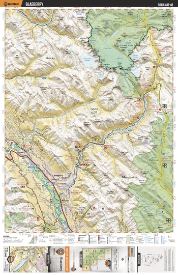
SOAB48 Blaeberry - Southern Alberta Topo
Backroad Mapbooks
This recreation topographic map for the Blaeberry area highlights all the logging and resource roads, multi-use trails for hikers, mountain bikers, horseback riders, cross-country skiers and snowshoers, motorized trails for ATVers and snowmobilers, fishing lakes and rivers, recreation areas, campgrounds, day-use areas, viewpoints, backcountry campsites, work camps, oil & gas sites, backcountry huts and cabins and more. No other map for the area provides you with this level of recreational or topographic detail. Covering 2,465 km2 (950 mi2) in total, this 1:75,000 scale map measures 43 x 57 km (27 x 35.5 mi). Special features include Crown Forest Management Areas, Public Land Use Zones, labelled fish species, enhanced oil & gas data and countless roads, trails and recreational Points of Interest. This map includes Yoho National Park, Banf National Park, Blaeberry River, Columbia River, Waitabit Creek, Donal, Ford, Blaeberry, Moberly and more!
Page Size: 24 x 37 in (610 x 940 mm)
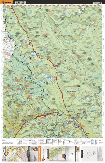
SOAB49 Lake Louise - Southern Alberta Topo
Backroad Mapbooks
This recreation topographic map for the Lake Louise area highlights all the logging and resource roads, multi-use trails for hikers, mountain bikers, horseback riders, cross-country skiers and snowshoers, motorized trails for ATVers and snowmobilers, fishing lakes and rivers, recreation areas, campgrounds, day-use areas, viewpoints, backcountry campsites, work camps, oil & gas sites, backcountry huts and cabins and more. No other map for the area provides you with this level of recreational or topographic detail. Covering 2,465 km2 (950 mi2) in total, this 1:75,000 scale map measures 43 x 57 km (27 x 35.5 mi). Special features include Crown Forest Management Areas, Public Land Use Zones, labelled fish species, enhanced oil & gas data and countless roads, trails and recreational Points of Interest. This map includes Banff National Park, Bow River, Kicking Horse River, Hector Lake, Bow Lake, Peyto Lake, Mistaya Lake, Waterfowl Lakes, Chephren Lake, Lake Louise, Emard Lake, Field, Yoho, Hector, Stephen, Cathedral and more!
Page Size: 24 x 37 in (610 x 940 mm)
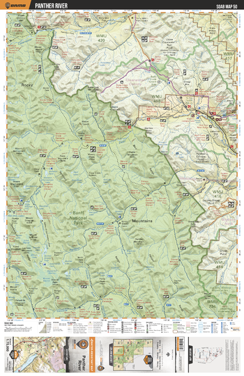
SOAB50 Panther River - Southern Alberta Topo
Backroad Mapbooks
This recreation topographic map for the Panther River area highlights all the logging and resource roads, multi-use trails for hikers, mountain bikers, horseback riders, cross-country skiers and snowshoers, motorized trails for ATVers and snowmobilers, fishing lakes and rivers, recreation areas, campgrounds, day-use areas, viewpoints, backcountry campsites, work camps, oil & gas sites, backcountry huts and cabins and more. No other map for the area provides you with this level of recreational or topographic detail. Covering 2,465 km2 (950 mi2) in total, this 1:75,000 scale map measures 43 x 57 km (27 x 35.5 mi). Special features include Crown Forest Management Areas, Public Land Use Zones, labelled fish species, enhanced oil & gas data and countless roads, trails and recreational Points of Interest. This map includes Banff National Park, Red Deer River, Panther River, Clear Water, Douglas Lake, Skeleton Lake and more!
Page Size: 24 x 37 in (610 x 940 mm)
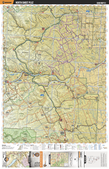
SOAB51 North Ghost PLUZ - Southern Alberta Topo
Backroad Mapbooks
This recreation topographic map for the North Ghost PLUZ area highlights all the logging and resource roads, multi-use trails for hikers, mountain bikers, horseback riders, cross-country skiers and snowshoers, motorized trails for ATVers and snowmobilers, fishing lakes and rivers, recreation areas, campgrounds, day-use areas, viewpoints, backcountry campsites, work camps, oil & gas sites, backcountry huts and cabins and more. No other map for the area provides you with this level of recreational or topographic detail. Covering 2,465 km2 (950 mi2) in total, this 1:75,000 scale map measures 43 x 57 km (27 x 35.5 mi). Special features include Crown Forest Management Areas, Public Land Use Zones, labelled fish species, enhanced oil & gas data and countless roads, trails and recreational Points of Interest. This map includes Ghost PLUZ, Bearberry, Whiskey Jack Crossing, Don Getty Wildland Prov Park, Hunter Valley and more!
Page Size: 24 x 37 in (610 x 940 mm)
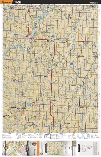
SOAB52 Sundre - Southern Alberta Topo
Backroad Mapbooks
This recreation topographic map for the Sundre area highlights all the logging and resource roads, multi-use trails for hikers, mountain bikers, horseback riders, cross-country skiers and snowshoers, motorized trails for ATVers and snowmobilers, fishing lakes and rivers, recreation areas, campgrounds, day-use areas, viewpoints, backcountry campsites, work camps, oil & gas sites, backcountry huts and cabins and more. No other map for the area provides you with this level of recreational or topographic detail. Covering 2,465 km2 (950 mi2) in total, this 1:75,000 scale map measures 43 x 57 km (27 x 35.5 mi). Special features include Crown Forest Management Areas, Public Land Use Zones, labelled fish species, enhanced oil & gas data and countless roads, trails and recreational Points of Interest. This map includes Little Red Deer River, Sundre, Water Valley, Boggy Lake, Bergen, Westward Ho, Rice's Coulee, Hicklon Lake, Murray Valley, Red Deer River and more!
Page Size: 24 x 37 in (610 x 940 mm)
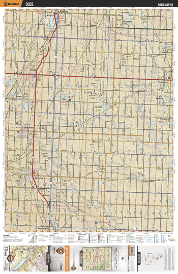
SOAB53 Olds - Southern Alberta Topo
Backroad Mapbooks
This recreation topographic map for the Olds area highlights all the logging and resource roads, multi-use trails for hikers, mountain bikers, horseback riders, cross-country skiers and snowshoers, motorized trails for ATVers and snowmobilers, fishing lakes and rivers, recreation areas, campgrounds, day-use areas, viewpoints, backcountry campsites, work camps, oil & gas sites, backcountry huts and cabins and more. No other map for the area provides you with this level of recreational or topographic detail. Covering 2,465 km2 (950 mi2) in total, this 1:75,000 scale map measures 43 x 57 km (27 x 35.5 mi). Special features include Crown Forest Management Areas, Public Land Use Zones, labelled fish species, enhanced oil & gas data and countless roads, trails and recreational Points of Interest. This map includes Didsbury, Carstairs, Olds, Stewert Lake, Bowden, Rosebud River, Bloxham's Slough, Burns Lake, Bowden lake, Barrie Lake and more!
Page Size: 24 x 37 in (610 x 940 mm)
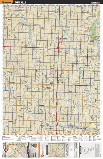
SOAB54 Three Hills - Southern Alberta Topo
Backroad Mapbooks
This recreation topographic map for the Three Hills area highlights all the logging and resource roads, multi-use trails for hikers, mountain bikers, horseback riders, cross-country skiers and snowshoers, motorized trails for ATVers and snowmobilers, fishing lakes and rivers, recreation areas, campgrounds, day-use areas, viewpoints, backcountry campsites, work camps, oil & gas sites, backcountry huts and cabins and more. No other map for the area provides you with this level of recreational or topographic detail. Covering 2,465 km2 (950 mi2) in total, this 1:75,000 scale map measures 43 x 57 km (27 x 35.5 mi). Special features include Crown Forest Management Areas, Public Land Use Zones, labelled fish species, enhanced oil & gas data and countless roads, trails and recreational Points of Interest. This map includes Trochu, Red Deer River, Dry Island Prov Park, Tolman, Three Hills, Kneehills Creek, Linden, Ghostpine Creek, Begelow Reservoir, Three Hills Creek and more!
Page Size: 24 x 37 in (610 x 940 mm)
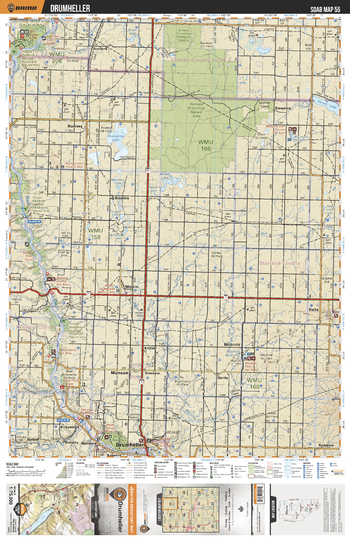
SOAB55 Drumheller - Southern Alberta Topo
Backroad Mapbooks
This recreation topographic map for the Drumheller area highlights all the logging and resource roads, multi-use trails for hikers, mountain bikers, horseback riders, cross-country skiers and snowshoers, motorized trails for ATVers and snowmobilers, fishing lakes and rivers, recreation areas, campgrounds, day-use areas, viewpoints, backcountry campsites, work camps, oil & gas sites, backcountry huts and cabins and more. No other map for the area provides you with this level of recreational or topographic detail. Covering 2,465 km2 (950 mi2) in total, this 1:75,000 scale map measures 43 x 57 km (27 x 35.5 mi). Special features include Crown Forest Management Areas, Public Land Use Zones, labelled fish species, enhanced oil & gas data and countless roads, trails and recreational Points of Interest. This map includes Rumsey Provincial Natural Area, Mudspring Lake, Morrin, Drumheller, Michichi, Delia, Munson, Farrell Lake, Red Deer River, Tolman Badlands Heritage Rangeland and more!
Page Size: 24 x 37 in (610 x 940 mm)
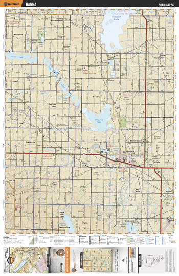
SOAB56 Hanna - Southern Alberta Topo
Backroad Mapbooks
This recreation topographic map for the Hanna area highlights all the logging and resource roads, multi-use trails for hikers, mountain bikers, horseback riders, cross-country skiers and snowshoers, motorized trails for ATVers and snowmobilers, fishing lakes and rivers, recreation areas, campgrounds, day-use areas, viewpoints, backcountry campsites, work camps, oil & gas sites, backcountry huts and cabins and more. No other map for the area provides you with this level of recreational or topographic detail. Covering 2,465 km2 (950 mi2) in total, this 1:75,000 scale map measures 43 x 57 km (27 x 35.5 mi). Special features include Crown Forest Management Areas, Public Land Use Zones, labelled fish species, enhanced oil & gas data and countless roads, trails and recreational Points of Interest. This map includes Sullivan Lake, Dowling Lake, Chain Lakes, Farrell Lake, Heart Lake, Hanna, Handhills Lake, Clear Lake, Craigmyle, Spiers Lake and more!
Page Size: 24 x 37 in (610 x 940 mm)
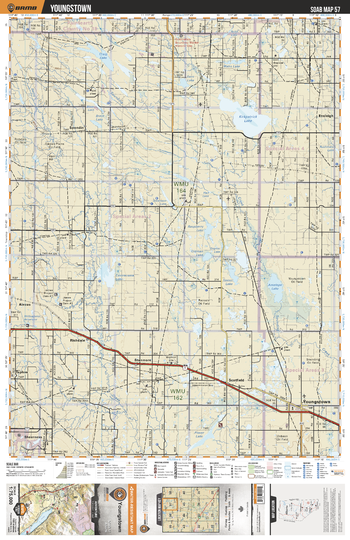
SOAB57 Youngstown - Southern Alberta Topo
Backroad Mapbooks
This recreation topographic map for the Youngstown area highlights all the logging and resource roads, multi-use trails for hikers, mountain bikers, horseback riders, cross-country skiers and snowshoers, motorized trails for ATVers and snowmobilers, fishing lakes and rivers, recreation areas, campgrounds, day-use areas, viewpoints, backcountry campsites, work camps, oil & gas sites, backcountry huts and cabins and more. No other map for the area provides you with this level of recreational or topographic detail. Covering 2,465 km2 (950 mi2) in total, this 1:75,000 scale map measures 43 x 57 km (27 x 35.5 mi). Special features include Crown Forest Management Areas, Public Land Use Zones, labelled fish species, enhanced oil & gas data and countless roads, trails and recreational Points of Interest. This map includes Kirkpatrick Lake, Contracosta Lake, Youngstown, Craig Lake, Antelope Lake, Spondin, Raspberry Lake, Goose Lake, Watts Lake, Plover Lake and more!
Page Size: 24 x 37 in (610 x 940 mm)
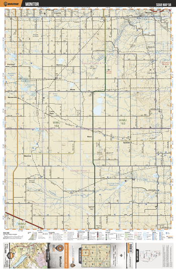
SOAB58 Monitor - Southern Alberta Topo
Backroad Mapbooks
This recreation topographic map for the Monitor area highlights all the logging and resource roads, multi-use trails for hikers, mountain bikers, horseback riders, cross-country skiers and snowshoers, motorized trails for ATVers and snowmobilers, fishing lakes and rivers, recreation areas, campgrounds, day-use areas, viewpoints, backcountry campsites, work camps, oil & gas sites, backcountry huts and cabins and more. No other map for the area provides you with this level of recreational or topographic detail. Covering 2,465 km2 (950 mi2) in total, this 1:75,000 scale map measures 43 x 57 km (27 x 35.5 mi). Special features include Crown Forest Management Areas, Public Land Use Zones, labelled fish species, enhanced oil & gas data and countless roads, trails and recreational Points of Interest. This map includes Monitor, Grays Lake, Fitzgerald Lake, Sounding Creek Reservoir, Sounding Creek, Sedalia, Loyalist, Ensleigh, Idamay, Little Gem and more!
Page Size: 24 x 37 in (610 x 940 mm)
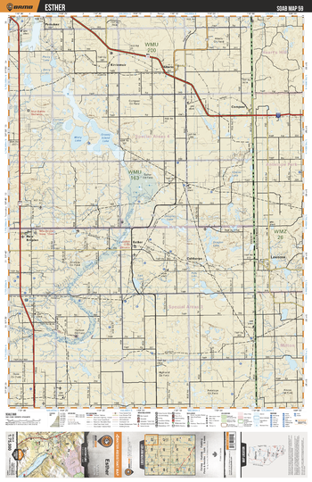
SOAB59 Esther - Southern Alberta Topo
Backroad Mapbooks
This recreation topographic map for the Esther area highlights all the logging and resource roads, multi-use trails for hikers, mountain bikers, horseback riders, cross-country skiers and snowshoers, motorized trails for ATVers and snowmobilers, fishing lakes and rivers, recreation areas, campgrounds, day-use areas, viewpoints, backcountry campsites, work camps, oil & gas sites, backcountry huts and cabins and more. No other map for the area provides you with this level of recreational or topographic detail. Covering 2,465 km2 (950 mi2) in total, this 1:75,000 scale map measures 43 x 57 km (27 x 35.5 mi). Special features include Crown Forest Management Areas, Public Land Use Zones, labelled fish species, enhanced oil & gas data and countless roads, trails and recreational Points of Interest. This map includes Esther, Salt Lake, Sounding Creek, Misty Lake, Grassy Island Lake, Currant Lake, Pemukan, Altario, Compeer, New Brigden and more!
Page Size: 24 x 37 in (610 x 940 mm)
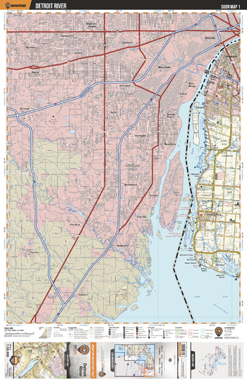
SOON01 Detroit River - Southern Ontario Topo
Backroad Mapbooks
This recreation topographic map for Detroit River highlights all the logging/resource roads, hunting areas, fishing lakes & streams, campsites, paddling routes for canoeing and kayaking, wildlife viewing areas, multi-use trails for hiking, biking, horseback riding, cross-country skiing and snowshoeing, motorized trails for ATVing and snowmobiling & more. Covering 1,325 km2 (510 mi2), this 1:55,000 scale map measures 31.5 x 42 km (19.5 x 26 mi), providing you with more topographic and recreational detail for the Detroit River area than any other map on the market. New features include expanded road and trail data and countless recreational Points of Interest. Included on this map are Amhertsburg, Edgewater Beach, La Salle, Lakewood Beach, Lake Erie, Loiselleville, Willow Beach, Windsor and parts of Michigan, including Detroit.
Page Size: 24 x 37 in (610 x 940 mm)
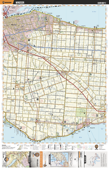
SOON02 Windsor - Southern Ontario Topo
Backroad Mapbooks
This recreation topographic map for Windsor highlights all the logging/resource roads, hunting areas, fishing lakes & streams, campsites, paddling routes for canoeing and kayaking, wildlife viewing areas, multi-use trails for hiking, biking, horseback riding, cross-country skiing and snowshoeing, motorized trails for ATVing and snowmobiling & more. Covering 1,325 km2 (510 mi2), this 1:55,000 scale map measures 31.5 x 42 km (19.5 x 26 mi), providing you with more topographic and recreational detail for the Detroit River area than any other map on the market. New features include expanded road and trail data and countless recreational Points of Interest. Included on this map are Windsor, Lake St Clair, Riverside Kiwanis Park, Essex, Lake Erie, Jack Miner Bird Sanctuary, Canard River, Puce River and more!
Page Size: 24 x 37 in (610 x 940 mm)
No search results