


MapSherpa Catalog
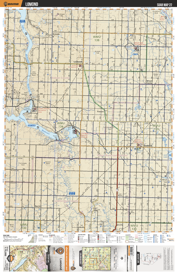
SOAB22 Lomond - Southern Alberta Topo
Backroad Mapbooks
This recreation topographic map for the Lomond area highlights all the logging and resource roads, multi-use trails for hikers, mountain bikers, horseback riders, cross-country skiers and snowshoers, motorized trails for ATVers and snowmobilers, fishing lakes and rivers, recreation areas, campgrounds, day-use areas, viewpoints, backcountry campsites, work camps, oil & gas sites, backcountry huts and cabins and more. No other map for the area provides you with this level of recreational or topographic detail. Covering 2,465 km2 (950 mi2) in total, this 1:75,000 scale map measures 43 x 57 km (27 x 35.5 mi). Special features include Crown Forest Management Areas, Public Land Use Zones, labelled fish species, enhanced oil & gas data and countless roads, trails and recreational Points of Interest. This map includes Travers Reservoir, Little Bow Lake, McGregor Lake, Enchant, Lomond, Little Bow River, Armada, Badger Lake, Travers, Barrhill and more!
Page Size: 24 x 37 in (610 x 940 mm)
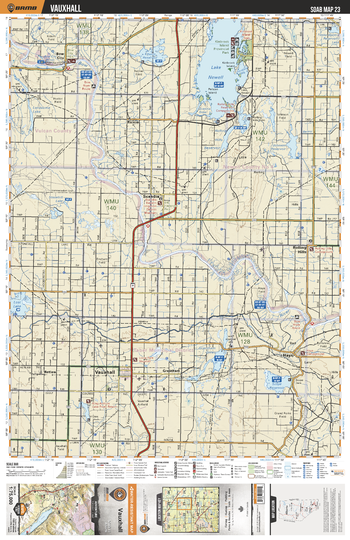
SOAB23 Vauxhall - Southern Alberta Topo
Backroad Mapbooks
This recreation topographic map for the Vauxhall area highlights all the logging and resource roads, multi-use trails for hikers, mountain bikers, horseback riders, cross-country skiers and snowshoers, motorized trails for ATVers and snowmobilers, fishing lakes and rivers, recreation areas, campgrounds, day-use areas, viewpoints, backcountry campsites, work camps, oil & gas sites, backcountry huts and cabins and more. No other map for the area provides you with this level of recreational or topographic detail. Covering 2,465 km2 (950 mi2) in total, this 1:75,000 scale map measures 43 x 57 km (27 x 35.5 mi). Special features include Crown Forest Management Areas, Public Land Use Zones, labelled fish species, enhanced oil & gas data and countless roads, trails and recreational Points of Interest. This map includes Lake Newell, Kinbrook Island Prov Park, Grantham Lakes, Vauxhall, Lost Lake, Bow River, Scandia, Rainier, Rolling Hills, Bow City and more!
Page Size: 24 x 37 in (610 x 940 mm)
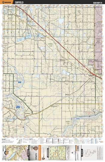
SOAB24 Suffield - Southern Alberta Topo
Backroad Mapbooks
This recreation topographic map for the Suffield area highlights all the logging and resource roads, multi-use trails for hikers, mountain bikers, horseback riders, cross-country skiers and snowshoers, motorized trails for ATVers and snowmobilers, fishing lakes and rivers, recreation areas, campgrounds, day-use areas, viewpoints, backcountry campsites, work camps, oil & gas sites, backcountry huts and cabins and more. No other map for the area provides you with this level of recreational or topographic detail. Covering 2,465 km2 (950 mi2) in total, this 1:75,000 scale map measures 43 x 57 km (27 x 35.5 mi). Special features include Crown Forest Management Areas, Public Land Use Zones, labelled fish species, enhanced oil & gas data and countless roads, trails and recreational Points of Interest. This map includes South Saskatchewan River, Alderson, Tilley, Suffield, Ralston, Bow River, Scots Lake, Minor Lakes, Bandry, Louisiana Lakes and more!
Page Size: 24 x 37 in (610 x 940 mm)
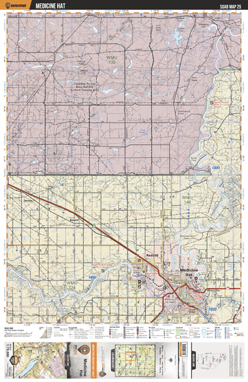
SOAB25 Medicine Hat - Southern Alberta Topo
Backroad Mapbooks
This recreation topographic map for the Medicine Hat area highlights all the logging and resource roads, multi-use trails for hikers, mountain bikers, horseback riders, cross-country skiers and snowshoers, motorized trails for ATVers and snowmobilers, fishing lakes and rivers, recreation areas, campgrounds, day-use areas, viewpoints, backcountry campsites, work camps, oil & gas sites, backcountry huts and cabins and more. No other map for the area provides you with this level of recreational or topographic detail. Covering 2,465 km2 (950 mi2) in total, this 1:75,000 scale map measures 43 x 57 km (27 x 35.5 mi). Special features include Crown Forest Management Areas, Public Land Use Zones, labelled fish species, enhanced oil & gas data and countless roads, trails and recreational Points of Interest. This map includes Canadian Forces Base Suffield, Medicine Hat, Redcliff, South Saskatchewan River, Drowning Ford, Dennis, Bowell, Veinerville, Finns Lake, Brush Flats and more!
Page Size: 24 x 37 in (610 x 940 mm)
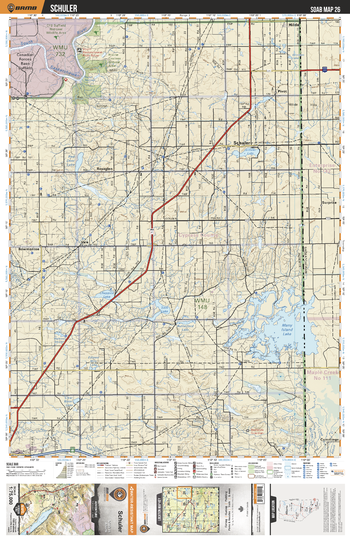
SOAB26 Schuler - Southern Alberta Topo
Backroad Mapbooks
This recreation topographic map for the Schuler area highlights all the logging and resource roads, multi-use trails for hikers, mountain bikers, horseback riders, cross-country skiers and snowshoers, motorized trails for ATVers and snowmobilers, fishing lakes and rivers, recreation areas, campgrounds, day-use areas, viewpoints, backcountry campsites, work camps, oil & gas sites, backcountry huts and cabins and more. No other map for the area provides you with this level of recreational or topographic detail. Covering 2,465 km2 (950 mi2) in total, this 1:75,000 scale map measures 43 x 57 km (27 x 35.5 mi). Special features include Crown Forest Management Areas, Public Land Use Zones, labelled fish species, enhanced oil & gas data and countless roads, trails and recreational Points of Interest. This map includes Many Island Lake, Chappice Lake, Roseglen, Schuler, Schuler Lake, Pivot, South Saskatchewan River, Prairie Coulees Natural Area, Red Deer Lake, Canadian Forces Base Suffield and more!
Page Size: 24 x 37 in (610 x 940 mm)
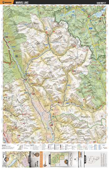
SOAB27 Marvel Lake - Southern Alberta Topo
Backroad Mapbooks
This recreation topographic map for the Marvel Lake area highlights all the logging and resource roads, multi-use trails for hikers, mountain bikers, horseback riders, cross-country skiers and snowshoers, motorized trails for ATVers and snowmobilers, fishing lakes and rivers, recreation areas, campgrounds, day-use areas, viewpoints, backcountry campsites, work camps, oil & gas sites, backcountry huts and cabins and more. No other map for the area provides you with this level of recreational or topographic detail. Covering 2,465 km2 (950 mi2) in total, this 1:75,000 scale map measures 43 x 57 km (27 x 35.5 mi). Special features include Crown Forest Management Areas, Public Land Use Zones, labelled fish species, enhanced oil & gas data and countless roads, trails and recreational Points of Interest. This map includes Marvel Lake, Kootenay National Park, Kootenay River, Cross River, Spray Lakes Reservoir, Height of Rockies Provincial Park and more!
Page Size: 24 x 37 in (610 x 940 mm)
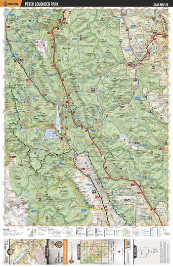
SOAB28 Peter Lougheed Park - Southern Alberta Topo
Backroad Mapbooks
This recreation topographic map for the Peter Lougheed Park area highlights all the logging and resource roads, multi-use trails for hikers, mountain bikers, horseback riders, cross-country skiers and snowshoers, motorized trails for ATVers and snowmobilers, fishing lakes and rivers, recreation areas, campgrounds, day-use areas, viewpoints, backcountry campsites, work camps, oil & gas sites, backcountry huts and cabins and more. No other map for the area provides you with this level of recreational or topographic detail. Covering 2,465 km2 (950 mi2) in total, this 1:75,000 scale map measures 43 x 57 km (27 x 35.5 mi). Special features include Crown Forest Management Areas, Public Land Use Zones, labelled fish species, enhanced oil & gas data and countless roads, trails and recreational Points of Interest. This map includes Upper Kananaskis Lake, Lower Kananaskis Lake, Elbow Sheep Wildland Prov Park, Elbow River, Elk Lakes Prov Park, Spray Valley Prov Park, Height of the Rockies Prov Park, Peter Lougheed Prov Park, Smith Dorrien Creek, Evan Thomas Creek and more!
Page Size: 24 x 37 in (610 x 940 mm)
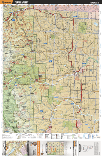
SOAB29 Turner Valley - Southern Alberta Topo
Backroad Mapbooks
This recreation topographic map for the Turner Valley area highlights all the logging and resource roads, multi-use trails for hikers, mountain bikers, horseback riders, cross-country skiers and snowshoers, motorized trails for ATVers and snowmobilers, fishing lakes and rivers, recreation areas, campgrounds, day-use areas, viewpoints, backcountry campsites, work camps, oil & gas sites, backcountry huts and cabins and more. No other map for the area provides you with this level of recreational or topographic detail. Covering 2,465 km2 (950 mi2) in total, this 1:75,000 scale map measures 43 x 57 km (27 x 35.5 mi). Special features include Crown Forest Management Areas, Public Land Use Zones, labelled fish species, enhanced oil & gas data and countless roads, trails and recreational Points of Interest. This map includes Sheep River Prov Park, Elbow-Sheep Prov Park, Highwood River, Lloyd Lake, Turner Valley, Elbow River, Sheep River Prov Park, Sheep River, McLean Pond, Black Diamond and more!
Page Size: 24 x 37 in (610 x 940 mm)
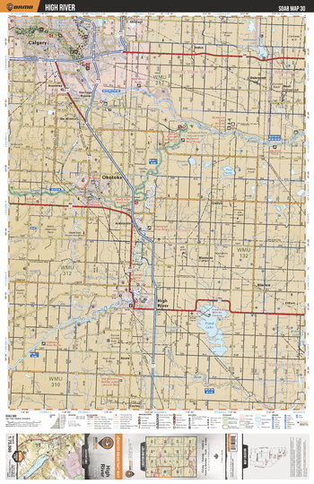
SOAB30 High River - Southern Alberta Topo
Backroad Mapbooks
This recreation topographic map for the High River area highlights all the logging and resource roads, multi-use trails for hikers, mountain bikers, horseback riders, cross-country skiers and snowshoers, motorized trails for ATVers and snowmobilers, fishing lakes and rivers, recreation areas, campgrounds, day-use areas, viewpoints, backcountry campsites, work camps, oil & gas sites, backcountry huts and cabins and more. No other map for the area provides you with this level of recreational or topographic detail. Covering 2,465 km2 (950 mi2) in total, this 1:75,000 scale map measures 43 x 57 km (27 x 35.5 mi). Special features include Crown Forest Management Areas, Public Land Use Zones, labelled fish species, enhanced oil & gas data and countless roads, trails and recreational Points of Interest. This map includes Frank Lake, High River, Okotoks, Calgary, Sheep River, Highwood River, Bow River, Dalemead Lake, Blackie, Blizzard Lake, Third Lake and more!
Page Size: 24 x 37 in (610 x 940 mm)
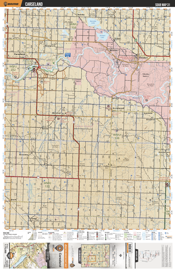
SOAB31 Carseland - Southern Alberta Topo
Backroad Mapbooks
This recreation topographic map for the Carseland area highlights all the logging and resource roads, multi-use trails for hikers, mountain bikers, horseback riders, cross-country skiers and snowshoers, motorized trails for ATVers and snowmobilers, fishing lakes and rivers, recreation areas, campgrounds, day-use areas, viewpoints, backcountry campsites, work camps, oil & gas sites, backcountry huts and cabins and more. No other map for the area provides you with this level of recreational or topographic detail. Covering 2,465 km2 (950 mi2) in total, this 1:75,000 scale map measures 43 x 57 km (27 x 35.5 mi). Special features include Crown Forest Management Areas, Public Land Use Zones, labelled fish species, enhanced oil & gas data and countless roads, trails and recreational Points of Interest. This map includes Siksika Nation, Namaka Lake, Stobert Lake, Carseland, Alkaline Lake, Brant, Gleichen, Namaka, Herronton, Arrowwood and more!
Page Size: 24 x 37 in (610 x 940 mm)
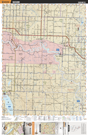
SOAB32 Bassano - Southern Alberta Topo
Backroad Mapbooks
This recreation topographic map for the Bassano area highlights all the logging and resource roads, multi-use trails for hikers, mountain bikers, horseback riders, cross-country skiers and snowshoers, motorized trails for ATVers and snowmobilers, fishing lakes and rivers, recreation areas, campgrounds, day-use areas, viewpoints, backcountry campsites, work camps, oil & gas sites, backcountry huts and cabins and more. No other map for the area provides you with this level of recreational or topographic detail. Covering 2,465 km2 (950 mi2) in total, this 1:75,000 scale map measures 43 x 57 km (27 x 35.5 mi). Special features include Crown Forest Management Areas, Public Land Use Zones, labelled fish species, enhanced oil & gas data and countless roads, trails and recreational Points of Interest. This map includes Bassano, Siksika Nation, McGregor Lake, Bow River, Cluny, Crawling Valley Regional Park, Majorville, Milo, Makepeace, Crowfoot River and more!
Page Size: 24 x 37 in (610 x 940 mm)
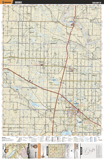
SOAB33 Brooks - Southern Alberta Topo
Backroad Mapbooks
This recreation topographic map for the Brooks area highlights all the logging and resource roads, multi-use trails for hikers, mountain bikers, horseback riders, cross-country skiers and snowshoers, motorized trails for ATVers and snowmobilers, fishing lakes and rivers, recreation areas, campgrounds, day-use areas, viewpoints, backcountry campsites, work camps, oil & gas sites, backcountry huts and cabins and more. No other map for the area provides you with this level of recreational or topographic detail. Covering 2,465 km2 (950 mi2) in total, this 1:75,000 scale map measures 43 x 57 km (27 x 35.5 mi). Special features include Crown Forest Management Areas, Public Land Use Zones, labelled fish species, enhanced oil & gas data and countless roads, trails and recreational Points of Interest. This map includes Brooks, Red Deer River, Gem, Rosemary, Duchess, Tillebrook Prov Park, Bantry, San Francisco Lake, Nerwell Lake Reservoir, Rock Lake and more!
Page Size: 24 x 37 in (610 x 940 mm)
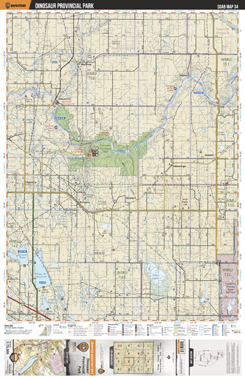
SOAB34 Dinosaur Provincial Park - Southern Alberta Topo
Backroad Mapbooks
This recreation topographic map for the Dinosaur Provincial Park area highlights all the logging and resource roads, multi-use trails for hikers, mountain bikers, horseback riders, cross-country skiers and snowshoers, motorized trails for ATVers and snowmobilers, fishing lakes and rivers, recreation areas, campgrounds, day-use areas, viewpoints, backcountry campsites, work camps, oil & gas sites, backcountry huts and cabins and more. No other map for the area provides you with this level of recreational or topographic detail. Covering 2,465 km2 (950 mi2) in total, this 1:75,000 scale map measures 43 x 57 km (27 x 35.5 mi). Special features include Crown Forest Management Areas, Public Land Use Zones, labelled fish species, enhanced oil & gas data and countless roads, trails and recreational Points of Interest. This map includes Dinosaur Prov Park, Red Deer River, Tide Lake, Cowoki Reservoir, Jenner, Howie, Wardlow, Patricia, Louisiana Lakes, Denhart and more!
Page Size: 24 x 37 in (610 x 940 mm)
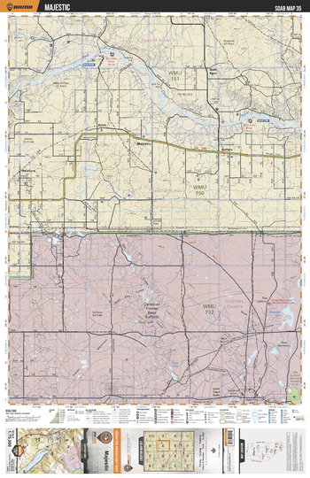
SOAB35 Majestic - Southern Alberta Topo
Backroad Mapbooks
This recreation topographic map for the Majestic area highlights all the logging and resource roads, multi-use trails for hikers, mountain bikers, horseback riders, cross-country skiers and snowshoers, motorized trails for ATVers and snowmobilers, fishing lakes and rivers, recreation areas, campgrounds, day-use areas, viewpoints, backcountry campsites, work camps, oil & gas sites, backcountry huts and cabins and more. No other map for the area provides you with this level of recreational or topographic detail. Covering 2,465 km2 (950 mi2) in total, this 1:75,000 scale map measures 43 x 57 km (27 x 35.5 mi). Special features include Crown Forest Management Areas, Public Land Use Zones, labelled fish species, enhanced oil & gas data and countless roads, trails and recreational Points of Interest. This map includes Canadian Forces Base Suffield, Red Deer River, Majestic, Buffalo, Gold Spur, Atlee, Halsbury, Dishpan Lake, Easy Lake and more!
Page Size: 24 x 37 in (610 x 940 mm)
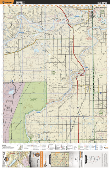
SOAB36 Empress - Southern Alberta Topo
Backroad Mapbooks
This recreation topographic map for the Empress area highlights all the logging and resource roads, multi-use trails for hikers, mountain bikers, horseback riders, cross-country skiers and snowshoers, motorized trails for ATVers and snowmobilers, fishing lakes and rivers, recreation areas, campgrounds, day-use areas, viewpoints, backcountry campsites, work camps, oil & gas sites, backcountry huts and cabins and more. No other map for the area provides you with this level of recreational or topographic detail. Covering 2,465 km2 (950 mi2) in total, this 1:75,000 scale map measures 43 x 57 km (27 x 35.5 mi). Special features include Crown Forest Management Areas, Public Land Use Zones, labelled fish species, enhanced oil & gas data and countless roads, trails and recreational Points of Interest. This map includes CFB Suffield National Wildlife Area, South Saskatchewan River, Red Deer River, Empress, Sandy Point Regional Park, Sharrow, Cavendish, McNeill, CFB Suffield, Hilda and more!
Page Size: 24 x 37 in (610 x 940 mm)
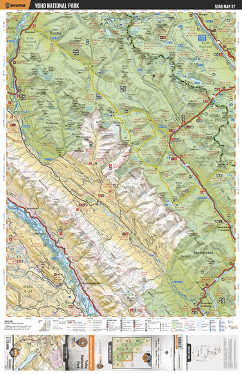
SOAB37 Yoho National Park - Southern Alberta Topo
Backroad Mapbooks
This recreation topographic map for the Yoho National Park area highlights all the logging and resource roads, multi-use trails for hikers, mountain bikers, horseback riders, cross-country skiers and snowshoers, motorized trails for ATVers and snowmobilers, fishing lakes and rivers, recreation areas, campgrounds, day-use areas, viewpoints, backcountry campsites, work camps, oil & gas sites, backcountry huts and cabins and more. No other map for the area provides you with this level of recreational or topographic detail. Covering 2,465 km2 (950 mi2) in total, this 1:75,000 scale map measures 43 x 57 km (27 x 35.5 mi). Special features include Crown Forest Management Areas, Public Land Use Zones, labelled fish species, enhanced oil & gas data and countless roads, trails and recreational Points of Interest. This map includes Kootenay National Park, Yoho National Park, Columbia River, Kicking Horse River,Boom Lake, Bow River, Eldon, Ottertail, Castledale, Harrogate, Kootenay Crossing, Spillimacheen, Vermilion Crossing and more!
Page Size: 24 x 37 in (610 x 940 mm)
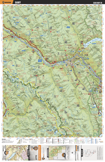
SOAB38 Banff - Southern Alberta Topo
Backroad Mapbooks
This recreation topographic map for the Banff area highlights all the logging and resource roads, multi-use trails for hikers, mountain bikers, horseback riders, cross-country skiers and snowshoers, motorized trails for ATVers and snowmobilers, fishing lakes and rivers, recreation areas, campgrounds, day-use areas, viewpoints, backcountry campsites, work camps, oil & gas sites, backcountry huts and cabins and more. No other map for the area provides you with this level of recreational or topographic detail. Covering 2,465 km2 (950 mi2) in total, this 1:75,000 scale map measures 43 x 57 km (27 x 35.5 mi). Special features include Crown Forest Management Areas, Public Land Use Zones, labelled fish species, enhanced oil & gas data and countless roads, trails and recreational Points of Interest. This map includes Banff National Park, Bow River, Spray River, Lake Minnewanka, Lake Magog, Goat Pond, Conmore, Banff, Harvie Heights, Anthracite, Massive, Castle Junction, Bankhead and more!
Page Size: 24 x 37 in (610 x 940 mm)
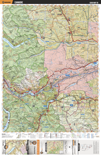
SOAB39 Canmore - Southern Alberta Topo
Backroad Mapbooks
This recreation topographic map for the Canmore area highlights all the logging and resource roads, multi-use trails for hikers, mountain bikers, horseback riders, cross-country skiers and snowshoers, motorized trails for ATVers and snowmobilers, fishing lakes and rivers, recreation areas, campgrounds, day-use areas, viewpoints, backcountry campsites, work camps, oil & gas sites, backcountry huts and cabins and more. No other map for the area provides you with this level of recreational or topographic detail. Covering 2,465 km2 (950 mi2) in total, this 1:75,000 scale map measures 43 x 57 km (27 x 35.5 mi). Special features include Crown Forest Management Areas, Public Land Use Zones, labelled fish species, enhanced oil & gas data and countless roads, trails and recreational Points of Interest. This map includes Dead Man's Flats, Lac des Arcs, Spray Lakes Reservoir, Bow Valley Prov Park, Lake Minnewanka, Don Getty Prov Park, Canmore, Kananaskis River, Barrier Lake, Banff National Park and more!
Page Size: 24 x 37 in (610 x 940 mm)
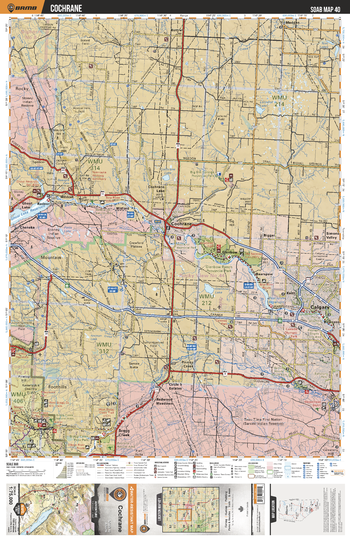
SOAB40 Cochrane - Southern Alberta Topo
Backroad Mapbooks
This recreation topographic map for the Cochrane area highlights all the logging and resource roads, multi-use trails for hikers, mountain bikers, horseback riders, cross-country skiers and snowshoers, motorized trails for ATVers and snowmobilers, fishing lakes and rivers, recreation areas, campgrounds, day-use areas, viewpoints, backcountry campsites, work camps, oil & gas sites, backcountry huts and cabins and more. No other map for the area provides you with this level of recreational or topographic detail. Covering 2,465 km2 (950 mi2) in total, this 1:75,000 scale map measures 43 x 57 km (27 x 35.5 mi). Special features include Crown Forest Management Areas, Public Land Use Zones, labelled fish species, enhanced oil & gas data and countless roads, trails and recreational Points of Interest. This map includes Cochrane, Ghost Lake, Calgary, Bragg Creek, Bearspaw, Madden, Big Hill Springs Prov Park, Bow River, Elbow River, Sarcee Indian Reservation and more!
Page Size: 24 x 37 in (610 x 940 mm)
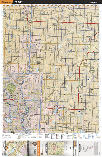
SOAB41 Calgary - Southern Alberta Topo
Backroad Mapbooks
This recreation topographic map for the Calgary area highlights all the logging and resource roads, multi-use trails for hikers, mountain bikers, horseback riders, cross-country skiers and snowshoers, motorized trails for ATVers and snowmobilers, fishing lakes and rivers, recreation areas, campgrounds, day-use areas, viewpoints, backcountry campsites, work camps, oil & gas sites, backcountry huts and cabins and more. No other map for the area provides you with this level of recreational or topographic detail. Covering 2,465 km2 (950 mi2) in total, this 1:75,000 scale map measures 43 x 57 km (27 x 35.5 mi). Special features include Crown Forest Management Areas, Public Land Use Zones, labelled fish species, enhanced oil & gas data and countless roads, trails and recreational Points of Interest. This map includes Calgary, Airdrie, Crossfield, Chestermere, Glenmore Reservoir, Rosebud River, Chestermere Lake, Nose Hill Park, Irricana, Langdon and more!
Page Size: 24 x 37 in (610 x 940 mm)
No search results