


MapSherpa Catalog
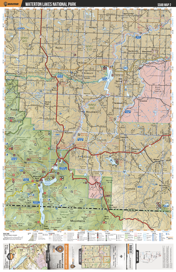
SOAB02 Waterton Lakes National Park - Southern Alberta Topo
Backroad Mapbooks
This recreation topographic map for the Waterton Lakes National Park area highlights all the logging and resource roads, multi-use trails for hikers, mountain bikers, horseback riders, cross-country skiers and snowshoers, motorized trails for ATVers and snowmobilers, fishing lakes and rivers, recreation areas, campgrounds, day-use areas, viewpoints, backcountry campsites, work camps, oil & gas sites, backcountry huts and cabins and more. No other map for the area provides you with this level of recreational or topographic detail. Covering 2,465 km2 (950 mi2) in total, this 1:75,000 scale map measures 43 x 57 km (27 x 35.5 mi). Special features include Crown Forest Management Areas, Public Land Use Zones, labelled fish species, enhanced oil & gas data and countless roads, trails and recreational Points of Interest. This map includes Waterton Reservoir, Waterton Lakes National Park, Blood Indian Reserve, Payne Lake, Beazer, Police Outpost Prov Park, Yarrow, Belly River, Waterton River, Glenwood and more!
Page Size: 24 x 37 in (610 x 940 mm)
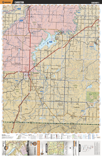
SOAB03 Cardston - Southern Alberta Topo
Backroad Mapbooks
This recreation topographic map for the Cardston area highlights all the logging and resource roads, multi-use trails for hikers, mountain bikers, horseback riders, cross-country skiers and snowshoers, motorized trails for ATVers and snowmobilers, fishing lakes and rivers, recreation areas, campgrounds, day-use areas, viewpoints, backcountry campsites, work camps, oil & gas sites, backcountry huts and cabins and more. No other map for the area provides you with this level of recreational or topographic detail. Covering 2,465 km2 (950 mi2) in total, this 1:75,000 scale map measures 43 x 57 km (27 x 35.5 mi). Special features include Crown Forest Management Areas, Public Land Use Zones, labelled fish species, enhanced oil & gas data and countless roads, trails and recreational Points of Interest. This map includes St Mary Reservoir, Blood Indian Reserve, Belly River, Aetna, St Mary River, Cardston, Jensen Reservoir, North Milk River, Spring Coulee and more!
Page Size: 24 x 37 in (610 x 940 mm)
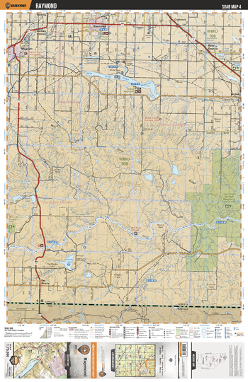
SOAB04 Raymond - Southern Alberta Topo
Backroad Mapbooks
This recreation topographic map for the Raymond area highlights all the logging and resource roads, multi-use trails for hikers, mountain bikers, horseback riders, cross-country skiers and snowshoers, motorized trails for ATVers and snowmobilers, fishing lakes and rivers, recreation areas, campgrounds, day-use areas, viewpoints, backcountry campsites, work camps, oil & gas sites, backcountry huts and cabins and more. No other map for the area provides you with this level of recreational or topographic detail. Covering 2,465 km2 (950 mi2) in total, this 1:75,000 scale map measures 43 x 57 km (27 x 35.5 mi). Special features include Crown Forest Management Areas, Public Land Use Zones, labelled fish species, enhanced oil & gas data and countless roads, trails and recreational Points of Interest. This map includes Twin River Heritage Rangeland Natural Area, Milk River Ridge Reservoir, Raymond, Magrath, New Dayton, Shanks Lake, Del Bonita, North Milk River, Milk River, Ridge Regional Park and more!
Page Size: 24 x 37 in (610 x 940 mm)
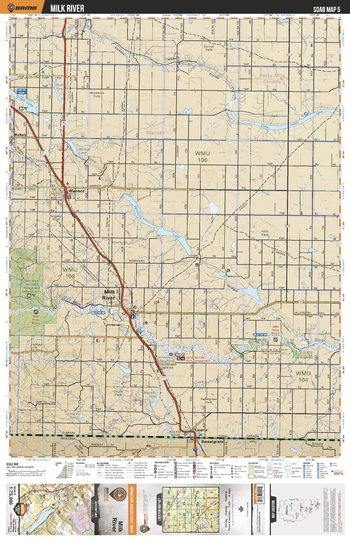
SOAB05 Milk River - Southern Alberta Topo
Backroad Mapbooks
This recreation topographic map for the Milk River area highlights all the logging and resource roads, multi-use trails for hikers, mountain bikers, horseback riders, cross-country skiers and snowshoers, motorized trails for ATVers and snowmobilers, fishing lakes and rivers, recreation areas, campgrounds, day-use areas, viewpoints, backcountry campsites, work camps, oil & gas sites, backcountry huts and cabins and more. No other map for the area provides you with this level of recreational or topographic detail. Covering 2,465 km2 (950 mi2) in total, this 1:75,000 scale map measures 43 x 57 km (27 x 35.5 mi). Special features include Crown Forest Management Areas, Public Land Use Zones, labelled fish species, enhanced oil & gas data and countless roads, trails and recreational Points of Interest. This map includes Milk River, Verdigris Lake, Crow Indian Lake, Goldsprings Park, Warner, Tyrrell Lake, Coutts, Twin River Heritage Rangeland Natural Area, Verdigris Coulee Natural Area, McNab and more!
Page Size: 24 x 37 in (610 x 940 mm)
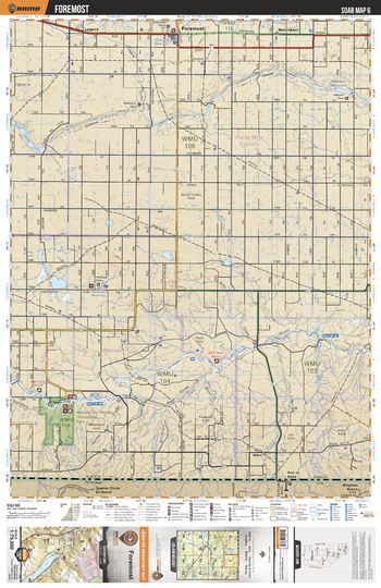
SOAB06 Foremost - Southern Alberta Topo
Backroad Mapbooks
This recreation topographic map for the Foremost area highlights all the logging and resource roads, multi-use trails for hikers, mountain bikers, horseback riders, cross-country skiers and snowshoers, motorized trails for ATVers and snowmobilers, fishing lakes and rivers, recreation areas, campgrounds, day-use areas, viewpoints, backcountry campsites, work camps, oil & gas sites, backcountry huts and cabins and more. No other map for the area provides you with this level of recreational or topographic detail. Covering 2,465 km2 (950 mi2) in total, this 1:75,000 scale map measures 43 x 57 km (27 x 35.5 mi). Special features include Crown Forest Management Areas, Public Land Use Zones, labelled fish species, enhanced oil & gas data and countless roads, trails and recreational Points of Interest. This map includes Writing on Stone Prov Park, Crow Indian Lake, Nemiskam, Foremost, Legend, Milk River, Aden, Port of Aden, Heningers Reservoir and more!
Page Size: 24 x 37 in (610 x 940 mm)
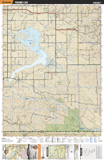
SOAB07 Pakowki Lake - Southern Alberta Topo
Backroad Mapbooks
This recreation topographic map for the Pakowki Lake area highlights all the logging and resource roads, multi-use trails for hikers, mountain bikers, horseback riders, cross-country skiers and snowshoers, motorized trails for ATVers and snowmobilers, fishing lakes and rivers, recreation areas, campgrounds, day-use areas, viewpoints, backcountry campsites, work camps, oil & gas sites, backcountry huts and cabins and more. No other map for the area provides you with this level of recreational or topographic detail. Covering 2,465 km2 (950 mi2) in total, this 1:75,000 scale map measures 43 x 57 km (27 x 35.5 mi). Special features include Crown Forest Management Areas, Public Land Use Zones, labelled fish species, enhanced oil & gas data and countless roads, trails and recreational Points of Interest. This map includes Pakowki Lake, Manyberries, Pakowki, Etzikom, Gahern, Milk River, Kennedy Coulee Eco Reserve, Pinhorn Provincial Grazing Reserve, Milk River Natural Area, Onefour Heritage Rangeland and more!
Page Size: 24 x 37 in (610 x 940 mm)
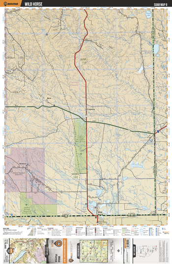
SOAB08 Wild Horse - Southern Alberta Topo
Backroad Mapbooks
This recreation topographic map for the Wild Horse area highlights all the logging and resource roads, multi-use trails for hikers, mountain bikers, horseback riders, cross-country skiers and snowshoers, motorized trails for ATVers and snowmobilers, fishing lakes and rivers, recreation areas, campgrounds, day-use areas, viewpoints, backcountry campsites, work camps, oil & gas sites, backcountry huts and cabins and more. No other map for the area provides you with this level of recreational or topographic detail. Covering 2,465 km2 (950 mi2) in total, this 1:75,000 scale map measures 43 x 57 km (27 x 35.5 mi). Special features include Crown Forest Management Areas, Public Land Use Zones, labelled fish species, enhanced oil & gas data and countless roads, trails and recreational Points of Interest. This map includes Wild Horse, Cressday, Onefour, Bain, Green Lake, Lodge Creek, Onefour Heritage Rangeland Natural Area, Cutbank Creek, Lost River, Bare Creek, Milk River Lake and more!
Page Size: 24 x 37 in (610 x 940 mm)
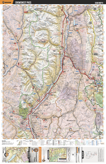
SOAB09 Crowsnest Pass - Southern Alberta Topo
Backroad Mapbooks
This recreation topographic map for the Crowsnest Pass area highlights all the logging and resource roads, multi-use trails for hikers, mountain bikers, horseback riders, cross-country skiers and snowshoers, motorized trails for ATVers and snowmobilers, fishing lakes and rivers, recreation areas, campgrounds, day-use areas, viewpoints, backcountry campsites, work camps, oil & gas sites, backcountry huts and cabins and more. No other map for the area provides you with this level of recreational or topographic detail. Covering 2,465 km2 (950 mi2) in total, this 1:75,000 scale map measures 43 x 57 km (27 x 35.5 mi). Special features include Crown Forest Management Areas, Public Land Use Zones, labelled fish species, enhanced oil & gas data and countless roads, trails and recreational Points of Interest. This map includes Sparwood, Crowsnest, Fernie, Elk River, Ptolemy Creek, Island Lake, Tent Mtn, Hazell, Crowsnest Prov Park, Deadman Pass and more!
Page Size: 24 x 37 in (610 x 940 mm)
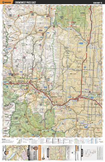
SOAB10 Crowsnest Pass East - Southern Alberta Topo
Backroad Mapbooks
This recreation topographic map for the Crowsnest Pass East area highlights all the logging and resource roads, multi-use trails for hikers, mountain bikers, horseback riders, cross-country skiers and snowshoers, motorized trails for ATVers and snowmobilers, fishing lakes and rivers, recreation areas, campgrounds, day-use areas, viewpoints, backcountry campsites, work camps, oil & gas sites, backcountry huts and cabins and more. No other map for the area provides you with this level of recreational or topographic detail. Covering 2,465 km2 (950 mi2) in total, this 1:75,000 scale map measures 43 x 57 km (27 x 35.5 mi). Special features include Crown Forest Management Areas, Public Land Use Zones, labelled fish species, enhanced oil & gas data and countless roads, trails and recreational Points of Interest. This map includes Bob Creek Prov Park, Castle Special Management Area, Lundbreck, Bellevue, Crowsnest Pass, Blairmore, Mt Secord, Crowsnest Lake, Crowsnest River, Oldman River Reservoir and more!
Page Size: 24 x 37 in (610 x 940 mm)
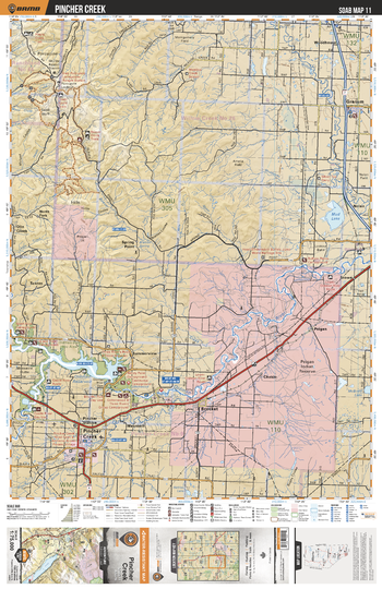
SOAB11 Pincher Creek - Southern Alberta Topo
Backroad Mapbooks
This recreation topographic map for the Pincher Creek area highlights all the logging and resource roads, multi-use trails for hikers, mountain bikers, horseback riders, cross-country skiers and snowshoers, motorized trails for ATVers and snowmobilers, fishing lakes and rivers, recreation areas, campgrounds, day-use areas, viewpoints, backcountry campsites, work camps, oil & gas sites, backcountry huts and cabins and more. No other map for the area provides you with this level of recreational or topographic detail. Covering 2,465 km2 (950 mi2) in total, this 1:75,000 scale map measures 43 x 57 km (27 x 35.5 mi). Special features include Crown Forest Management Areas, Public Land Use Zones, labelled fish species, enhanced oil & gas data and countless roads, trails and recreational Points of Interest. This map includes Mud Lake, Oldman River, Oldman River Reservoir, Brocket, Pincher Creek, Granum, Peigan Indian Reserve, Porcupine Hills, Willow Creek, Woodhouse and more!
Page Size: 24 x 37 in (610 x 940 mm)
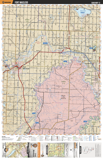
SOAB12 Fort Macleod - Southern Alberta Topo
Backroad Mapbooks
This recreation topographic map for the Fort Macleod area highlights all the logging and resource roads, multi-use trails for hikers, mountain bikers, horseback riders, cross-country skiers and snowshoers, motorized trails for ATVers and snowmobilers, fishing lakes and rivers, recreation areas, campgrounds, day-use areas, viewpoints, backcountry campsites, work camps, oil & gas sites, backcountry huts and cabins and more. No other map for the area provides you with this level of recreational or topographic detail. Covering 2,465 km2 (950 mi2) in total, this 1:75,000 scale map measures 43 x 57 km (27 x 35.5 mi). Special features include Crown Forest Management Areas, Public Land Use Zones, labelled fish species, enhanced oil & gas data and countless roads, trails and recreational Points of Interest. This map includes Blood Indian Reserve, Coalhurst, St Mary River, Fort Macleod, Keho Lake Reservoir, Nobleford, Oldman River, West Lethbridge, Belly River, River Valley Wilderness Park and more!
Page Size: 24 x 37 in (610 x 940 mm)
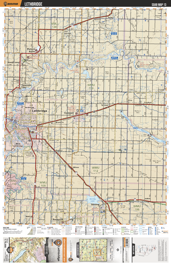
SOAB13 Lethbridge - Southern Alberta Topo
Backroad Mapbooks
This recreation topographic map for the Lethbridge area highlights all the logging and resource roads, multi-use trails for hikers, mountain bikers, horseback riders, cross-country skiers and snowshoers, motorized trails for ATVers and snowmobilers, fishing lakes and rivers, recreation areas, campgrounds, day-use areas, viewpoints, backcountry campsites, work camps, oil & gas sites, backcountry huts and cabins and more. No other map for the area provides you with this level of recreational or topographic detail. Covering 2,465 km2 (950 mi2) in total, this 1:75,000 scale map measures 43 x 57 km (27 x 35.5 mi). Special features include Crown Forest Management Areas, Public Land Use Zones, labelled fish species, enhanced oil & gas data and countless roads, trails and recreational Points of Interest. This map includes Lethbridge, Coaldale, Picture Butte, Shaughnessy, Diamond City, Oldman River, Chin Lakes, Stirling, Stirling Lake, Iron Springs and more!
Page Size: 24 x 37 in (610 x 940 mm)
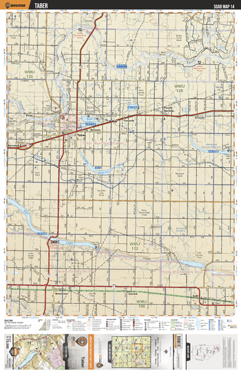
SOAB14 Taber - Southern Alberta Topo
Backroad Mapbooks
This recreation topographic map for the Taber area highlights all the logging and resource roads, multi-use trails for hikers, mountain bikers, horseback riders, cross-country skiers and snowshoers, motorized trails for ATVers and snowmobilers, fishing lakes and rivers, recreation areas, campgrounds, day-use areas, viewpoints, backcountry campsites, work camps, oil & gas sites, backcountry huts and cabins and more. No other map for the area provides you with this level of recreational or topographic detail. Covering 2,465 km2 (950 mi2) in total, this 1:75,000 scale map measures 43 x 57 km (27 x 35.5 mi). Special features include Crown Forest Management Areas, Public Land Use Zones, labelled fish species, enhanced oil & gas data and countless roads, trails and recreational Points of Interest. This map includes Taber, Purple Springs, Chin Lakes, Horsefly Lake Reservoire, Sherburne Lake, Taber Lake, Fincastle Lake, Oldman River, Elcan, Antonio, Conrad, Skiff and more!
Page Size: 24 x 37 in (610 x 940 mm)
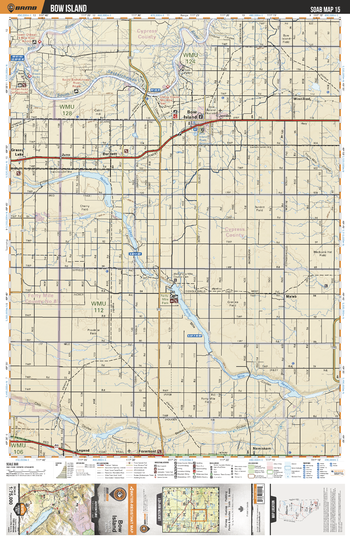
SOAB15 Bow Island - Southern Alberta Topo
Backroad Mapbooks
This recreation topographic map for the Bow Island area highlights all the logging and resource roads, multi-use trails for hikers, mountain bikers, horseback riders, cross-country skiers and snowshoers, motorized trails for ATVers and snowmobilers, fishing lakes and rivers, recreation areas, campgrounds, day-use areas, viewpoints, backcountry campsites, work camps, oil & gas sites, backcountry huts and cabins and more. No other map for the area provides you with this level of recreational or topographic detail. Covering 2,465 km2 (950 mi2) in total, this 1:75,000 scale map measures 43 x 57 km (27 x 35.5 mi). Special features include Crown Forest Management Areas, Public Land Use Zones, labelled fish species, enhanced oil & gas data and countless roads, trails and recreational Points of Interest. This map includes South Saskatchewan River, Bow Island, Burdett, Yellow Lake, Grassy Lake, Forty Mile Regional Park, Nemiskam, Foremost, Maleb, Winnifred and more!
Page Size: 24 x 37 in (610 x 940 mm)
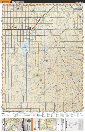
SOAB16 Seven Persons - Southern Alberta Topo
Backroad Mapbooks
This recreation topographic map for the Seven Persons area highlights all the logging and resource roads, multi-use trails for hikers, mountain bikers, horseback riders, cross-country skiers and snowshoers, motorized trails for ATVers and snowmobilers, fishing lakes and rivers, recreation areas, campgrounds, day-use areas, viewpoints, backcountry campsites, work camps, oil & gas sites, backcountry huts and cabins and more. No other map for the area provides you with this level of recreational or topographic detail. Covering 2,465 km2 (950 mi2) in total, this 1:75,000 scale map measures 43 x 57 km (27 x 35.5 mi). Special features include Crown Forest Management Areas, Public Land Use Zones, labelled fish species, enhanced oil & gas data and countless roads, trails and recreational Points of Interest. This map includes Murray Lake, Seven Persons, Red Rock Coulee Natural Area, Seven Persons Creek, Rush Lake, Fitzgerald, Bullshead, Dunmore, Macson, Roytal and more!
Page Size: 24 x 37 in (610 x 940 mm)
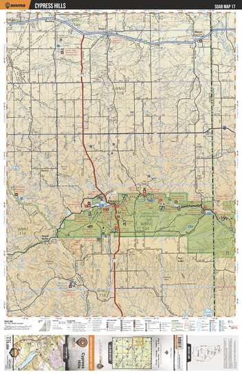
SOAB17 Cypress Hills - Southern Alberta Topo
Backroad Mapbooks
This recreation topographic map for the Cypress Hills area highlights all the logging and resource roads, multi-use trails for hikers, mountain bikers, horseback riders, cross-country skiers and snowshoers, motorized trails for ATVers and snowmobilers, fishing lakes and rivers, recreation areas, campgrounds, day-use areas, viewpoints, backcountry campsites, work camps, oil & gas sites, backcountry huts and cabins and more. No other map for the area provides you with this level of recreational or topographic detail. Covering 2,465 km2 (950 mi2) in total, this 1:75,000 scale map measures 43 x 57 km (27 x 35.5 mi). Special features include Crown Forest Management Areas, Public Land Use Zones, labelled fish species, enhanced oil & gas data and countless roads, trails and recreational Points of Interest. This map includes Cypress Hills Interprovincial Park, Elkwater, Cypress Hills, Gros Ventre Creek, Irvine, Cavan Lake, Walsh, Fox Lake, Elkwater Lake, Battle Creek and more!
Page Size: 24 x 37 in (610 x 940 mm)
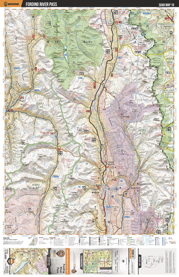
SOAB18 Fording River Pass - Southern Alberta Topo
Backroad Mapbooks
This recreation topographic map for the Fording River Pass area highlights all the logging and resource roads, multi-use trails for hikers, mountain bikers, horseback riders, cross-country skiers and snowshoers, motorized trails for ATVers and snowmobilers, fishing lakes and rivers, recreation areas, campgrounds, day-use areas, viewpoints, backcountry campsites, work camps, oil & gas sites, backcountry huts and cabins and more. No other map for the area provides you with this level of recreational or topographic detail. Covering 2,465 km2 (950 mi2) in total, this 1:75,000 scale map measures 43 x 57 km (27 x 35.5 mi). Special features include Crown Forest Management Areas, Public Land Use Zones, labelled fish species, enhanced oil & gas data and countless roads, trails and recreational Points of Interest. This map includes Kananaskis Country, Don Getty Wildland Prov Park, Beehive Natural Area, Elkford, Elk River, Connor Lakes and more!
Page Size: 24 x 37 in (610 x 940 mm)
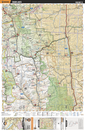
SOAB19 Chain Lakes - Southern Alberta Topo
Backroad Mapbooks
This recreation topographic map for the Chain Lakes area highlights all the logging and resource roads, multi-use trails for hikers, mountain bikers, horseback riders, cross-country skiers and snowshoers, motorized trails for ATVers and snowmobilers, fishing lakes and rivers, recreation areas, campgrounds, day-use areas, viewpoints, backcountry campsites, work camps, oil & gas sites, backcountry huts and cabins and more. No other map for the area provides you with this level of recreational or topographic detail. Covering 2,465 km2 (950 mi2) in total, this 1:75,000 scale map measures 43 x 57 km (27 x 35.5 mi). Special features include Crown Forest Management Areas, Public Land Use Zones, labelled fish species, enhanced oil & gas data and countless roads, trails and recreational Points of Interest. This map includes Bob Creek Prov Park, Mt Livingstone, Beehive Mtn, Chain Lakes Reservoir, Plateau Mtn, Don Getty Prov Park, Highwood River, Highwood Junction, Holy Cross Mtn, Chain Lakes Prov Park and more!
Page Size: 24 x 37 in (610 x 940 mm)
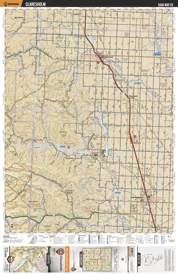
SOAB20 Claresholm - Southern Alberta Topo
Backroad Mapbooks
This recreation topographic map for the Claresholm area highlights all the logging and resource roads, multi-use trails for hikers, mountain bikers, horseback riders, cross-country skiers and snowshoers, motorized trails for ATVers and snowmobilers, fishing lakes and rivers, recreation areas, campgrounds, day-use areas, viewpoints, backcountry campsites, work camps, oil & gas sites, backcountry huts and cabins and more. No other map for the area provides you with this level of recreational or topographic detail. Covering 2,465 km2 (950 mi2) in total, this 1:75,000 scale map measures 43 x 57 km (27 x 35.5 mi). Special features include Crown Forest Management Areas, Public Land Use Zones, labelled fish species, enhanced oil & gas data and countless roads, trails and recreational Points of Interest. This map includes Nanton, Claresholm, Silver Lake, Mosquito Creek, Little Bow River, MacMillan, Blacktail, Stavely, Willow Creek Prov Park, Furman and more!
Page Size: 24 x 37 in (610 x 940 mm)
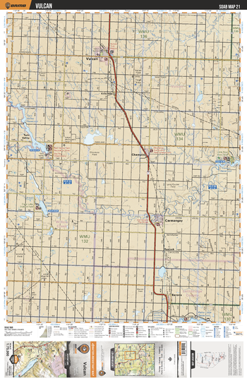
SOAB21 Vulcan - Southern Alberta Topo
Backroad Mapbooks
This recreation topographic map for the Vulcan area highlights all the logging and resource roads, multi-use trails for hikers, mountain bikers, horseback riders, cross-country skiers and snowshoers, motorized trails for ATVers and snowmobilers, fishing lakes and rivers, recreation areas, campgrounds, day-use areas, viewpoints, backcountry campsites, work camps, oil & gas sites, backcountry huts and cabins and more. No other map for the area provides you with this level of recreational or topographic detail. Covering 2,465 km2 (950 mi2) in total, this 1:75,000 scale map measures 43 x 57 km (27 x 35.5 mi). Special features include Crown Forest Management Areas, Public Land Use Zones, labelled fish species, enhanced oil & gas data and countless roads, trails and recreational Points of Interest. This map includes Little Bow River, Vulcan, Clear Lake, Little Bow Prov Park, Travers Reservoir, Carmangay, Kirkcaldy, Champion, Barons, Hay Lake and more!
Page Size: 24 x 37 in (610 x 940 mm)
No search results