


MapSherpa Catalog
Regional Relief - Northern Europe
MapSherpa
These beautiful maps show Political and Physical features for Northern Europe; from Iceland in the west, and Scandinavia in the east. Maps contain extensive country specific features and text. Relief shading and the use of different colors by height above sea level are both informative and attractive. Custom maps can be made at scales between 1:900,000 and 1:3,500,000.
Regional Relief - Northern South America
MapSherpa
These beautiful maps show Political and Physical features for Northern South America; from Venezeula in the north to Bolivia in the south. Maps contain extensive country specific features and text. Relief shading and the use of different colors by height above sea level are both informative and attractive. Custom maps can be made at scales between 1:1,250,000 and 1:5,000,000.
Regional Relief - Russian Federation
MapSherpa
These beautiful maps show Political and Physical features for the Russian Federation; from the Baltic States in the west to Japan and Korea in the east. Maps contain extensive country specific features and text. Relief shading and the use of different colors by height above sea level are both informative and attractive. Custom maps can be made at scales between 1:1,750,000 and 1:7,000,000.
Regional Relief - Southeastern Asia
MapSherpa
These beautiful maps show Political and Physical features for Southeast Asia; from India in the west to Papua New Guinea in the east. Maps contain extensive country specific features and text. Relief shading and the use of different colors by height above sea level are both informative and attractive. Custom maps can be made at scales between 1:2,000,000 and 1:8,000,000.
Regional Relief - Southern Africa
MapSherpa
These beautiful maps show Political and Physical features for Southern Africa; from the Gulf of Guinea and Ethiopia in the north to South Africa in the south. Maps contain extensive country specific features and text. Relief shading and the use of different colors by height above sea level are both informative and attractive. Custom maps can be made at scales between 1:1,600,000 and 1:6,400,000.
Regional Relief - Southern Europe
MapSherpa
These beautiful maps show Political and Physical features for Southern Europe; from Spain and Portugal in the west, to Ukraine and Turkey in the east. Maps contain extensive country specific features and text. Relief shading and the use of different colors by height above sea level are both informative and attractive. Custom maps can be made at scales between 1:900,000 and 1:3,500,000.
Regional Relief - Southern South America
MapSherpa
These beautiful maps show Political and Physical features for Southern South America from; Paraguay and Uruguay in the north, to the Falkland Islands in the south. Maps contain extensive country specific features and text. Relief shading and the use of different colors by height above sea level are both informative and attractive. Custom maps can be made at scales between 1:1,250,000 and 1:5,000,000.
Regional Relief - United Kingdom & Ireland
MapSherpa
These beautiful maps show Political and Physical features for the United Kingdom, Ireland as well as Benelux in mainland Europe. Maps contain extensive country specific features and text. Relief shading and the use of different colors by height above sea level are both informative and attractive. Custom maps can be made at scales between 1:300,000 and 1:1,500,000.
Regional Relief - United States
MapSherpa
These beautiful maps show Political and Physical features for the lower 48 U.S. States. Maps contain extensive country specific features and text. Relief shading and the use of different colors by height above sea level are both informative and attractive. Custom maps can be made at scales between 1:1,000,000 and 1:4,000,000.

Relief Map East Sheet (1906)
Natural Resources Canada
Contained within the 1st Edition (1906) of the Atlas of Canada is a map that shows the relief (in feet) for Eastern Canada. Depth of the elevation is proportional to the varying tints of brown. The highest elevations are shown in the darkest tints and lower portions in lighter tints. Relatively large areas of Western Canada had incomplete data on relief as of 1906. The map also shows major drainage divides and railways.
Page Size: 24 x 17.25 in (608 x 434 mm)

Relief Map West Sheet (1906)
Natural Resources Canada
Contained within the 1st Edition (1906) of the Atlas of Canada, is a map that shows the relief (in feet) for Western Canada. Depth of the elevation is proportional to the varying tints of brown. The highest elevations are shown in the darkest tints, and lower portions in lighter tints. Relatively large areas of Western Canada had incomplete data on relief as of 1906. The map also shows major drainage divides and railways.
Page Size: 24 x 17.25 in (607 x 434 mm)
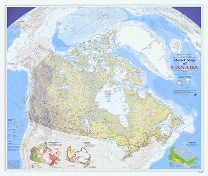
Relief Map of Canada Wall Map - Atlas of Canada
Natural Resources Canada
This map uses the Vertical Near-Side Perspective Projection. The map's main feature is showing Canada with very-detailed digital shaded relief. All official Canadian, provincial, and surrounding international boundaries are shown, including the proposed boundary for the new territory of Nunavut (which came into existence in 1999). There are three small maps of Canada shown on this map sheet, all at scale 1:35 000 000. One shows the major physiographic regions; the second shows major drainage basins, and the third map shows classes of vegetation cover. All data on the map is current to the mid to late 1990's.
Page Size: 42.75 x 36.25 in (1086 x 917 mm)
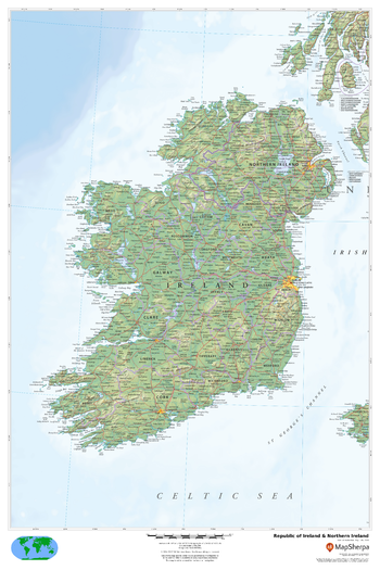
Republic of Ireland & Northern Ireland
MapSherpa
This beautiful map shows physical and political features for the Republic of Ireland and Northern Ireland. Relief shading and the use of different colours by height above sea level are both informative and attractive.
Page Size: 24 x 36 in (610 x 914 mm)
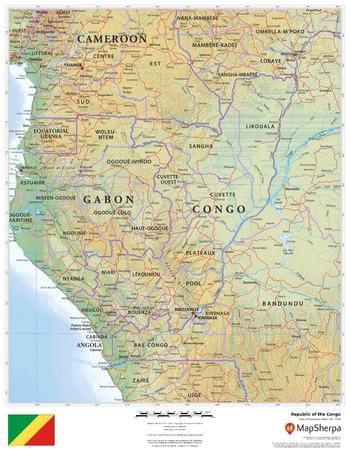
Republic of the Congo
MapSherpa
This beautiful map shows physical and political features for the Republic of the Congo and surrounding areas. Relief shading and the use of different colours by height above sea level are both informative and attractive.
Page Size: 17 x 22 in (432 x 559 mm)
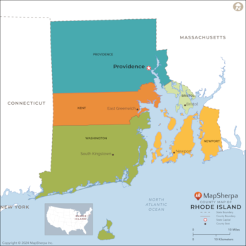
Rhode Island Counties Map - Extra Large
MapSherpa
This map has been created exclusively for MapSherpa, and designed for reference or business use. Clear and clean colors & fonts matched with cartographic research makes this map of the 5 Rhode Island counties easily readable and useful.
Page Size: 60 x 60 in (1524 x 1524 mm)
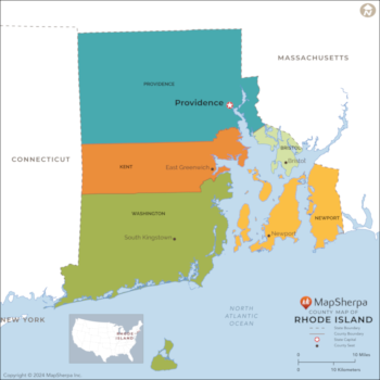
Rhode Island Counties Map - Large
MapSherpa
This map has been created exclusively for MapSherpa, and designed for reference or business use. Clear and clean colors & fonts matched with cartographic research makes this map of the 5 Rhode Island counties easily readable and useful.
Page Size: 48 x 48 in (1219 x 1219 mm)
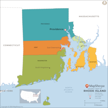
Rhode Island Counties Map - Standard
MapSherpa
This map has been created exclusively for MapSherpa, and designed for reference or business use. Clear and clean colors & fonts matched with cartographic research makes this map of the 5 Rhode Island counties easily readable and useful.
Page Size: 36 x 36 in (914 x 914 mm)
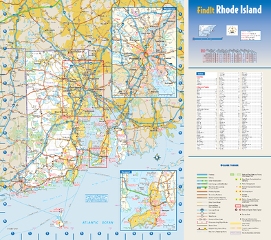
Rhode Island State Wall Map
Globe Turner
This colorful, easy-to-read state map of Rhode Island identifies all major thoroughfares, secondary roads, freeway interchanges, rest areas, distance markers, landmarks, recreational areas, and more. Shaded relief on the state map provides a three-dimensional sense of Rhode Island’s topography. Detailed city inset maps of Newport and Providence are based on the latest street information from our cartographic experts. County and city indices make it simple to locate even the smallest town.
Page Size: 15.75 x 14 in (400 x 356 mm)
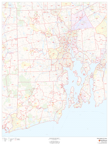
Rhode Island ZIP Code Map
MapSherpa
This map of Rhode Island shows ZIP code areas overlaid on a road map. Ideal for planning of deliveries, home services, sales territories, real estate and much more. Base map features include all roads with major roads and highways labelled; municipality and county boundaries; neighborhood names; railways; and high level land use such as parks and recreation areas, industrial areas and hospital campuses.
Page Size: 36 x 48 in (914 x 1219 mm)
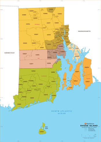
Rhode Island ZIP Code Map with Counties - Extra Large
MapSherpa
This map has been created exclusively for MapSherpa, and designed for business or reference use. Clear and clean colors & fonts matched with cartographic research makes this map of Rhode Island's counties and ZIP codes easily readable and useful.
Page Size: 60 x 84.5 in (1524 x 2141 mm)
No search results