


MapSherpa Catalog
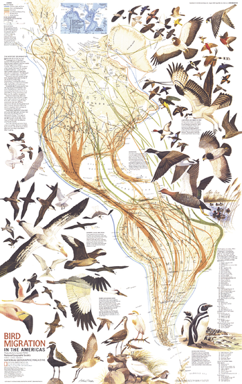
Bird Migration in the Americas - Published 1979
National Geographic
Bird lovers will treasure this educational map of the migratory birds of the Americas. Published in August 1979 in conjunction with a political and physical map of the Americas and the article "Mysteries of Bird Migration," this piece contains an abundance of information on migratory routes as well as beautiful illustrations of 67 bird species.
Page Size: 22.75 x 36 in (575 x 910 mm)
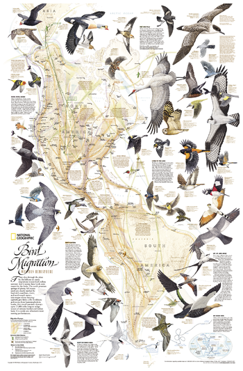
Bird Migration, Western Hemisphere
National Geographic
This National Geographic classic shows the mystery of bird migration and the incredible journeys that birds undertake in the Americas each year. 67 types of birds that migrate are shown on a map of the Americas that is overlaid with pathways that show migration routes from nesting grounds to wintering areas. Full-color bird paintings by noted illustrator Arthur Singer show each of the 67 species, making it easy to identify birds as they fly their amazing journeys.
Page Size: 21 x 32 in (533 x 813 mm)
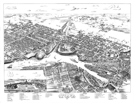
Bird's Eye View of the City of Ottawa
Natural Resources Canada
Contained within the Historical Maps, 1639 to 1949, Atlas of Canada map series, is a reproduction of one of the bird's eye view sketches of cities which were very popular in the late 19th century. In this case, it is a black-and-white sketch drawn by Herm. Brosius and originally published by Chicago Litho. Co. As of 1876, Ottawa consisted of only part of Centretown, Byward, and Sandy Hill. The view lists dozens of major buildings at the time. It also has a sketch of the three buildings of Parliament. Of interest, all streets and railway lines are named.
Page Size: 28 x 21.5 in (710 x 543 mm)
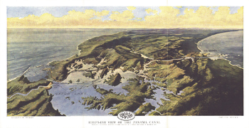
Birds Eye View of the Panama Canal - Published 1912
National Geographic
Published in February 1912 two years before the Panama Canal opened, this stunning relief map-painting illustrates the Panama railroad, locks, breakwater, and other details of the region. One of the largest engineering projects ever undertaken, the canal had an enormous impact on shipping, creating a passage between the Pacific and Atlantic Oceans. Prior to the canal's opening, ships had to travel the long and treacherous route around the tip of South America.
Page Size: 18.75 x 9.75 in (474 x 244 mm)
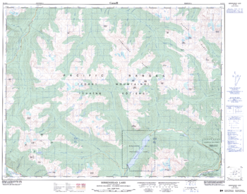
Birkenhead Lake - 92 J/10 - British Columbia
Natural Resources Canada
Canadian topographic map of Birkenhead Lake, British Columbia. NTS sheet 092J10 Edition 2.
Page Size: 32.25 x 25.5 in (815 x 642 mm)

Birmingham - B - Postcode Wall Map
XYZ Maps
The Birmingham Postcode Sector Wall Map shows detailed postcode sector boundaries (B1 1, B1 2) on a comprehensive background and is perfect for determining postcode boundaries for sales areas, planning mailshots and also an excellent reference for logistics. This wall map covers the whole of the B Postcode Area.
Page Size: 33.25 x 47 in (841 x 1189 mm)
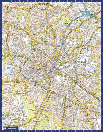
Birmingham A-Z Street Map
A-Z Maps
The perfect reference map for finding your way around Birmingham. This up-to-date detailed A-Z town plan includes more than 3,000 streets in and around Birmingham. As well as the city centre and St Philip’s Cathedral, the other areas covered include Moseley, Edgbaston, Small Heath, the Jewellery Quarter, Winson Green, Gib Heath, Lozells, Saltley and Aston. The highly detailed 1 mile to 5.5 inch street map includes places of interest, among other features.
Page Size: 22.25 x 28.5 in (560 x 718 mm)
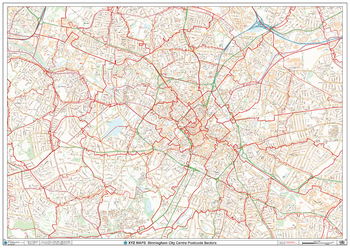
Birmingham City Centre Postcode Sectors Wall Map (C4)
XYZ Maps
The Birmingham City Centre Poscode Sector Wall Map shows detailed postcode sector boundaries along with its associated label (B1 1, B1 2) on a comprehensive background and is perfect for determining postcode boundaries, for sales, logistics, planning mailshots or as a regional reference guide.
Page Size: 47 x 33.25 in (1189 x 841 mm)
Black Butte Quadrangle, Oregon
United States Department of Agriculture Forest Service
United States Department of Agriculture Forestry Service topographical map of Black Butte, Deschutes National Forest, Oregon.
Page Size: 21.75 x 27 in (552 x 686 mm)
Black Crater Quadrangle, Oregon
United States Department of Agriculture Forest Service
United States Department of Agriculture Forestry Service topographical map of Black Crater, Deschutes National Forest, Oregon.
Page Size: 21.75 x 27 in (552 x 686 mm)
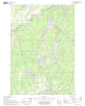
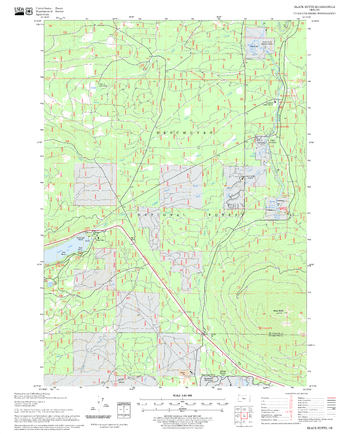
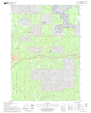
Black Hills Quadrangle, South Dakota
United States Department of Agriculture Forest Service
United States Department of Agriculture Forestry Service topographical map of Black Hills, Black Hills National Forest, South Dakota.
Page Size: 21.75 x 27 in (552 x 686 mm)
Black Rock Mountain Quadrangle, California
United States Department of Agriculture Forest Service
United States Department of Agriculture Forestry Service topographical map of Black Rock Mountain, Mendocino National Forest, California.
Page Size: 21.75 x 27 in (552 x 686 mm)
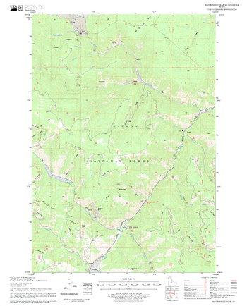
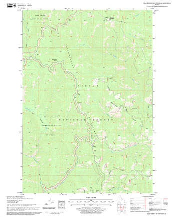
Blackbird Creek Quadrangle, Idaho
United States Department of Agriculture Forest Service
United States Department of Agriculture Forestry Service topographical map of Blackbird Creek, Salmon-Chalis National Forest, Idaho.
Page Size: 21.75 x 27 in (552 x 686 mm)
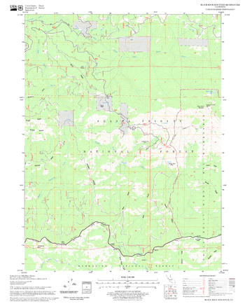
Blackbird Mountain Quadrangle, Idaho
United States Department of Agriculture Forest Service
United States Department of Agriculture Forestry Service topographical map of Blackbird Mountain, Salmon-Chalis National Forest, Idaho.
Page Size: 21.75 x 27 in (552 x 686 mm)

Blackburn - BB - Postcode Wall Map
XYZ Maps
The Blackburn Postcode Sector Wall Map shows detailed postcode sector boundaries (BB1 1, BB1 2) on a comprehensive background and is perfect for determining postcode boundaries for sales areas, planning mailshots and also an excellent reference for logistics. This wall map covers the whole of the BB Postcode Area.
Page Size: 47 x 33.25 in (1189 x 841 mm)
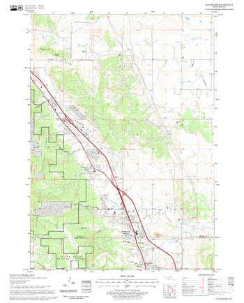
Blackhawk Quadrangle, South Dakota
United States Department of Agriculture Forest Service
United States Department of Agriculture Forestry Service topographical map of Blackhawk, Black Hills National Forest, South Dakota.
Page Size: 21.75 x 27 in (552 x 686 mm)
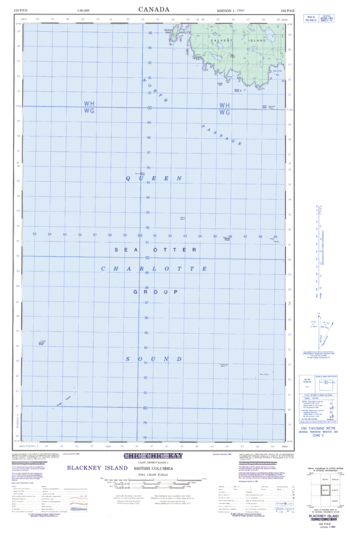
Blackney Island - 109 P/8 E - British Columbia
Natural Resources Canada
Canadian topographic map of Blackney Island, British Columbia. NTS sheet 102P08 E Edition 1.
Page Size: 18.5 x 28.25 in (466 x 713 mm)

Blackpool - FY - Postcode Wall Map
XYZ Maps
The Blackpool Postcode Sector Wall Map shows detailed postcode sector boundaries (FY1 1, FY1 2) on a comprehensive background and is perfect for determining postcode boundaries for sales areas, planning mailshots and also an excellent reference for logistics. This wall map covers the whole of the FY Postcode Area.
Page Size: 33.25 x 47 in (841 x 1189 mm)
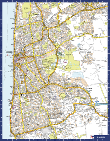
Blackpool A-Z Street Map
A-Z Maps
The perfect reference map for finding your way around Blackpool. This detailed A-Z town plan includes all of the 2,100 streets in and around Blackpool. As well as the Promenade this handy map covers Great Marton Moss, Common Edge, Pleasure Beach, Hawes Side, Staining, Laytoun, North Shore and Warbreck. The large scale 1 mile to 5.5 inch street map includes the following:
• Places of interest
• Blackpool tramway stops and route (Cavendish Road to Starr Gate)
Page Size: 22.25 x 28.5 in (560 x 718 mm)
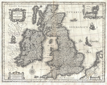
Blaeu Map of the British Isles (1631)
Artokoloro
1631 map of England, Scotland and Ireland by Dutch catrographer Willem Janszoon Blaeu. Full title: Magnae Britanniae et Hiberniae Tabula.
Page Size: 18.75 x 14.75 in (472 x 374 mm)
No search results