


MapSherpa Catalog
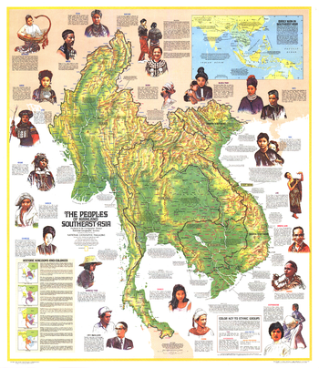
Peoples of Mainland Southeast Asia - Published 1971
National Geographic
Discover the varied cultures and ethnicities of the peoples of mainland Southeast Asia with this educational map. Published in March 1971 to accompany a map of Asia and the article "Pagan, on the Road to Mandalay."
Page Size: 32.5 x 37.5 in (824 x 952 mm)
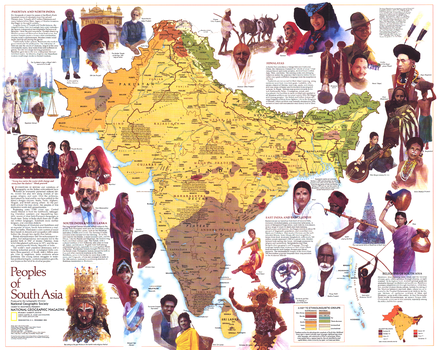
Peoples of South Asia - Published 1984
National Geographic
An informative map featuring the peoples of South Asia, this work includes compelling illustrations and notes about the religions, history, languages, and ways of life of these diverse groups. Published in December 1984 as a companion to the "South Asia with Afghanistan and Burma" map and an article on monsoons.
Page Size: 28.5 x 22.75 in (720 x 575 mm)
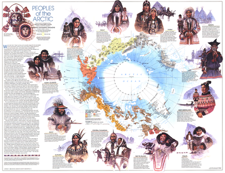
Peoples of the Arctic - Published 1983
National Geographic
This beautiful map contains a large quantity of information about the diverse peoples who inhabit the Arctic region. Of particular note is the demonstration of the approximate boundaries of the various inhabitants circa 1825. Published in February 1983 as a companion to the "Arctic Ocean" map and four articles, including "Hunters of the Lost Spirit."
Page Size: 29.5 x 22.75 in (748 x 577 mm)
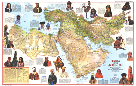
Peoples of the Middle East - Published 1972
National Geographic
A beautiful relief map of the Middle East that also contains a wealth of information about its diverse population. Includes compelling illustrations and details about the history, religions, languages, trades, and lifestyles of the region's inhabitants. Published in July 1972.
Page Size: 35.75 x 22.75 in (903 x 573 mm)
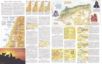
Peoples of the Middle East Theme - Published 1972
National Geographic
Half of a two-map set, the Peoples of the Middle East map is filled with a wealth of information about the region and its inhabitants including their work, religions, languages, the role of women, politics, and more. Published in July 1972, this map contains over a dozen maps detailing historical periods, religious sites, land use, and ethnic groups.
Page Size: 35.75 x 22.75 in (903 x 573 mm)
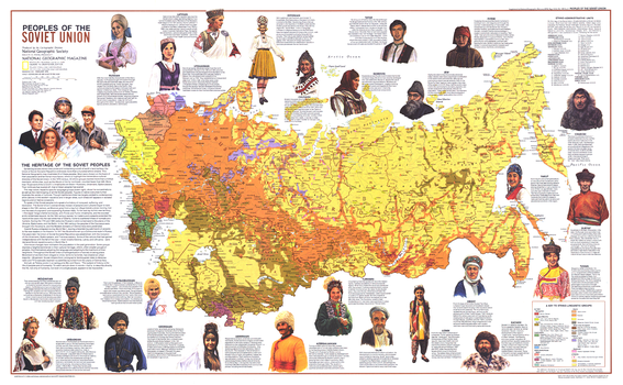
Peoples of the Soviet Union - Published 1976
National Geographic
This map provides a wealth of information about the amazing cultural diversity of the former Soviet Union. Twenty-four ethnicities are highlighted, showing their territorial extents as well as illustrations and information about their cultures. Published in February 1976 as half of a two-map set with the "Soviet Union" map.
Page Size: 37 x 23 in (939 x 579 mm)
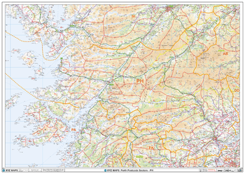
Perth - PH - Postcode Wall Map
XYZ Maps
The Perth Postcode Sector Wall Map shows detailed postcode sector boundaries (PH1 1, PH1 2) on a comprehensive background and is perfect for determining postcode boundaries for sales areas, planning mailshots and also an excellent reference for logistics. This wall map covers the whole of the PH Postcode Area.
Page Size: 47 x 33.25 in (1189 x 841 mm)

Perth, Australia Regional Supermap
Hema Maps
A large map of the Perth region that is ideal as a reference and for planning sales and delivery zones.
Page Size: 39.5 x 56.25 in (1000 x 1428 mm)

Perth, Australia Regional Wall Map
Hema Maps
A map of the Perth region that is ideal as a reference and for planning sales and delivery zones.
Page Size: 27.75 x 39.5 in (700 x 1000 mm)
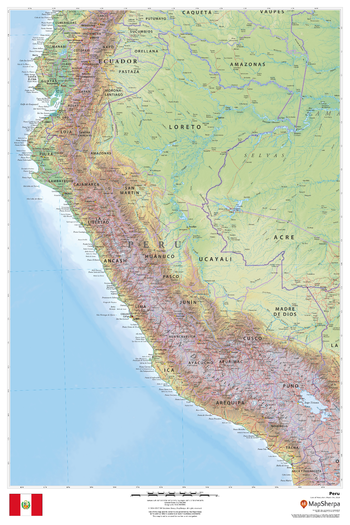
Peru
MapSherpa
This beautiful map shows physical and political features for Peru and surrounding areas. Relief shading and the use of different colours by height above sea level are both informative and attractive.
Page Size: 24 x 36 in (610 x 914 mm)
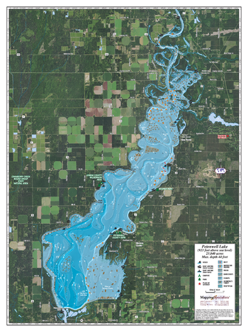
Petenwell Lake
Mapping Specialists
An Attractive map of the lake showing a visual 3D representation of the lake bottom. Includes boat launches, rock area and vegetation. Land area is high resolution aerial imagery.
Page Size: 27.75 x 37.25 in (705 x 943 mm)
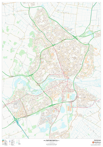
Peterborough
MapSherpa
This map of Peterborough shows detailed street level information including extensive street labelling. Ideal for planning of deliveries, home services, sales territories, real estate and much more.
Page Size: 33.25 x 47 in (841 x 1189 mm)
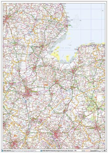
Peterborough - PE - Postcode Wall Map
XYZ Maps
The Peterborough Postcode Sector Wall Map shows detailed postcode sector boundaries (PE1 1, PE1 2) on a comprehensive background and is perfect for determining postcode boundaries for sales areas, planning mailshots and also an excellent reference for logistics. This wall map covers the whole of the PE Postcode Area.
Page Size: 33.25 x 47 in (841 x 1189 mm)
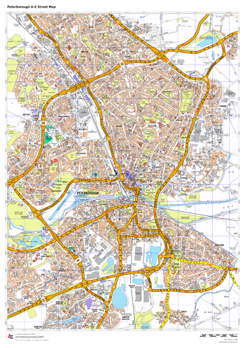
Peterborough A-Z Street Map
A-Z Maps
This up-to-date A-Z street map covers Peterborough and the immediate suburbs, showing the town centre with Peterborough Cathedral. Other areas included: Bretton, Orton, Hampton, Paston and Stanground. Includes transport symbols, car parks and points of interest.
Page Size: 23.5 x 33.25 in (594 x 841 mm)
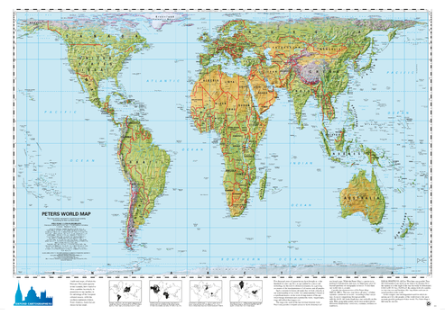
Peters Projection World Environmental
Oxford Cartographers
World map, with environmental colours (vegetation/desert/ice), on the Peters Projection
Page Size: 34 x 24.25 in (863 x 613 mm)
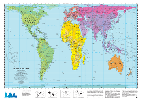
Peters Projection World political
Oxford Cartographers
World map, politically coloured, on the Peters Projection
Page Size: 34 x 24.25 in (863 x 613 mm)

Peters World Map - Arabic
Kartographie Huber
The Peters Projection World Map is one of the most stimulating, and controversial, images of the world. When this map was first introduced by historian and cartographer Dr. Arno Peters in Germany in 1974 it generated a firestorm of debate. The first English-version of the map was published in 1983, and it continues to have passionate fans as well as staunch detractors.
The earth is round. The challenge of any world map is to represent a round earth on a flat surface. There are literally thousands of map projections. Each has certain strengths and corresponding weaknesses. Choosing among them is an exercise in values clarification: you have to decide what's important to you. That is generally determined by the way you intend to use the map.
The Peters Projection is an area accurate map (equal area map). This map shows all areas; countries, continents and oceans, according to their actual size. Accurate comparisons become possible. The Peters Map is an equal axis map. All North-South lines run vertical on this map, thus geographic points can be seen in their precise directional relationship. The Peters Map shows equal positions. All East-West Lines run parallel, thus the relationship of any point on the map to its distance from the equator or the angle of the sun can readily be determined.
Page Size: 38.5 x 24.5 in (978 x 622 mm)

Peters World Map - Deutsch
Kartographie Huber
The Peters Projection World Map is one of the most stimulating, and controversial, images of the world. When this map was first introduced by historian and cartographer Dr. Arno Peters in Germany in 1974 it generated a firestorm of debate. The first English-version of the map was published in 1983, and it continues to have passionate fans as well as staunch detractors.
The earth is round. The challenge of any world map is to represent a round earth on a flat surface. There are literally thousands of map projections. Each has certain strengths and corresponding weaknesses. Choosing among them is an exercise in values clarification: you have to decide what's important to you. That is generally determined by the way you intend to use the map.
The Peters Projection is an area accurate map (equal area map). This map shows all areas; countries, continents and oceans, according to their actual size. Accurate comparisons become possible. The Peters Map is an equal axis map. All North-South lines run vertical on this map, thus geographic points can be seen in their precise directional relationship. The Peters Map shows equal positions. All East-West Lines run parallel, thus the relationship of any point on the map to its distance from the equator or the angle of the sun can readily be determined.
Page Size: 51.25 x 32.75 in (1300 x 830 mm)

Peters World Map - English
Kartographie Huber
The Peters Projection World Map is one of the most stimulating, and controversial, images of the world. When this map was first introduced by historian and cartographer Dr. Arno Peters in Germany in 1974 it generated a firestorm of debate. The first English-version of the map was published in 1983, and it continues to have passionate fans as well as staunch detractors.
The earth is round. The challenge of any world map is to represent a round earth on a flat surface. There are literally thousands of map projections. Each has certain strengths and corresponding weaknesses. Choosing among them is an exercise in values clarification: you have to decide what's important to you. That is generally determined by the way you intend to use the map.
The Peters Projection is an area accurate map (equal area map). This map shows all areas; countries, continents and oceans, according to their actual size. Accurate comparisons become possible. The Peters Map is an equal axis map. All North-South lines run vertical on this map, thus geographic points can be seen in their precise directional relationship. The Peters Map shows equal positions. All East-West Lines run parallel, thus the relationship of any point on the map to its distance from the equator or the angle of the sun can readily be determined.
Page Size: 71 x 47.25 in (1800 x 1200 mm)

Peters World Map - Espagnol
Kartographie Huber
The Peters Projection World Map is one of the most stimulating, and controversial, images of the world. When this map was first introduced by historian and cartographer Dr. Arno Peters in Germany in 1974 it generated a firestorm of debate. The first English-version of the map was published in 1983, and it continues to have passionate fans as well as staunch detractors.
The earth is round. The challenge of any world map is to represent a round earth on a flat surface. There are literally thousands of map projections. Each has certain strengths and corresponding weaknesses. Choosing among them is an exercise in values clarification: you have to decide what's important to you. That is generally determined by the way you intend to use the map.
The Peters Projection is an area accurate map (equal area map). This map shows all areas; countries, continents and oceans, according to their actual size. Accurate comparisons become possible. The Peters Map is an equal axis map. All North-South lines run vertical on this map, thus geographic points can be seen in their precise directional relationship. The Peters Map shows equal positions. All East-West Lines run parallel, thus the relationship of any point on the map to its distance from the equator or the angle of the sun can readily be determined.
Page Size: 47.5 x 32.75 in (1203 x 827 mm)
No search results