


MapSherpa Catalog
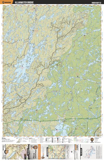
NWON53 Allanwater Bridge - Northwestern Ontario Topo
Backroad Mapbooks
This recreation topographic map for Allanwater Bridge highlights all the logging/resource roads, hunting areas, fishing lakes & streams, campsites, paddling routes for canoeing and kayaking, wildlife viewing areas, multi-use trails for hiking, biking, horseback riding, cross-country skiing and snowshoeing, motorized trails for ATVing and snowmobiling & more. Covering 3,040 km2 (1,175 mi2), this 1:85,000 scale map measures 48 x 63.5 km (30 x 39.5 mi), providing you with more topographic and recreational detail for the Lac La Croix area than any other map on the market. New features include expanded road and trail data and countless recreational Points of Interest. Included on this map are Allanwater Bridge, Wabakimi Provincial Park, Brightsands River Provincial Park, Savant Lake, Allan Water River, Flindt River, Nemo River and more!
Page Size: 24 x 37 in (610 x 940 mm)
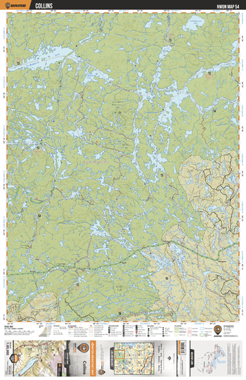
NWON54 Collins - Northwestern Ontario Topo
Backroad Mapbooks
This recreation topographic map for Collins highlights all the logging/resource roads, hunting areas, fishing lakes & streams, campsites, paddling routes for canoeing and kayaking, wildlife viewing areas, multi-use trails for hiking, biking, horseback riding, cross-country skiing and snowshoeing, motorized trails for ATVing and snowmobiling & more. Covering 3,040 km2 (1,175 mi2), this 1:85,000 scale map measures 48 x 63.5 km (30 x 39.5 mi), providing you with more topographic and recreational detail for the Lac La Croix area than any other map on the market. New features include expanded road and trail data and countless recreational Points of Interest. Included on this map are Collins, Wabakami Provincial Park, Wabakami Lake, Smoothrock Lake, Kopka River Provincial Park, Allan Water River, Boiling Sand River and more!
Page Size: 24 x 37 in (610 x 940 mm)
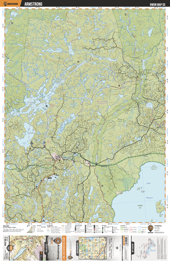
NWON55 Armstrong - Northwestern Ontario Topo
Backroad Mapbooks
This recreation topographic map for Armstrong highlights all the logging/resource roads, hunting areas, fishing lakes & streams, campsites, paddling routes for canoeing and kayaking, wildlife viewing areas, multi-use trails for hiking, biking, horseback riding, cross-country skiing and snowshoeing, motorized trails for ATVing and snowmobiling & more. Covering 3,040 km2 (1,175 mi2), this 1:85,000 scale map measures 48 x 63.5 km (30 x 39.5 mi), providing you with more topographic and recreational detail for the Lac La Croix area than any other map on the market. New features include expanded road and trail data and countless recreational Points of Interest. Included on this map are Armstrong, Wabakami Provincial Park, Windigo Bay Provincial Park, Lake Nipigon, Whitesand River, Caribou River, Little Caribou Lake and more!
Page Size: 24 x 37 in (610 x 940 mm)
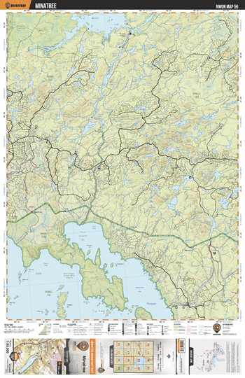
NWON56 Minataree - Northwestern Ontario Topo
Backroad Mapbooks
This recreation topographic map for Minataree highlights all the logging/resource roads, hunting areas, fishing lakes & streams, campsites, paddling routes for canoeing and kayaking, wildlife viewing areas, multi-use trails for hiking, biking, horseback riding, cross-country skiing and snowshoeing, motorized trails for ATVing and snowmobiling & more. Covering 3,040 km2 (1,175 mi2), this 1:85,000 scale map measures 48 x 63.5 km (30 x 39.5 mi), providing you with more topographic and recreational detail for the Lac La Croix area than any other map on the market. New features include expanded road and trail data and countless recreational Points of Interest. Included on this map are Minataree, Mojikit Lake, Little Jackfish River, Lake Nipigon Conservation Reserve, Ombabika River, Stork Lake, Pikitigushi River, Seymou Lake and more!
Page Size: 24 x 37 in (610 x 940 mm)
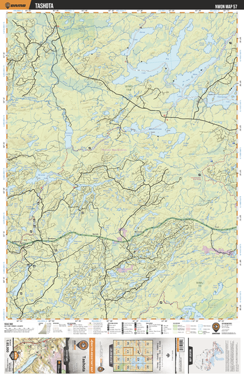
NWON57 Tashota - Northwestern Ontario Topo
Backroad Mapbooks
This recreation topographic map for Tashota highlights all the logging/resource roads, hunting areas, fishing lakes & streams, campsites, paddling routes for canoeing and kayaking, wildlife viewing areas, multi-use trails for hiking, biking, horseback riding, cross-country skiing and snowshoeing, motorized trails for ATVing and snowmobiling & more. Covering 3,040 km2 (1,175 mi2), this 1:85,000 scale map measures 48 x 63.5 km (30 x 39.5 mi), providing you with more topographic and recreational detail for the Lac La Croix area than any other map on the market. New features include expanded road and trail data and countless recreational Points of Interest. Included on this map are Tashota, Ara Lake, Meta Lake, Kapikotongwa River, Onaman River, Kawashikagama River, Toronto Lake, Sedgman Lake Provincial Nature Reserve and more!
Page Size: 24 x 37 in (610 x 940 mm)
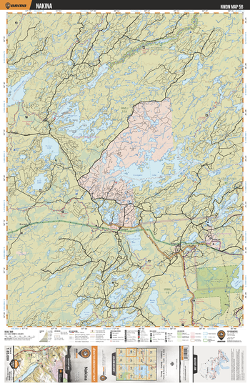
NWON58 Nakina - Northwestern Ontario Topo
Backroad Mapbooks
This recreation topographic map for Nakina highlights all the logging/resource roads, hunting areas, fishing lakes & streams, campsites, paddling routes for canoeing and kayaking, wildlife viewing areas, multi-use trails for hiking, biking, horseback riding, cross-country skiing and snowshoeing, motorized trails for ATVing and snowmobiling & more. Covering 3,040 km2 (1,175 mi2), this 1:85,000 scale map measures 48 x 63.5 km (30 x 39.5 mi), providing you with more topographic and recreational detail for the Lac La Croix area than any other map on the market. New features include expanded road and trail data and countless recreational Points of Interest. Included on this map are Nakina, Little Current River, Nakina Moraine Provincial Park, Esnagami Lake, Little Current River Provincial Park, O'sullivan Lake, Muriel River and more!
Page Size: 24 x 37 in (610 x 940 mm)
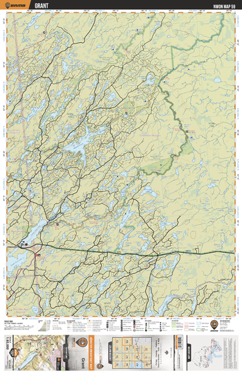
NWON59 Grant - Northwestern Ontario Topo
Backroad Mapbooks
This recreation topographic map for Grant highlights all the logging/resource roads, hunting areas, fishing lakes & streams, campsites, paddling routes for canoeing and kayaking, wildlife viewing areas, multi-use trails for hiking, biking, horseback riding, cross-country skiing and snowshoeing, motorized trails for ATVing and snowmobiling & more. Covering 3,040 km2 (1,175 mi2), this 1:85,000 scale map measures 48 x 63.5 km (30 x 39.5 mi), providing you with more topographic and recreational detail for the Lac La Croix area than any other map on the market. New features include expanded road and trail data and countless recreational Points of Interest. Included on this map are Grant, Nakina Northeast Waterway Conservation Reserve, Drowning River, Wababimiga Lake, Wababimiga River, Squaw River, Lower Twin Lake, Upper Twin Lake and more!
Page Size: 24 x 37 in (610 x 940 mm)
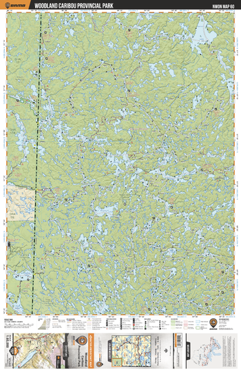
NWON60 Woodland Caribou Provincial Park - Northwestern Ontario Topo
Backroad Mapbooks
This recreation topographic map for Woodland Caribou Provincial Park highlights all the logging/resource roads, hunting areas, fishing lakes & streams, campsites, paddling routes for canoeing and kayaking, wildlife viewing areas, multi-use trails for hiking, biking, horseback riding, cross-country skiing and snowshoeing, motorized trails for ATVing and snowmobiling & more. Covering 3,040 km2 (1,175 mi2), this 1:85,000 scale map measures 48 x 63.5 km (30 x 39.5 mi), providing you with more topographic and recreational detail for the Lac La Croix area than any other map on the market. New features include expanded road and trail data and countless recreational Points of Interest. Included on this map are Woodland Caribou Provincial Park, Larus Lake, Gammon Lake, Bulging Lake, Haggart River, Carroll Lake, Bloodvein River, Donald Lake, Bird River and more!
Page Size: 24 x 37 in (610 x 940 mm)
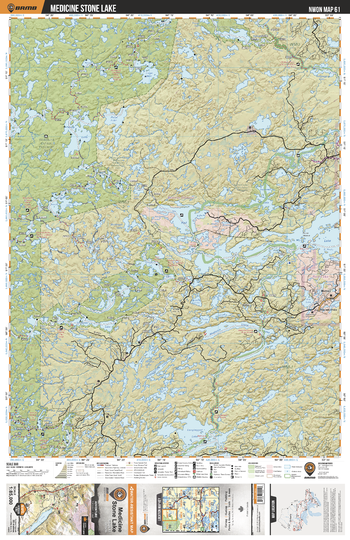
NWON61 Medicine Stone Lake - Northwestern Ontario Topo
Backroad Mapbooks
This recreation topographic map for Medicine Stone Lake highlights all the logging/resource roads, hunting areas, fishing lakes & streams, campsites, paddling routes for canoeing and kayaking, wildlife viewing areas, multi-use trails for hiking, biking, horseback riding, cross-country skiing and snowshoeing, motorized trails for ATVing and snowmobiling & more. Covering 3,040 km2 (1,175 mi2), this 1:85,000 scale map measures 48 x 63.5 km (30 x 39.5 mi), providing you with more topographic and recreational detail for the Lac La Croix area than any other map on the market. New features include expanded road and trail data and countless recreational Points of Interest. Included on this map are Medicine Stone Lake, Red Lake, Woodland Caribou Provincial Park, Hammell Lake Conservation Area, Medicine Stone Lake, Knox Lake, Longlegged Lake and more!
Page Size: 24 x 37 in (610 x 940 mm)
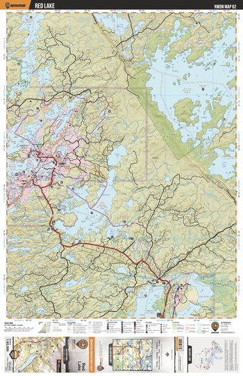
NWON62 Red Lake - Northwestern Ontario Topo
Backroad Mapbooks
This recreation topographic map for Red Lake highlights all the logging/resource roads, hunting areas, fishing lakes & streams, campsites, paddling routes for canoeing and kayaking, wildlife viewing areas, multi-use trails for hiking, biking, horseback riding, cross-country skiing and snowshoeing, motorized trails for ATVing and snowmobiling & more. Covering 3,040 km2 (1,175 mi2), this 1:85,000 scale map measures 48 x 63.5 km (30 x 39.5 mi), providing you with more topographic and recreational detail for the Lac La Croix area than any other map on the market. New features include expanded road and trail data and countless recreational Points of Interest. Included on this map are Red Lake, Little Vermillion Lake, Trout Lake, Trout Lake Provincial Park, Gullrock Lake, Pakwash Lake, Pakwash Provincial Park, Bruce Lake and more!
Page Size: 24 x 37 in (610 x 940 mm)
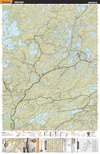
NWON63 South Bay - Northwestern Ontario Topo
Backroad Mapbooks
This recreation topographic map for South Bay highlights all the logging/resource roads, hunting areas, fishing lakes & streams, campsites, paddling routes for canoeing and kayaking, wildlife viewing areas, multi-use trails for hiking, biking, horseback riding, cross-country skiing and snowshoeing, motorized trails for ATVing and snowmobiling & more. Covering 3,040 km2 (1,175 mi2), this 1:85,000 scale map measures 48 x 63.5 km (30 x 39.5 mi), providing you with more topographic and recreational detail for the Lac La Croix area than any other map on the market. New features include expanded road and trail data and countless recreational Points of Interest. Included on this map are South Bay, Trout Lake, Joyce Lake, Woman River, Confederation Lake, Woman Lake, Bluffy Lake, Wenasaga River, Whitemud Lake, Uchi Lake and more!
Page Size: 24 x 37 in (610 x 940 mm)
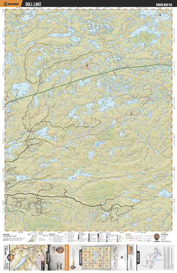
NWON64 Gull Lake - Northwestern Ontario Topo
Backroad Mapbooks
This recreation topographic map for Gull Lake highlights all the logging/resource roads, hunting areas, fishing lakes & streams, campsites, paddling routes for canoeing and kayaking, wildlife viewing areas, multi-use trails for hiking, biking, horseback riding, cross-country skiing and snowshoeing, motorized trails for ATVing and snowmobiling & more. Covering 3,040 km2 (1,175 mi2), this 1:85,000 scale map measures 48 x 63.5 km (30 x 39.5 mi), providing you with more topographic and recreational detail for the Lac La Croix area than any other map on the market. New features include expanded road and trail data and countless recreational Points of Interest. Included on this map are Gull Lake, Gull-Christina Conservation Reserve, Christina Lake, Brokenmouth River, Harth Lake Conservation Reserve, Wesley River, Jeanette Lake and more!
Page Size: 24 x 37 in (610 x 940 mm)
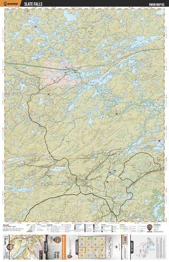
NWON65 Slate Falls - Northwestern Ontario Topo
Backroad Mapbooks
This recreation topographic map for Slate Falls highlights all the logging/resource roads, hunting areas, fishing lakes & streams, campsites, paddling routes for canoeing and kayaking, wildlife viewing areas, multi-use trails for hiking, biking, horseback riding, cross-country skiing and snowshoeing, motorized trails for ATVing and snowmobiling & more. Covering 3,040 km2 (1,175 mi2), this 1:85,000 scale map measures 48 x 63.5 km (30 x 39.5 mi), providing you with more topographic and recreational detail for the Lac La Croix area than any other map on the market. New features include expanded road and trail data and countless recreational Points of Interest. Included on this map are Slate Falls, Lake St Joseph, Bamaji Lake, Brokenmouth River, Kezik Lake, Cat River, St Raphael Provincial Park, Churchil Lake, Blackstone Lake and more!
Page Size: 24 x 37 in (610 x 940 mm)
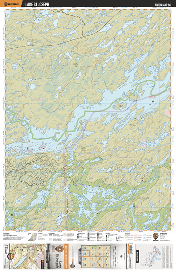
NWON66 Lake St Joseph - Northwestern Ontario Topo
Backroad Mapbooks
This recreation topographic map for Lake St Joseph highlights all the logging/resource roads, hunting areas, fishing lakes & streams, campsites, paddling routes for canoeing and kayaking, wildlife viewing areas, multi-use trails for hiking, biking, horseback riding, cross-country skiing and snowshoeing, motorized trails for ATVing and snowmobiling & more. Covering 3,040 km2 (1,175 mi2), this 1:85,000 scale map measures 48 x 63.5 km (30 x 39.5 mi), providing you with more topographic and recreational detail for the Lac La Croix area than any other map on the market. New features include expanded road and trail data and countless recreational Points of Interest. Included on this map are Lake St Joseph, Lake St Raphael River, Miniss River, Miniss Lake, St Raphael Provincial Park, De Lesseps Lake, Churchill Lake, Medcalf Lake and more!
Page Size: 24 x 37 in (610 x 940 mm)
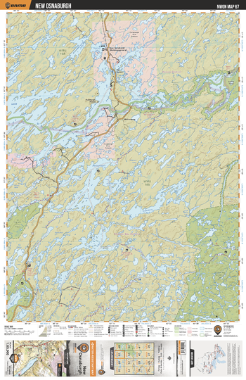
NWON67 New Osnaburgh - Northwestern Ontario Topo
Backroad Mapbooks
This recreation topographic map for New Osnaburgh highlights all the logging/resource roads, hunting areas, fishing lakes & streams, campsites, paddling routes for canoeing and kayaking, wildlife viewing areas, multi-use trails for hiking, biking, horseback riding, cross-country skiing and snowshoeing, motorized trails for ATVing and snowmobiling & more. Covering 3,040 km2 (1,175 mi2), this 1:85,000 scale map measures 48 x 63.5 km (30 x 39.5 mi), providing you with more topographic and recreational detail for the Lac La Croix area than any other map on the market. New features include expanded road and trail data and countless recreational Points of Interest. Included on this map are New Osnaburgh, Lake St Joseph, Albany River Provincial Park, Albany River, Pashkokogan Lake, Wabakimi Provincial Park, Savant River and more!
Page Size: 24 x 37 in (610 x 940 mm)
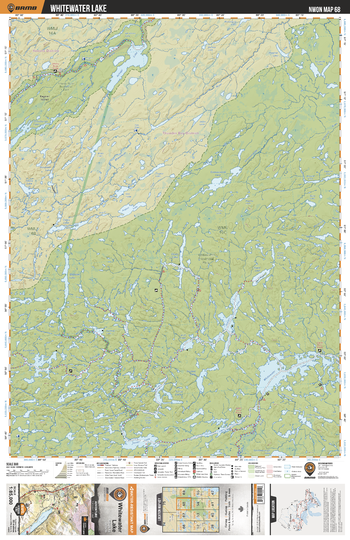
NWON68 Whitewater Lake - Northwestern Ontario Topo
Backroad Mapbooks
This recreation topographic map for Whitewater Lake highlights all the logging/resource roads, hunting areas, fishing lakes & streams, campsites, paddling routes for canoeing and kayaking, wildlife viewing areas, multi-use trails for hiking, biking, horseback riding, cross-country skiing and snowshoeing, motorized trails for ATVing and snowmobiling & more. Covering 3,040 km2 (1,175 mi2), this 1:85,000 scale map measures 48 x 63.5 km (30 x 39.5 mi), providing you with more topographic and recreational detail for the Lac La Croix area than any other map on the market. New features include expanded road and trail data and countless recreational Points of Interest. Included on this map are Whitewater Lake, Wabakimi Provincial Park, Albany River Provincial Park, De Palma Lake, Misenkow Lake, Dawn Lake, Grayson Lake and more!
Page Size: 24 x 37 in (610 x 940 mm)
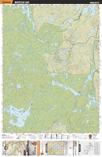
NWON69 Whiteclay Lake - Northwestern Ontario Topo
Backroad Mapbooks
This recreation topographic map for Whiteclay Lake highlights all the logging/resource roads, hunting areas, fishing lakes & streams, campsites, paddling routes for canoeing and kayaking, wildlife viewing areas, multi-use trails for hiking, biking, horseback riding, cross-country skiing and snowshoeing, motorized trails for ATVing and snowmobiling & more. Covering 3,040 km2 (1,175 mi2), this 1:85,000 scale map measures 48 x 63.5 km (30 x 39.5 mi), providing you with more topographic and recreational detail for the Lac La Croix area than any other map on the market. New features include expanded road and trail data and countless recreational Points of Interest. Included on this map are Whiteclay Lake, Ogoki River, Whitewater Lake, Scallop Lake, Raymond River, Mojikit Lake Conservation Reserve, Wabakimi Provincial Park and more!
Page Size: 24 x 37 in (610 x 940 mm)
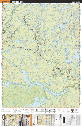
NWON70 Ogoki Reservoir - Northwestern Ontario Topo
Backroad Mapbooks
This recreation topographic map for Ogoki Reservoir highlights all the logging/resource roads, hunting areas, fishing lakes & streams, campsites, paddling routes for canoeing and kayaking, wildlife viewing areas, multi-use trails for hiking, biking, horseback riding, cross-country skiing and snowshoeing, motorized trails for ATVing and snowmobiling & more. Covering 3,040 km2 (1,175 mi2), this 1:85,000 scale map measures 48 x 63.5 km (30 x 39.5 mi), providing you with more topographic and recreational detail for the Lac La Croix area than any other map on the market. New features include expanded road and trail data and countless recreational Points of Interest. Included on this map are Ogoki Reservoir, Witchwood River, Ogoki River, Mojikit Lake Conservation Reserve, Ogoki River Provincial Park, d'Orsonnens River, Muskrat Lake and more!
Page Size: 24 x 37 in (610 x 940 mm)
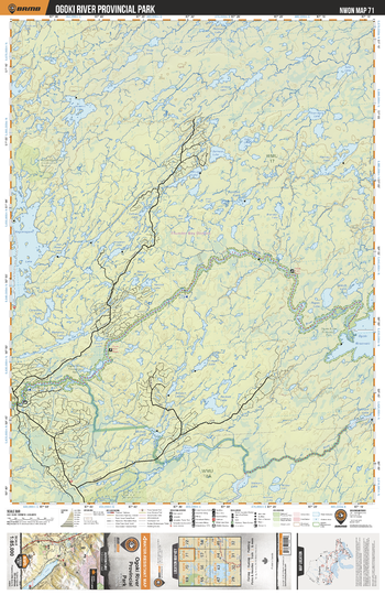
NWON71 Ogoki River Provincial Park - Northwestern Ontario Topo
Backroad Mapbooks
This recreation topographic map for Ogoki River Provincial Park highlights all the logging/resource roads, hunting areas, fishing lakes & streams, campsites, paddling routes for canoeing and kayaking, wildlife viewing areas, multi-use trails for hiking, biking, horseback riding, cross-country skiing and snowshoeing, motorized trails for ATVing and snowmobiling & more. Covering 3,040 km2 (1,175 mi2), this 1:85,000 scale map measures 48 x 63.5 km (30 x 39.5 mi), providing you with more topographic and recreational detail for the Lac La Croix area than any other map on the market. New features include expanded road and trail data and countless recreational Points of Interest. Included on this map are Ogoki River Provincial Park, Ogoki River, Ogoki Reservoir, Kapitkotongwa River, Whitefish Lake, Kagianagami Lake, Harvey Lake and more!
Page Size: 24 x 37 in (610 x 940 mm)
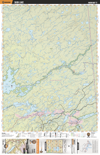
NWON72 Skibi Lake - Northwestern Ontario Topo
Backroad Mapbooks
This recreation topographic map for Skibi Lake highlights all the logging/resource roads, hunting areas, fishing lakes & streams, campsites, paddling routes for canoeing and kayaking, wildlife viewing areas, multi-use trails for hiking, biking, horseback riding, cross-country skiing and snowshoeing, motorized trails for ATVing and snowmobiling & more. Covering 3,040 km2 (1,175 mi2), this 1:85,000 scale map measures 48 x 63.5 km (30 x 39.5 mi), providing you with more topographic and recreational detail for the Lac La Croix area than any other map on the market. New features include expanded road and trail data and countless recreational Points of Interest. Included on this map are Skibi Lake, Ogoki Reservoir, Kayedon Lake, Ogoki River, Patience Lake, Kapitkotongwa River, Kapitkotongwa Lake, Little Current River, Little Current River Provincial Park and more!
Page Size: 24 x 37 in (610 x 940 mm)
No search results