


MapSherpa Catalog
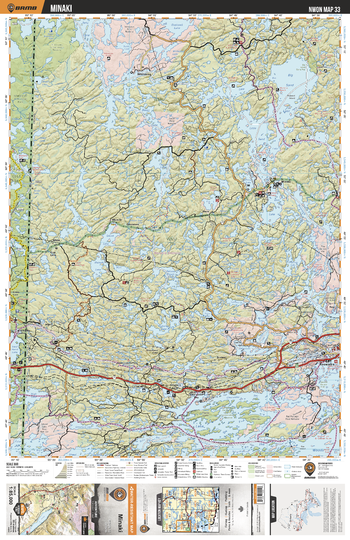
NWON33 Minaki - Northwestern Ontario Topo
Backroad Mapbooks
This recreation topographic map for Minaki highlights all the logging/resource roads, hunting areas, fishing lakes & streams, campsites, paddling routes for canoeing and kayaking, wildlife viewing areas, multi-use trails for hiking, biking, horseback riding, cross-country skiing and snowshoeing, motorized trails for ATVing and snowmobiling & more. Covering 3,040 km2 (1,175 mi2), this 1:85,000 scale map measures 48 x 63.5 km (30 x 39.5 mi), providing you with more topographic and recreational detail for the Lac La Croix area than any other map on the market. New features include expanded road and trail data and countless recreational Points of Interest. Included on this map are Minaki, Big Sand Lake, Tetu Lake, Cygnet Lake, Winnipeg River, Lake Of The Woods, Swan Lake, Musk Lake Conservation Reserve and more!
Page Size: 24 x 37 in (610 x 940 mm)
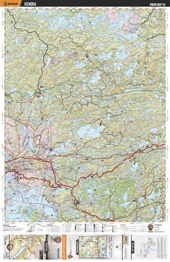
NWON34 Kenora - Northwestern Ontario Topo
Backroad Mapbooks
This recreation topographic map for Kenora highlights all the logging/resource roads, hunting areas, fishing lakes & streams, campsites, paddling routes for canoeing and kayaking, wildlife viewing areas, multi-use trails for hiking, biking, horseback riding, cross-country skiing and snowshoeing, motorized trails for ATVing and snowmobiling & more. Covering 3,040 km2 (1,175 mi2), this 1:85,000 scale map measures 48 x 63.5 km (30 x 39.5 mi), providing you with more topographic and recreational detail for the Lac La Croix area than any other map on the market. New features include expanded road and trail data and countless recreational Points of Interest. Included on this map are Kenora, Silver Lake, Red Deer Lake, Eagle Dogtooth Provincial Park, Keys Lake, Lount Lake, Wonderland Lake, Delaney Lake and more!
Page Size: 24 x 37 in (610 x 940 mm)
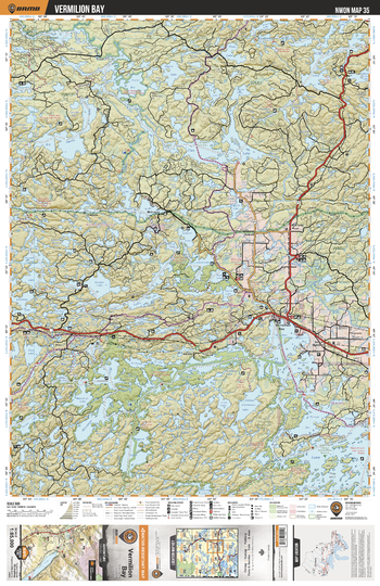
NWON35 Vermillion Bay - Northwestern Ontario Topo
Backroad Mapbooks
This recreation topographic map for Vermillion Bay highlights all the logging/resource roads, hunting areas, fishing lakes & streams, campsites, paddling routes for canoeing and kayaking, wildlife viewing areas, multi-use trails for hiking, biking, horseback riding, cross-country skiing and snowshoeing, motorized trails for ATVing and snowmobiling & more. Covering 3,040 km2 (1,175 mi2), this 1:85,000 scale map measures 48 x 63.5 km (30 x 39.5 mi), providing you with more topographic and recreational detail for the Lac La Croix area than any other map on the market. New features include expanded road and trail data and countless recreational Points of Interest. Included on this map are Vermillion Bay, Big Canon Lake, Clay Lake, Gordon Lake, Blue Lake Provincial Park, Winnange Lake Provincial Park and more!
Page Size: 24 x 37 in (610 x 940 mm)
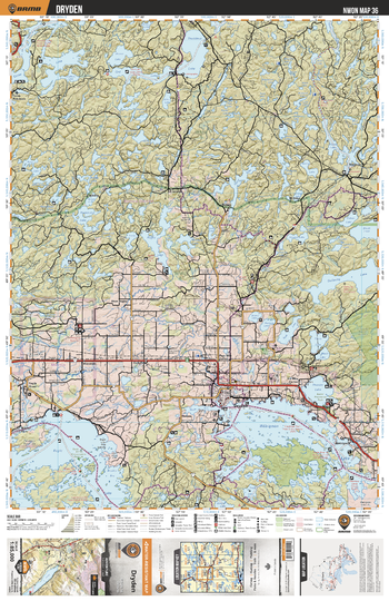
NWON36 Dryden - Northwestern Ontario Topo
Backroad Mapbooks
This recreation topographic map for Dryden highlights all the logging/resource roads, hunting areas, fishing lakes & streams, campsites, paddling routes for canoeing and kayaking, wildlife viewing areas, multi-use trails for hiking, biking, horseback riding, cross-country skiing and snowshoeing, motorized trails for ATVing and snowmobiling & more. Covering 3,040 km2 (1,175 mi2), this 1:85,000 scale map measures 48 x 63.5 km (30 x 39.5 mi), providing you with more topographic and recreational detail for the Lac La Croix area than any other map on the market. New features include expanded road and trail data and countless recreational Points of Interest. Included on this map are Dryden, Wabigoon Lake, Eagle Lake, Butler Lake Nature Reserve, Lola Lake Nature Preserve, Rugby Lake, Gullwing Lake and more!
Page Size: 24 x 37 in (610 x 940 mm)
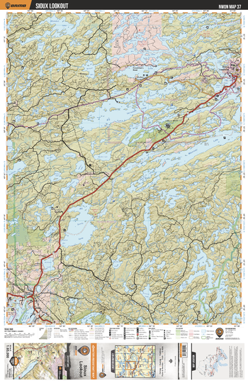
NWON37 Sioux Lookout - Northwestern Ontario Topo
Backroad Mapbooks
This recreation topographic map for Sioux Lookout highlights all the logging/resource roads, hunting areas, fishing lakes & streams, campsites, paddling routes for canoeing and kayaking, wildlife viewing areas, multi-use trails for hiking, biking, horseback riding, cross-country skiing and snowshoeing, motorized trails for ATVing and snowmobiling & more. Covering 3,040 km2 (1,175 mi2), this 1:85,000 scale map measures 48 x 63.5 km (30 x 39.5 mi), providing you with more topographic and recreational detail for the Lac La Croix area than any other map on the market. New features include expanded road and trail data and countless recreational Points of Interest. Included on this map are Sioux Lookout, Big Sandy Lake, Big Vermillion Lake, Ojibway Provincial Park, Basket Lake, Lola Lake Nature Reserve and more!
Page Size: 24 x 37 in (610 x 940 mm)
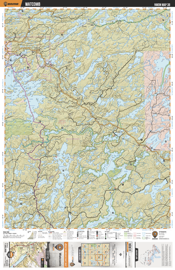
NWON38 Watcomb - Northwestern Ontario Topo
Backroad Mapbooks
This recreation topographic map for Watcomb highlights all the logging/resource roads, hunting areas, fishing lakes & streams, campsites, paddling routes for canoeing and kayaking, wildlife viewing areas, multi-use trails for hiking, biking, horseback riding, cross-country skiing and snowshoeing, motorized trails for ATVing and snowmobiling & more. Covering 3,040 km2 (1,175 mi2), this 1:85,000 scale map measures 48 x 63.5 km (30 x 39.5 mi), providing you with more topographic and recreational detail for the Lac La Croix area than any other map on the market. New features include expanded road and trail data and countless recreational Points of Interest. Included on this map are Watcomb, Minnitaki Lake, Press Lake, East English River Provincial Park, Kukukus Lake, Lake Of Bays, Botsford Lake and more!
Page Size: 24 x 37 in (610 x 940 mm)
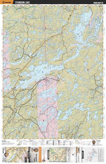
NWON39 Sturgeon Lake - Northwestern Ontario Topo
Backroad Mapbooks
This recreation topographic map for Sturgeon Lake highlights all the logging/resource roads, hunting areas, fishing lakes & streams, campsites, paddling routes for canoeing and kayaking, wildlife viewing areas, multi-use trails for hiking, biking, horseback riding, cross-country skiing and snowshoeing, motorized trails for ATVing and snowmobiling & more. Covering 3,040 km2 (1,175 mi2), this 1:85,000 scale map measures 48 x 63.5 km (30 x 39.5 mi), providing you with more topographic and recreational detail for the Lac La Croix area than any other map on the market. New features include expanded road and trail data and countless recreational Points of Interest. Included on this map are Sturgeon Lake, Bell Lake, Mattawa Lake, Sturgeon River, Upper English River Conservation Reserve, Willow Lake and more!
Page Size: 24 x 37 in (610 x 940 mm)
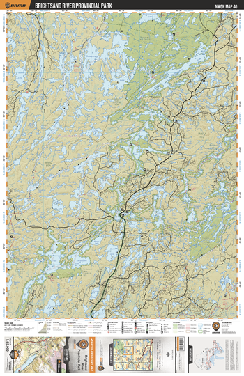
NWON40 Brightsand River Provincial Park - Northwestern Ontario Topo
Backroad Mapbooks
This recreation topographic map for Brightsand River Provincial Park highlights all the logging/resource roads, hunting areas, fishing lakes & streams, campsites, paddling routes for canoeing and kayaking, wildlife viewing areas, multi-use trails for hiking, biking, horseback riding, cross-country skiing and snowshoeing, motorized trails for ATVing and snowmobiling & more. Covering 3,040 km2 (1,175 mi2), this 1:85,000 scale map measures 48 x 63.5 km (30 x 39.5 mi), providing you with more topographic and recreational detail for the Lac La Croix area than any other map on the market. New features include expanded road and trail data and countless recreational Points of Interest. Included on this map are Brightsand River Provincial Park, Wabakimi Provincial Park, Brightsand River Provincial Park, Obonga-Ottertooth Provincial Park, Seseganaga Lake and more!
Page Size: 24 x 37 in (610 x 940 mm)
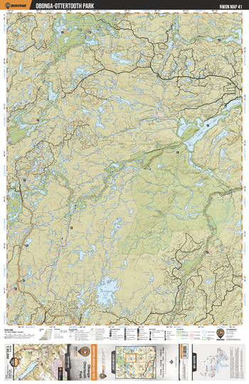
NWON41 Obonga-Ottertooth Park - Northwestern Ontario Topo
Backroad Mapbooks
This recreation topographic map for Obonga-Ottertooth Park highlights all the logging/resource roads, hunting areas, fishing lakes & streams, campsites, paddling routes for canoeing and kayaking, wildlife viewing areas, multi-use trails for hiking, biking, horseback riding, cross-country skiing and snowshoeing, motorized trails for ATVing and snowmobiling & more. Covering 3,040 km2 (1,175 mi2), this 1:85,000 scale map measures 48 x 63.5 km (30 x 39.5 mi), providing you with more topographic and recreational detail for the Lac La Croix area than any other map on the market. New features include expanded road and trail data and countless recreational Points of Interest. Included on this map are Obonga-Ottertooth Park, Wabakimi Provincial Park, Kopka River, Ottertooth Conservation Reserve, Gull River Provincial Park, Holinshead Lake and more!
Page Size: 24 x 37 in (610 x 940 mm)
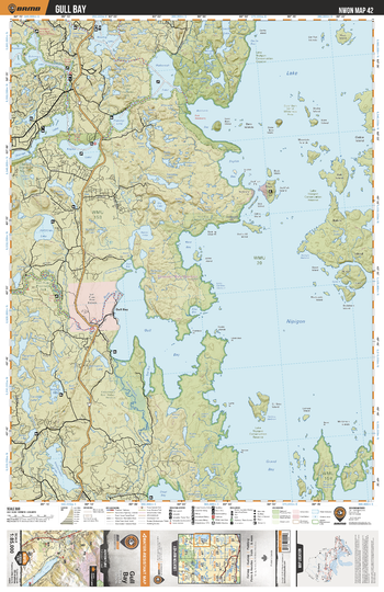
NWON42 Gull Bay - Northwestern Ontario Topo
Backroad Mapbooks
This recreation topographic map for Gull Bay highlights all the logging/resource roads, hunting areas, fishing lakes & streams, campsites, paddling routes for canoeing and kayaking, wildlife viewing areas, multi-use trails for hiking, biking, horseback riding, cross-country skiing and snowshoeing, motorized trails for ATVing and snowmobiling & more. Covering 3,040 km2 (1,175 mi2), this 1:85,000 scale map measures 48 x 63.5 km (30 x 39.5 mi), providing you with more topographic and recreational detail for the Lac La Croix area than any other map on the market. New features include expanded road and trail data and countless recreational Points of Interest. Included on this map are Gull Bay, Kopka River Provincial park, Lake Nipigon Conservation Reserve, Wabinosh Lake, Kopka Lake, Grand Bay, Lake Nipigon, Kabitotikwia River and more!
Page Size: 24 x 37 in (610 x 940 mm)
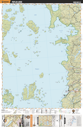
NWON43 Poplar Lodge - Northwestern Ontario Topo
Backroad Mapbooks
This recreation topographic map for Poplar Lodge highlights all the logging/resource roads, hunting areas, fishing lakes & streams, campsites, paddling routes for canoeing and kayaking, wildlife viewing areas, multi-use trails for hiking, biking, horseback riding, cross-country skiing and snowshoeing, motorized trails for ATVing and snowmobiling & more. Covering 3,040 km2 (1,175 mi2), this 1:85,000 scale map measures 48 x 63.5 km (30 x 39.5 mi), providing you with more topographic and recreational detail for the Lac La Croix area than any other map on the market. New features include expanded road and trail data and countless recreational Points of Interest. Included on this map are Poplar Lodge, Lake Nipigon Conservation Reserve, Humbolt Bay, Blackwater River, Namewaminikan River, Livingstone Point Nature Reserve and more!
Page Size: 24 x 37 in (610 x 940 mm)
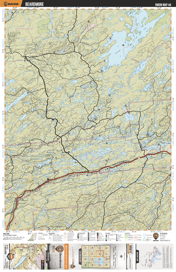
NWON44 Beardmore - Northwestern Ontario Topo
Backroad Mapbooks
This recreation topographic map for Beardmore highlights all the logging/resource roads, hunting areas, fishing lakes & streams, campsites, paddling routes for canoeing and kayaking, wildlife viewing areas, multi-use trails for hiking, biking, horseback riding, cross-country skiing and snowshoeing, motorized trails for ATVing and snowmobiling & more. Covering 3,040 km2 (1,175 mi2), this 1:85,000 scale map measures 48 x 63.5 km (30 x 39.5 mi), providing you with more topographic and recreational detail for the Lac La Croix area than any other map on the market. New features include expanded road and trail data and countless recreational Points of Interest. Included on this map are Beardmore, Onaman Lake, Namewaminikan River, Blackwater River, North Wind Lake, Partridge Lake, Onaman Lake Conservation Area and more!
Page Size: 24 x 37 in (610 x 940 mm)
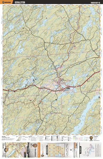
NWON45 Geraldton - Northwestern Ontario Topo
Backroad Mapbooks
This recreation topographic map for Geraldton highlights all the logging/resource roads, hunting areas, fishing lakes & streams, campsites, paddling routes for canoeing and kayaking, wildlife viewing areas, multi-use trails for hiking, biking, horseback riding, cross-country skiing and snowshoeing, motorized trails for ATVing and snowmobiling & more. Covering 3,040 km2 (1,175 mi2), this 1:85,000 scale map measures 48 x 63.5 km (30 x 39.5 mi), providing you with more topographic and recreational detail for the Lac La Croix area than any other map on the market. New features include expanded road and trail data and countless recreational Points of Interest. Included on this map are Geraldton, Long Lake, Kenogamisis Lake, Mcleod Provincial Park, Treptow Lake, Treptow Creek, Great Lake, Wildgoose Lake, Kenogamisis River and more!
Page Size: 24 x 37 in (610 x 940 mm)
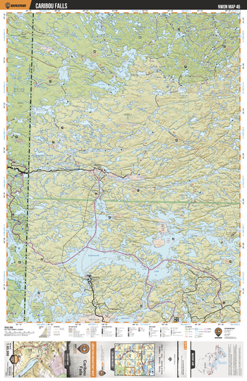
NWON46 Caribou Falls - Northwestern Ontario Topo
Backroad Mapbooks
This recreation topographic map for Caribou Falls highlights all the logging/resource roads, hunting areas, fishing lakes & streams, campsites, paddling routes for canoeing and kayaking, wildlife viewing areas, multi-use trails for hiking, biking, horseback riding, cross-country skiing and snowshoeing, motorized trails for ATVing and snowmobiling & more. Covering 3,040 km2 (1,175 mi2), this 1:85,000 scale map measures 48 x 63.5 km (30 x 39.5 mi), providing you with more topographic and recreational detail for the Lac La Croix area than any other map on the market. New features include expanded road and trail data and countless recreational Points of Interest. Included on this map are Caribou Falls, Nopiming Provincial Park, Woodland Caribou Provincial Park, Whiteshell Provincial Park, Umfreville Lake, Trapline Lake, Elbow Lake and more!
Page Size: 24 x 37 in (610 x 940 mm)
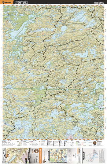
NWON47 Sydney Lake - Northwestern Ontario Topo
Backroad Mapbooks
This recreation topographic map for Sydney Lake highlights all the logging/resource roads, hunting areas, fishing lakes & streams, campsites, paddling routes for canoeing and kayaking, wildlife viewing areas, multi-use trails for hiking, biking, horseback riding, cross-country skiing and snowshoeing, motorized trails for ATVing and snowmobiling & more. Covering 3,040 km2 (1,175 mi2), this 1:85,000 scale map measures 48 x 63.5 km (30 x 39.5 mi), providing you with more topographic and recreational detail for the Lac La Croix area than any other map on the market. New features include expanded road and trail data and countless recreational Points of Interest. Included on this map are Sydney Lake, Woodland Caribou Provincial Park, West English River Provincial Park, Sturgeon River, Longlegged Lake, Rowdy Lake and more!
Page Size: 24 x 37 in (610 x 940 mm)
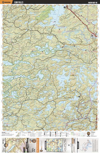
NWON48 Ear Falls - Northwestern Ontario Topo
Backroad Mapbooks
This recreation topographic map for Ear Falls highlights all the logging/resource roads, hunting areas, fishing lakes & streams, campsites, paddling routes for canoeing and kayaking, wildlife viewing areas, multi-use trails for hiking, biking, horseback riding, cross-country skiing and snowshoeing, motorized trails for ATVing and snowmobiling & more. Covering 3,040 km2 (1,175 mi2), this 1:85,000 scale map measures 48 x 63.5 km (30 x 39.5 mi), providing you with more topographic and recreational detail for the Lac La Croix area than any other map on the market. New features include expanded road and trail data and countless recreational Points of Interest. Included on this map are Ear Falls, Pakwash Provincial Park, English River, Manitou Falls, Chukuni River, West English River Provincial Park, Pakwash Lake, Wabaskang Lake and more!
Page Size: 24 x 37 in (610 x 940 mm)
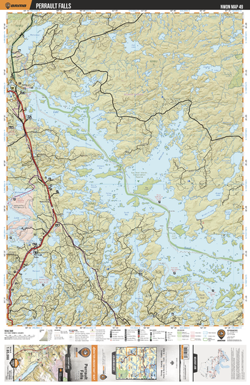
NWON49 Perrault Falls - Northwestern Ontario Topo
Backroad Mapbooks
This recreation topographic map for Perrault Falls highlights all the logging/resource roads, hunting areas, fishing lakes & streams, campsites, paddling routes for canoeing and kayaking, wildlife viewing areas, multi-use trails for hiking, biking, horseback riding, cross-country skiing and snowshoeing, motorized trails for ATVing and snowmobiling & more. Covering 3,040 km2 (1,175 mi2), this 1:85,000 scale map measures 48 x 63.5 km (30 x 39.5 mi), providing you with more topographic and recreational detail for the Lac La Croix area than any other map on the market. New features include expanded road and trail data and countless recreational Points of Interest. Included on this map are Perrault Falls, Wenasaga Lake, Lac Seul, Lac Seul Islands Conservation Reserve, Perrault Lake, Windigo Point Provincial Park, Barrington Lake and more!
Page Size: 24 x 37 in (610 x 940 mm)
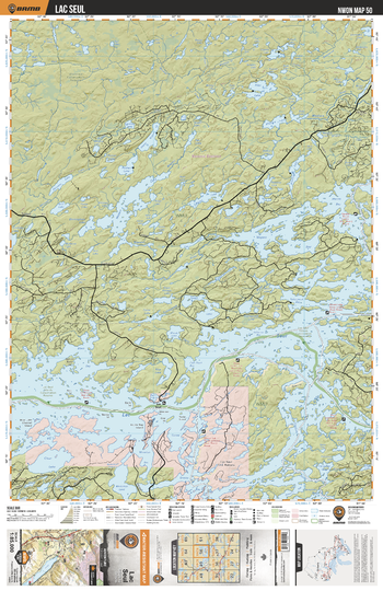
NWON50 Lac Seul - Northwestern Ontario Topo
Backroad Mapbooks
This recreation topographic map for Lac Seul highlights all the logging/resource roads, hunting areas, fishing lakes & streams, campsites, paddling routes for canoeing and kayaking, wildlife viewing areas, multi-use trails for hiking, biking, horseback riding, cross-country skiing and snowshoeing, motorized trails for ATVing and snowmobiling & more. Covering 3,040 km2 (1,175 mi2), this 1:85,000 scale map measures 48 x 63.5 km (30 x 39.5 mi), providing you with more topographic and recreational detail for the Lac La Croix area than any other map on the market. New features include expanded road and trail data and countless recreational Points of Interest. Included on this map are Lac Seul, Whitemud Conservation Reserve, Wapesi Bay, Lac Seul Islands Conservation Reserve, Wapesi Lake, Whitefish Lake, Bray Lake and more!
Page Size: 24 x 37 in (610 x 940 mm)
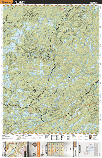
NWON51 Tully Lake - Northwestern Ontario Topo
Backroad Mapbooks
This recreation topographic map for Tully Lake highlights all the logging/resource roads, hunting areas, fishing lakes & streams, campsites, paddling routes for canoeing and kayaking, wildlife viewing areas, multi-use trails for hiking, biking, horseback riding, cross-country skiing and snowshoeing, motorized trails for ATVing and snowmobiling & more. Covering 3,040 km2 (1,175 mi2), this 1:85,000 scale map measures 48 x 63.5 km (30 x 39.5 mi), providing you with more topographic and recreational detail for the Lac La Croix area than any other map on the market. New features include expanded road and trail data and countless recreational Points of Interest. Included on this map are Tully Lake, Lac Seul, Adamhay Lake, St Raphael Provincial Park, Marchington River, Stranger Lake, Vermillion River, Kimmewin Lake, Marchington Lake and more!
Page Size: 24 x 37 in (610 x 940 mm)
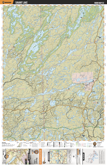
NWON52 Savant Lake - Northwestern Ontario Topo
Backroad Mapbooks
This recreation topographic map for Savant Lake highlights all the logging/resource roads, hunting areas, fishing lakes & streams, campsites, paddling routes for canoeing and kayaking, wildlife viewing areas, multi-use trails for hiking, biking, horseback riding, cross-country skiing and snowshoeing, motorized trails for ATVing and snowmobiling & more. Covering 3,040 km2 (1,175 mi2), this 1:85,000 scale map measures 48 x 63.5 km (30 x 39.5 mi), providing you with more topographic and recreational detail for the Lac La Croix area than any other map on the market. New features include expanded road and trail data and countless recreational Points of Interest. Included on this map are Savant Lake, St Raphael Lake, St Raphael Provincial Park, Hooker Lake, Fairchild Lake, Armit Lake, De Lesseps Lake, Marchington River, Tawatinaw River and more!
Page Size: 24 x 37 in (610 x 940 mm)
No search results