


MapSherpa Catalog
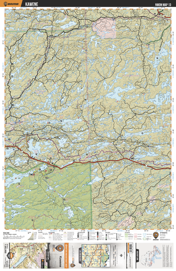
NWON13 Kawene - Northwestern Ontario Topo
Backroad Mapbooks
This recreation topographic map for Kawene highlights all the logging/resource roads, hunting areas, fishing lakes & streams, campsites, paddling routes for canoeing and kayaking, wildlife viewing areas, multi-use trails for hiking, biking, horseback riding, cross-country skiing and snowshoeing, motorized trails for ATVing and snowmobiling & more. Covering 3,040 km2 (1,175 mi2), this 1:85,000 scale map measures 48 x 63.5 km (30 x 39.5 mi), providing you with more topographic and recreational detail for the Lac La Croix area than any other map on the market. New features include expanded road and trail data and countless recreational Points of Interest. Included on this map are Kawene, Firesteel River, Quetico Provincial Park, Pickerel Lake, Cache Lake, Eva Lake, Seine River, Bedivere Lake and more!
Page Size: 24 x 37 in (610 x 940 mm)
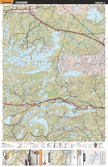
NWON14 Kashabowie - Northwestern Ontario Topo
Backroad Mapbooks
This recreation topographic map for Kashabowie highlights all the logging/resource roads, hunting areas, fishing lakes & streams, campsites, paddling routes for canoeing and kayaking, wildlife viewing areas, multi-use trails for hiking, biking, horseback riding, cross-country skiing and snowshoeing, motorized trails for ATVing and snowmobiling & more. Covering 3,040 km2 (1,175 mi2), this 1:85,000 scale map measures 48 x 63.5 km (30 x 39.5 mi), providing you with more topographic and recreational detail for the Lac La Croix area than any other map on the market. New features include expanded road and trail data and countless recreational Points of Interest. Included on this map are Kashabowie, Lac des Mille, Kashabowie Provincial Park, Greenwater Lake, Bolton Bay, Athelstane Lake, Savanne River and more!
Page Size: 24 x 37 in (610 x 940 mm)
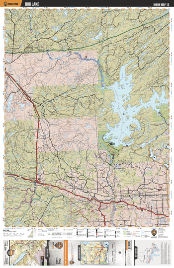
NWON15 Dog Lake - Northwestern Ontario Topo
Backroad Mapbooks
This recreation topographic map for Dog Lake highlights all the logging/resource roads, hunting areas, fishing lakes & streams, campsites, paddling routes for canoeing and kayaking, wildlife viewing areas, multi-use trails for hiking, biking, horseback riding, cross-country skiing and snowshoeing, motorized trails for ATVing and snowmobiling & more. Covering 3,040 km2 (1,175 mi2), this 1:85,000 scale map measures 48 x 63.5 km (30 x 39.5 mi), providing you with more topographic and recreational detail for the Lac La Croix area than any other map on the market. New features include expanded road and trail data and countless recreational Points of Interest. Included on this map are Dog Lake, Dog River, Silver Falls Provincial Park, Kaministiquia River, Wiegand River, Orth Lake, East Bay Conservation Reserve and more!
Page Size: 24 x 37 in (610 x 940 mm)
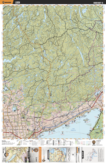
NWON16 Loon - Northwestern Ontario Topo
Backroad Mapbooks
This recreation topographic map for Loon highlights all the logging/resource roads, hunting areas, fishing lakes & streams, campsites, paddling routes for canoeing and kayaking, wildlife viewing areas, multi-use trails for hiking, biking, horseback riding, cross-country skiing and snowshoeing, motorized trails for ATVing and snowmobiling & more. Covering 3,040 km2 (1,175 mi2), this 1:85,000 scale map measures 48 x 63.5 km (30 x 39.5 mi), providing you with more topographic and recreational detail for the Lac La Croix area than any other map on the market. New features include expanded road and trail data and countless recreational Points of Interest. Included on this map are Loon, Lake Superior, Sleeping Giant Provincial Park, Greewich Lake, Loon Lake, Thunder Bay, Onion Lake and more!
Page Size: 24 x 37 in (610 x 940 mm)
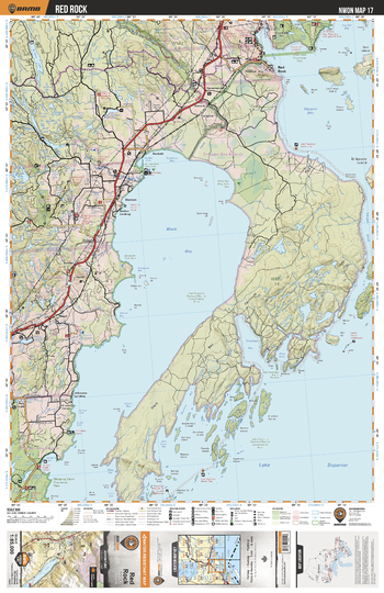
NWON17 Red Rock - Northwestern Ontario Topo
Backroad Mapbooks
This recreation topographic map for Red Rock highlights all the logging/resource roads, hunting areas, fishing lakes & streams, campsites, paddling routes for canoeing and kayaking, wildlife viewing areas, multi-use trails for hiking, biking, horseback riding, cross-country skiing and snowshoeing, motorized trails for ATVing and snowmobiling & more. Covering 3,040 km2 (1,175 mi2), this 1:85,000 scale map measures 48 x 63.5 km (30 x 39.5 mi), providing you with more topographic and recreational detail for the Lac La Croix area than any other map on the market. New features include expanded road and trail data and countless recreational Points of Interest. Included on this map are Red Rock, Black Sturgeon River Provincial Park, Ruby Lake Provincial Park, Black Bay, Sleeping Giant Provincial Park and more!
Page Size: 24 x 37 in (610 x 940 mm)
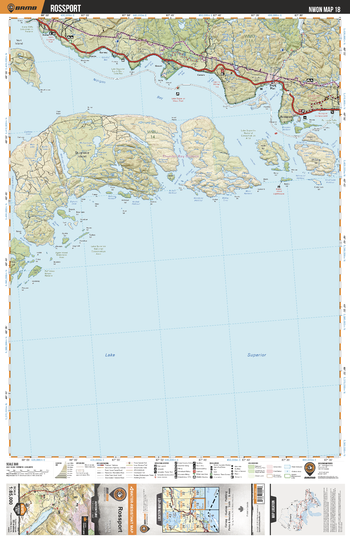
NWON18 Rossport - Northwestern Ontario Topo
Backroad Mapbooks
This recreation topographic map for Rossport highlights all the logging/resource roads, hunting areas, fishing lakes & streams, campsites, paddling routes for canoeing and kayaking, wildlife viewing areas, multi-use trails for hiking, biking, horseback riding, cross-country skiing and snowshoeing, motorized trails for ATVing and snowmobiling & more. Covering 3,040 km2 (1,175 mi2), this 1:85,000 scale map measures 48 x 63.5 km (30 x 39.5 mi), providing you with more topographic and recreational detail for the Lac La Croix area than any other map on the market. New features include expanded road and trail data and countless recreational Points of Interest. Included on this map are Rossport, St Ignace Island, Gravel River Conservation Reserve, Rainbow Falls Provincial Park, Nipigon Bay and more!
Page Size: 24 x 37 in (610 x 940 mm)
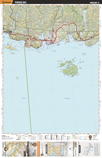
NWON19 Terrace Bay - Northwestern Ontario Topo
Backroad Mapbooks
This recreation topographic map for Terrace Bay highlights all the logging/resource roads, hunting areas, fishing lakes & streams, campsites, paddling routes for canoeing and kayaking, wildlife viewing areas, multi-use trails for hiking, biking, horseback riding, cross-country skiing and snowshoeing, motorized trails for ATVing and snowmobiling & more. Covering 3,040 km2 (1,175 mi2), this 1:85,000 scale map measures 48 x 63.5 km (30 x 39.5 mi), providing you with more topographic and recreational detail for the Lac La Croix area than any other map on the market. New features include expanded road and trail data and countless recreational Points of Interest. Included on this map are Terrace Bay, Slate Islands, Hays Lake, Fishnet Lake Conservation Reserve, Steel River Provincial Park, Santoy Lake and more!
Page Size: 24 x 37 in (610 x 940 mm)
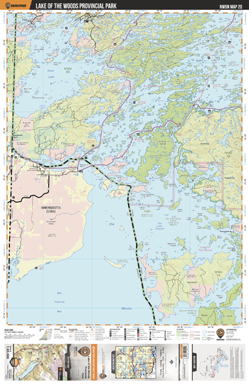
NWON20 Lake Of The Woods Provincial Park - Northwestern Ontario Topo
Backroad Mapbooks
This recreation topographic map for Lake Of The Woods Provincial Park highlights all the logging/resource roads, hunting areas, fishing lakes & streams, campsites, paddling routes for canoeing and kayaking, wildlife viewing areas, multi-use trails for hiking, biking, horseback riding, cross-country skiing and snowshoeing, motorized trails for ATVing and snowmobiling & more. Covering 3,040 km2 (1,175 mi2), this 1:85,000 scale map measures 48 x 63.5 km (30 x 39.5 mi), providing you with more topographic and recreational detail for the Lac La Croix area than any other map on the market. New features include expanded road and trail data and countless recreational Points of Interest. Included on this map are Lake Of The Woods Provincial Park, Shoal Lake, Lake Of The Woods, Lake Of The Woods Islands Conservation Reserve and more!
Page Size: 24 x 37 in (610 x 940 mm)
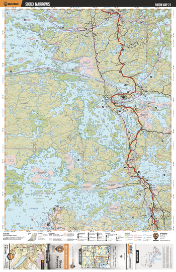
NWON21 Sioux Narrows - Northwestern Ontario Topo
Backroad Mapbooks
This recreation topographic map for Sioux Narrows highlights all the logging/resource roads, hunting areas, fishing lakes & streams, campsites, paddling routes for canoeing and kayaking, wildlife viewing areas, multi-use trails for hiking, biking, horseback riding, cross-country skiing and snowshoeing, motorized trails for ATVing and snowmobiling & more. Covering 3,040 km2 (1,175 mi2), this 1:85,000 scale map measures 48 x 63.5 km (30 x 39.5 mi), providing you with more topographic and recreational detail for the Lac La Croix area than any other map on the market. New features include expanded road and trail data and countless recreational Points of Interest. Included on this map are Sioux Narrows, Whitefish Bay, Auineau Interior Conservation Reserve, Miles Bay, Kakagi Lake, Sabaskong Lake and more!
Page Size: 24 x 37 in (610 x 940 mm)
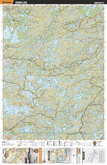
NWON22 Rowan Lake - Northwestern Ontario Topo
Backroad Mapbooks
This recreation topographic map for Rowan Lake highlights all the logging/resource roads, hunting areas, fishing lakes & streams, campsites, paddling routes for canoeing and kayaking, wildlife viewing areas, multi-use trails for hiking, biking, horseback riding, cross-country skiing and snowshoeing, motorized trails for ATVing and snowmobiling & more. Covering 3,040 km2 (1,175 mi2), this 1:85,000 scale map measures 48 x 63.5 km (30 x 39.5 mi), providing you with more topographic and recreational detail for the Lac La Croix area than any other map on the market. New features include expanded road and trail data and countless recreational Points of Interest. Included on this map are Rowan Lake, Dryberry Lake, Eagle Dogtooth Provincial Park, Aitkwa Lake, Kakagi Lake, Lawrence Lake, Eagle Lake and more!
Page Size: 24 x 37 in (610 x 940 mm)
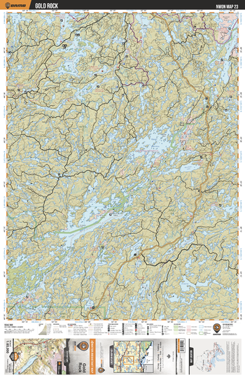
NWON23 Gold Rock - Northwestern Ontario Topo
Backroad Mapbooks
This recreation topographic map for Gold Rock highlights all the logging/resource roads, hunting areas, fishing lakes & streams, campsites, paddling routes for canoeing and kayaking, wildlife viewing areas, multi-use trails for hiking, biking, horseback riding, cross-country skiing and snowshoeing, motorized trails for ATVing and snowmobiling & more. Covering 3,040 km2 (1,175 mi2), this 1:85,000 scale map measures 48 x 63.5 km (30 x 39.5 mi), providing you with more topographic and recreational detail for the Lac La Croix area than any other map on the market. New features include expanded road and trail data and countless recreational Points of Interest. Included on this map are Gold Rock, Lower Manitou Lake, Upper Manitou Lake, Entwine Lake, Meggisi Lake, Manitou Conservation Reserve and more!
Page Size: 24 x 37 in (610 x 940 mm)
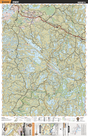
NWON24 Dyment - Northwestern Ontario Topo
Backroad Mapbooks
This recreation topographic map for Dyment highlights all the logging/resource roads, hunting areas, fishing lakes & streams, campsites, paddling routes for canoeing and kayaking, wildlife viewing areas, multi-use trails for hiking, biking, horseback riding, cross-country skiing and snowshoeing, motorized trails for ATVing and snowmobiling & more. Covering 3,040 km2 (1,175 mi2), this 1:85,000 scale map measures 48 x 63.5 km (30 x 39.5 mi), providing you with more topographic and recreational detail for the Lac La Croix area than any other map on the market. New features include expanded road and trail data and countless recreational Points of Interest. Included on this map are Dyment, Adair Lake Conservation Reservation, Stormy Lake, Trutle River Provincial Park, Turtle River, Pyatt Lake Conservation Area and more!
Page Size: 24 x 37 in (610 x 940 mm)
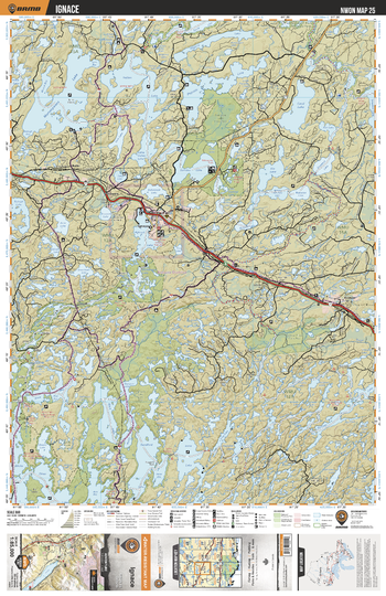
NWON25 Ignace - Northwestern Ontario Topo
Backroad Mapbooks
This recreation topographic map for Ignace highlights all the logging/resource roads, hunting areas, fishing lakes & streams, campsites, paddling routes for canoeing and kayaking, wildlife viewing areas, multi-use trails for hiking, biking, horseback riding, cross-country skiing and snowshoeing, motorized trails for ATVing and snowmobiling & more. Covering 3,040 km2 (1,175 mi2), this 1:85,000 scale map measures 48 x 63.5 km (30 x 39.5 mi), providing you with more topographic and recreational detail for the Lac La Croix area than any other map on the market. New features include expanded road and trail data and countless recreational Points of Interest. Included on this map are Ignace, Sandbar Lake Provincial Park, Turtle River Provincial Park, Campus Lake Conservation, Gulliver River and more!
Page Size: 24 x 37 in (610 x 940 mm)
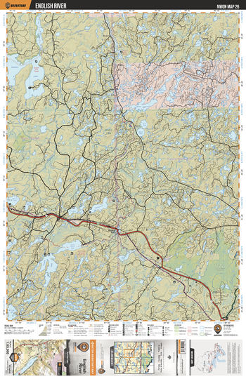
NWON26 English River - Northwestern Ontario Topo
Backroad Mapbooks
This recreation topographic map for English River highlights all the logging/resource roads, hunting areas, fishing lakes & streams, campsites, paddling routes for canoeing and kayaking, wildlife viewing areas, multi-use trails for hiking, biking, horseback riding, cross-country skiing and snowshoeing, motorized trails for ATVing and snowmobiling & more. Covering 3,040 km2 (1,175 mi2), this 1:85,000 scale map measures 48 x 63.5 km (30 x 39.5 mi), providing you with more topographic and recreational detail for the Lac La Croix area than any other map on the market. New features include expanded road and trail data and countless recreational Points of Interest. Included on this map are English River, Trewartha Creek Conservation Reserve, Trewartha Lake, Quorn Lake, Savoy Lake, Scotch Lake and more!
Page Size: 24 x 37 in (610 x 940 mm)
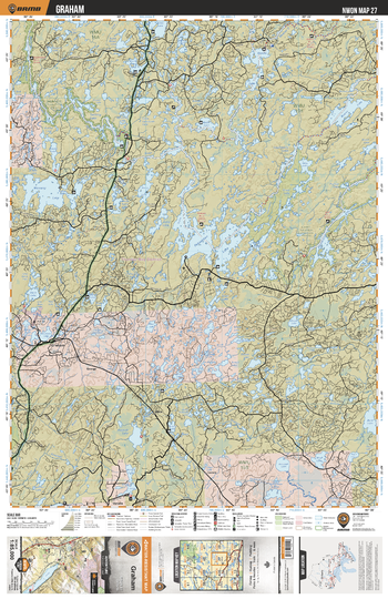
NWON27 Graham - Northwestern Ontario Topo
Backroad Mapbooks
This recreation topographic map for Graham highlights all the logging/resource roads, hunting areas, fishing lakes & streams, campsites, paddling routes for canoeing and kayaking, wildlife viewing areas, multi-use trails for hiking, biking, horseback riding, cross-country skiing and snowshoeing, motorized trails for ATVing and snowmobiling & more. Covering 3,040 km2 (1,175 mi2), this 1:85,000 scale map measures 48 x 63.5 km (30 x 39.5 mi), providing you with more topographic and recreational detail for the Lac La Croix area than any other map on the market. New features include expanded road and trail data and countless recreational Points of Interest. Included on this map are Graham, Brightsand River Provincial Park, Pakashkan Lake, Wawang Lake, Kearns Lake, Hogarth Lake, Radio Lake and more!
Page Size: 24 x 37 in (610 x 940 mm)
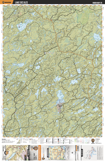
NWON28 Lake De Lles - Northwestern Ontario Topo
Backroad Mapbooks
This recreation topographic map for Lake De Lles highlights all the logging/resource roads, hunting areas, fishing lakes & streams, campsites, paddling routes for canoeing and kayaking, wildlife viewing areas, multi-use trails for hiking, biking, horseback riding, cross-country skiing and snowshoeing, motorized trails for ATVing and snowmobiling & more. Covering 3,040 km2 (1,175 mi2), this 1:85,000 scale map measures 48 x 63.5 km (30 x 39.5 mi), providing you with more topographic and recreational detail for the Lac La Croix area than any other map on the market. New features include expanded road and trail data and countless recreational Points of Interest. Included on this map are Lake De Lles, Garden Lake, Mooseland River, Armistice Lake, Cheeseman Lake, Gull River, Heaven Lake, Kabitotikwia River and more!
Page Size: 24 x 37 in (610 x 940 mm)
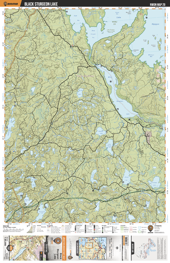
NWON29 Black Sturgeon Lake - Northwestern Ontario Topo
Backroad Mapbooks
This recreation topographic map for Black Sturgeon Lake highlights all the logging/resource roads, hunting areas, fishing lakes & streams, campsites, paddling routes for canoeing and kayaking, wildlife viewing areas, multi-use trails for hiking, biking, horseback riding, cross-country skiing and snowshoeing, motorized trails for ATVing and snowmobiling & more. Covering 3,040 km2 (1,175 mi2), this 1:85,000 scale map measures 48 x 63.5 km (30 x 39.5 mi), providing you with more topographic and recreational detail for the Lac La Croix area than any other map on the market. New features include expanded road and trail data and countless recreational Points of Interest. Included on this map are Black Sturgeon Lake, Lake Nipigon, Lake Nipigon Conservation Reserve, Black Sturgeon River, Eaglehead Lake and more!
Page Size: 24 x 37 in (610 x 940 mm)
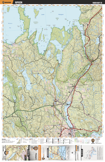
NWON30 Nipigon - Northwestern Ontario Topo
Backroad Mapbooks
This recreation topographic map for Nipigon highlights all the logging/resource roads, hunting areas, fishing lakes & streams, campsites, paddling routes for canoeing and kayaking, wildlife viewing areas, multi-use trails for hiking, biking, horseback riding, cross-country skiing and snowshoeing, motorized trails for ATVing and snowmobiling & more. Covering 3,040 km2 (1,175 mi2), this 1:85,000 scale map measures 48 x 63.5 km (30 x 39.5 mi), providing you with more topographic and recreational detail for the Lac La Croix area than any other map on the market. New features include expanded road and trail data and countless recreational Points of Interest. Included on this map are Nipigon, Nipigon River, Ruby Lake Provincial Park, Helen Lake, Sturgeon River, Nipigon River Conservation Reserve and more!
Page Size: 24 x 37 in (610 x 940 mm)
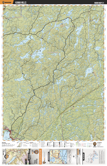
NWON31 Kama Hills - Northwestern Ontario Topo
Backroad Mapbooks
This recreation topographic map for Kama Hills highlights all the logging/resource roads, hunting areas, fishing lakes & streams, campsites, paddling routes for canoeing and kayaking, wildlife viewing areas, multi-use trails for hiking, biking, horseback riding, cross-country skiing and snowshoeing, motorized trails for ATVing and snowmobiling & more. Covering 3,040 km2 (1,175 mi2), this 1:85,000 scale map measures 48 x 63.5 km (30 x 39.5 mi), providing you with more topographic and recreational detail for the Lac La Croix area than any other map on the market. New features include expanded road and trail data and countless recreational Points of Interest. Included on this map are Kama Hills, Gravel River Conservation Reserve, Kama Cliffs Conservation Reserve, East Cypress River, Barbara Lake and more!
Page Size: 24 x 37 in (610 x 940 mm)
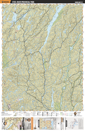
NWON32 Steel River Provincial Park - Northwestern Ontario Topo
Backroad Mapbooks
This recreation topographic map for Steel River Provincial Park highlights all the logging/resource roads, hunting areas, fishing lakes & streams, campsites, paddling routes for canoeing and kayaking, wildlife viewing areas, multi-use trails for hiking, biking, horseback riding, cross-country skiing and snowshoeing, motorized trails for ATVing and snowmobiling & more. Covering 3,040 km2 (1,175 mi2), this 1:85,000 scale map measures 48 x 63.5 km (30 x 39.5 mi), providing you with more topographic and recreational detail for the Lac La Croix area than any other map on the market. New features include expanded road and trail data and countless recreational Points of Interest. Included on this map are Steel River Provincial Park, Long Lake, Long Lake Conservation Reserve, Steel Lake, Aguasabon River, Owl Lake and more!
Page Size: 24 x 37 in (610 x 940 mm)
No search results