


MapSherpa Catalog
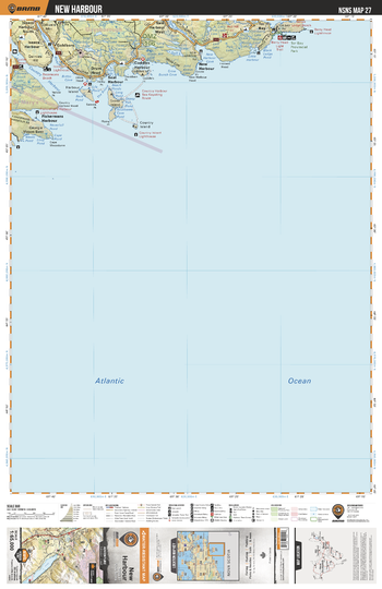
NSNS27 New Harbour - Nova Scotia Topo
Backroad Mapbooks
This recreation topographic map for New Harbour highlights all the logging/resource roads, hunting areas, fishing lakes & streams, campsites, paddling routes for canoeing and kayaking, wildlife viewing areas, multi-use trails for hiking, biking, horseback riding, cross-country skiing and snowshoeing, motorized trails for ATVing and snowmobiling & more. Covering 1,925 km2 (745 mi2), this 1:65,000 scale map measures 38 x 50 km (24 x 31 mi), providing you with more topographic and recreational detail for the Yarmouth area than any other map on the market. Special features include the addition of Crown land areas and countless new roads, trails and recreational Points of Interest. Included on this map are Country Harbour, Isaacs Harbour, Drum Head, Goose Island, New Harbour, Tor Bay Atlantic Prov Park, Tor Bay, New Harbour West, Goldboro, Georgie Mason Bank and more!
Page Size: 24 x 37 in (610 x 940 mm)
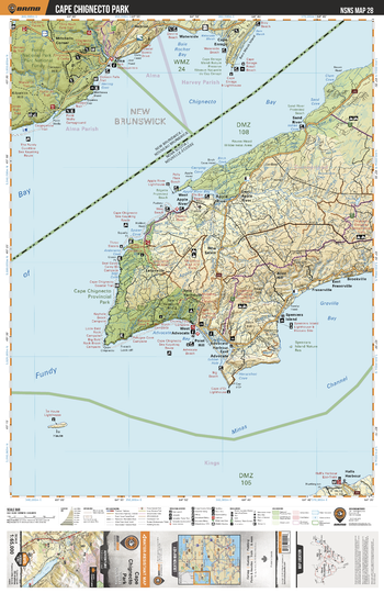
NSNS28 Cape Chignecto Park - Nova Scotia Topo
Backroad Mapbooks
This recreation topographic map for Cape Chignecto Park highlights all the logging/resource roads, hunting areas, fishing lakes & streams, campsites, paddling routes for canoeing and kayaking, wildlife viewing areas, multi-use trails for hiking, biking, horseback riding, cross-country skiing and snowshoeing, motorized trails for ATVing and snowmobiling & more. Covering 1,925 km2 (745 mi2), this 1:65,000 scale map measures 38 x 50 km (24 x 31 mi), providing you with more topographic and recreational detail for the Yarmouth area than any other map on the market. Special features include the addition of Crown land areas and countless new roads, trails and recreational Points of Interest. Included on this map are Minas Channel, Cape Chignecto Prov Park, Apple River, Advocate Bay, Greville Bay, Spencers Island, Shulie Lake, Sand River, Halls Harbour, New Salem and more!
Page Size: 24 x 37 in (610 x 940 mm)
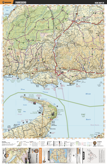
NSNS29 Parrsboro - Nova Scotia Topo
Backroad Mapbooks
This recreation topographic map for Parrsboro highlights all the logging/resource roads, hunting areas, fishing lakes & streams, campsites, paddling routes for canoeing and kayaking, wildlife viewing areas, multi-use trails for hiking, biking, horseback riding, cross-country skiing and snowshoeing, motorized trails for ATVing and snowmobiling & more. Covering 1,925 km2 (745 mi2), this 1:65,000 scale map measures 38 x 50 km (24 x 31 mi), providing you with more topographic and recreational detail for the Yarmouth area than any other map on the market. Special features include the addition of Crown land areas and countless new roads, trails and recreational Points of Interest. Included on this map are Chigneto Game Sanctuary, River Hebert, Parrsboro, Port Greville, Blomidon Prov Park, Minas Channel, Minas Basin, Scots Bay, Halfway River, Moose River and more!
Page Size: 24 x 37 in (610 x 940 mm)
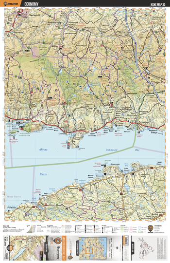
NSNS30 Economy - Nova Scotia Topo
Backroad Mapbooks
This recreation topographic map for Economy highlights all the logging/resource roads, hunting areas, fishing lakes & streams, campsites, paddling routes for canoeing and kayaking, wildlife viewing areas, multi-use trails for hiking, biking, horseback riding, cross-country skiing and snowshoeing, motorized trails for ATVing and snowmobiling & more. Covering 1,925 km2 (745 mi2), this 1:65,000 scale map measures 38 x 50 km (24 x 31 mi), providing you with more topographic and recreational detail for the Yarmouth area than any other map on the market. Special features include the addition of Crown land areas and countless new roads, trails and recreational Points of Interest. Included on this map are Minas Basin, Cobequid Bay, Five Islands Prov Park, Westchester Mountain, Economy River Wilderness Area, Portapique, Springhill, Walton, Gormanville, Wyvern and more!
Page Size: 24 x 37 in (610 x 940 mm)
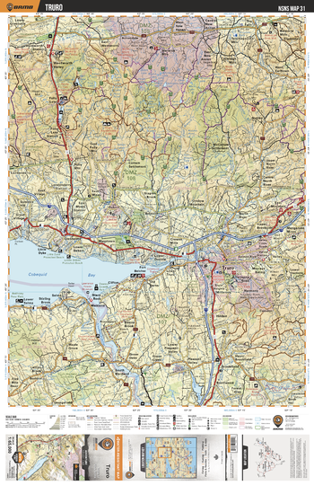
NSNS31 Truro - Nova Scotia Topo
Backroad Mapbooks
This recreation topographic map for Truro highlights all the logging/resource roads, hunting areas, fishing lakes & streams, campsites, paddling routes for canoeing and kayaking, wildlife viewing areas, multi-use trails for hiking, biking, horseback riding, cross-country skiing and snowshoeing, motorized trails for ATVing and snowmobiling & more. Covering 1,925 km2 (745 mi2), this 1:65,000 scale map measures 38 x 50 km (24 x 31 mi), providing you with more topographic and recreational detail for the Yarmouth area than any other map on the market. Special features include the addition of Crown land areas and countless new roads, trails and recreational Points of Interest. Included on this map are Cobequid Bay, Shubencadie River, Salmon River, Truro, Wentworth Valley, Folly Lake, Nuttby, Brookfield, Fort Belcher, Shortts Lake and more!
Page Size: 24 x 37 in (610 x 940 mm)
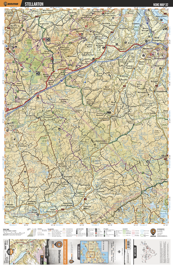
NSNS32 Stellarton - Nova Scotia Topo
Backroad Mapbooks
This recreation topographic map for Stellarton highlights all the logging/resource roads, hunting areas, fishing lakes & streams, campsites, paddling routes for canoeing and kayaking, wildlife viewing areas, multi-use trails for hiking, biking, horseback riding, cross-country skiing and snowshoeing, motorized trails for ATVing and snowmobiling & more. Covering 1,925 km2 (745 mi2), this 1:65,000 scale map measures 38 x 50 km (24 x 31 mi), providing you with more topographic and recreational detail for the Yarmouth area than any other map on the market. Special features include the addition of Crown land areas and countless new roads, trails and recreational Points of Interest. Included on this map are New Glasgow, Stellarton, Gully Lake Wilderness Area, Trafalgar, Hopewell, Westville, Riversdale, Burnside, Greenhill Prov Park, Eureka and more!
Page Size: 24 x 37 in (610 x 940 mm)
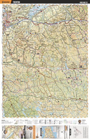
NSNS33 Trenton - Nova Scotia Topo
Backroad Mapbooks
This recreation topographic map for Trenton highlights all the logging/resource roads, hunting areas, fishing lakes & streams, campsites, paddling routes for canoeing and kayaking, wildlife viewing areas, multi-use trails for hiking, biking, horseback riding, cross-country skiing and snowshoeing, motorized trails for ATVing and snowmobiling & more. Covering 1,925 km2 (745 mi2), this 1:65,000 scale map measures 38 x 50 km (24 x 31 mi), providing you with more topographic and recreational detail for the Yarmouth area than any other map on the market. Special features include the addition of Crown land areas and countless new roads, trails and recreational Points of Interest. Included on this map are Garden River, Eden Lake, Caledonia, St Marys River, Liscomb Game Sanctuary, New Glasgow, Trenton, Willowdale, Sutherlands River, Millstream and more!
Page Size: 24 x 37 in (610 x 940 mm)
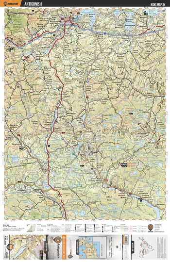
NSNS34 Antigonish - Nova Scotia Topo
Backroad Mapbooks
This recreation topographic map for Antigonish highlights all the logging/resource roads, hunting areas, fishing lakes & streams, campsites, paddling routes for canoeing and kayaking, wildlife viewing areas, multi-use trails for hiking, biking, horseback riding, cross-country skiing and snowshoeing, motorized trails for ATVing and snowmobiling & more. Covering 1,925 km2 (745 mi2), this 1:65,000 scale map measures 38 x 50 km (24 x 31 mi), providing you with more topographic and recreational detail for the Yarmouth area than any other map on the market. Special features include the addition of Crown land areas and countless new roads, trails and recreational Points of Interest. Included on this map are Antigonish, Lochaber Lake, Purlbrook, Melrose, St Marys River, Harbour River, Lochiel Lake, Forest Hill, Erinville, Glen Alpine and more!
Page Size: 24 x 37 in (610 x 940 mm)
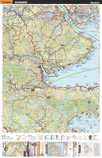
NSNS35 Guysborough - Nova Scotia Topo
Backroad Mapbooks
This recreation topographic map for Guysborough highlights all the logging/resource roads, hunting areas, fishing lakes & streams, campsites, paddling routes for canoeing and kayaking, wildlife viewing areas, multi-use trails for hiking, biking, horseback riding, cross-country skiing and snowshoeing, motorized trails for ATVing and snowmobiling & more. Covering 1,925 km2 (745 mi2), this 1:65,000 scale map measures 38 x 50 km (24 x 31 mi), providing you with more topographic and recreational detail for the Yarmouth area than any other map on the market. Special features include the addition of Crown land areas and countless new roads, trails and recreational Points of Interest. Included on this map are Chedabucto Bay, Queensport, Tor Bay, Milford Haven River, Mulgrave, Guysborough, Port Hawkesbury, Ogden Round Lake Wilderness Area, Salmon River, Tracadie and more!
Page Size: 24 x 37 in (610 x 940 mm)
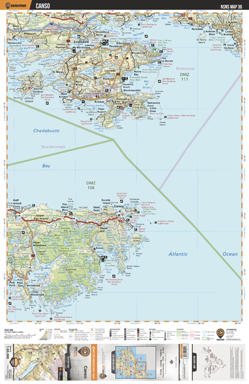
NSNS36 Canso - Nova Scotia Topo
Backroad Mapbooks
This recreation topographic map for Canso highlights all the logging/resource roads, hunting areas, fishing lakes & streams, campsites, paddling routes for canoeing and kayaking, wildlife viewing areas, multi-use trails for hiking, biking, horseback riding, cross-country skiing and snowshoeing, motorized trails for ATVing and snowmobiling & more. Covering 1,925 km2 (745 mi2), this 1:65,000 scale map measures 38 x 50 km (24 x 31 mi), providing you with more topographic and recreational detail for the Yarmouth area than any other map on the market. Special features include the addition of Crown land areas and countless new roads, trails and recreational Points of Interest. Included on this map are Chedabucto Bay, Hazel Hill, Louisdale, Canso, Dover Bay, St Peters Bay, Arichat, St Marys, Little Harbour, Point Michaud and more!
Page Size: 24 x 37 in (610 x 940 mm)
NSNS37 Port Michaud - Nova Scotia Topo
Backroad Mapbooks
This recreation topographic map for Port Michaud highlights all the logging/resource roads, hunting areas, fishing lakes & streams, campsites, paddling routes for canoeing and kayaking, wildlife viewing areas, multi-use trails for hiking, biking, horseback riding, cross-country skiing and snowshoeing, motorized trails for ATVing and snowmobiling & more. Covering 1,925 km2 (745 mi2), this 1:65,000 scale map measures 38 x 50 km (24 x 31 mi), providing you with more topographic and recreational detail for the Yarmouth area than any other map on the market. Special features include the addition of Crown land areas and countless new roads, trails and recreational Points of Interest. Included on this map are Port Michaud,Cape Breton Island,Point Michaud Beach Provincial Park,Gracieville and more!
Page Size: 24 x 37 in (610 x 940 mm)
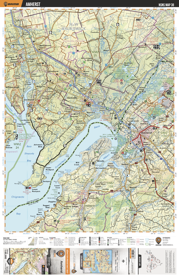
NSNS38 Amherst - Nova Scotia Topo
Backroad Mapbooks
This recreation topographic map for Amherst highlights all the logging/resource roads, hunting areas, fishing lakes & streams, campsites, paddling routes for canoeing and kayaking, wildlife viewing areas, multi-use trails for hiking, biking, horseback riding, cross-country skiing and snowshoeing, motorized trails for ATVing and snowmobiling & more. Covering 1,925 km2 (745 mi2), this 1:65,000 scale map measures 38 x 50 km (24 x 31 mi), providing you with more topographic and recreational detail for the Yarmouth area than any other map on the market. Special features include the addition of Crown land areas and countless new roads, trails and recreational Points of Interest. Included on this map are Chignecto Bay, Cumberland Basin, River Hebert, Maccan River, Amherst, Little Forks, Two Rivers, Missaguash River, Amherst Marsh, Athol and more!
Page Size: 24 x 37 in (610 x 940 mm)
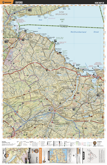
NSNS39 Oxford - Nova Scotia Topo
Backroad Mapbooks
This recreation topographic map for Oxford highlights all the logging/resource roads, hunting areas, fishing lakes & streams, campsites, paddling routes for canoeing and kayaking, wildlife viewing areas, multi-use trails for hiking, biking, horseback riding, cross-country skiing and snowshoeing, motorized trails for ATVing and snowmobiling & more. Covering 1,925 km2 (745 mi2), this 1:65,000 scale map measures 38 x 50 km (24 x 31 mi), providing you with more topographic and recreational detail for the Yarmouth area than any other map on the market. Special features include the addition of Crown land areas and countless new roads, trails and recreational Points of Interest. Included on this map are Pugwash, Tidnish, Oxford, Springhill, Northumberland Strait, Baie Vert, Black River, Big Lake, Lake Killarney, Pugwash Basin and more!
Page Size: 24 x 37 in (610 x 940 mm)
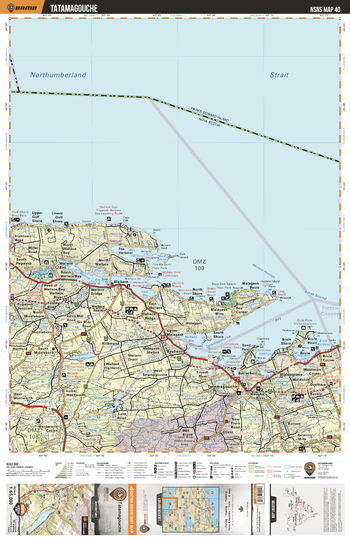
NSNS40 Tatamagouche- Nova Scotia.pdf
Backroad Mapbooks
This recreation topographic map for Tatamagouche highlights all the logging/resource roads, hunting areas, fishing lakes & streams, campsites, paddling routes for canoeing and kayaking, wildlife viewing areas, multi-use trails for hiking, biking, horseback riding, cross-country skiing and snowshoeing, motorized trails for ATVing and snowmobiling & more. Covering 1,925 km2 (745 mi2), this 1:65,000 scale map measures 38 x 50 km (24 x 31 mi), providing you with more topographic and recreational detail for the Yarmouth area than any other map on the market. Special features include the addition of Crown land areas and countless new roads, trails and recreational Points of Interest. Included on this map are Northumberland Strait, Wallace Ridge, Tatamagouche, Brule, Bayhead, Malagash Point, Fox Harbour Provincial Park, Tatamagouche Bay, Wallace Bay, Mattatall Lake and more!
Page Size: 24 x 37 in (610 x 940 mm)
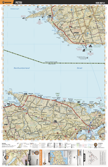
NSNS41 Pictou - Nova Scotia Topo
Backroad Mapbooks
This recreation topographic map for Pictou highlights all the logging/resource roads, hunting areas, fishing lakes & streams, campsites, paddling routes for canoeing and kayaking, wildlife viewing areas, multi-use trails for hiking, biking, horseback riding, cross-country skiing and snowshoeing, motorized trails for ATVing and snowmobiling & more. Covering 1,925 km2 (745 mi2), this 1:65,000 scale map measures 38 x 50 km (24 x 31 mi), providing you with more topographic and recreational detail for the Yarmouth area than any other map on the market. Special features include the addition of Crown land areas and countless new roads, trails and recreational Points of Interest. Included on this map are Northumberland Strait, Pictou, River John, Cariboo Harbour, Rushton Beach Provincial Park, Waterside Beach Provincial Park, Caribou-Munroes Island Provincial Park, MacKenzie Beach Park, and more!
Page Size: 24 x 37 in (610 x 940 mm)
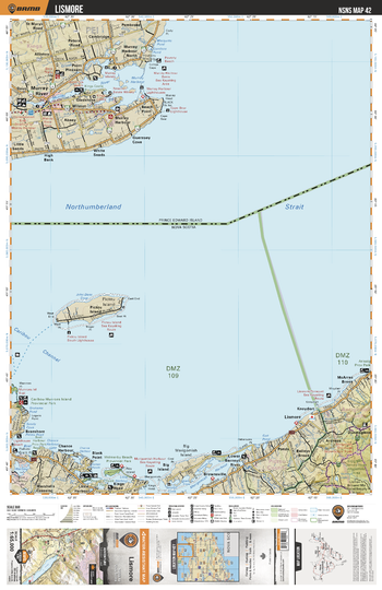
NSNS42 Lismore - Nova Scotia Topo
Backroad Mapbooks
This recreation topographic map for Lismore highlights all the logging/resource roads, hunting areas, fishing lakes & streams, campsites, paddling routes for canoeing and kayaking, wildlife viewing areas, multi-use trails for hiking, biking, horseback riding, cross-country skiing and snowshoeing, motorized trails for ATVing and snowmobiling & more. Covering 1,925 km2 (745 mi2), this 1:65,000 scale map measures 38 x 50 km (24 x 31 mi), providing you with more topographic and recreational detail for the Yarmouth area than any other map on the market. Special features include the addition of Crown land areas and countless new roads, trails and recreational Points of Interest. Included on this map are Eigg Mtn-James River Wilderness Area, The Ponds Park, Melmerby Beach Provincial Park, Chance Harbour, Big Island, Pictou Island, Lismore, Bailey's Brook, Kings Head Powell's Provincial Park and more!
Page Size: 24 x 37 in (610 x 940 mm)
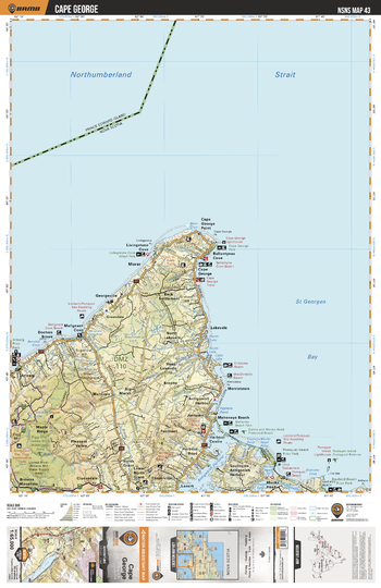
NSNS43 Cape George - Nova Scotia Topo
Backroad Mapbooks
This recreation topographic map for Cape George highlights all the logging/resource roads, hunting areas, fishing lakes & streams, campsites, paddling routes for canoeing and kayaking, wildlife viewing areas, multi-use trails for hiking, biking, horseback riding, cross-country skiing and snowshoeing, motorized trails for ATVing and snowmobiling & more. Covering 1,925 km2 (745 mi2), this 1:65,000 scale map measures 38 x 50 km (24 x 31 mi), providing you with more topographic and recreational detail for the Yarmouth area than any other map on the market. Special features include the addition of Crown land areas and countless new roads, trails and recreational Points of Interest. Included on this map are St Georges Bay, Antigonish Harbour, Mahoneys Beach Park, Pomquet Beach Provincial Park, Maple Ridge, Cape George, Doctors Brook, Browns Mountain, Monks Head, Cloverville and more!
Page Size: 24 x 37 in (610 x 940 mm)
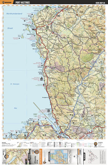
NSNS44 Port Hastings - Nova Scotia Topo
Backroad Mapbooks
This recreation topographic map for Port Hastings highlights all the logging/resource roads, hunting areas, fishing lakes & streams, campsites, paddling routes for canoeing and kayaking, wildlife viewing areas, multi-use trails for hiking, biking, horseback riding, cross-country skiing and snowshoeing, motorized trails for ATVing and snowmobiling & more. Covering 1,925 km2 (745 mi2), this 1:65,000 scale map measures 38 x 50 km (24 x 31 mi), providing you with more topographic and recreational detail for the Yarmouth area than any other map on the market. Special features include the addition of Crown land areas and countless new roads, trails and recreational Points of Interest. Included on this map are Port Hastings, Cape Jack, West Arm Protected Beach, Strait of Canso, Judique, Dungarry, Port Hood Station Provincial Park, Mabou, MacIntyre Lake, St Georges Bay and more!
Page Size: 24 x 37 in (610 x 940 mm)
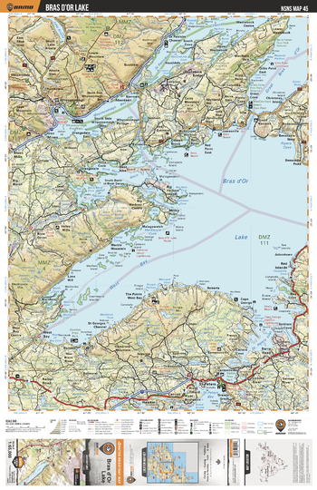
NSNS45 Bras dOr Lake - Nova Scotia Topo
Backroad Mapbooks
This recreation topographic map for Bras dOr Lake highlights all the logging/resource roads, hunting areas, fishing lakes & streams, campsites, paddling routes for canoeing and kayaking, wildlife viewing areas, multi-use trails for hiking, biking, horseback riding, cross-country skiing and snowshoeing, motorized trails for ATVing and snowmobiling & more. Covering 1,925 km2 (745 mi2), this 1:65,000 scale map measures 38 x 50 km (24 x 31 mi), providing you with more topographic and recreational detail for the Yarmouth area than any other map on the market. Special features include the addition of Crown land areas and countless new roads, trails and recreational Points of Interest. Included on this map are Bras d'Or Lake, Pringle Lake, St Patricks Channel, Whycocomagh Bay, Bucklaw, Red Point, Christmas Island, Red Islands, Grande Greve, Big Harbour Centre and more!
Page Size: 24 x 37 in (610 x 940 mm)
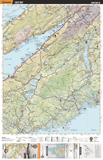
NSNS46 East Bay - Nova Scotia Topo
Backroad Mapbooks
This recreation topographic map for East Bay highlights all the logging/resource roads, hunting areas, fishing lakes & streams, campsites, paddling routes for canoeing and kayaking, wildlife viewing areas, multi-use trails for hiking, biking, horseback riding, cross-country skiing and snowshoeing, motorized trails for ATVing and snowmobiling & more. Covering 1,925 km2 (745 mi2), this 1:65,000 scale map measures 38 x 50 km (24 x 31 mi), providing you with more topographic and recreational detail for the Yarmouth area than any other map on the market. Special features include the addition of Crown land areas and countless new roads, trails and recreational Points of Interest. Included on this map are Mira River, East Bay, Loch Lomond, Portage, Irish Cove Provincial Park, Big Brook, Great Bras D'Or, Middle River-Framboise Wilderness Area, Fourchu, Big Pond and more!
Page Size: 24 x 37 in (610 x 940 mm)
No search results