


MapSherpa Catalog
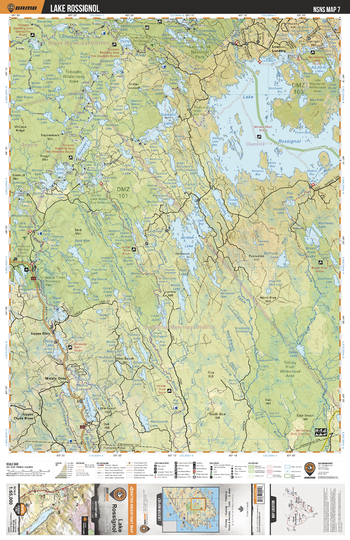
NSNS07 Lake Rossignol - Nova Scotia Topo
Backroad Mapbooks
This recreation topographic map for Lake Rossignol highlights all the logging/resource roads, hunting areas, fishing lakes & streams, campsites, paddling routes for canoeing and kayaking, wildlife viewing areas, multi-use trails for hiking, biking, horseback riding, cross-country skiing and snowshoeing, motorized trails for ATVing and snowmobiling & more. Covering 1,925 km2 (745 mi2), this 1:65,000 scale map measures 38 x 50 km (24 x 31 mi), providing you with more topographic and recreational detail for the Yarmouth area than any other map on the market. Special features include the addition of Crown land areas and countless new roads, trails and recreational Points of Interest. Included on this map are Lake Rossignol, Jordan Lake, Broad River Lake, Tidney River Wilderness Area, Tobeatic Wilderness Area, Deception Lake, Wentworth Lake, Mink Lake, Roseway Lake, Shelburne River and more!
Page Size: 24 x 37 in (610 x 940 mm)
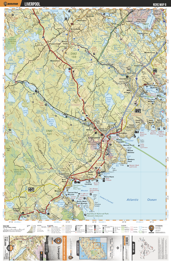
NSNS08 Liverpool - Nova Scotia Topo
Backroad Mapbooks
This recreation topographic map for Liverpool highlights all the logging/resource roads, hunting areas, fishing lakes & streams, campsites, paddling routes for canoeing and kayaking, wildlife viewing areas, multi-use trails for hiking, biking, horseback riding, cross-country skiing and snowshoeing, motorized trails for ATVing and snowmobiling & more. Covering 1,925 km2 (745 mi2), this 1:65,000 scale map measures 38 x 50 km (24 x 31 mi), providing you with more topographic and recreational detail for the Yarmouth area than any other map on the market. Special features include the addition of Crown land areas and countless new roads, trails and recreational Points of Interest. Included on this map are Liverpool, Port Mouton, Liverpool Bay, Ten Mile Lake, Mersey River, Broad River, Mill Village, Herring Cove Lake, Big Bon Mature Lake, Medway River and more!
Page Size: 24 x 37 in (610 x 940 mm)
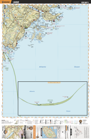
NSNS09 LaHave - Nova Scotia Topo
Backroad Mapbooks
This recreation topographic map for LaHave highlights all the logging/resource roads, hunting areas, fishing lakes & streams, campsites, paddling routes for canoeing and kayaking, wildlife viewing areas, multi-use trails for hiking, biking, horseback riding, cross-country skiing and snowshoeing, motorized trails for ATVing and snowmobiling & more. Covering 1,925 km2 (745 mi2), this 1:65,000 scale map measures 38 x 50 km (24 x 31 mi), providing you with more topographic and recreational detail for the Yarmouth area than any other map on the market. Special features include the addition of Crown land areas and countless new roads, trails and recreational Points of Interest. Included on this map are LeHave River, Petite Riviere Bridge, Rose Bay, Kingsburg, Cape La Have Island, Italy Cross, Voglers Cove, Cross Island, Crescent Beach, Petite Riviere and more!
Page Size: 24 x 37 in (610 x 940 mm)
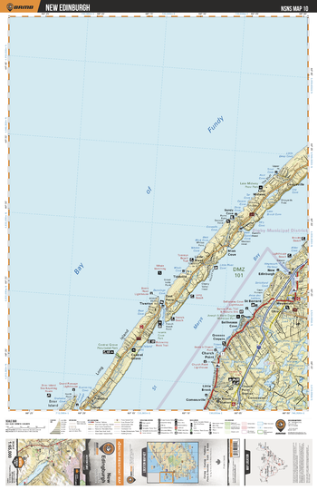
NSNS10 New Edinburgh - Nova Scotia Topo
Backroad Mapbooks
This recreation topographic map for New Edinburgh highlights all the logging/resource roads, hunting areas, fishing lakes & streams, campsites, paddling routes for canoeing and kayaking, wildlife viewing areas, multi-use trails for hiking, biking, horseback riding, cross-country skiing and snowshoeing, motorized trails for ATVing and snowmobiling & more. Covering 1,925 km2 (745 mi2), this 1:65,000 scale map measures 38 x 50 km (24 x 31 mi), providing you with more topographic and recreational detail for the Yarmouth area than any other map on the market. Special features include the addition of Crown land areas and countless new roads, trails and recreational Points of Interest. Included on this map are Bay of Fundy, St Marys Bay, Long Island, Weymouth, Church Point, Brier Island, Tiddville, Lake Midway, Little River, New Edinburgh and more!
Page Size: 24 x 37 in (610 x 940 mm)
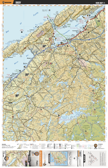
NSNS11 Digby - Nova Scotia Topo
Backroad Mapbooks
This recreation topographic map for Digby highlights all the logging/resource roads, hunting areas, fishing lakes & streams, campsites, paddling routes for canoeing and kayaking, wildlife viewing areas, multi-use trails for hiking, biking, horseback riding, cross-country skiing and snowshoeing, motorized trails for ATVing and snowmobiling & more. Covering 1,925 km2 (745 mi2), this 1:65,000 scale map measures 38 x 50 km (24 x 31 mi), providing you with more topographic and recreational detail for the Yarmouth area than any other map on the market. Special features include the addition of Crown land areas and countless new roads, trails and recreational Points of Interest. Included on this map are Annapolis Basin, St Marys Bay, Bay of Fundy, Digby Neck, Digby, Fourth Lake Flowage, Fifth Lake Flowage, Sissiboo Falls, Cornwallis Park, Annapolis River and more!
Page Size: 24 x 37 in (610 x 940 mm)
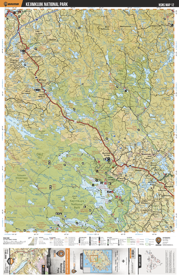
NSNS12 Kejimkujik National Park - Nova Scotia Topo
Backroad Mapbooks
This recreation topographic map for Kejimkujik National Park highlights all the logging/resource roads, hunting areas, fishing lakes & streams, campsites, paddling routes for canoeing and kayaking, wildlife viewing areas, multi-use trails for hiking, biking, horseback riding, cross-country skiing and snowshoeing, motorized trails for ATVing and snowmobiling & more. Covering 1,925 km2 (745 mi2), this 1:65,000 scale map measures 38 x 50 km (24 x 31 mi), providing you with more topographic and recreational detail for the Yarmouth area than any other map on the market. Special features include the addition of Crown land areas and countless new roads, trails and recreational Points of Interest. Included on this map are Kejimkujik National Park, Lequille, Kejimkujik Lake, Tobeatic Wilderness Area, Lake Mulgrave, Graywood, Peskowesk Lake, Peskawa Lake, Milford, Medway River and more!
Page Size: 24 x 37 in (610 x 940 mm)
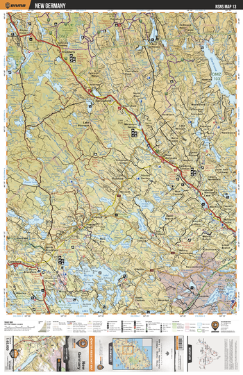
NSNS13 New Germany - Nova Scotia Topo
Backroad Mapbooks
This recreation topographic map for New Germany highlights all the logging/resource roads, hunting areas, fishing lakes & streams, campsites, paddling routes for canoeing and kayaking, wildlife viewing areas, multi-use trails for hiking, biking, horseback riding, cross-country skiing and snowshoeing, motorized trails for ATVing and snowmobiling & more. Covering 1,925 km2 (745 mi2), this 1:65,000 scale map measures 38 x 50 km (24 x 31 mi), providing you with more topographic and recreational detail for the Yarmouth area than any other map on the market. Special features include the addition of Crown land areas and countless new roads, trails and recreational Points of Interest. Included on this map are Sherbrooke Lake, New Germany, Springfield, Molega Lake, Ponhook Lake, Lake Torment, Albany Cross, Crossburn, Wildcat River, Pleasant River and more!
Page Size: 24 x 37 in (610 x 940 mm)
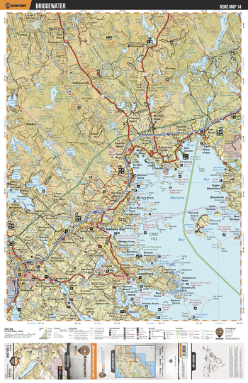
NSNS14 Brigewater - Nova Scotia Topo
Backroad Mapbooks
This recreation topographic map for Brigewater highlights all the logging/resource roads, hunting areas, fishing lakes & streams, campsites, paddling routes for canoeing and kayaking, wildlife viewing areas, multi-use trails for hiking, biking, horseback riding, cross-country skiing and snowshoeing, motorized trails for ATVing and snowmobiling & more. Covering 1,925 km2 (745 mi2), this 1:65,000 scale map measures 38 x 50 km (24 x 31 mi), providing you with more topographic and recreational detail for the Yarmouth area than any other map on the market. Special features include the addition of Crown land areas and countless new roads, trails and recreational Points of Interest. Included on this map are Mahone Bay, Lunenburg Bay, River Bay, Chester, Tancook Island, Card Lake, New Ross, Middle River, Bridgewater, La Have River and more!
Page Size: 24 x 37 in (610 x 940 mm)
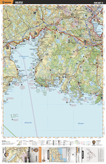
NSNS15 Halifax - Nova Scotia Topo
Backroad Mapbooks
This recreation topographic map for Halifax highlights all the logging/resource roads, hunting areas, fishing lakes & streams, campsites, paddling routes for canoeing and kayaking, wildlife viewing areas, multi-use trails for hiking, biking, horseback riding, cross-country skiing and snowshoeing, motorized trails for ATVing and snowmobiling & more. Covering 1,925 km2 (745 mi2), this 1:65,000 scale map measures 38 x 50 km (24 x 31 mi), providing you with more topographic and recreational detail for the Yarmouth area than any other map on the market. Special features include the addition of Crown land areas and countless new roads, trails and recreational Points of Interest. Included on this map are St Margarets Bay, Peggy's Cove, Pennant Bay, Queensland, Bedford Basin, Bedford, Halifax, Stillwater Lake, Black Point, Hacketts Cove and more!
Page Size: 24 x 37 in (610 x 940 mm)
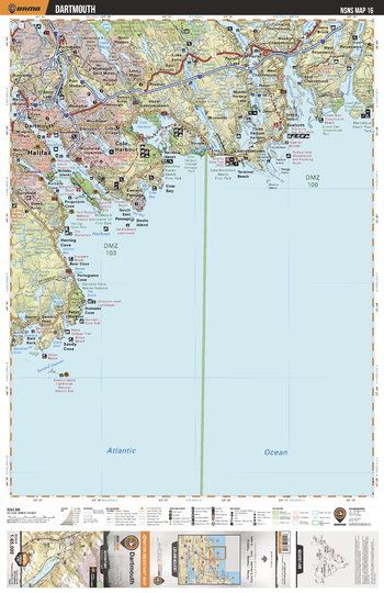
NSNS16 Dartmouth - Nova Scotia Topo
Backroad Mapbooks
This recreation topographic map for Dartmouth highlights all the logging/resource roads, hunting areas, fishing lakes & streams, campsites, paddling routes for canoeing and kayaking, wildlife viewing areas, multi-use trails for hiking, biking, horseback riding, cross-country skiing and snowshoeing, motorized trails for ATVing and snowmobiling & more. Covering 1,925 km2 (745 mi2), this 1:65,000 scale map measures 38 x 50 km (24 x 31 mi), providing you with more topographic and recreational detail for the Yarmouth area than any other map on the market. Special features include the addition of Crown land areas and countless new roads, trails and recreational Points of Interest. Included on this map are Halifax, Dartmouth, Lake Echo, Halifax Harbour, Cole Harbour, Porters Lake, Chezzetcook Inlet, Petpeswick Inlet, Seaforth, Rainbow Haven and more!
Page Size: 24 x 37 in (610 x 940 mm)
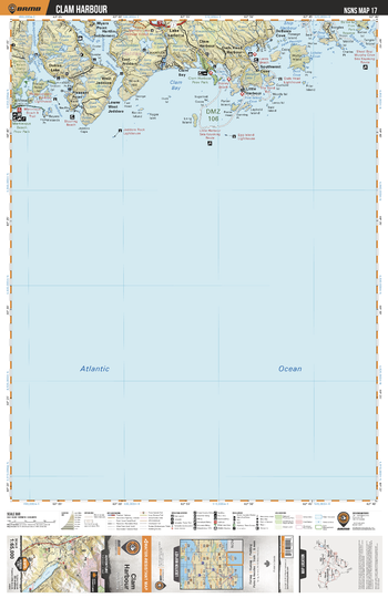
NSNS17 Clam Harbour - Nova Scotia Topo
Backroad Mapbooks
This recreation topographic map for Clam Harbour highlights all the logging/resource roads, hunting areas, fishing lakes & streams, campsites, paddling routes for canoeing and kayaking, wildlife viewing areas, multi-use trails for hiking, biking, horseback riding, cross-country skiing and snowshoeing, motorized trails for ATVing and snowmobiling & more. Covering 1,925 km2 (745 mi2), this 1:65,000 scale map measures 38 x 50 km (24 x 31 mi), providing you with more topographic and recreational detail for the Yarmouth area than any other map on the market. Special features include the addition of Crown land areas and countless new roads, trails and recreational Points of Interest. Included on this map are Clam Bay, Ship Harbour, Baltee Island Park, Wolfes Island Park, Murphys Lake, Lake Charlotte, Buttermilk Harbour, Martinique Beach Prov Park, Owls Head Harbour, Francis Nose Island and more!
Page Size: 24 x 37 in (610 x 940 mm)
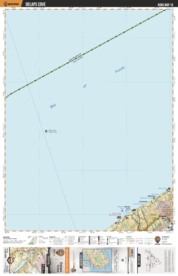
NSNS18 Delaps Cove - Nova Scotia Topo
Backroad Mapbooks
This recreation topographic map for Delaps Cove highlights all the logging/resource roads, hunting areas, fishing lakes & streams, campsites, paddling routes for canoeing and kayaking, wildlife viewing areas, multi-use trails for hiking, biking, horseback riding, cross-country skiing and snowshoeing, motorized trails for ATVing and snowmobiling & more. Covering 1,925 km2 (745 mi2), this 1:65,000 scale map measures 38 x 50 km (24 x 31 mi), providing you with more topographic and recreational detail for the Yarmouth area than any other map on the market. Special features include the addition of Crown land areas and countless new roads, trails and recreational Points of Interest. Included on this map are Bay of Fundy, Granville Ferry, Annapolis Royal, Hillsburn, Litchfield, Delaps Cove, Bluff Cove, Parkers Cove and more!
Page Size: 24 x 37 in (610 x 940 mm)
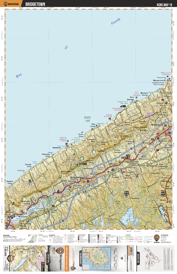
NSNS19 Bridgetown - Nova Scotia Topo
Backroad Mapbooks
This recreation topographic map for Bridgetown highlights all the logging/resource roads, hunting areas, fishing lakes & streams, campsites, paddling routes for canoeing and kayaking, wildlife viewing areas, multi-use trails for hiking, biking, horseback riding, cross-country skiing and snowshoeing, motorized trails for ATVing and snowmobiling & more. Covering 1,925 km2 (745 mi2), this 1:65,000 scale map measures 38 x 50 km (24 x 31 mi), providing you with more topographic and recreational detail for the Yarmouth area than any other map on the market. Special features include the addition of Crown land areas and countless new roads, trails and recreational Points of Interest. Included on this map are Port George, Bridgetown, Annapolis River, Belleisle, Annapolis Royal, Middleton, Paradise Lake, Dalhousie Lake, Birch Hill Lake, St Croix Cove and more!
Page Size: 24 x 37 in (610 x 940 mm)
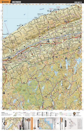
NSNS20 Greenwood - Nova Scotia Topo
Backroad Mapbooks
This recreation topographic map for Greenwood highlights all the logging/resource roads, hunting areas, fishing lakes & streams, campsites, paddling routes for canoeing and kayaking, wildlife viewing areas, multi-use trails for hiking, biking, horseback riding, cross-country skiing and snowshoeing, motorized trails for ATVing and snowmobiling & more. Covering 1,925 km2 (745 mi2), this 1:65,000 scale map measures 38 x 50 km (24 x 31 mi), providing you with more topographic and recreational detail for the Yarmouth area than any other map on the market. Special features include the addition of Crown land areas and countless new roads, trails and recreational Points of Interest. Included on this map are Bay of Fundy, Greenwood, Middleton, Coldbrook, Lake George, Cloud Lake Wilderness Area, Nictaux River, Aylesford Lake, Gaspereau Lake, Annapolis River and more!
Page Size: 24 x 37 in (610 x 940 mm)
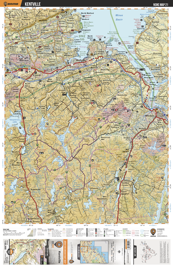
NSNS21 Kentville - Nova Scotia Topo
Backroad Mapbooks
This recreation topographic map for Kentville highlights all the logging/resource roads, hunting areas, fishing lakes & streams, campsites, paddling routes for canoeing and kayaking, wildlife viewing areas, multi-use trails for hiking, biking, horseback riding, cross-country skiing and snowshoeing, motorized trails for ATVing and snowmobiling & more. Covering 1,925 km2 (745 mi2), this 1:65,000 scale map measures 38 x 50 km (24 x 31 mi), providing you with more topographic and recreational detail for the Yarmouth area than any other map on the market. Special features include the addition of Crown land areas and countless new roads, trails and recreational Points of Interest. Included on this map are Minas Basin, Avon River, Windsor, Wolfville, Kentville, Gaspereau Lake, Black River Lake, Panuke Lake, Aldersville, Smiths Corner and more!
Page Size: 24 x 37 in (610 x 940 mm)
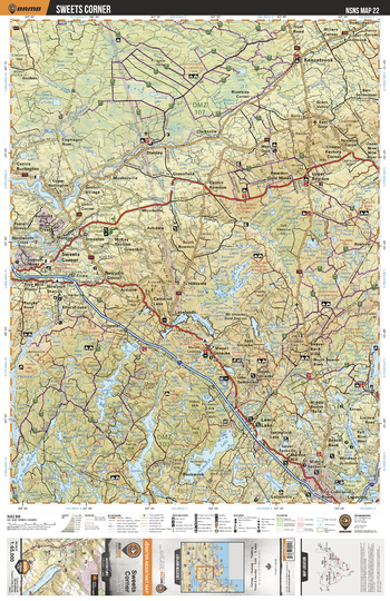
NSNS22 Sweets Corner - Nova Scotia Topo
Backroad Mapbooks
This recreation topographic map for Sweets Corner highlights all the logging/resource roads, hunting areas, fishing lakes & streams, campsites, paddling routes for canoeing and kayaking, wildlife viewing areas, multi-use trails for hiking, biking, horseback riding, cross-country skiing and snowshoeing, motorized trails for ATVing and snowmobiling & more. Covering 1,925 km2 (745 mi2), this 1:65,000 scale map measures 38 x 50 km (24 x 31 mi), providing you with more topographic and recreational detail for the Yarmouth area than any other map on the market. Special features include the addition of Crown land areas and countless new roads, trails and recreational Points of Interest. Included on this map are Kennetcook, Sweets Corner, Lewis Lake, Beaver Bank, Pockwock Lake, Panuke Lake, Kennetcook River, Cogmagun River, Kinsac Lake, Middle Sackville and more!
Page Size: 24 x 37 in (610 x 940 mm)
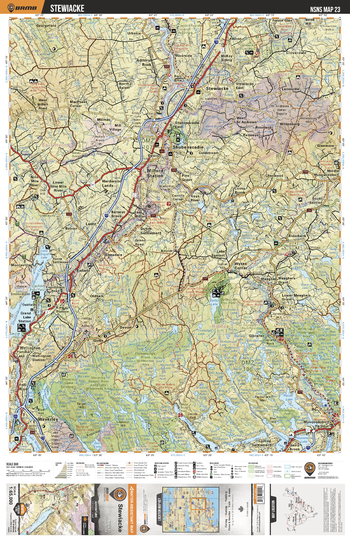
NSNS23 Stewiacke - Nova Scotia Topo
Backroad Mapbooks
This recreation topographic map for Stewiacke highlights all the logging/resource roads, hunting areas, fishing lakes & streams, campsites, paddling routes for canoeing and kayaking, wildlife viewing areas, multi-use trails for hiking, biking, horseback riding, cross-country skiing and snowshoeing, motorized trails for ATVing and snowmobiling & more. Covering 1,925 km2 (745 mi2), this 1:65,000 scale map measures 38 x 50 km (24 x 31 mi), providing you with more topographic and recreational detail for the Yarmouth area than any other map on the market. Special features include the addition of Crown land areas and countless new roads, trails and recreational Points of Interest. Included on this map are Stewiacke, Shubenacadie Grand Lake, Oakfield, Waverley, Dollar Lake, Musquodoboit River, Shubencadie, Porters Lake, Milford Station, Waverley-Salmon River Long Lake Wilderness Area and more!
Page Size: 24 x 37 in (610 x 940 mm)
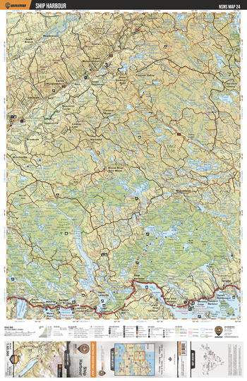
NSNS24 Ship Harbour - Nova Scotia Topo
Backroad Mapbooks
This recreation topographic map for Ship Harbour highlights all the logging/resource roads, hunting areas, fishing lakes & streams, campsites, paddling routes for canoeing and kayaking, wildlife viewing areas, multi-use trails for hiking, biking, horseback riding, cross-country skiing and snowshoeing, motorized trails for ATVing and snowmobiling & more. Covering 1,925 km2 (745 mi2), this 1:65,000 scale map measures 38 x 50 km (24 x 31 mi), providing you with more topographic and recreational detail for the Yarmouth area than any other map on the market. Special features include the addition of Crown land areas and countless new roads, trails and recreational Points of Interest. Included on this map are Tangier Grand Lake Wilderness Area, Lake Charlotte, Shoal Bay, Mooseland, Pleasant valley, Musquodoboit River, Meadowvale, Ten Mile Lake, Como Lake, Scraggy Lake and more!
Page Size: 24 x 37 in (610 x 940 mm)
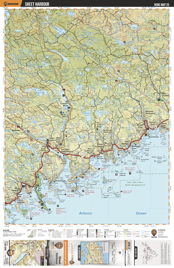
NSNS25 Sheet Harbour - Nova Scotia Topo
Backroad Mapbooks
This recreation topographic map for Sheet Harbour highlights all the logging/resource roads, hunting areas, fishing lakes & streams, campsites, paddling routes for canoeing and kayaking, wildlife viewing areas, multi-use trails for hiking, biking, horseback riding, cross-country skiing and snowshoeing, motorized trails for ATVing and snowmobiling & more. Covering 1,925 km2 (745 mi2), this 1:65,000 scale map measures 38 x 50 km (24 x 31 mi), providing you with more topographic and recreational detail for the Yarmouth area than any other map on the market. Special features include the addition of Crown land areas and countless new roads, trails and recreational Points of Interest. Included on this map are Sheet Harbour, Spry Harbour, Spry Bay, Harrigan Cove, Spar Lake, Moser River, Liscombe Game Sanctuary, Marshall Flowage, Liscombe River, Seloam Lake and more!
Page Size: 24 x 37 in (610 x 940 mm)
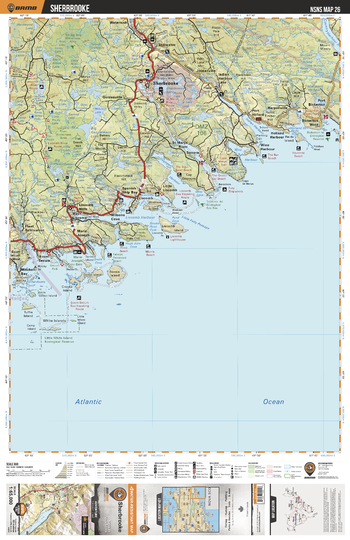
NSNS26 Sherbrooke - Nova Scotia Topo
Backroad Mapbooks
This recreation topographic map for Sherbrooke highlights all the logging/resource roads, hunting areas, fishing lakes & streams, campsites, paddling routes for canoeing and kayaking, wildlife viewing areas, multi-use trails for hiking, biking, horseback riding, cross-country skiing and snowshoeing, motorized trails for ATVing and snowmobiling & more. Covering 1,925 km2 (745 mi2), this 1:65,000 scale map measures 38 x 50 km (24 x 31 mi), providing you with more topographic and recreational detail for the Yarmouth area than any other map on the market. Special features include the addition of Crown land areas and countless new roads, trails and recreational Points of Interest. Included on this map are Sherbrooke, Liscomb Harbour, Gegogan Harbour, St Marys River, Indian Harbour, Holland Harbour, Port Bickerton, Little White Island Eco Reserve, Little Folly Passage, Liscomb River and more!
Page Size: 24 x 37 in (610 x 940 mm)
No search results