


MapSherpa Catalog
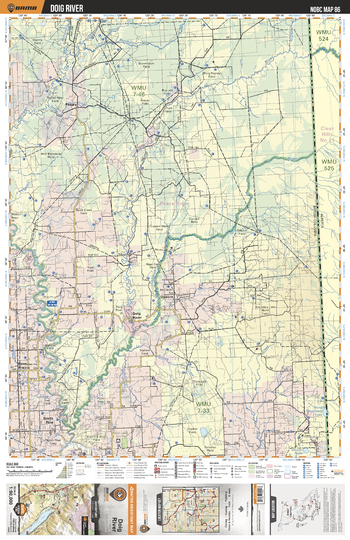
NOBC86 Doig River - Northern BC
Backroad Mapbooks
This recreation topographic map for the Doig River area highlights all the logging and resource roads, recreational features and trails for hiking, mountain biking, ATVing, snowmobiling, skiing, snowshoeing, fishing, camping, hunting, canoeing, kayaking, wildlife viewing and more. New features include private land and labelled fish species, plus new roads, recreational trails and Points of Interest. No other map for the area provides you with this level of recreational or topographic detail. Measuring 52.5 x 70 km (32.5 x 43.5 mi), this 1:90,000 scale map covers 3,680 km2 (1,420 mi2) in total and includes Doig River, Osborn, Peejay, North Pine, Cecil Lake Ecological Reserve, Beatton River, Doig River, Osborne River and more!
Page Size: 24 x 37 in (610 x 940 mm)
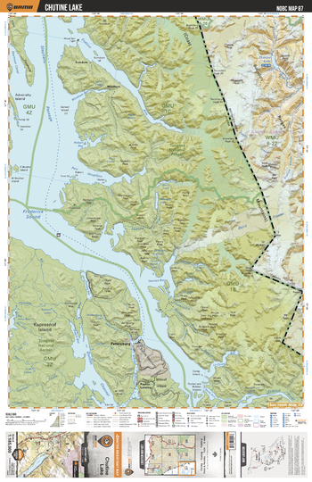
NOBC87 Chutine Lake - Northern BC
Backroad Mapbooks
This recreation topographic map for the Chutine Lake area highlights all the logging and resource roads, recreational features and trails for hiking, mountain biking, ATVing, snowmobiling, skiing, snowshoeing, fishing, camping, hunting, canoeing, kayaking, wildlife viewing and more. New features include private land and labelled fish species, plus new roads, recreational trails and Points of Interest. No other map for the area provides you with this level of recreational or topographic detail. Measuring 52.5 x 70 km (32.5 x 43.5 mi), this 1:90,000 scale map covers 3,680 km2 (1,420 mi2) in total and includes Chutine Lake, Chutine River, Boundary Ranges, Owens Peak, Noel Peak, Mussell Peak, Mt Ratz, Baird Glacier, Mt Gilroy, Triumph Glacier and more!
Page Size: 24 x 37 in (610 x 940 mm)
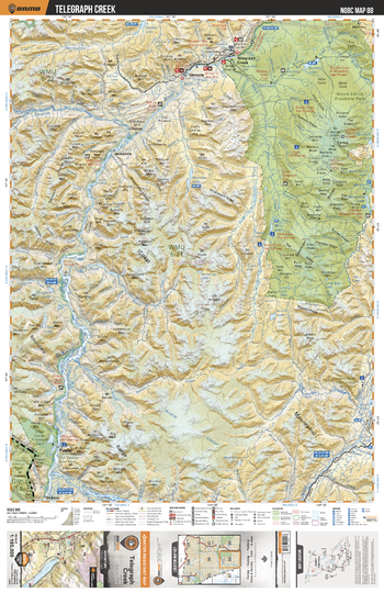
NOBC88 Telegraph Creek - Northern BC
Backroad Mapbooks
This recreation map for the Telegraph Creek area highlights all the logging and resource roads, recreational features and trails for hiking, mountain biking, ATVing, snowmobiling, skiing, snowshoeing, fishing, camping, hunting, canoeing, kayaking, wildlife viewing and more. New features include private land and labelled fish species, plus new roads, recreational trails and Points of Interest. No other map provides you with this level of recreational and topographic detail for the Telegraph Creek area. Measuring 105 x 140 km (65 x 87 mi), this 1:185,000 scale map covers 14,750 km2 (5,695 mi2) in total and includes Buckley Lake, Choquette Hot Springs, Chutine River, Elwyn Creek Hot Springs, Glenora, Great Glacier Provincial Park, Iskut River Hot Springs, Mess Creek Hot Springs, Mess Lake Hot Springs, Mount Edziza Provincial Park, Sezil Hot Springs, Stikine River, Telegraph Creek and more!
Page Size: 24 x 37 in (610 x 940 mm)
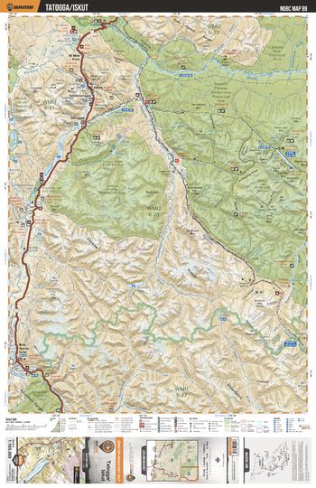
NOBC89 Tatogga/Iskut - Northern BC
Backroad Mapbooks
This recreation map for the Tatogga/Iskut area highlights all the logging and resource roads, recreational features and trails for hiking, mountain biking, ATVing, snowmobiling, skiing, snowshoeing, fishing, camping, hunting, canoeing, kayaking, wildlife viewing and more. New features include private land and labelled fish species, plus new roads, recreational trails and Points of Interest. No other map for the area provides you with this level of recreational or topographic detail. Measuring 105 x 140 km (65 x 87 mi), this 1:185,000 scale map covers 14,750 km2 (5,695 mi2) in total and includes Spatsizi Plateau Wilderness Prov Park, Cold Fish Lake, Kinaskan Lake, Tatogga, Iskut, Bob Quinn Lake, Tumeka Lake, Spatsizi Headwaters Prov Park, Klappan River, Stikine River, and more!
Page Size: 24 x 37 in (610 x 940 mm)
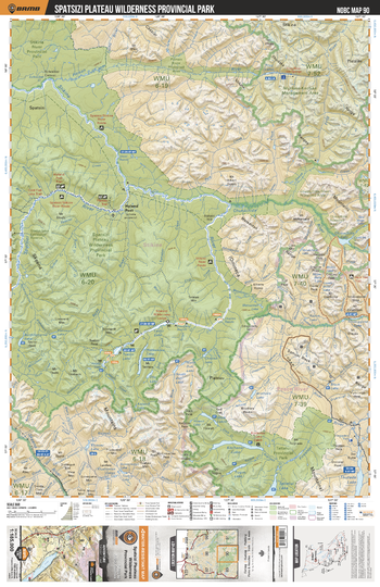
NOBC90 Spatsizi Plateau Wilderness Provincial Park - Northern BC
Backroad Mapbooks
This recreation map for the Spatsizi Plateau Wilderness Provincial Park area highlights all the logging and resource roads, recreational features and trails for hiking, mountain biking, ATVing, snowmobiling, skiing, snowshoeing, fishing, camping, hunting, canoeing, kayaking, wildlife viewing and more. New features include private land and labelled fish species, plus new roads, recreational trails and Points of Interest. No other map for the area provides you with this level of recreational or topographic detail. Measuring 105 x 140 km (65 x 87 mi), this 1:185,000 scale map covers 14,750 km2 (5,695 mi2) in total and includes Spatsizi Plateau Wilderness Prov Park, Fountain Rapids, Tuaton Lake, Happy Lake, Stikine River, Muskwa-Kechika Management Area, Tatlatui Prov Park, Stikine Rover Prov Park, Chukachida River,Spatsizi River and more!
Page Size: 24 x 37 in (610 x 940 mm)
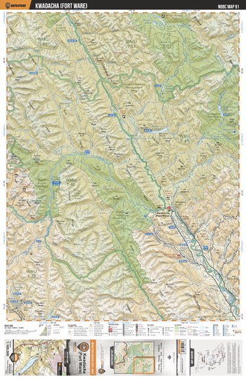
NOBC91 Fort Ware - Northern BC
Backroad Mapbooks
This recreation map for the Fort Ware area highlights all the logging and resource roads, recreational features and trails for hiking, mountain biking, ATVing, snowmobiling, skiing, snowshoeing, fishing, camping, hunting, canoeing, kayaking, wildlife viewing and more. New features include private land and labelled fish species, plus new roads, recreational trails and Points of Interest. No other map for the area provides you with this level of recreational or topographic detail. Measuring 105 x 140 km (65 x 87 mi), this 1:185,000 scale map covers 14,750 km2 (5,695 mi2) in total and includes Muskwa-Kechika Management Area, Kwadacha Wilderness Prov Park, Fort Ware, Finlay Russel Protected Area, Finlay River, Stelkuz Lake, Fox Lake, Weissener Lake, Dune Za Keyih Prov Park, Fox River and more!
Page Size: 24 x 37 in (610 x 940 mm)
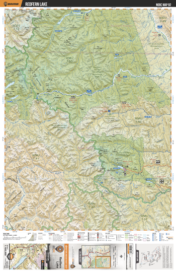
NOBC92 Redfern Lake - Northern BC
Backroad Mapbooks
This recreation map for the Redfern Lake area highlights all the logging and resource roads, recreational features and trails for hiking, mountain biking, ATVing, snowmobiling, skiing, snowshoeing, fishing, camping, hunting, canoeing, kayaking, wildlife viewing and more. New features include private land and labelled fish species, plus new roads, recreational trails and Points of Interest. No other map for the area provides you with this level of recreational or topographic detail. Measuring 105 x 140 km (65 x 87 mi), this 1:185,000 scale map covers 14,750 km2 (5,695 mi2) in total and includes Northen Rocky Mountains Prov Park, Muskwa River, Tuchodi Lakes, Prohet River Hotsprings Prov Park, Trimble Lake, Mt Withrow, Redfern-Keily Prov Park, Muskwa-Kechika Management Area, Kwadacha Wilderness Prov Park, Redfern Lake and more!
Page Size: 24 x 37 in (610 x 940 mm)
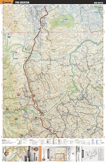
NOBC93 Pink Mountain - Northern BC
Backroad Mapbooks
This recreation map for the Pink Mountain area highlights all the logging and resource roads, recreational features and trails for hiking, mountain biking, ATVing, snowmobiling, skiing, snowshoeing, fishing, camping, hunting, canoeing, kayaking, wildlife viewing and more. New features include private land and labelled fish species, plus new roads, recreational trails and Points of Interest. No other map for the area provides you with this level of recreational or topographic detail. Measuring 105 x 140 km (65 x 87 mi), this 1:185,000 scale map covers 14,750 km2 (5,695 mi2) in total and includes Prophet River, Pink Mountain, Halfway River, Loranger Creek, Sikanni Cheif, Mason Creek, Buckinghorse River, Trutch, Klua Lakes, Muskwa-Kechika Management Area and more!
Page Size: 24 x 37 in (610 x 940 mm)
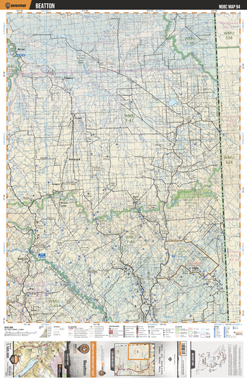
NOBC94 Beatton - Northern BC
Backroad Mapbooks
This recreation map for the Beatton area highlights all the logging and resource roads, recreational features and trails for hiking, mountain biking, ATVing, snowmobiling, skiing, snowshoeing, fishing, camping, hunting, canoeing, kayaking, wildlife viewing and more. New features include private land and labelled fish species, plus new roads, recreational trails and Points of Interest. No other map for the area provides you with this level of recreational or topographic detail. Measuring 105 x 140 km (65 x 87 mi), this 1:185,000 scale map covers 14,750 km2 (5,695 mi2) in total and includes Beatton, Chinchaga Lakes, Milligan Hills Prov Park, Tamarack, Sikanni, Niteal, Silver Lake, Dahl City, Beatton River, Fontas River and more!
Page Size: 24 x 37 in (610 x 940 mm)
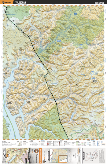
NOBC95 Tulsequah - Northern BC
Backroad Mapbooks
This recreation map for the Tulsequah area highlights all the logging and resource roads, recreational features and trails for hiking, mountain biking, ATVing, snowmobiling, skiing, snowshoeing, fishing, camping, hunting, canoeing, kayaking, wildlife viewing and more. New features include private land and labelled fish species, plus new roads, recreational trails and Points of Interest. No other map for the area provides you with this level of recreational or topographic detail. Measuring 105 x 140 km (65 x 87 mi), this 1:185,000 scale map covers 14,750 km2 (5,695 mi2) in total and includes Atlin Prov Park, Tulsequah, Sawyer Glacier, Trapper Lake, Tatsamenie Lake, Whiting Lake, Taku River, Tulsequah Lake, King Salmon Lake, Little Trapper Lake and more!
Page Size: 24 x 37 in (610 x 940 mm)
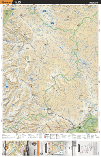
NOBC96 Saloon - Northern BC
Backroad Mapbooks
This recreation map for the Saloon area highlights all the logging and resource roads, recreational features and trails for hiking, mountain biking, ATVing, snowmobiling, skiing, snowshoeing, fishing, camping, hunting, canoeing, kayaking, wildlife viewing and more. New features include private land and labelled fish species, plus new roads, recreational trails and Points of Interest. No other map for the area provides you with this level of recreational or topographic detail. Measuring 105 x 140 km (65 x 87 mi), this 1:185,000 scale map covers 14,750 km2 (5,695 mi2) in total and includes Stikine River Prov Park, Callison Ranch, Saloon, Thaltan, Cariboo Meadows, Days Ranch, Hiusta Meadow, Hyland Ranch, Sheslay, Sheslay River and more!
Page Size: 24 x 37 in (610 x 940 mm)
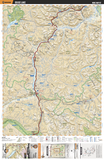
NOBC97 Dease Lake - Northern BC
Backroad Mapbooks
This recreation map for the Dease Lake area highlights all the logging and resource roads, recreational features and trails for hiking, mountain biking, ATVing, snowmobiling, skiing, snowshoeing, fishing, camping, hunting, canoeing, kayaking, wildlife viewing and more. New features include private land and labelled fish species, plus new roads, recreational trails and Points of Interest. No other map for the area provides you with this level of recreational or topographic detail. Measuring 105 x 140 km (65 x 87 mi), this 1:185,000 scale map covers 14,750 km2 (5,695 mi2) in total and includes Dease Lake, Cry Lake, Porter Landing, Good Hope Lake, Jade City, Boulder City, Stikine River, Tanzilla River, McDame, Tuya Mountains Prov Park and more!
Page Size: 24 x 37 in (610 x 940 mm)
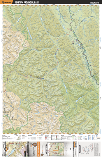
NOBC98 Denetiah Provincial Park - Northern BC
Backroad Mapbooks
This recreation map for the Denetiah Provincial Park area highlights all the logging and resource roads, recreational features and trails for hiking, mountain biking, ATVing, snowmobiling, skiing, snowshoeing, fishing, camping, hunting, canoeing, kayaking, wildlife viewing and more. New features include private land and labelled fish species, plus new roads, recreational trails and Points of Interest. No other map for the area provides you with this level of recreational or topographic detail. Measuring 105 x 140 km (65 x 87 mi), this 1:185,000 scale map covers 14,750 km2 (5,695 mi2) in total and includes Muskwa-Kechika Management Area, Denetiah Prov Park, Kechika River, Turnagain River, Dall Lake, Denetiah Lake, Dune Za Keyih Prov Park, Scoop Lake, Aeroplane Lake, Looncry Lake and more!
Page Size: 24 x 37 in (610 x 940 mm)
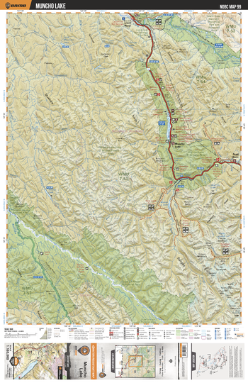
NOBC99 Mucho Lake - Northern BC
Backroad Mapbooks
This recreation map for the Mucho Lake area highlights all the logging and resource roads, recreational features and trails for hiking, mountain biking, ATVing, snowmobiling, skiing, snowshoeing, fishing, camping, hunting, canoeing, kayaking, wildlife viewing and more. New features include private land and labelled fish species, plus new roads, recreational trails and Points of Interest. No other map for the area provides you with this level of recreational or topographic detail. Measuring 105 x 140 km (65 x 87 mi), this 1:185,000 scale map covers 14,750 km2 (5,695 mi2) in total and includes Muncho Lake, Toad River, Moose Lake, Nonda Creek, Gataga River, Kechika River, Netson Lake, Muncho Lake Prov Park, Liard River, Trout River and more!
Page Size: 24 x 37 in (610 x 940 mm)
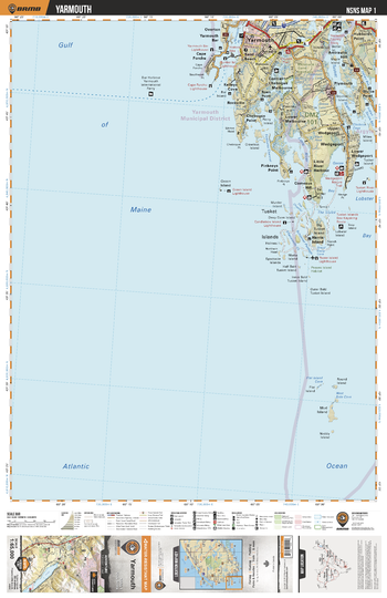
NSNS01 Yarmouth - Nova Scotia Topo
Backroad Mapbooks
This recreation topographic map for Yarmouth highlights all the logging/resource roads, hunting areas, fishing lakes & streams, campsites, paddling routes for canoeing and kayaking, wildlife viewing areas, multi-use trails for hiking, biking, horseback riding, cross-country skiing and snowshoeing, motorized trails for ATVing and snowmobiling & more. Covering 1,925 km2 (745 mi2), this 1:65,000 scale map measures 38 x 50 km (24 x 31 mi), providing you with more topographic and recreational detail for the Yarmouth area than any other map on the market. Special features include the addition of Crown land areas and countless new roads, trails and recreational Points of Interest. Included on this map are Cape Forchu, Gulf of Maine, Lobster Bay, Melbourne, Mud Island, Sluice Point, Tusket Islands, Tusket River, Wedgeport, Yarmouth and more!
Page Size: 24 x 37 in (610 x 940 mm)
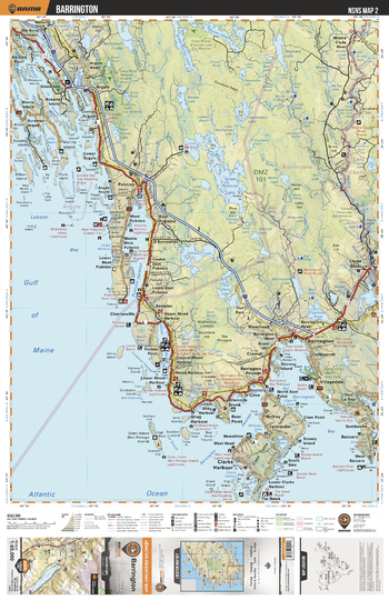
NSNS02 Barrington - Nova Scotia Topo
Backroad Mapbooks
This recreation topographic map for Barrington highlights all the logging/resource roads, hunting areas, fishing lakes & streams, campsites, paddling routes for canoeing and kayaking, wildlife viewing areas, multi-use trails for hiking, biking, horseback riding, cross-country skiing and snowshoeing, motorized trails for ATVing and snowmobiling & more. Covering 1,925 km2 (745 mi2), this 1:65,000 scale map measures 38 x 50 km (24 x 31 mi), providing you with more topographic and recreational detail for the Yarmouth area than any other map on the market. Special features include the addition of Crown land areas and countless new roads, trails and recreational Points of Interest. Included on this map are Gulf of Maine, Barrington, Clarks Harbour, Cape Sable Island, Charlesville, Argyle, Clyde River, Great Pubnico Lake, Abrams River, Morris Island and more!
Page Size: 24 x 37 in (610 x 940 mm)
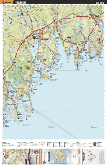
NSNS03 Shelburne - Nova Scotia Topo
Backroad Mapbooks
This recreation topographic map for Shelburne highlights all the logging/resource roads, hunting areas, fishing lakes & streams, campsites, paddling routes for canoeing and kayaking, wildlife viewing areas, multi-use trails for hiking, biking, horseback riding, cross-country skiing and snowshoeing, motorized trails for ATVing and snowmobiling & more. Covering 1,925 km2 (745 mi2), this 1:65,000 scale map measures 38 x 50 km (24 x 31 mi), providing you with more topographic and recreational detail for the Yarmouth area than any other map on the market. Special features include the addition of Crown land areas and countless new roads, trails and recreational Points of Interest. Included on this map are Shelburne, Sable River, Lockeport Harbour, Green Harbour, Jordan Bay, Shelburne Harbour, Negro Harbour, Kejimkujik National Park (Seaside Adjunct), Cape Negro, McNutts Island and more!
Page Size: 24 x 37 in (610 x 940 mm)
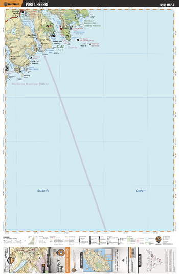
NSNS04 Port LHebert - Nova Scotia Topo
Backroad Mapbooks
This recreation topographic map for Port LHebert highlights all the logging/resource roads, hunting areas, fishing lakes & streams, campsites, paddling routes for canoeing and kayaking, wildlife viewing areas, multi-use trails for hiking, biking, horseback riding, cross-country skiing and snowshoeing, motorized trails for ATVing and snowmobiling & more. Covering 1,925 km2 (745 mi2), this 1:65,000 scale map measures 38 x 50 km (24 x 31 mi), providing you with more topographic and recreational detail for the Yarmouth area than any other map on the market. Special features include the addition of Crown land areas and countless new roads, trails and recreational Points of Interest. Included on this map are Port Lhebert,Kejimkujik National Park,Port Joli,Thomas Radall Provincial Park,Sable River and more!
Page Size: 24 x 37 in (610 x 940 mm)
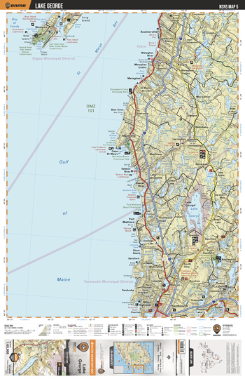
NSNS05 Lake George - Nova Scotia Topo
Backroad Mapbooks
This recreation topographic map for Lake George highlights all the logging/resource roads, hunting areas, fishing lakes & streams, campsites, paddling routes for canoeing and kayaking, wildlife viewing areas, multi-use trails for hiking, biking, horseback riding, cross-country skiing and snowshoeing, motorized trails for ATVing and snowmobiling & more. Covering 1,925 km2 (745 mi2), this 1:65,000 scale map measures 38 x 50 km (24 x 31 mi), providing you with more topographic and recreational detail for the Yarmouth area than any other map on the market. Special features include the addition of Crown land areas and countless new roads, trails and recreational Points of Interest. Included on this map are St Marys Bay, Gulf of Maine, Westport, Lake George, Yarmouth, Cape St Marys, Agard Lake, Tusket Falls, Meteghan, St Joseph and more!
Page Size: 24 x 37 in (610 x 940 mm)
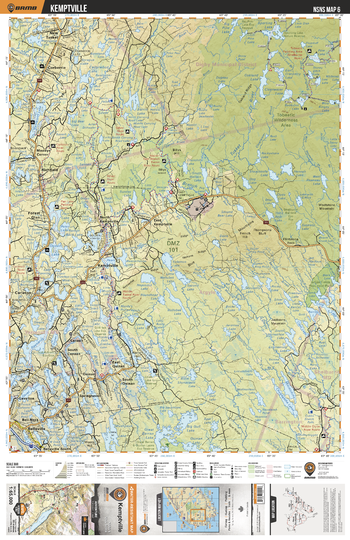
NSNS06 Kemptville - Nova Scotia Topo
Backroad Mapbooks
This recreation topographic map for Kemptville highlights all the logging/resource roads, hunting areas, fishing lakes & streams, campsites, paddling routes for canoeing and kayaking, wildlife viewing areas, multi-use trails for hiking, biking, horseback riding, cross-country skiing and snowshoeing, motorized trails for ATVing and snowmobiling & more. Covering 1,925 km2 (745 mi2), this 1:65,000 scale map measures 38 x 50 km (24 x 31 mi), providing you with more topographic and recreational detail for the Yarmouth area than any other map on the market. Special features include the addition of Crown land areas and countless new roads, trails and recreational Points of Interest. Included on this map are Tobeatic Wilderness Area, Kemptville, Richfield, Tusket River, Corberrie, Quinan, Ogden Lake, Raynards Lake, Shelburne River, Davis River and more!
Page Size: 24 x 37 in (610 x 940 mm)
No search results