


MapSherpa Catalog
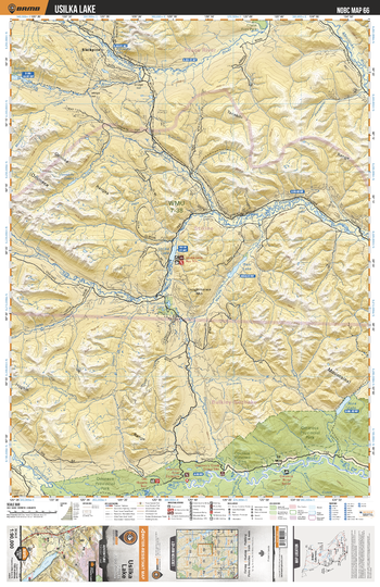
NOBC66 Usilka Lake - Northern BC
Backroad Mapbooks
This recreation topographic map for the Usilka Lake area highlights all the logging and resource roads, recreational features and trails for hiking, mountain biking, ATVing, snowmobiling, skiing, snowshoeing, fishing, camping, hunting, canoeing, kayaking, wildlife viewing and more. New features include private land and labelled fish species, plus new roads, recreational trails and Points of Interest. No other map for the area provides you with this level of recreational or topographic detail. Measuring 52.5 x 70 km (32.5 x 43.5 mi), this 1:90,000 scale map covers 3,680 km2 (1,420 mi2) in total and includes 12 Mile, Omineca Provincial Park, Tutizika River, Uslika Lake, Wasi Lake, Osilinka River, Nina Lake and more!
Page Size: 24 x 37 in (610 x 940 mm)
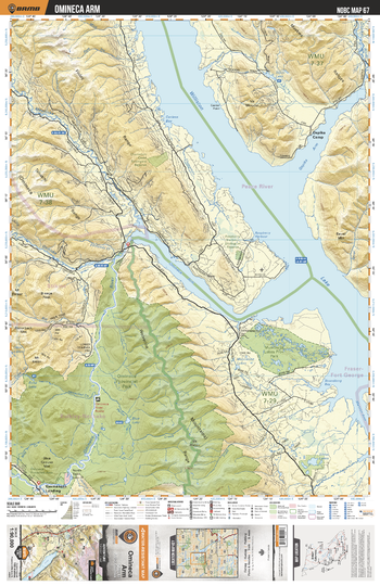
NOBC67 Omineca Arm - Northern BC
Backroad Mapbooks
This recreation topographic map for the Omineca Arm area highlights all the logging and resource roads, recreational features and trails for hiking, mountain biking, ATVing, snowmobiling, skiing, snowshoeing, fishing, camping, hunting, canoeing, kayaking, wildlife viewing and more. New features include private land and labelled fish species, plus new roads, recreational trails and Points of Interest. No other map for the area provides you with this level of recreational or topographic detail. Measuring 52.5 x 70 km (32.5 x 43.5 mi), this 1:90,000 scale map covers 3,680 km2 (1,420 mi2) in total and includes Germansen Landing, Omineca Provincial Park, Raspberry Harbour Ecological Reserve, Muscovite Lakes Park, Mesilinka River, Osilinka River, Omineca River, Williston Lake, Shoal Lakes and more!
Page Size: 24 x 37 in (610 x 940 mm)
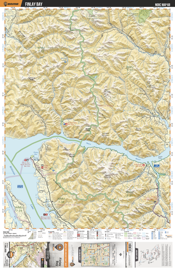
NOBC68 Finlay Bay - Northern BC
Backroad Mapbooks
This recreation topographic map for the Finlay Bay area highlights all the logging and resource roads, recreational features and trails for hiking, mountain biking, ATVing, snowmobiling, skiing, snowshoeing, fishing, camping, hunting, canoeing, kayaking, wildlife viewing and more. New features include private land and labelled fish species, plus new roads, recreational trails and Points of Interest. No other map for the area provides you with this level of recreational or topographic detail. Measuring 52.5 x 70 km (32.5 x 43.5 mi), this 1:90,000 scale map covers 3,680 km2 (1,420 mi2) in total and includes Finlay Bay, Graham - Laurier Park, Wicked River, Williston Lake, West Nabesche River, Nabesche River and more!
Page Size: 24 x 37 in (610 x 940 mm)
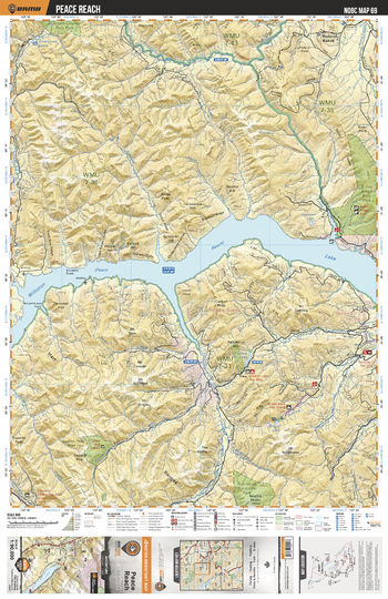
NOBC69 Peace Reach - Northern BC
Backroad Mapbooks
This recreation topographic map for the Peace Reach area highlights all the logging and resource roads, recreational features and trails for hiking, mountain biking, ATVing, snowmobiling, skiing, snowshoeing, fishing, camping, hunting, canoeing, kayaking, wildlife viewing and more. New features include private land and labelled fish species, plus new roads, recreational trails and Points of Interest. No other map for the area provides you with this level of recreational or topographic detail. Measuring 52.5 x 70 km (32.5 x 43.5 mi), this 1:90,000 scale map covers 3,680 km2 (1,420 mi2) in total and includes Bocock Peak Park, Klin-Se-Za Park, Butler Ridge Park, Carbon Lake, Wright Lake, Peace Reach, Schooler Creek and more!
Page Size: 24 x 37 in (610 x 940 mm)
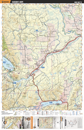
NOBC70 Hudson's Hope - Northern BC
Backroad Mapbooks
This recreation topographic map for the Hudson's Hope area highlights all the logging and resource roads, recreational features and trails for hiking, mountain biking, ATVing, snowmobiling, skiing, snowshoeing, fishing, camping, hunting, canoeing, kayaking, wildlife viewing and more. New features include private land and labelled fish species, plus new roads, recreational trails and Points of Interest. No other map for the area provides you with this level of recreational or topographic detail. Measuring 52.5 x 70 km (32.5 x 43.5 mi), this 1:90,000 scale map covers 3,680 km2 (1,420 mi2) in total and includes Hudson's Hope, Moberly Lake, Beryl Prairie, Farrell Creek, Lynx Creek, Moberly Lake Park,Butler Ridge Park, Peace River, Halfway River and more!
Page Size: 24 x 37 in (610 x 940 mm)
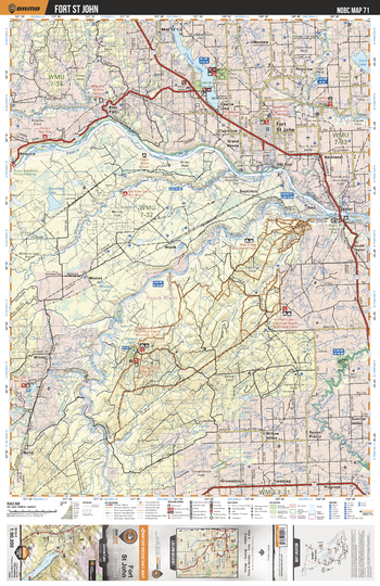
NOBC71 Fort St John - Northern BC
Backroad Mapbooks
This recreation topographic map for the Fort St John area highlights all the logging and resource roads, recreational features and trails for hiking, mountain biking, ATVing, snowmobiling, skiing, snowshoeing, fishing, camping, hunting, canoeing, kayaking, wildlife viewing and more. New features include private land and labelled fish species, plus new roads, recreational trails and Points of Interest. No other map for the area provides you with this level of recreational or topographic detail. Measuring 52.5 x 70 km (32.5 x 43.5 mi), this 1:90,000 scale map covers 3,680 km2 (1,420 mi2) in total and includes Fort St John, Taylor, Charlie Lake Park, Beatton Park, Taylor Landing Park, Charlie Lake, Stewart Lake, Pine River, Peace River and more!
Page Size: 24 x 37 in (610 x 940 mm)
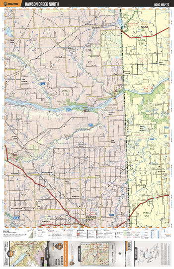
NOBC72 Dawson Creek North - Northern BC
Backroad Mapbooks
This recreation topographic map for the Dawson Creek North area highlights all the logging and resource roads, recreational features and trails for hiking, mountain biking, ATVing, snowmobiling, skiing, snowshoeing, fishing, camping, hunting, canoeing, kayaking, wildlife viewing and more. New features include private land and labelled fish species, plus new roads, recreational trails and Points of Interest. No other map for the area provides you with this level of recreational or topographic detail. Measuring 52.5 x 70 km (32.5 x 43.5 mi), this 1:90,000 scale map covers 3,680 km2 (1,420 mi2) in total and includes Dawson Creek, Kiskatinaw River Park, Peace River Corridor Park, Clayhurst Ecological Reserve, Cecil Lake, Alces River, Kiskatinaw River, Beatton River and more!
Page Size: 24 x 37 in (610 x 940 mm)
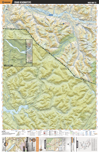
NOBC73 Craig Headwaters - Northern BC
Backroad Mapbooks
This recreation topographic map for the Craig Headwaters area highlights all the logging and resource roads, recreational features and trails for hiking, mountain biking, ATVing, snowmobiling, skiing, snowshoeing, fishing, camping, hunting, canoeing, kayaking, wildlife viewing and more. New features include private land and labelled fish species, plus new roads, recreational trails and Points of Interest. No other map for the area provides you with this level of recreational or topographic detail. Measuring 52.5 x 70 km (32.5 x 43.5 mi), this 1:90,000 scale map covers 3,680 km2 (1,420 mi2) in total and includes Craig Headwaters Protected Area, Lava Forks Park, Iskut River, Craig River, Jekill River, Inhini River, and more!
Page Size: 24 x 37 in (610 x 940 mm)
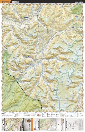
NOBC74 Granduc - Northern BC
Backroad Mapbooks
This recreation topographic map for the Granduc area highlights all the logging and resource roads, recreational features and trails for hiking, mountain biking, ATVing, snowmobiling, skiing, snowshoeing, fishing, camping, hunting, canoeing, kayaking, wildlife viewing and more. New features include private land and labelled fish species, plus new roads, recreational trails and Points of Interest. No other map for the area provides you with this level of recreational or topographic detail. Measuring 52.5 x 70 km (32.5 x 43.5 mi), this 1:90,000 scale map covers 3,680 km2 (1,420 mi2) in total and includes Granduce, Lava Forks Park, Border Lake Park, Lava Lakes, King Creek Hot Springs, Unuk River, Bowser River, Summit Lake and more!
Page Size: 24 x 37 in (610 x 940 mm)
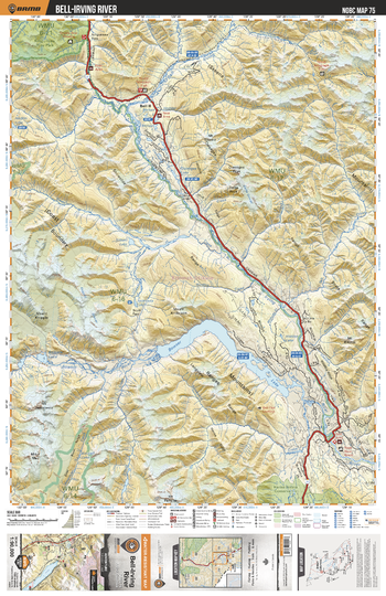
NOBC75 Bell Irving River - Northern BC
Backroad Mapbooks
This recreation topographic map for the Bell Irving River area highlights all the logging and resource roads, recreational features and trails for hiking, mountain biking, ATVing, snowmobiling, skiing, snowshoeing, fishing, camping, hunting, canoeing, kayaking, wildlife viewing and more. New features include private land and labelled fish species, plus new roads, recreational trails and Points of Interest. No other map for the area provides you with this level of recreational or topographic detail. Measuring 52.5 x 70 km (32.5 x 43.5 mi), this 1:90,000 scale map covers 3,680 km2 (1,420 mi2) in total and includes Bell II, Ningunsaw Park, Hanna-Tintina Conservancy, Bowser Lake, Bell-Irving River, Mehan Lake and more!
Page Size: 24 x 37 in (610 x 940 mm)
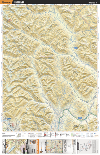
NOBC76 Nass River - Northern BC
Backroad Mapbooks
This recreation topographic map for the Nass River area highlights all the logging and resource roads, recreational features and trails for hiking, mountain biking, ATVing, snowmobiling, skiing, snowshoeing, fishing, camping, hunting, canoeing, kayaking, wildlife viewing and more. New features include private land and labelled fish species, plus new roads, recreational trails and Points of Interest. No other map for the area provides you with this level of recreational or topographic detail. Measuring 52.5 x 70 km (32.5 x 43.5 mi), this 1:90,000 scale map covers 3,680 km2 (1,420 mi2) in total and includes Taylor River, Nass River, Kotsinta Creek and more!
Page Size: 24 x 37 in (610 x 940 mm)
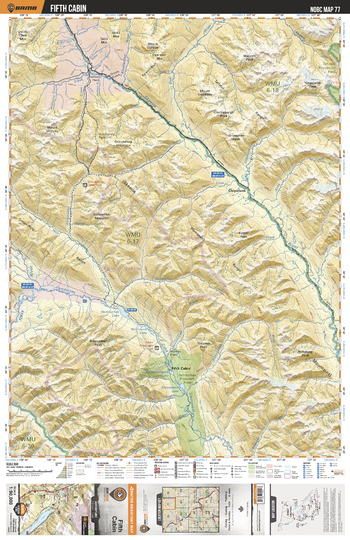
NOBC77 Fifth Cabin - Northern BC
Backroad Mapbooks
This recreation topographic map for the Fifth Cabin area highlights all the logging and resource roads, recreational features and trails for hiking, mountain biking, ATVing, snowmobiling, skiing, snowshoeing, fishing, camping, hunting, canoeing, kayaking, wildlife viewing and more. New features include private land and labelled fish species, plus new roads, recreational trails and Points of Interest. No other map for the area provides you with this level of recreational or topographic detail. Measuring 52.5 x 70 km (32.5 x 43.5 mi), this 1:90,000 scale map covers 3,680 km2 (1,420 mi2) in total and includes Fifth Cabin, Damdochax Protected Area, Skeena River, Damdochax Lake, Wiminasik Lake, Duti River, Slamgeesh Lake, Damshilgwit Lake, Slamgeesh River and more!
Page Size: 24 x 37 in (610 x 940 mm)
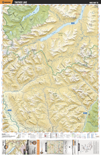
NOBC78 Thutade Lake - Northern BC
Backroad Mapbooks
This recreation topographic map for the Thutade Lake area highlights all the logging and resource roads, recreational features and trails for hiking, mountain biking, ATVing, snowmobiling, skiing, snowshoeing, fishing, camping, hunting, canoeing, kayaking, wildlife viewing and more. New features include private land and labelled fish species, plus new roads, recreational trails and Points of Interest. No other map for the area provides you with this level of recreational or topographic detail. Measuring 52.5 x 70 km (32.5 x 43.5 mi), this 1:90,000 scale map covers 3,680 km2 (1,420 mi2) in total and includes Mosque River, Tatlatui Lake, Thutade Lake, Side Channel, Niven River, Sustut River, Tatlatui Park, Sustut Protected Area and more!
Page Size: 24 x 37 in (610 x 940 mm)
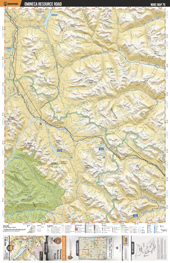
NOBC79 Omineca Resource Road - Northern BC
Backroad Mapbooks
This recreation topographic map for the Omineca Resource Road area highlights all the logging and resource roads, recreational features and trails for hiking, mountain biking, ATVing, snowmobiling, skiing, snowshoeing, fishing, camping, hunting, canoeing, kayaking, wildlife viewing and more. New features include private land and labelled fish species, plus new roads, recreational trails and Points of Interest. No other map for the area provides you with this level of recreational or topographic detail. Measuring 52.5 x 70 km (32.5 x 43.5 mi), this 1:90,000 scale map covers 3,680 km2 (1,420 mi2) in total and includes Omineca Resource Road, Sustut Provincial Park, Fredrikson Lake, McConnell Lakes, Asitka Lake, Ingenika River, Moosevale Creek, Sustut Lake, Johanson Lake, Mesilinka River and more!
Page Size: 24 x 37 in (610 x 940 mm)
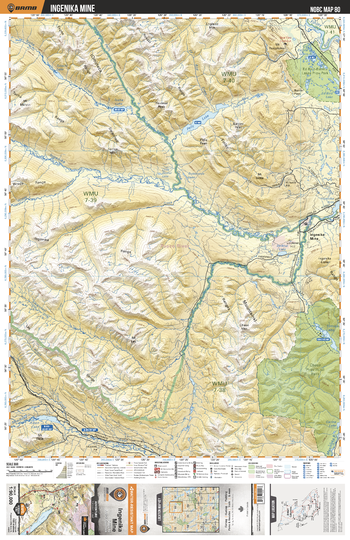
NOBC80 Ingenika Mine - Northern BC
Backroad Mapbooks
This recreation topographic map for the Ingenika Mine area highlights all the logging and resource roads, recreational features and trails for hiking, mountain biking, ATVing, snowmobiling, skiing, snowshoeing, fishing, camping, hunting, canoeing, kayaking, wildlife viewing and more. New features include private land and labelled fish species, plus new roads, recreational trails and Points of Interest. No other map for the area provides you with this level of recreational or topographic detail. Measuring 52.5 x 70 km (32.5 x 43.5 mi), this 1:90,000 scale map covers 3,680 km2 (1,420 mi2) in total and includes Ingenika Mine, Ed Bird - Estella Lakes Park, Chase Park, Aiken Lake, Tucha Lake, Ingenika River, Pelly Lake, Swannell River, Estella Lakes, Tomias Lake and more!
Page Size: 24 x 37 in (610 x 940 mm)
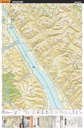
NOBC81 Tseh Keh Dene - Northern BC
Backroad Mapbooks
This recreation topographic map for the Tseh Keh Dene area highlights all the logging and resource roads, recreational features and trails for hiking, mountain biking, ATVing, snowmobiling, skiing, snowshoeing, fishing, camping, hunting, canoeing, kayaking, wildlife viewing and more. New features include private land and labelled fish species, plus new roads, recreational trails and Points of Interest. No other map for the area provides you with this level of recreational or topographic detail. Measuring 52.5 x 70 km (32.5 x 43.5 mi), this 1:90,000 scale map covers 3,680 km2 (1,420 mi2) in total and includes Tsay Keh Dene, Chase Park, Ospika Cones Ecological Reserve, Williston Lake, Ed Bird Lake, Carina Lake, Davis River, Ospika River and more!
Page Size: 24 x 37 in (610 x 940 mm)
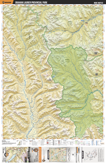
NOBC82 Graham Laurier Provincial Park - Northern BC
Backroad Mapbooks
This recreation topographic map for the Graham Laurier Provincial Park area highlights all the logging and resource roads, recreational features and trails for hiking, mountain biking, ATVing, snowmobiling, skiing, snowshoeing, fishing, camping, hunting, canoeing, kayaking, wildlife viewing and more. New features include private land and labelled fish species, plus new roads, recreational trails and Points of Interest. No other map for the area provides you with this level of recreational or topographic detail. Measuring 52.5 x 70 km (32.5 x 43.5 mi), this 1:90,000 scale map covers 3,680 km2 (1,420 mi2) in total and includes Graham - Laurier Provincial Park, Muskwa-Kechika Management Area, Ospika River, Halfway River, Graham River, Lady Laurier Lake, Robb Lake, Chowade River and more!
Page Size: 24 x 37 in (610 x 940 mm)
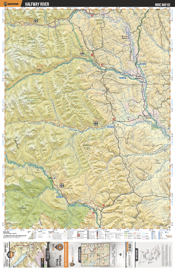
NOBC83 Halfway River - Northern BC
Backroad Mapbooks
This recreation topographic map for the Halfway River area highlights all the logging and resource roads, recreational features and trails for hiking, mountain biking, ATVing, snowmobiling, skiing, snowshoeing, fishing, camping, hunting, canoeing, kayaking, wildlife viewing and more. New features include private land and labelled fish species, plus new roads, recreational trails and Points of Interest. No other map for the area provides you with this level of recreational or topographic detail. Measuring 52.5 x 70 km (32.5 x 43.5 mi), this 1:90,000 scale map covers 3,680 km2 (1,420 mi2) in total and includes Beatton Ranch, Brady Ranch, Boring Ranch, Graham - Laurier Park, Muskwa-Kechika Management Area, Chowade River, Graham River, Halfway River, Cypress Creek and more!
Page Size: 24 x 37 in (610 x 940 mm)
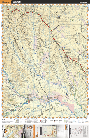
NOBC84 Wonowan - Northern BC
Backroad Mapbooks
This recreation topographic map for the Wonowan area highlights all the logging and resource roads, recreational features and trails for hiking, mountain biking, ATVing, snowmobiling, skiing, snowshoeing, fishing, camping, hunting, canoeing, kayaking, wildlife viewing and more. New features include private land and labelled fish species, plus new roads, recreational trails and Points of Interest. No other map for the area provides you with this level of recreational or topographic detail. Measuring 52.5 x 70 km (32.5 x 43.5 mi), this 1:90,000 scale map covers 3,680 km2 (1,420 mi2) in total and includes Wonowon, Upper Halfway, Kobes, Cameron River, Davies Lake, Blueberry River, Halfway River, Townsend Creek and more!
Page Size: 24 x 37 in (610 x 940 mm)
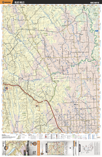
NOBC85 Blue Hills - Northern BC
Backroad Mapbooks
This recreation topographic map for the Blue Hills area highlights all the logging and resource roads, recreational features and trails for hiking, mountain biking, ATVing, snowmobiling, skiing, snowshoeing, fishing, camping, hunting, canoeing, kayaking, wildlife viewing and more. New features include private land and labelled fish species, plus new roads, recreational trails and Points of Interest. No other map for the area provides you with this level of recreational or topographic detail. Measuring 52.5 x 70 km (32.5 x 43.5 mi), this 1:90,000 scale map covers 3,680 km2 (1,420 mi2) in total and includes Blue Hills, Altona, Buick, Montney, Murdale, Prespatou, Snyder, Whispering Pine Lake, Murdale Lake, Inga Lake, Blueberry River, Aitken Creek, Beatton River and more!
Page Size: 24 x 37 in (610 x 940 mm)
No search results